|
||||||||||||||||||||||||||||||||||||
|
||||||||||||||||||||||||||||||||||||
Home > Treks > Sunshine > Day 1 > 1.1 |
||||||||||||||||||||||||||||||||||||
|
||||||||||||||||||||||||||||||||||||
|
THICK fog covered much of the Blackall Range, heavy laden with the soft drizzle that had fallen throughout the night. There was no sign of it clearing yet, even though it wasn’t forecast to fall here today.
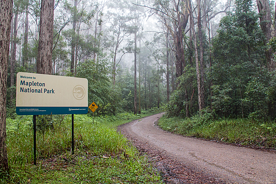
It had taken nearly two hours to get here from Brisbane, having left in the darkness of night. We had travelled along the top of the Blackall Range where the last two days of the track will be roughly following. The top of the range was fairly flat with steep gullies dropping off into the valleys on either side. The relative flatness of the top of the range allowed for several small old forestry towns to be established here during the 1880s, namely Melany, Montville, Flaxton and Mapleton. The track begins at the end of Mapleton at around 400 metres above sea level, passes through Flaxton and finishes near Montville. I worked out we will never be more than about six kilometres away from civilisation on this trip even though I imagined parts of the trail will feel very remote. We arrived at the relatively unmarked start of the track along a gravel road at the end of Mapleton, a little past where the houses end going into the tall eucalypt forest towards the Mapleton Day Use Area. From there some will rest in the crowded park, others will drive their four wheel drive vehicles over the bigger dirt tracks and cyclists would ride the smaller tracks.
The Great Walk isn’t overly well known, with just a couple of car parks and no other cars to be seen at this entrance. We chose this entrance only because it was the most logical starting point to complete the track in the shortest distance. There is another car park at the other end, and three more “official” entrances along different parts of the trail. This wasn’t an official entrance, but for us it was the most practical place to start. Walking isn’t much of a pursuit around this part of Australia. I think people here tend to be in too much of a love affair with their vehicles to take to the walking tracks. That largely contributes to the walking tracks not being terribly well known here.
As the track ends in two different locations, we were fortunate in having a friend kind enough to give us a lift up here on his way north to Hervey Bay, and will be returning through this way to pick us up at Baroon Pocket, at the other end of the track, at the end of the fourth day. The car disappeared back along the gravel road leaving myself, Sam and Doug ready to start the track. Now Sam and Doug are both very unphotogenic as many Australian hikers are, so in respect of their wishes their mugs won’t appear in any photos here.
The wet dank smell of gum forest hit us as we put our packs on. Normally parched dry, the gum forest was in the middle of the rainy season so it was showing signs of fresh life. That being said little rain had fallen here so far this summer. The tops of the Blackall Range were amongst the wettest parts of Australia with an average rainfall of around two and a half metres every year. There had been plenty of rainfall here earlier this year, with one storm from a spent cyclone dumping half a metre of rain in this area in a single morning. Although spring had produced around average rainfalls, summer was turning out to be quite dry with the El Nino in full swing. That would mean the streams were going to be running rather low on this trip. There was more rain predicted over the next few days, so perhaps they will rise again.
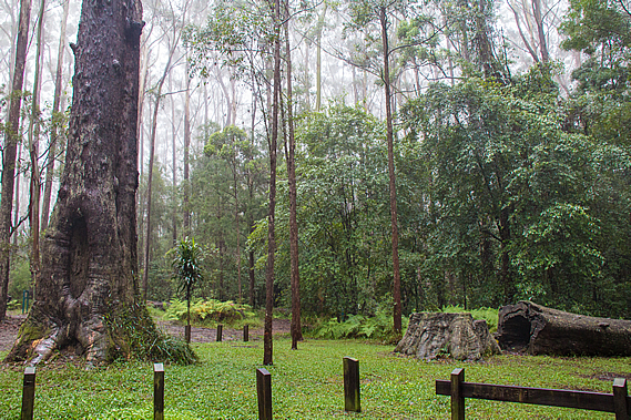
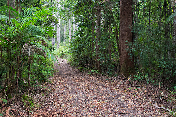
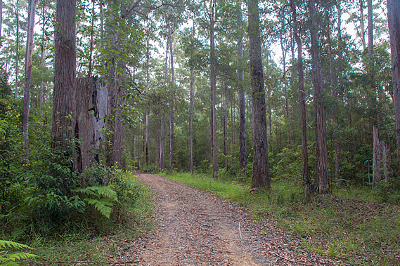
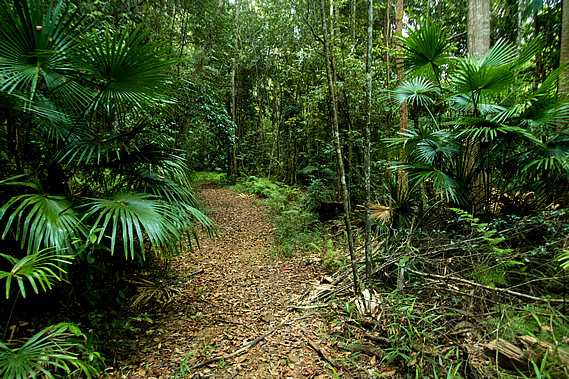
The little park where we set out had freshly mown grass under a couple of large gum trees and one that had been chopped down from the stump, but had been left there uncut with the inside of the trunk now rotting out. We set off along the broad track passing a fenced entrance into the Mapleton National Park. A wide firebreak track extended along the top of a long ridge extending north westward perpendicular to the Blackall Range. The bush here was quite thick, nearly passing as rainforest.
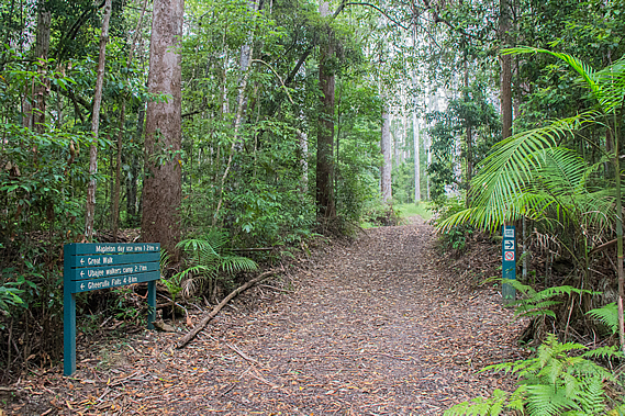
Only a couple minutes after starting, we reached the first junction. The main track continued along the ridge along the wide firebreak dirt road. A walking track led off to the left heading into the dense bush. From here we will continue along the firebreak going around a long circuit of around 27 kilometres before returning to this point in about 48 hours’ time to follow the other track roughly southward to the end of the track at Baroon Pocket, a total of 57 kilometres away. Being reasonably local, I had completed sections of the track in past day trips. The Great Walk links up between a number of popular shorter walks. Nearly everyone who comes up to the Blackall Range to hike just do one or two of the short walks. I was expecting these sections of the walk to be quite crowded, with the rest of the track being relatively quiet.
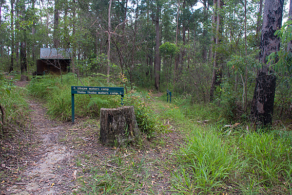
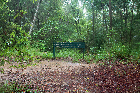
There were large sections of the track that I had never done, the biggest of these being almost the entire Gheerulla Circuit. These four days will be spent doing the entire great walk, so I will be filling in all the remaining gaps. Today we were heading towards the Thilba Thalba campsite, a good seventeen kilometres from here half way around the Gheerulla Circuit. Thilba Thalba wasn’t indicated on the sign, but the nearer campsite Ubajee where we will be staying tomorrow night after completing the circuit was 1.6 kilometres away, and the Gheerulla Falls on the circuit was 3.8 kilometres away.
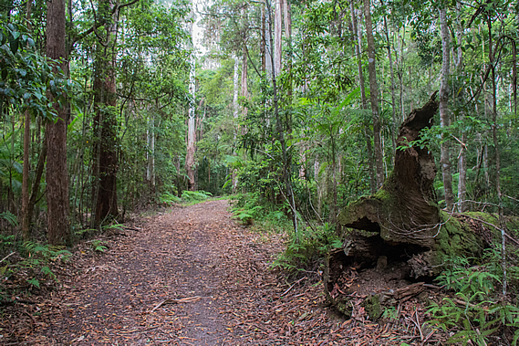
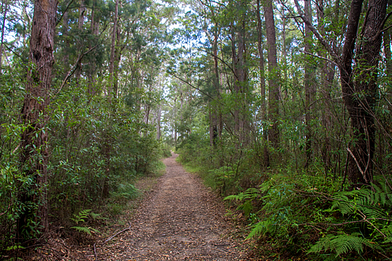
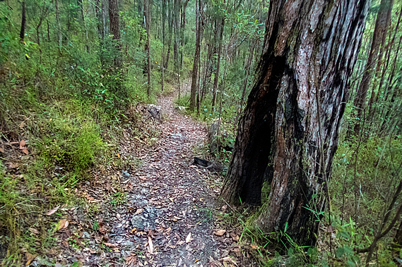
From the junction the wide track began ascending gradually. The bush quickly thinned revealing blackbutt forest - very tall grey gum trees towering a good thirty metres into the thick mist overhead. The name is given due to the regular bushfires in this type of forest leave the lower trunks almost permanently black from where the bark had been burnt into charcoal. Fortunately the bark of these trees is usually thick enough to protect the living tissue beneath. As we continued hiking along the ridge several firebreak tracks came off the main one. The first of these tracks was for cyclists only. The main track we were walking on was a shared one for walkers, cyclists and horses. A couple of ladies riding horses passed us coming the other way on their early morning ride. Shortly afterwards a cyclist overtook us and rode into one of the tracks descending off the main one.
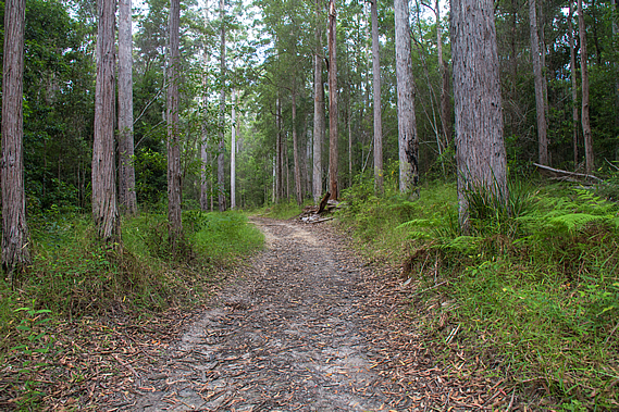
The foggy cloud briefly lifted and thinned enough for the sun to dimly shine through casting soft shadows from the soft slender trunks of the tall trees. This only lasted a few moments though, and once more the sun remained obscured behind thick cloud. About two kilometres along the track we reached a junction where the shared track descended to the left whilst the main walking track continued along the top of the ridge. This track was for walkers only now, so we won’t need to be sharing it with cyclists or horses.
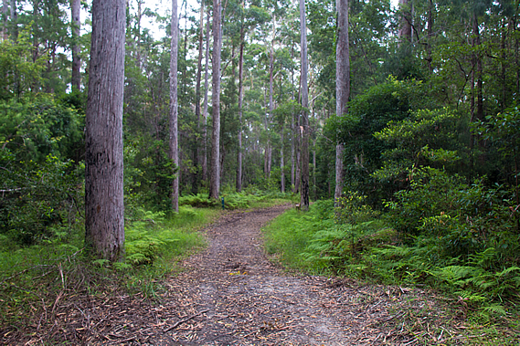
The track narrowed and the bush thickened. The trees here weren’t as tall as those at the start of the track. The ridge now dropped off moderately in both directions as valleys formed on either side. A bit further along the ridge suddenly dipped into a small saddle. The track dropped along the top of the saddle before rising back to almost the same altitude. Just after the drop there was a small sign indicating Ubajee was just 600 metres away. Eventually we reached the entrance to the Ubajee Walkers’ Camp, where we will be staying tomorrow night upon completing the circuit. One track to the left led into the campsite whilst the main track to the right suddenly narrowed and gradually descended towards the end of the ridge which was just nearby.
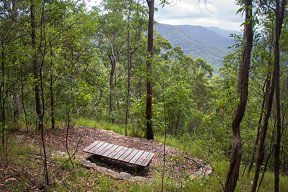
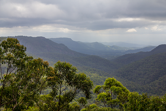
We followed the main track heading below the campsite before dropping to a junction where the track turned a hairpin bend. A short track continued from this bend to a lookout over the Gheerulla Valley. By now the drizzle had stopped falling and the cloud had lifted above the flat ridges on either side of the long valley that stretched out before us. Forested hills rose on either side to a very flat topped ridge on either side. The valley deepened for about seven kilometres to where either ridge suddenly ended and green farmland of the upper Mary Valley crossed over to a final backdrop of the Conondale Ranges and the distant Great Dividing Range.
From the lookout we followed a moderate descent down the end of the ridge into the Gheerulla Valley. After a hundred metres the track became a bit rougher with a sign indicating only experienced hikers should go here. Thick cloud suddenly enveloped us and light rain began falling. The open eucalypt forest clung against the side of the ridge for much of the descent only changing towards the bottom where it quickly changed to dry rainforest. About half way down we were overtaken by a couple of runners who were well equipped dressed as if they were running a serious race. They were clearly in a hurry to go around one of the circuits. Perhaps they were in training for some long distance run. Maybe this was just what they did for fitness and were just burning off their Christmas dinners.
The track had been a fairly gentle descent until almost the very bottom where it became stairs for a few minutes before reaching an old logging track, a dirt road wide enough to drive a four wheel drive on. By now the misty rain had stopped falling. The track followed this road in either direction, making up the 21 kilometre Gheerulla loop which we will be completing tomorrow morning. A signpost at the junction indicated Gheerulla Falls was to the left and Thilba Thalba campsite we were staying tonight was about ten kilometres in either direction on the other side of the loop. We decided to take the track to the right heading downstream. Rain was forecast tonight so perhaps there will be more water flowing over the falls when we arrive there tomorrow.
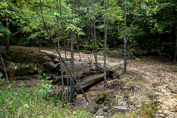
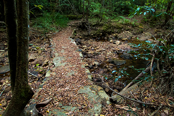
We followed the old dirt road above Gheerulla Creek. The rainforest was too thick to see or hear the creek below us. It descended at a fairly moderate rate with the occasional uphill going around small spurs. One gully had a substantial bridge constructed of a concrete ford laid directly over several large fallen trees that had washed down in past floods. I wondered how long this bridge would last with the huge tree trunks gradually rotting away. The side creek it crossed had no water flowing through it despite the rain that had fallen.
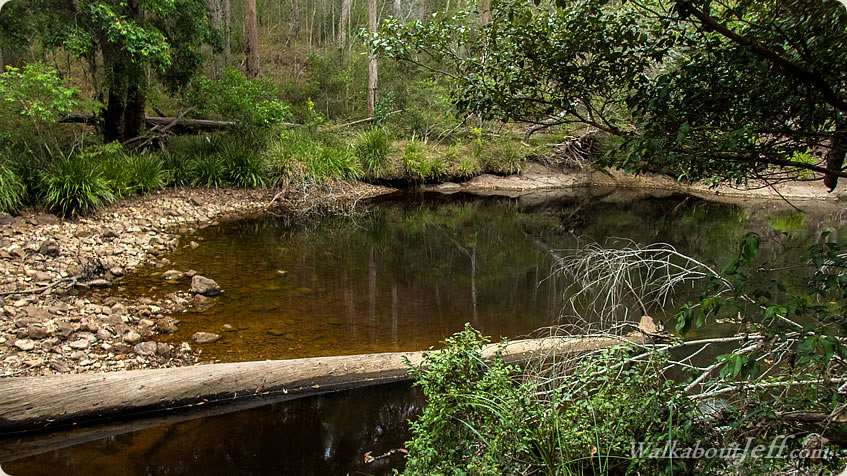
About half an hour passing through the rainforest from the junction we reached the first of three fords crossing Gheerulla Creek. The lateness of the summer rains had set the creek at an unusually low level expected only during the spring dry season. The creek had been reduced to a string of large puddles with almost no flow between them, only just enough of a trickle to keep the puddles full. Any water flowing downstream would be doing so under the boulders strewn along the riverbed.
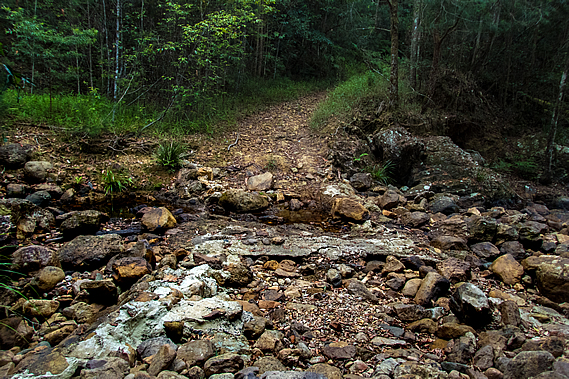
A concrete ford had been constructed across the creek at some time past, but now it had been reduced to rubble having been smashed hard from boulders carried down in past floods. Torrential downpours such as the huge storm last year would turn this nearly dry creek bed into a lethal torrent. Once across the stream the track steeply rose a few metres before continuing downstream through rainforest along a small flat. Upon reaching the next bend of the stream, another ford with a metre wide concrete platform crossed over to the flat on the other side.
Not long afterward we crossed the last of the three fords over the Gheerulla Creek. This ford was a well constructed concrete structure with culverts like the previous one. A large pool of tannin stained water stood upstream, but no water was flowing through the culvert. The gorge was beginning to widen with the vegetation along the dry side channels being pushed over from last years’ floods. It would have been very spectacular here during those floods, but they would have been impossible to reach.
The rainforest was gradually changing to dry eucalypt forest indicating we were now drawing near to the Mary Valley. |
||||||||||||||||||||||||||||||||||||
|
||||||||||||||||||||||||||||||||||||