|
||||||||||||||||||||||||||||||
|
||||||||||||||||||||||||||||||
Home > Treks > Sunshine > Day 1 > 1.2 |
||||||||||||||||||||||||||||||
|
||||||||||||||||||||||||||||||
|
FOLLOWING the three fords of Gheerulla Creek the track suddenly changed from a wide forestry road to a narrow trail clinging to the edge of the gorge. Perhaps the forestry road had never been constructed through this part of the valley, or maybe it did once exist but had been completely washed away from the frequent flooding that occurs in this area.
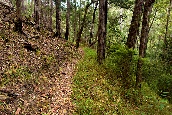
This became first obvious when we reached a small bluff and a steep staircase headed up the hill. It was slow going with our packs in the hot humid air rising above the narrow tract of rainforest by the creek into the relatively sparse open eucalypt forest. The narrow track maintained altitude traversing high above the stream. Occasionally we reached a small gully where the rock was exposed by torrents of water that would sometimes crash through here stripping away the vegetation.
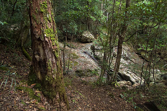
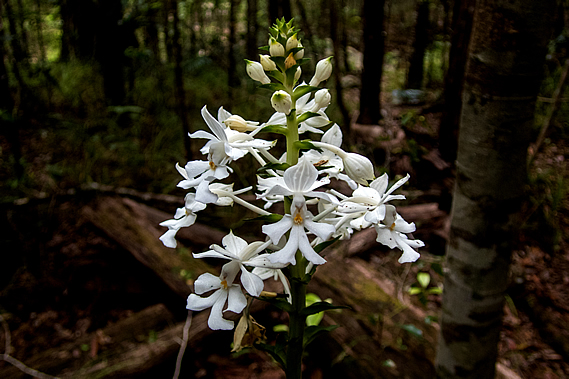
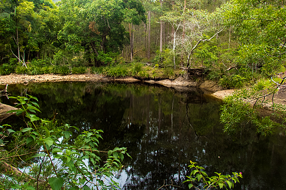
Eventually the track descended to follow close by the creek. The stream still remained little more than a trickle, but the ponds along its length were a lot bigger than the ones I had seen at the three fords. Platypus could sometimes be seen in the crepuscular hours of dawn and dusk. The mirror smooth water was black with tannin stain. The sky remained overcast and it was very humid, indicating rain was on the way. Rain is very hard to predict in these mountains. Sometimes huge storms strike almost without warning, Other times they completely pass you by. The track continued to traverse smooth rocky outcrops towering above the stream, sometimes rising substantially over long flights of stairs only to descend another set of stairs on the other side. Occasionally it would drop into a forested gully where the open eucalypt would become dry rainforest. The occasional white orchid was flowering, in its midsummer peak of spectacular flowers as was typical at this time of year. There was one spectacular specimen next to a cedar tree hidden just off the track. It had a flourish of perfectly formed white flowers with yellow stamens.
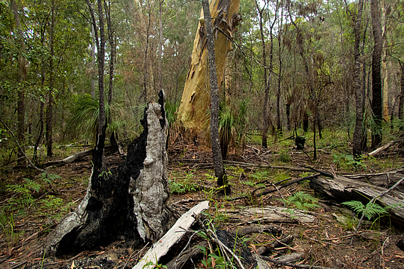
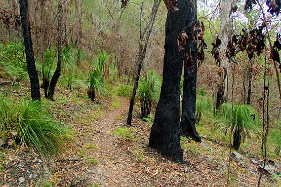
The forest undergrowth gradually became thinner with signs of a bushfire only a couple of years back. Patches of green grass were growing out of the tough soil, but the lower trunks of the trees were still blackened by the firestorm. The only area that didn’t seem to have been impacted was the area immediately around the stream. Here the very lush trees were now growing over a large black pool.
Shortly after the huge pool I reached a sign at the end of a thick forested flat. Ubajee was seven kilometres behind us. From there the stream had undercut the track in a past flood. We were guided around the edge of the stream by a couple of large cairns showing the way around a dry channel that had been carved out by the flooding.
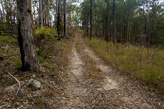
After the cutting the track suddenly came back onto a dirt road again. We followed it up and down for a while as it approached the road end from the Mary Valley. A man passed us heading the other way. He was the first hiker we had seen since the two runners coming down the hill of Ubajee several hours ago. Although this is supposed too be the peak holiday season, very few people hike at this time of the year. From here the mostly young trees had very old gum trees interspersed amongst them. There were a number of burnt out trunks from what would have been a very old forest, but only some of the old trees were still standing.
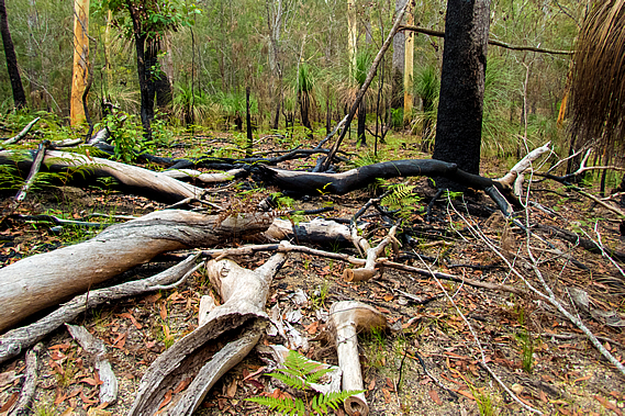
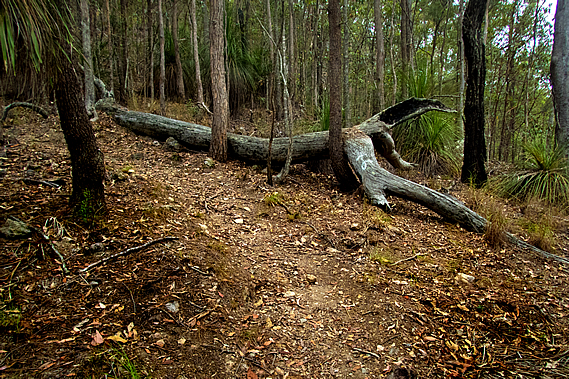
We reached a junction about a kilometre before the end of the dirt road. Although close to civilisation we will need to take the track heading up onto the long northern ridge of the creek for a little over five kilometres to the campsite. The track had been fairly level heading down the valley despite the usual obstacles that come from small landslides, undercutting and vegetation growth. Now that we were almost at the bottom of the valley we followed the great walk track gently around the nose of the range at the bottom of the Gheerulla Bluff. The bush at this end of the valley had by now changed to dry scribbly gum forest, with the tree trunks blackened by a bushfire that had swept through here a year or two ago. The forest floor was littered with fallen and burnt trees and branches.
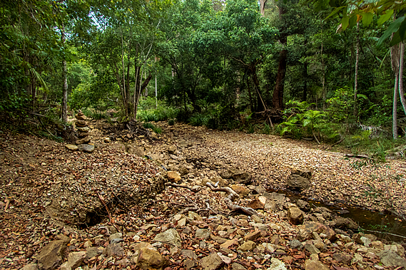
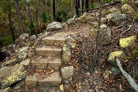
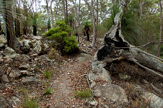
Grass trees grew in abundance around the burnt trees adding greenery to the otherwise struggling grass. Although grass trees are a lot shorter than the eucalypts they grow around, they are a lot older. The trunks grow only one centimetre per year. The grass trees growing around here were standing at a metre, being around a century old. The largest of the surrounding gum trees were no more than 50 years old. The track rose moderately crossing a couple of small gullies with completely dry creek beds. During flood conditions they would be cascading down the side of the hill, but little rain had fallen here of late. The track was mostly even but at one point there were a few concrete steps with deep patterns cast into them to provide better grip and to make them look natural in amongst the rock rubble. These were the first of many steps we’d see on the track.
Eventually the track reached the first of what would be 29 switchbacks up the steep Gheerulla Bluff. The steep ascent of the Gheerulla Bluff would have normally been straight forward, but carry backpacks in the high humidity made the climb brutal. Slowly we edged our way up the slope sweating under the thick hot air. Fortunately we still had plenty of water. The track was broad but getting quite steep with concrete steps at each turn. The terrain gradually steepened until the track was negotiating itself between several near vertical rock faces. The rock here was very solid, hard enough to have withstood the millions of years of erosion of the surrounding valleys to allow the bluff to stand out dominant along with the unnamed bluff on the other side of Gheerulla Creek. The forest in between the bluffs remained the same thin open eucalypt with century old grass trees growing amongst them. Smaller trees grew out of the cracks in the bluffs, their growth stunted by the lack of soil. Dried out moss and lichen covered much of the rock faces, clinging onto life.
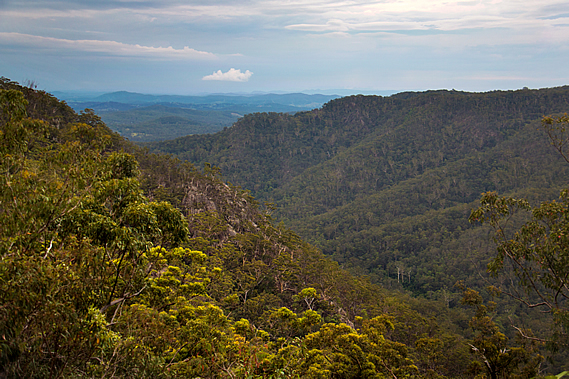
At one point along the steepest part of the bluff the track itself became a staircase of concrete steps, but fortunately this didn’t last long. The grade started easing off as we reached the tops of the low cliffs. There were a couple of spots where we had spectacular views over the upper Mary Valley across to the Conondale Ranges. The steepness of the terrain gradually eased off as we approached the summit of Gheerulla Bluff. The trees had changed markedly from the lowland eucalypts to the species with vibrant orange coloured bark found similar to those I had encountered in the Snowy Mountains earlier this year. It seemed strange to see these mountain gum trees growing here in such a humid environment, but the winters would be relatively harsh here on these exposed hills. The undergrowth here amongst the basalt rubble was almost non--existent. The rainfall must be a lot lower too being away from the Blackall Range where most of the prevailing rains fall on the other side. Nearby Kenilworth averages about 1500 millimetres of rain every year, a metre less than the top of the Blackall Range.
After the final hairpin bend the track headed straight over the summit of Gheerulla Bluff. Stunted trees grew out of the rubble of rocks making up the volcanic summit. This must have been a volcanic plug similar to the ones in the Glasshouse Mountains. Unlike the Glasshouse Mountains though, a ridgeline of the underlying rock still remained extending from here all the way back to the Blackall Range. The remaining three kilometre hike to Thilba Thalba Campsite would follow the top of this ridge. From the summit of Gheerulla Bluff the track headed down a short distance towards a small saddle. The vegetation very quickly thickened with century-old grass trees once more appearing and the withered paperbark gums standing ancient and dominant in their windswept state.
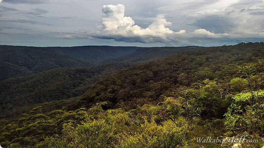
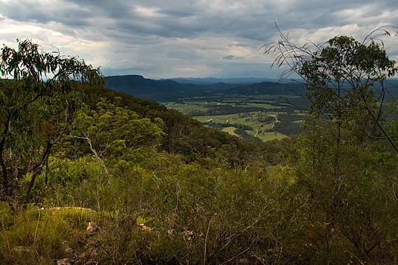
Huge scribbly gum trees covered the grassy fields that dropped steeply into the valleys on either side. The canopy was too thick to be able to see into the valley, but about half an hour and two saddles after reaching the Gheerulla Bluff summit, a side track led to the top of one of the hills. We climbed the side track through the forest to the edge of a vertical bluff from where I had spectacular views into the lower part of the Gheerulla Valley. I could see the creek snaking silently a good three hundred metres below. The forest covering the valley either side was very uniform, rising to the surprisingly flat ridge on the other side. Looking downstream I could see the Mary Valley opening out as it headed downstream under overcast skies. Beyond the valley I could see various hills and mountains all the way to the distant Great Dividing Range.
Looking across the Gheerulla Valley, the creek followed the winding valley floor through unbroken forest up to the top of the very flat ridge on the other side. Small storm clouds were passing by but fortunately they were missing this ridge line. The top of the ridge gradually broadened as we continued to approach Thilba Thalba. The track reached an old dirt road and followed it for about half an hour before turning off to continue supposedly a short cut, if it were not for a couple of trees that had fallen over it.
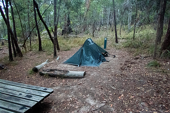
It was not long though before we saw the welcome sign of Thilba Thalba. A small solitary building stood in amongst the high grass and small tea trees. The building was a toilet with a water tank collecting the water from its roof. There were two camping areas. Near the toilet were several plots set up for smaller tents. On the other side of the track near the edge of the ridge were larger campsites for big groups. There was nobody else here and darkness will be falling soon, so we set up camp in the group area. I had my little one-person tent and the others shared a larger two person tent.
Once our tents were set up, we headed across to a nearby lookout at the edge of the camping area. Two large picnic tables sat at the end of what was effectively a cul-de-sac at the end of a dirt road that would be a service road to the campground. A short descent from the picnic tables down a narrow track led to a bean shaped low rock wall at the edge of a bluff with views down the Gheerulla Valley towards the Mary Valley and the Great Dividing Range under overcast skies. The sun was setting in the distance behind overcast skies. The clouds were quickly thickening so we quickly had dinner at the picnic tables before darkness set in. Nobody else arrived at the campsite, so we had it all to ourselves. That seemed strange being the peak season, but I figured most outdoors types would be crowding the beaches. The hiking types would no doubt be further south, most likely in New Zealand or Tasmania as most of the southern mainland can get extremely hot at this time of year with a severe bushfire risk.
It was about an hour after dark when drizzle started falling. With dinner finished there was nothing to do but for us to retreat to our respective tents. Fortunately we had good drainage around the tents. Although the ground was sloping downwards we had deliberately pitched them on slight rises in the middle of the small sites so water would run around them. There’s nothing worse than waking up in the darkness of night in a pool of water, so thankfully we had planned that well. Rain started falling moderately outside, falling onto the foliage above and large drops hammering the thin tent fly. It was too loud for me to fall asleep. I could hear distant thunder but fortunately it never approached. The rain gradually eased off over the next hour but large drips kept falling from the foliage above for several hours after that. It was about 11:00 when I finally fell asleep. |
||||||||||||||||||||||||||||||
|
||||||||||||||||||||||||||||||