|
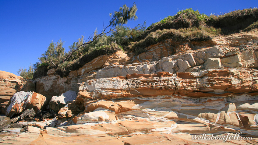
MUCH of the Sunshine Coast is golden sand with the occasional rocky headland. There are small areas of sandstone and coal exposed on the beaches where once great sand dunes stood.
At the mouth of the Maroochy River is once such sandstone outcrop, Pincushion Island. It is usually linked to the mainland with a large sand bar that only covers during the highest of tides.
The erosion around the island has created some very interesting sandstone weathering patterns. At some stage during the distant past thin layer upon layer of sand was deposited here creating the thin layers seen in the photograph. Thin windswept scrub perches to the large flat area at the top of the island.
|