|
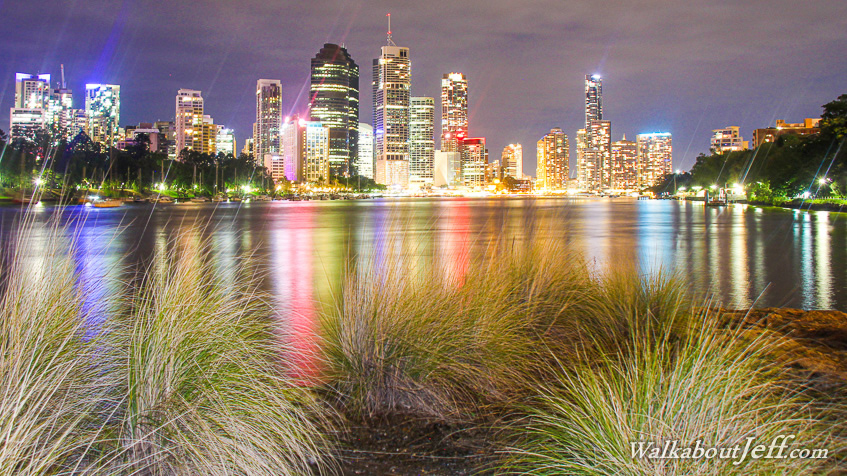
VIEW of Brisbane City taken from the old port at the end of the Kangaroo Point cliffs. Rain had threatened all day, but only light showers resulted, clearing the air enough for some crisp photography.
I walked around Southbank to Kangaroo Point. Although the south bank sweeps around the entire CBD, I knew straight away the best shots would be from this point at what had been the old port that serviced the quarry extracting the solid volcanic rock used to build much of the early city. All that is left of the quarry is a precipitous cliff face overlooking the meandering Brisbane River with the magnificent city creating a towering backdrop of illumination.
|