|
||||||||||||||||||
|
||||||||||||||||||
Home > Diaries > 2013 > 327 |
||||||||||||||||||
|
||||||||||||||||||
|
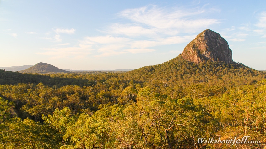
IT WAS late afternoon on the Trachyte Circuit southward from Mount Tibrogargan heading towards Mount Beerburrum. The trail started off following the lowlands passing a vertical cave shaft in the lowland forest as dry as tinder from the recent dry spell that showed no signs of abating. The trail then rose moderately to the top of the Trachyte Range, named after the volcanic rock this small range running between Mounts Berrburrum and Tibrogargan. The trail wound across the forested tops before a junction led to the Jack Ferris lookout at the top of a rock ledge. The late afternoon sun was low in the sky brightly highlighting the panorama of the Glasshouse Mountains. Dominant on the skyline was Mount Tibrogargan. Further out to the left was Mount Ngungan where I stood atop to watch the sunrise a few weeks ago. Photo from today: |
||||||||||||||||||
|
||||||||||||||||||