|
HEADING across the top of the island from Bulwer to North Point, the landscape has changed significantly from the sweeping beaches of yesterday, to the wildly changing maze of small sand drifts alternating with lagoons carved by the turbulent sea and the streams flowing over this part of the island.
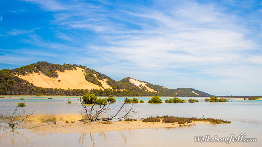
The most dramatic area is the large tidal estuary under the impressive sandblows of Seven Hills. Each bright sandblow is framed by a delicate forest of hardy silky oak, and mangroves cling tightly to the constantly shifting sands of the estuary filling and emptying of the pure blue ocean water with each tide.
|