|
||||||||||||||||||
|
||||||||||||||||||
Home > Diaries > 2023 > 1043 |
||||||||||||||||||
|
||||||||||||||||||
|
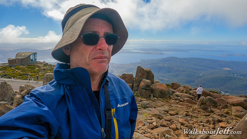
RETURNING to the Hobart waterfront in the early morning, I took another tour in a minibus heading westward through the city centre, turning off to follow the Mount Wellington Road up the mountain. The sky was free of clouds apart from a few lingering around the summit rising high above the city. It was not long before we were travelling through dense beech forest following the sealed road heading moderately uphill. Turning off the main road around a tight bend, we continued heading up towards the summit, stopping at a lookout 670 metres above sea level. From here I could see south to south westward over the hills out into the sea and over to parts of Bruny Island where I will be exploring tomorrow. Returning onto the bus, we continued heading up the mountain with the trees getting shorter and more stunted with increased elevation. At one point they ended at the tree line merging into heathland scrub similar to what I had hiked through on the Overland Track. The summit come into view held up by large dolerite columns similar to the mountains in the middle of the island. The road continued all the way up to the top, circling its 1271 metre high summit before we stopped at a car park. From here I followed the short track up to the summit. It was much colder up here than in the city where it had been about 15 degrees with no wind down there, but up here it was about five degrees with a very cold wind bringing the wind chill down to below freezing. The view from the summit was unbroken apart from a large concrete aerial about a hundred metres to the west. From here I could see all over the lower island with the clouds being about a hundred metres above. I could see much of Hobart and the southern parts of the island where the hills gradually submerge into the Southern Ocean. Descending from the summit I headed across the road to a lookout giving a clearer view down the steeper slope across Hobart far below, spreading around the hills below and up the Derwent River. Returning to the bus to thaw out, we headed back down the hill to The Springs, where we stopped to follow a short walkway around what had once been a small botanical garden now overgrown. From here we continued down the mountain to its base where we visited a couple of old breweries before walking through Cascade Gardens and heading back into the city. From the city centre, we swung around the Derwent River to the Hobart Botanical Gardens where I explored under the brilliant sunshine. All the late summer foliage was brilliant. The native plants section had a lot of varieties set amongst the rocks. I also found the vege garden which had featured a lot in Gardening Australia when I used to watch it years ago. The gardens even had a tropical garden house with a large water fountain in the middle of it. From the gardens we continued following the Derwent River crossing the Tasman Bridge and turning north eastward passing through the dry farmland until we reached the historic town of Richmond. We explored the town centre and its old sandstone buildings for a couple of hours before continuing to Bonorong Wildlife Sanctuary, a hospital and recovery area for various native animals including a lot of different birds, wombats, Tasmanian devils, snakes, and heaps of kangaroos. We explored the different pens and enclosures and watched a surgery in progress before returning to Hobart. |
||||||||||||||||||
|
||||||||||||||||||