Introduction to today's journey
Today's journey starts the Sydney Coast Trail at the Palm Beach wharf, heading another three kilometres up to the Barrenjoey Point lighthouse, the most northern point of Sydney. From here I follow Palm Beach southward continuing around headlands and beaches until finishing at Mona Vale Beach.
Distance hiked today: 21.0km
Total distance hiked: 21.0km
Today's Journey
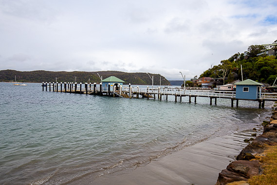 |
The Sydney Coastal Walk begins at the Palm Beach Wharf on Pittwater, a flooded sound. I can hear the waves breaking on Palm Beach just over the hill, but from here I head northward along the Pittwater shore. |
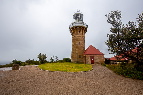 |
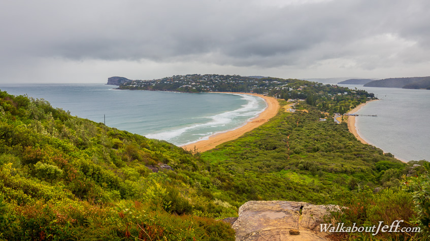
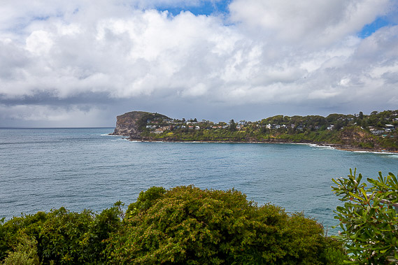
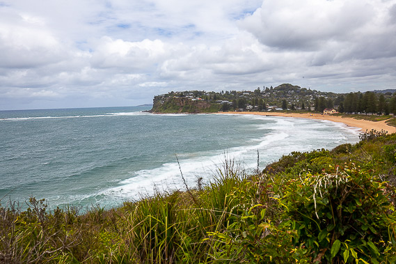
After about three kilometres of following the last of the road, the beach, and a walking track up the hill, I reach the Barrenjoey Lighthouse, Sydney's northernmost building. From here I can see down the coast where I will be following over the next two days towards Sydney Harbour - today's main image. |
 |
Descending from the lighthouse, I follow Palm Beach southwards to the northernmost suburbia of Sydney, a couple of hours north from the city. |
 |
Upon reaching the end of the beach, I find the start of the Bicentennial Coastal Walkway which goes from here down to Manly where I am aiming to reach by the end of tomorrow. This first section of the track follows the roads crossing over the rugged sandstone headlands. |
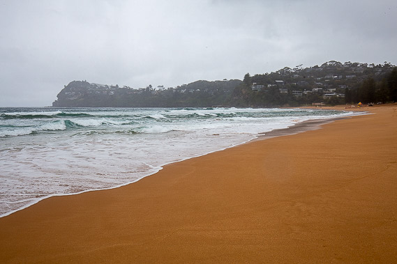 |
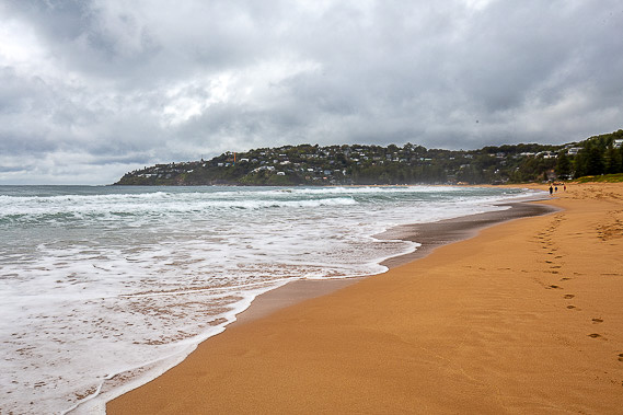
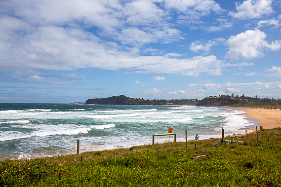
I follow the golden sand across Whale Beach. These beaches are usually very busy, but today there is hardly another person on the beaches as they are closed to swimming and surfing due to the stormy weather and strong winds blowing in from the south east bringing a big swell and dangerous currents. |
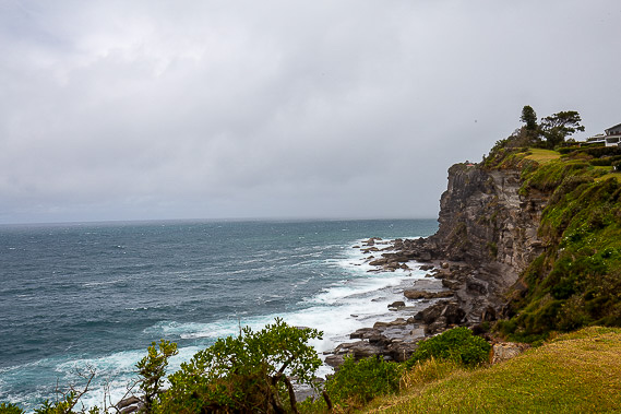 |
A walking track heads over the Careel Headland Reserve, a long succession of rugged headlands and steep cliffs against which the large waves pound. |
 |
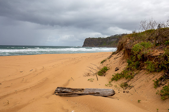
After following the track over all the headlands, it descends to follow the low sand dunes above Avalon Beach. |
 |
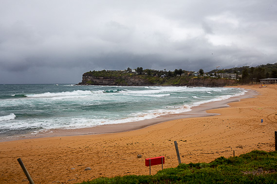
After crossing another headland, I descend into Newport Beach as I continue heading southwards. Long Reef Point which I will be rounding tomorrow appears in the distance as the clouds begin to break. |
 |
A narrow trail drops into the remote Bungan Beach, which I cross about half way before following another rough track up the steep hill to cross around the next headland. |
 |
I reach Mona Vale Beach in the mid afternoon where I complete today's hike, now almost half way along the Bicentennial Coastal Walk. |
|