Introduction to today's journey
Today's journey departs Manly Beach heading around Manly Head into the entrance of Sydney Harbour, passing an old military area and a quarantine station. Upon reaching the harbour side of Manly, I start hiking the Manly to Bondi walkway following the fish signs deeper into the harbour until finishing at the bridge at The Spit.
Distance hiked today: 23.4km
Total distance hiked: 65.6km
Today's Journey
 |
Starting from Manly Beach, I follow the path around to Shelley Beach and continue along the track to the start of the rugged headlands which this morning's track will be heading around into the harbour. Cloud still covers the sky but the strong head wind has completely disappeared making the ocean swell calmer. |
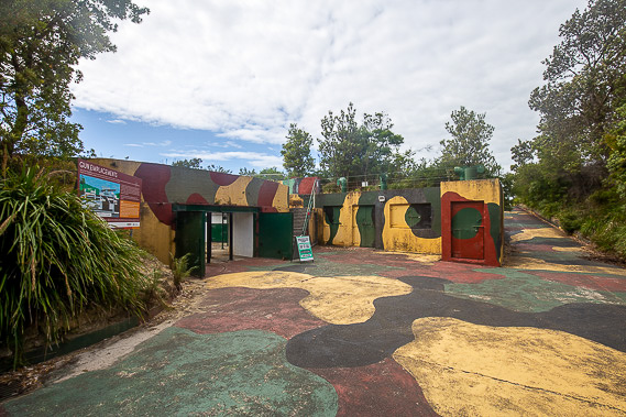 |
The track heads inland a little to enter an old military area defending the harbour during the second world war. This is one of several bunkers and gun emplacements on the otherwise scrubby headland. A little past here is a large memorial area to all the wars Australia has participated in. |
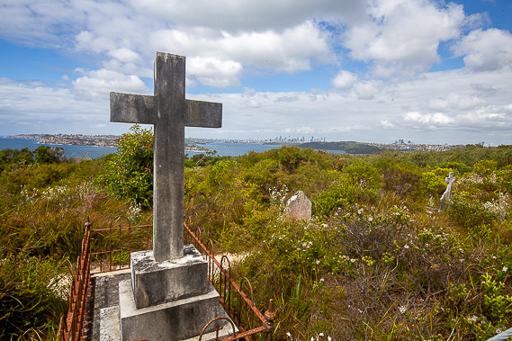 |
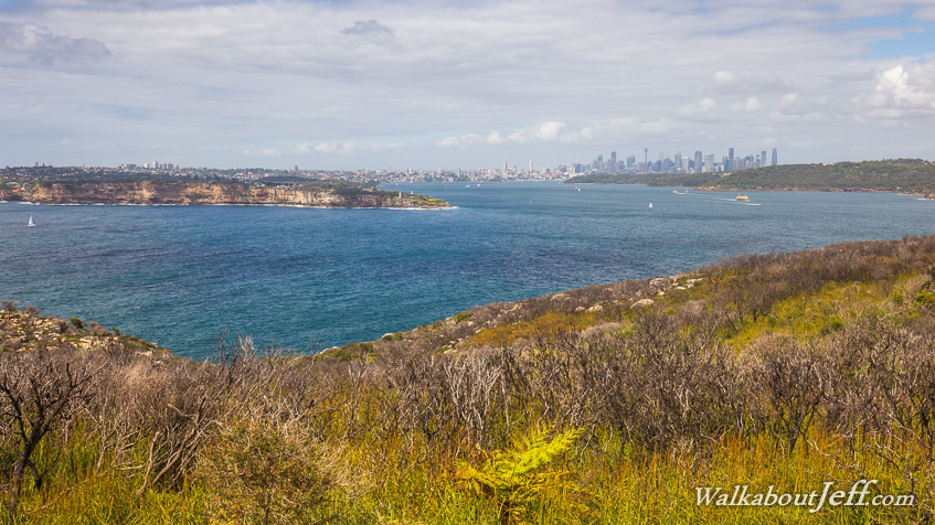
Heading over the top of the head, I get my first view of the harbour and the city centre. The trail then drops a little to the quarantine station cemetery with a lot of graves from the seafarers who arrived but didn't survive. Further down the track I walk through the old quarantine village. |
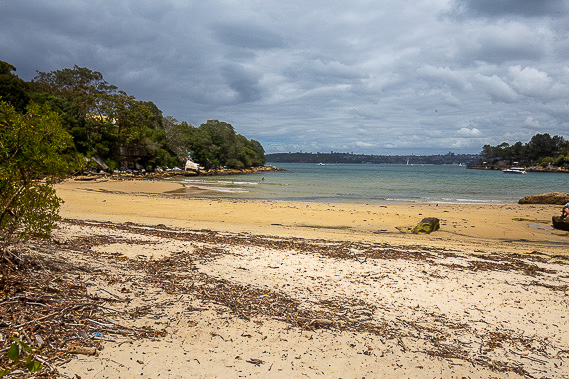 |
From the quarantine village the track continues to descend until it reaches Collins Beach, famous for its small penguin colony. After crossing the beach, a narrow track heads into suburbia crossing the suburb of Manly. |
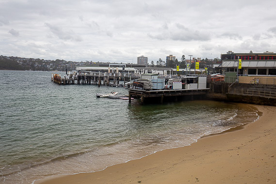 |
I reach Manly Harbour having completed the ten kilometre circuit around the headland. A narrow strip of land going back from here links the town centre with Manly Beach where I started earlier this morning just a couple of hundred metres away. From here the recently established eighty kilometre Manly to Bondi walking track begins. Little black and yellow fish signs will point the way over the next several days as I explore Sydney Harbour. |
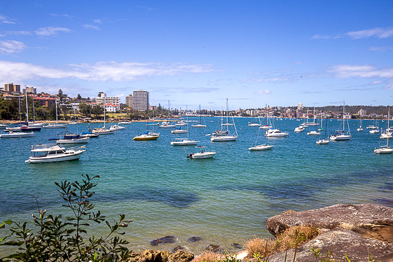 |
The walking track passes above the turquoise waters of North Harbour as I leave Manly passing under dense suburbia and seeing many boats on the water. |
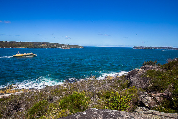 |
After heading around the back of North Harbour and heading up the other side, I reach the rugged Dobroyd Point from where I see through the entrance of Sydney Harbour as the Manly ferries pass heading to and from the city centre. |
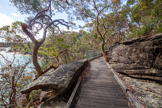 |
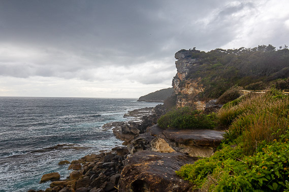
From Dobroyd Point the track crosses the scrubby heathland before descending through spectacular rock formations and gnarly orange trees as I begin heading up Middle Harbour. |
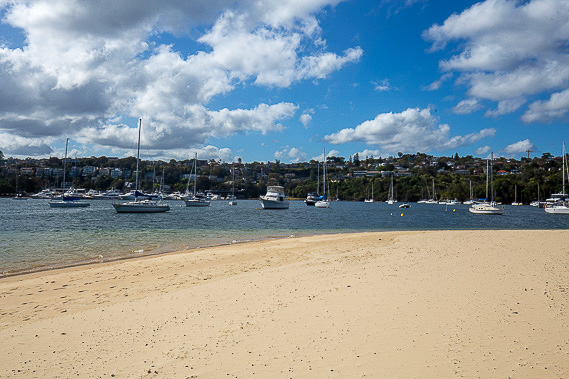 |
The track is rough and the going is a bit slow but eventually I reach sea level at the peaceful Clontarf Beach. Houses line the beach right to the foreshore and the harbour is full of boats. |
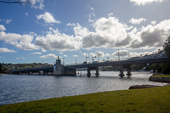 |
The trail continues heading around several small headlands before I reach and cross the bridge at The Spit, bringing me to the southern side of North Harbour and the end of today's trek. |
|