Introduction to today's journey
Today's journey starts with a spectacular sunrise at Cape Byron, before I head to Byron Bay Beach and Tyagarah Lagoon before heading inland to explore Nightcap National Park before finishing in Nimbin.
Today's Journey
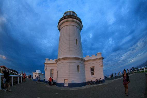 |
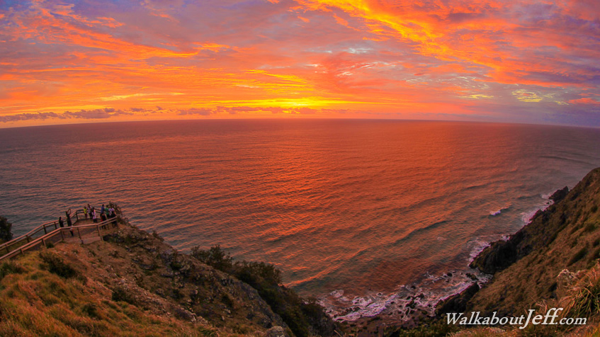
I watch the dramatic sunrise from the Byron Bay lighthouse. The sky illuminates a soft blue colour before the spectacular fiery colours of the sunrise spreads across the thin layers of cloud. Then the colours subdue to their normal daytime hues. |
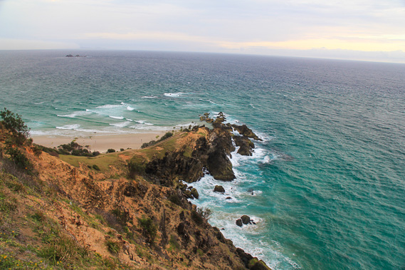 |
From the lighthouse I follow the walking track to the nearby lookout marking the easternmost point of the Australian mainland. From there I descend to the rocks marking the easternmost part of the Tweed Volcano above sea level, and follow Watego Beach towards Byron Bay village. |
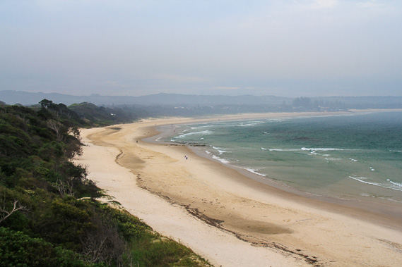 |
Whilst still on the track, I catch a view looking along the length of Byron Bay Beach. |
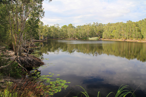 |
Heading a few kilometres along the coast, I reach Tyagarah Lagoon hidden in the forest. A short track leads from the road to this peaceful lake. |
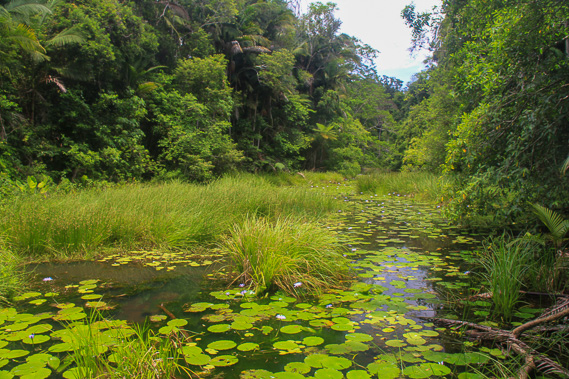 |
Heading inland, I reach the start of Big Scrub, in the Nightcaps National Park. Here I initially explore the wetlands following a track around the back of Rocky Creek Dam. |
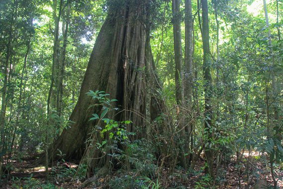 |
From the dam I follow the Big Scrub Loop Track through dense and tall rainforest, now just a small remnant of the enormous forest once covering much of northern New South Wales. |
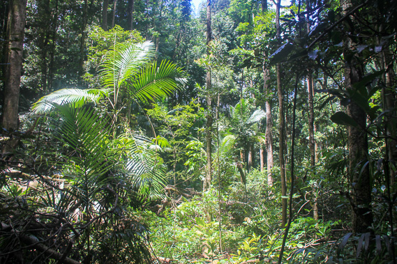 |
The undergrowth is dense under the tall trees as I continue heading around the circuit, eventually returning to Rocky Creek Dam. |
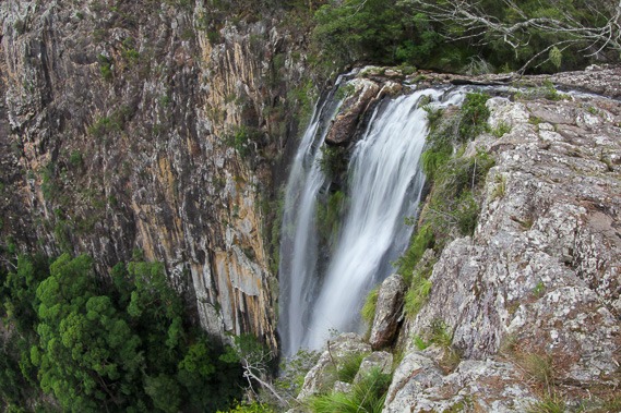 |
From the dam I head up the hill to the edge of a massive cliff being part of the southern part of the Tweed Shield Crater. Here Minyon Falls plunges over the edge falling to the dense rainforest far below. |
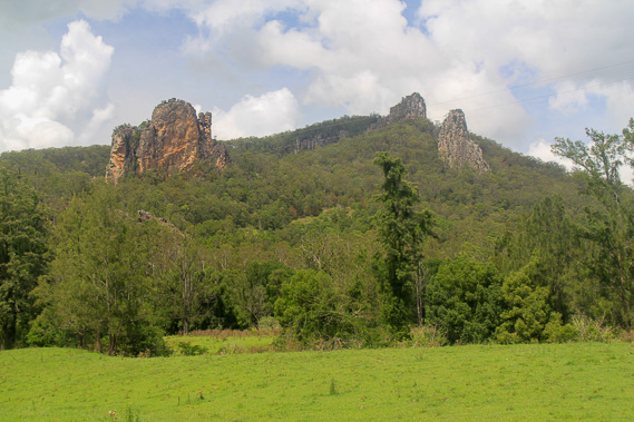 |
Following my stop of Minyon Falls, I head westward further inland until reaching Nimbin Rocks, some curious rock formations sticking out of the hill. These rocks are the oldest surviving formations of the Tweed Volcano, having formed 22 million years ago before the main crater formed further north. These formations are old volcanic plugs which solidified underground becoming much harder than the surrounding rocks. |
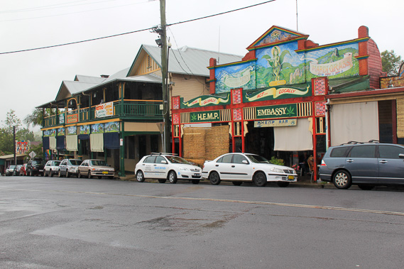 |
From Nimbin Rocks, I head to the nearby Nimbin village, the epicentre of Australia's alternative lifestyle culture. Here I stay the night. |
|