Introduction to today's journey
Today's journey heads up to the top of the Mount Tamborine Plateau in the north of the volcanic region. Here I explore the quaint town and hike several walkways along its forested edge. From there I head down to Coolangatta at the bottom end of the Gold Coast where the Queensland and New South Wales border meets the Tasman and Coral Seas.
Today's Journey
 |
I start the morning exploring the Curtis Creek Falls, at the northernmost extent of the Tweed Volcano. This area has received little rainfall of late so the waterfall is little more than a trickle. |
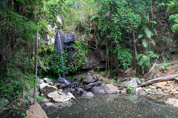 |
Heading further up Tamborine Mountain, close to the village at the top of the plateau, I follow another short trail to Curtis Falls. |
 |
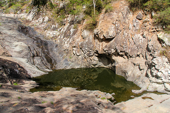
Heading to the west side of the plateau, I follow another track across the top of the escarpment through dense rainforest on the Witches Falls Track. |
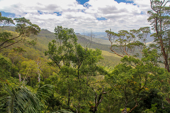 |
The track reaches a lookout over the falls (with no water going over it) looking westward across the Scenic Rim. |
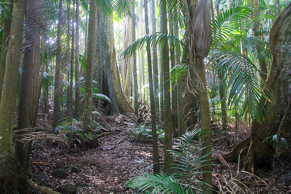 |
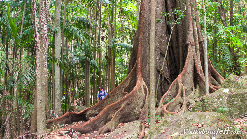
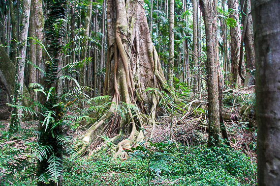
Heading to the other side of the plateau, I hike through tall rainforest along the Palm Grove Track. |
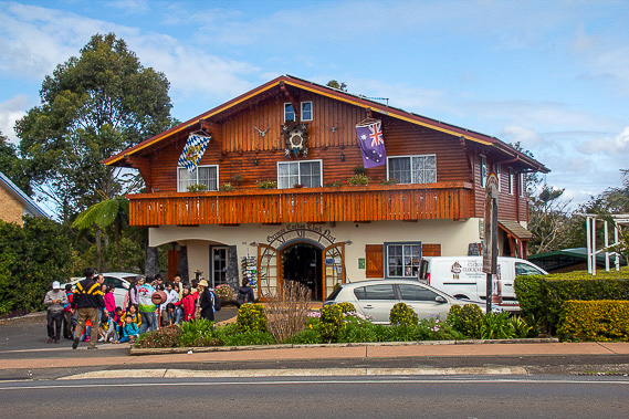 |
After completing all the walkways on Tamborine Mountain, I head to the historic village in the middle of the plateau. The clock shop is fascinating both inside and out. |
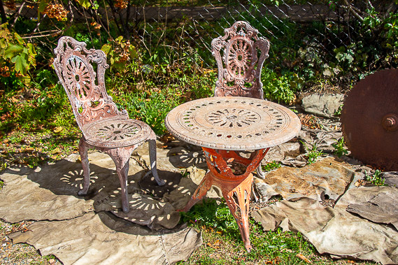 |
A small park has a very rustic dining set and a lot of other old antiques. |
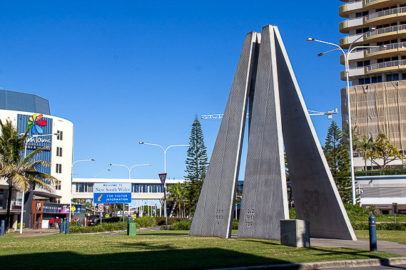 |
I descend Tamborine Mountain and head towards the coast finding this large marker dividing Queensland from New South Wales in the twin towns of Coolangatta and Tweed Heads. |
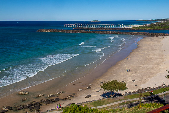 |
Heading up to nearby Point Danger, I look across Duranbah Beach in New South Wales overlooking the Tasman Sea to the mouth of the Tweed River, draining the extinct volcanic caldera into the sea. |
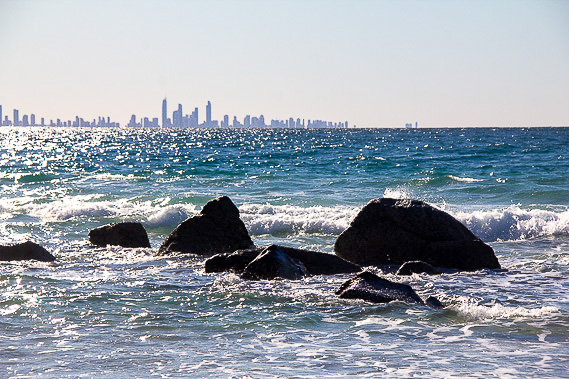 |
Looking north from the point, the mass of skyscrapers of the Gold Coast rises above the pristine waters of the southernmost part of the Coral Sea. |
|