Introduction to today's journey
Today's journey takes me from Routeburn Falls heading higher into the mountains to cross the main divide of the Southern Alps at Harris Saddle into Fiordland. From there the track follows the Hollyford River upstream above the bushline before descending into the hidden Lake Mackenzie.
Today's Journey
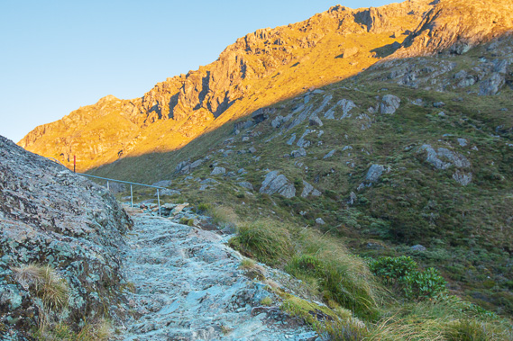 |
Leaving Routeburn Falls Hut at sunrise I climb the steep rocky track over the fault line and cascading Routeburn Falls to enter the hanging valley above it. |
 |
The track ascends moderately around the side of the valley, at the bottom of which the Route Burn flows between old glacial pools. From here I can see into Routeburn Gorge where I hiked yesterday. |
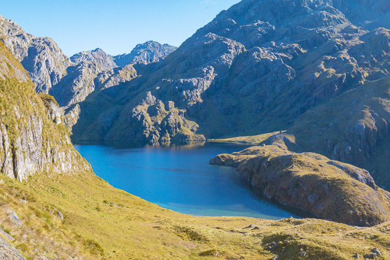 |
Looking down to Lake Harris, an old glacial lake which freezes over in winter and very cold at any time of year. Although this is commonly believed to be the source of the Route Burn, the river flows into it from a hidden valley draining another lake. |
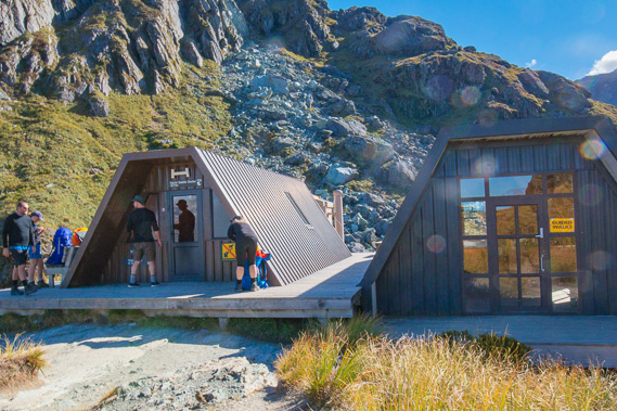 |
Reaching the top of Harris Saddle where we rest at a couple of emergency shelters. The saddle is on the main dividing range of the Southern Alps, with Mount Aspiring National Park to the right (where I have been hiking the past couple of days) and Fiordland National Park to the left. |
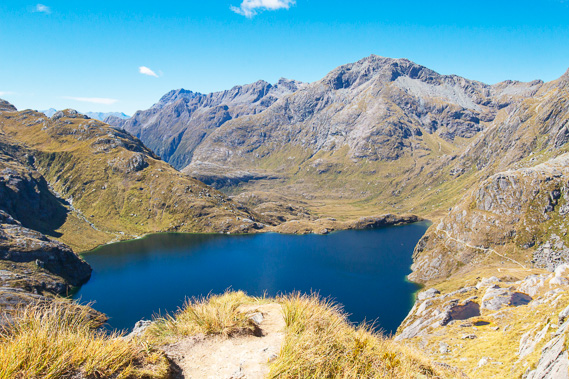 |
I climb Conical Hill behind the shelter to this viewpoint looking over Lake Harris and back along the track towards Queenstown. |
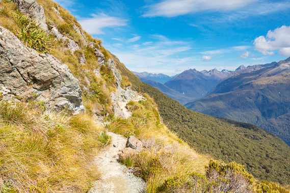 |
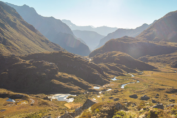
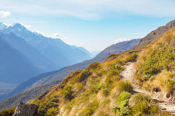
Returning to the shelters, I follow the track above the bushline high above the Hollyford River looking through Fiordland, New Zealand's largest national park. |
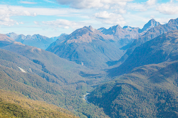 |
Zoomed into the upper Hollyford River with the Milford Road just visible in the centre, where the track ends in two days. |
 |
Looking back along the track down the Hollyford Valley to the Tasman Sea, my first glimpse of the west coast. |
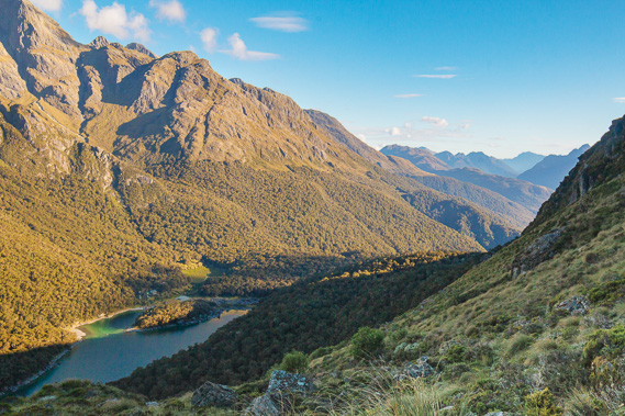 |
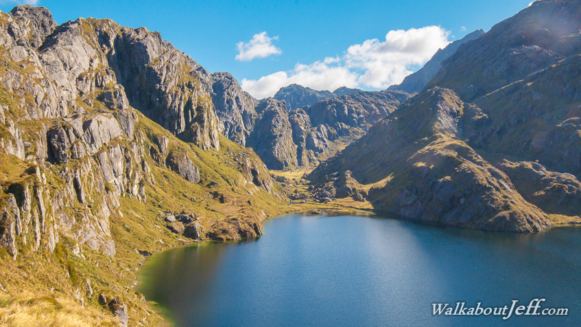
Eventually I reach Lake Mackenzie, with a long descent to the hut on the other side of the lake. |
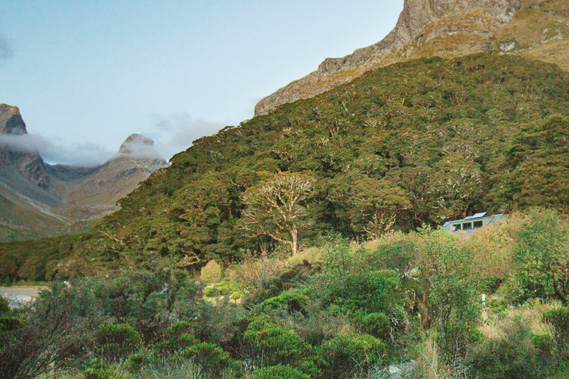 |
Eventually I reach the bottom of the valley crossing in front of the lake. It does not have an outlet stream, but the water seeps through the gravel the last ice age's glacier deposited. The hut now comes into view after a long day's hiking. |
|