Introduction to today's journey
Today's trek starts from Iris Burn Hut steeply ascending the side of the valley into Hanging Valley, then continuing the climb to the top of a ridge. From there I follow the ridge up to the main range of the Jackson Peaks. From there the track heads around the higher mountains of the Jackson Peaks above South Arm of Lake Te Anau. Eventually I reach behind the summit of Mount Luxmore before descending to a limestone plateau where I reach Luxmore Hut for my final night on the track.
Today's Journey
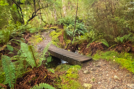 |
Starting from Iris Burn Hut when the ranger confirms the mountain weather has settled. Cold drizzle still falls as I begin rising through the forest up the mountain. |
 |
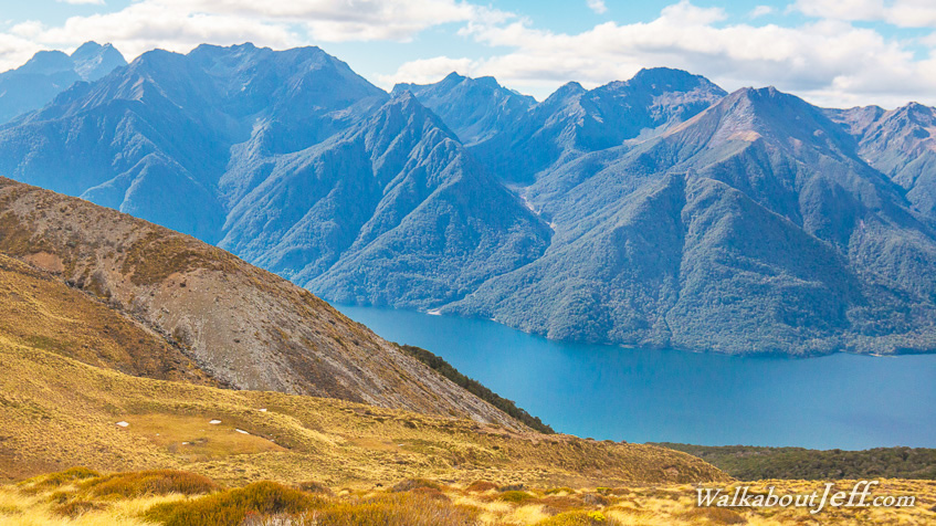
Occasionally I get a break in the forest where I look over the saddle I crossed yesterday towards the mountains. A waterfall plunges from a small hanging valley. |
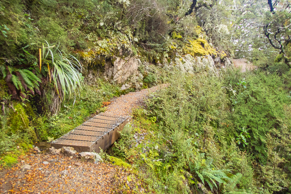 |
The forest gradually thins as the moderate track continues climbing the mountain crossing over Hanging Valley Stream and continues rising up to the ridge. |
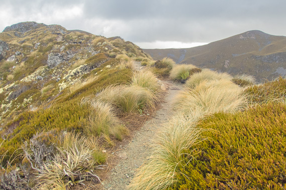 |
Reaching the ridge above the tree line leading up towards the main range of the Jackson Peaks. This is the most exposed part of the track. Fortunately the wind has slowed to a strong breeze carrying flakes of sleet. |
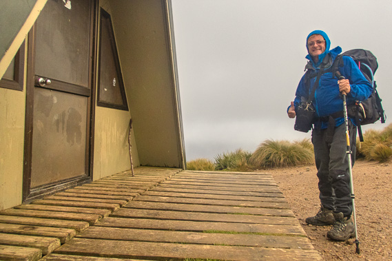 |
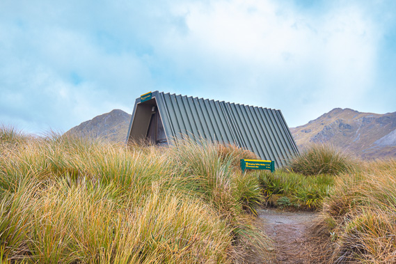
After a long ascent climbing a lot of wooden stairs and ascending gravel track along the narrow ridge, I reach Hanging Valley Shelter at the top of the range. |
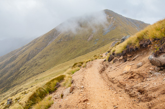 |
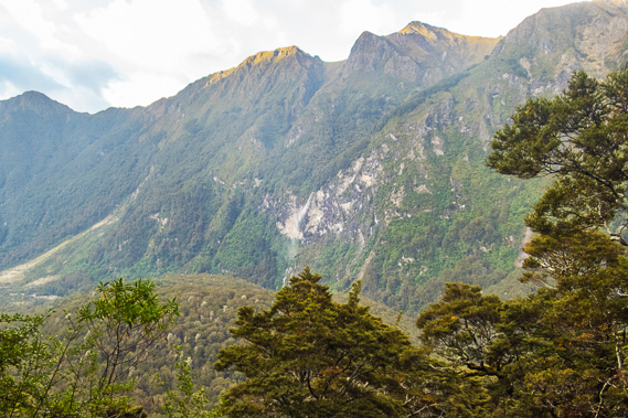
From the shelter, the track follows the Jackson Peaks traversing around the mountaintops high above Lake Te Anau. |
 |
The track rises and falls heading over the mountains. This area has claimed lives in past winters when avalanches fell from the thick snow covering these mountains. Fortunately there is no snow here in summer and early autumn. |
 |
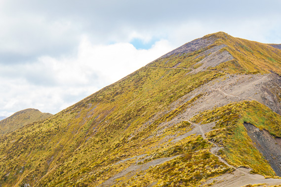
Reaching Forest Burn Shelter where I stop for another break before a moderate climb towards Mount Luxmore. |
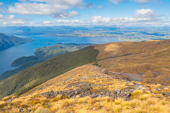 |
Once I've passed Mount Luxmore, the track descends towards Luxmore Hut with Lake Te Anau in clear view. I will be climbing down the mountain tomorrow and heading to Hidden Lakes just visible in the hills between the main lake and South Fiord the next day. |
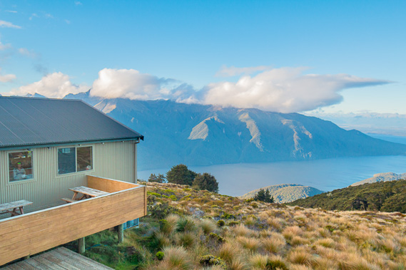 |
Relaxing at Luxmore Hut looking over the lake as the evening temperature quickly plummets. |
|