Introduction to today's journey
Today's journey continues along the backbone of the D'Aguilar Range following Range Road continuing northward through the northern section of the park approaching Mount Mee. I turn off the main trail steeply descending to cross Byron Creek before steeply rising again to eventaully meet the Somerset Trail. I follow the circuit to a spectacular view over Lake Somerset before continuing around the circuit to The Gantry Day Use Area where I complete today's trek.
Distance hiked today: 28.0km
Total distance hiked: 157.4km
Today's Journey
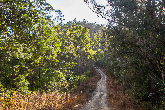 |
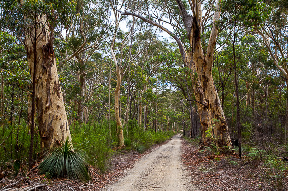
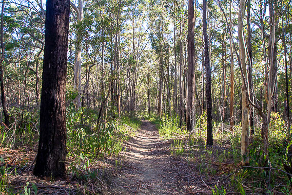
Departing the camp at first light, I follow the mostly descending Range Road over the tops of the northern D'Aguilar Range heading towards Mount Mee. |
 |
The road becomes quite rough as I follow it along the rugged backbone of the now descending range dropping to a low saddle. |
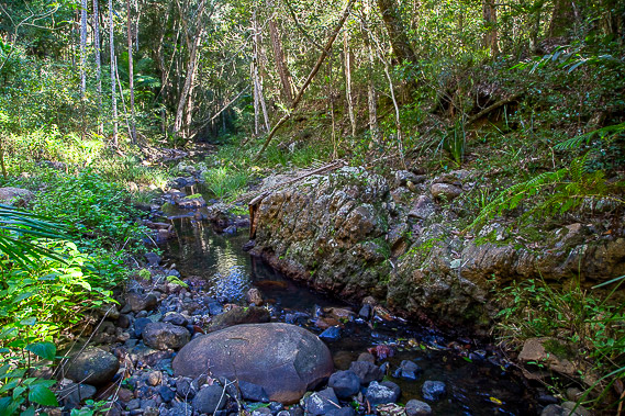 |
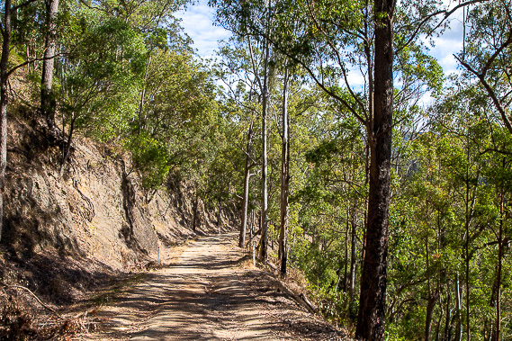
After crossing the saddle, the road rises moderately again over another hill before I turn off Range Road steeply descending Hanger Break to cross Byron Creek before steeply rising on its other side to the Mount Mee plateau at an elevation higher than the top of the range I have hiked so far today. |
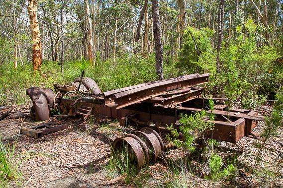 |
Upon reaching the top of the plateau at about 550 metres above sea level, Hangar Break ends and I follow the A Break dirt road heading towards the Somerset Trail. I briefly stop to have a look at some abandoned machinery left from the logging industry which once covered these ranges long before the national park was established. |
 |
Although the big timber of days gone by has long gone, the gnarly trees which remain here on the top of the plateau stand impressive as I continue following A Break. |
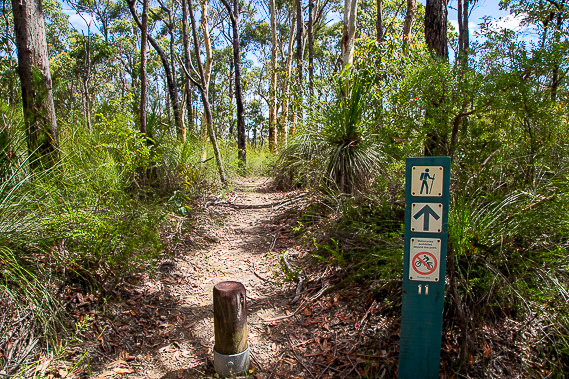 |
I divert along a couple of unnamed firebreaks through the forest before reaching the Somerset Trail, a dedicated walking track where I won't need to look out for vehicles anymore. The track runs along several low ridges gradually ascending towards the western side of the plateau. |
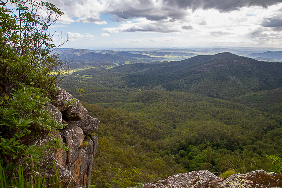 |
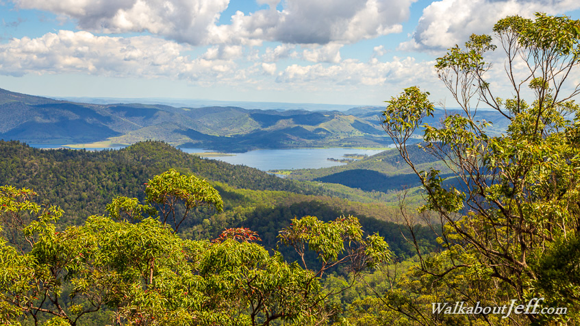
The highlight of the Somerset Trail is at its highest point at about 600 metres above level. Here the plateau suddenly ends in a vertical escarpment dropping over the Brisbane Valley. From here I have views of Lake Somerset and the now distant Lake Wivenhoe with the Great Dividing Range extending across the far distance to the west. |
 |
After resting for a very late lunch at the viewpoint, I continue following Somerset Trail, which gradually doubles back to the east through the eucalypt forest as the cloud dissolves overhead. |
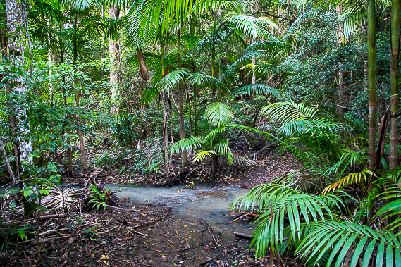 |
The forest gradually thickens into rainforest as I head across the plateau now heading south eastward towards the end of the track. |
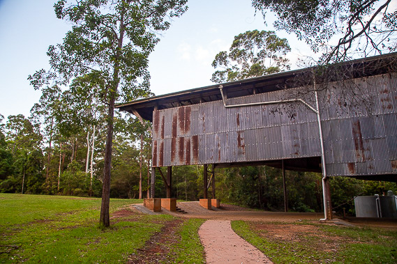 |
The sun has almost set when I reach the end of the Somerset Trail entering The Gantry Day Use Area. This is the main road entrance to the northern end of the D'Aguilar National Park. It was once the centre of the timber milling industry on the plateau, with this enormous shed still remaining, with mechanisms for lifting the huge logs still in place. This area was used for processing and cutting the logs before the timber was taken down off the mountain to be used mostly for building the expanding Brisbane area throughout the early 20th century. |
|