Introduction to today's journey
Today's journey takes me south of Hangaroa hiking along the rugged coast passing the airport before following an old track up the side of one of its main volcanoes. Upon reaching the top I follow the crater rim around to the ruins of Orongo Village looking out over the ledendary Motunui. From there I return down the side of the volcano and explore a sea cave and more of the town of Hangaroa.
Today's Journey
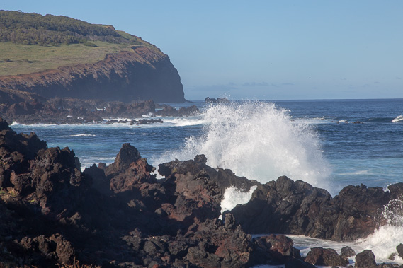 |
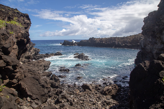
A big swell breaks on the rocky headlands as I look towards the cliffs of the Rano Kau volcano which I'm about to climb. |
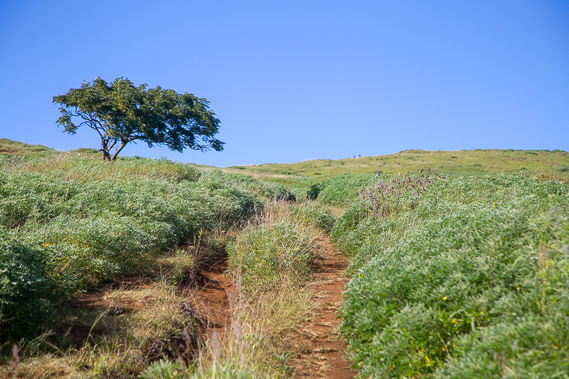 |
I follow the old track up the volcano. The volcano's crater was once the only source of fresh water on the island (there are no streams or rivers), so the locals hiked up here and descended the steep crater to collect their water. |
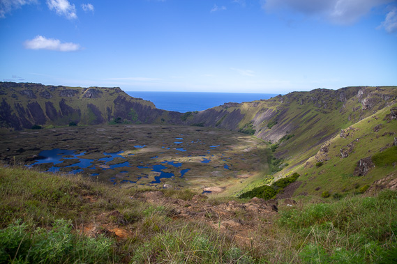 |
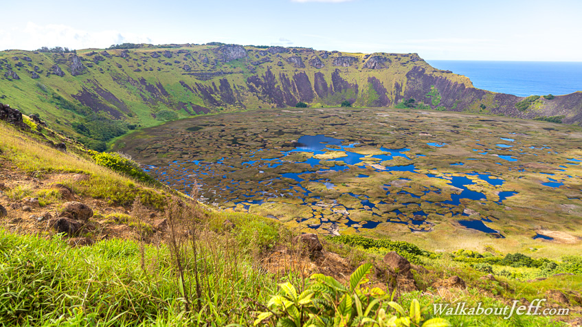
Reaching the top of the Rano Kau crater rim looking into the steep walled crater. The far side of it is being eroded by the sea. This is a dormant volcano which erupted between 150,000 and 210,000 years ago. |
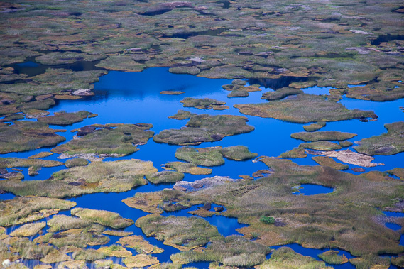 |
The bottom of the Rano Kau crater is a mysterious wetland containing some plant and fungus species unique to this crater. The water level is about 100 metres above sea level. Access to the wetlands is now very restricted to protect this natural environment for a few more thousand years before the sea breaks through the cliff on the far side. |
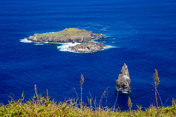 |
I walk around the top of the crater about 90 degrees to the indigenous settlement of Orongo from where an annual race would take place from here descending the cliffs into the ocean and swimming across to Motu Nui, the larger island behind the pointed Motu Iti. There they would collect an egg and bring it back to be elevated to a high social position in the tribe. |
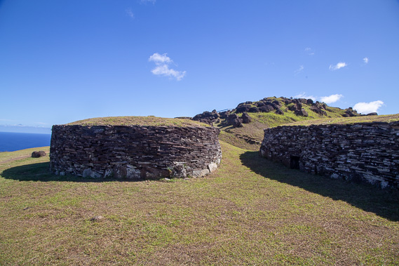 |
The tiny stone huts of Orongo the competitors stayed in whilst waiting for the birds in Motu Nui to lay their eggs. The short stone structures provided good shelter from the elements in this very exposed location. |
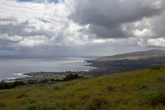 |
I return around the crater and start descending towards Hanga Roa. The entire town is in view below with the airport on this side of it. Beyond the village to the left is all ocean for about 3000 kilometres. The hill to the right is Terevaka, the tallest adn largest of Easter Island's volcanoes standing 507 metres high. |
 |
Just before reaching the start of the town I descend to this rugged bay to visit the Ana Kai Tangata cave with some faded cave paintings done by early settlers. |
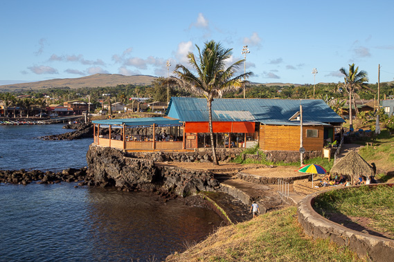 |
Returning to Hanga Roa town where several small shops sit above the very small harbour. |
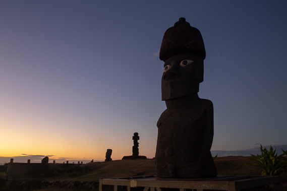 |
Watching the sunset with some of the Moai in the town. |
|