Introduction to today's journey
Today's journey takes me from Kona Kailua in the small hours of the morning up to a mountain pass between Mauna Kea and Mauna Loa. We head part way up Mauna Kea to acclimatise at an information centre before heading up to the summit for a spectacular sunrise. We return down the mountain and I catch a flight across to the far end of the Hawaiian chain landing in Lihue on the garden island of Kauai.
Today's Journey
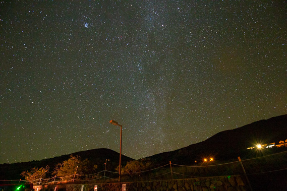 |
Departing Kailua Kona at about 2:30 AM, we head up to the 2021 metre high saddle between Mauna Kea and Mauna Loa, the island's highest mountains. From there we start heading up the mountain to Maunakea Visitor Information Station at 2800 metres above sea level where we stop for an hour to acclimatise to the high altitude under the most spectacular night sky I have ever seen. |
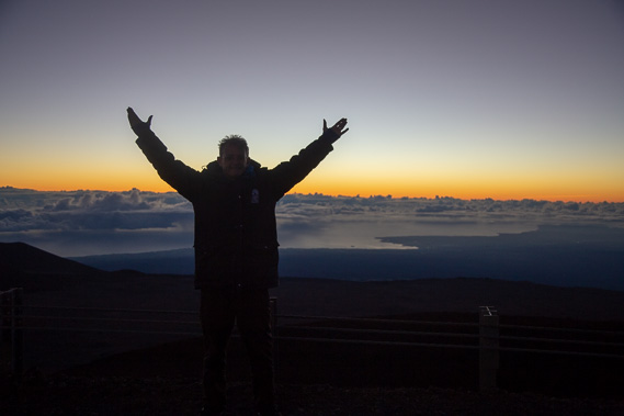 |
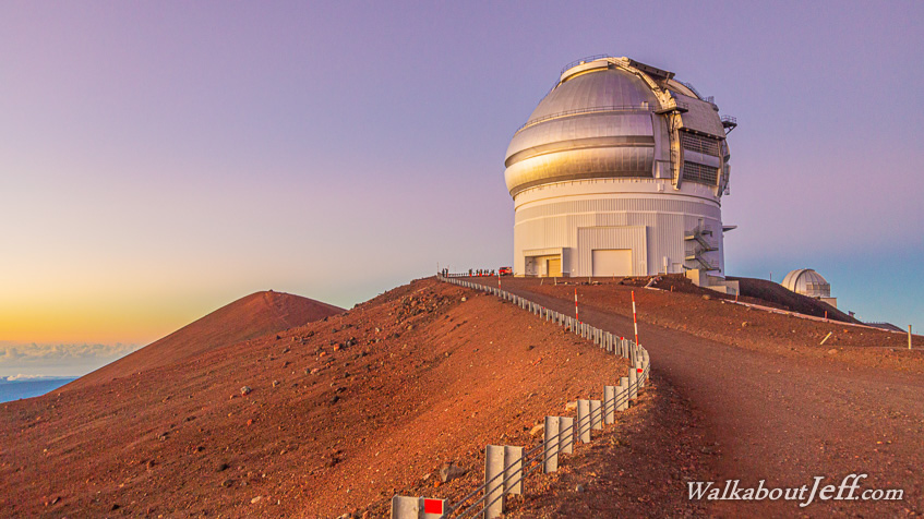
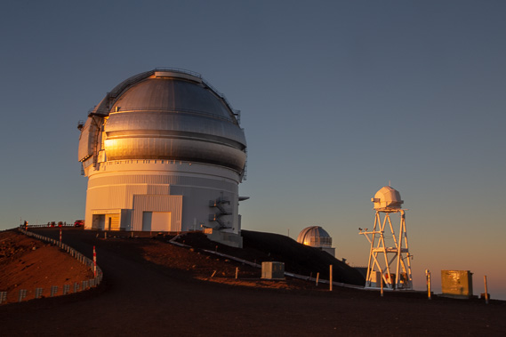
Once acclimatised, we continue heading up the road to the top of Mauna Kea at 4207 metres above sea level. Hawaii sits in 6 kilometres of water, making this the world's tallest mountain from base to summit at 10,200 metres. |
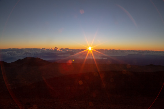 |
The sun rises over the horizon 231 kilometres away above the distant clouds on the other side of the mountain. |
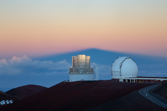 |
Heading to the other side of the summit the mountain's shadow extends nearly 1000 kilometres to the west, looking over the Keck Observatory. |
 |
Looking towards the Gemini Observatory with the United Kingdom Infrared Telescope in the distance. |
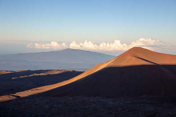 |
View of the Mauna Kea summit with the slightly lower (but much larger) Mauna Loa volcano in the distance as we start heading back down the mountain. |
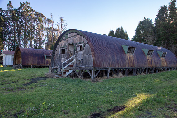 |
We head back down the mountain to the saddle between the two mountains where we have breakfast at this old military base which now operates as a farm. The top of the saddle a short distance down the hill is 2021 metres high. |
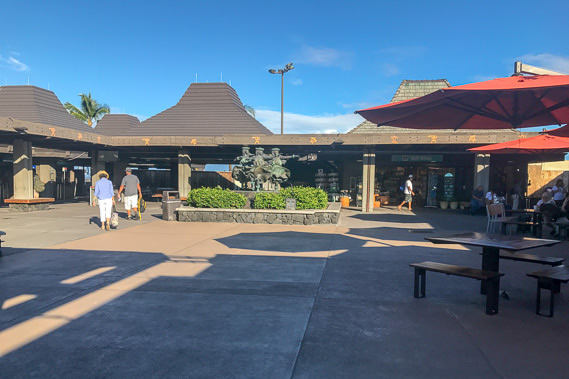 |
I return to the much warmer Kailua Kona and head to the airport. |
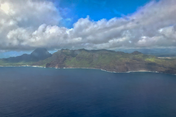 |
From Hawaii's big island I fly across the archepelego passing successively older volcanic islands until reaching Kauai at the other end. This is the oldest main island. This is the view of the island as I come into land at Lihue Airport. This coastline was filmed in the opening scenes of Jurassic Park Lost World. |
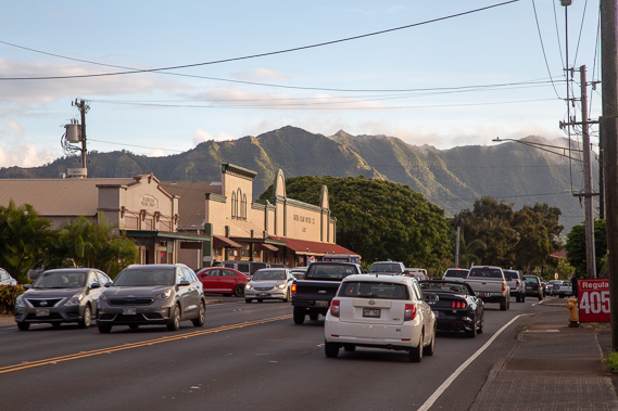 |
Exploring the town centre of Lihue as the sun draws low. |
|