|
||||||||||||||||||||||||||||||||||||||||||||||||||||||||||||||||||||||
|
||||||||||||||||||||||||||||||||||||||||||||||||||||||||||||||||||||||
Home > Treks > Australia > Sunshine Coast Hinterland > 1 |
||||||||||||||||||||||||||||||||||||||||||||||||||||||||||||||||||||||
|
||||||||||||||||||||||||||||||||||||||||||||||||||||||||||||||||||||||
Introduction to today's journeyWe are all visitors to this time, this place. We are just passing through. Our purpose here is to observe, to learn, to grow, to love… and then we return home. - Australian Aboriginal saying. Today's trek starts at the northern end of the track in Mapleton following the top of a plateau ridge to Ubajee Walkers' Camp before descending into Gheerulla valley and following the creek downstream. Upon reaching the Gheerulla bluff, the track steeply ascends it and follows the top of the ridge to the Thilba Thalba Walkers' Camp. Today's JourneyDistance trekked today: 15.5 kilometres. Total distance trekked to date: 15.5 kilometres. THICK fog covered much of the Blackall Range, heavy laden with the soft drizzle that had fallen throughout the night. There was no sign of it clearing yet, even though it wasn’t forecast to fall here today.
IT HAD taken nearly two hours to get here from Brisbane, having left in the darkness of night. We had travelled along the top of the Blackall Range where the last two days of the track will be roughly following. The top of the range was fairly flat with steep gullies dropping off into the valleys on either side. The relative flatness of the top of the range allowed for several small old forestry towns to be established here during the 1880s, namely Melany, Montville, Flaxton and Mapleton. The track begins at the end of Mapleton at around 400 metres above sea level, passes through Flaxton and finishes near Montville. I worked out we will never be more than about six kilometres away from civilisation on this trip even though I imagined parts of the trail will feel very remote. We arrived at the relatively unmarked start of the track along a gravel road at the end of Mapleton, a little past where the houses end going into the tall eucalypt forest towards the Mapleton Day Use Area. From there some will rest in the crowded park, others will drive their four wheel drive vehicles over the bigger dirt tracks and cyclists would ride the smaller tracks.
The Great Walk isn’t overly well known, with just a couple of car parks and no other cars to be seen at this entrance. We chose this entrance only because it was the most logical starting point to complete the track in the shortest distance. There is another car park at the other end, and three more “official” entrances along different parts of the trail. This wasn’t an official entrance, but for us it was the most practical place to start. Walking isn’t much of a pursuit around this part of Australia. I think people here tend to be in too much of a love affair with their vehicles to take to the walking tracks. That largely contributes to the walking tracks not being terribly well known here.
As the track ends in two different locations, we were fortunate in having a friend kind enough to give us a lift up here on his way north to Hervey Bay, and will be returning through this way to pick us up at Baroon Pocket, at the other end of the track, at the end of the fourth day. The car disappeared back along the gravel road leaving myself, Sam and Doug ready to start the track. Now Sam and Doug are both very unphotogenic as many Australian hikers are, so in respect of their wishes their mugs won’t appear in any photos here.
The wet dank smell of gum forest hit us as we put our packs on. Normally parched dry, the gum forest was in the middle of the rainy season so it was showing signs of fresh life. That being said little rain had fallen here so far this summer. The tops of the Blackall Range were amongst the wettest parts of Australia with an average rainfall of around two and a half metres every year. There had been plenty of rainfall here earlier this year, with one storm from a spent cyclone dumping half a metre of rain in this area in a single morning. Although spring had produced around average rainfalls, summer was turning out to be quite dry with the El Nino in full swing. That would mean the streams were going to be running rather low on this trip. There was more rain predicted over the next few days, so perhaps they will rise again.
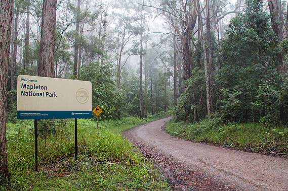
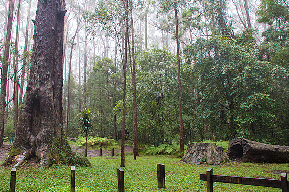
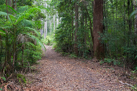
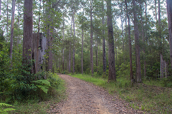
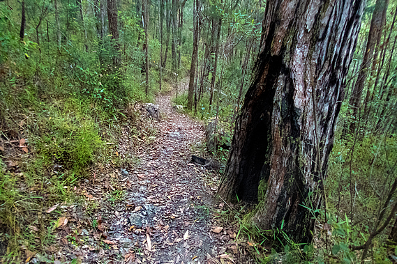
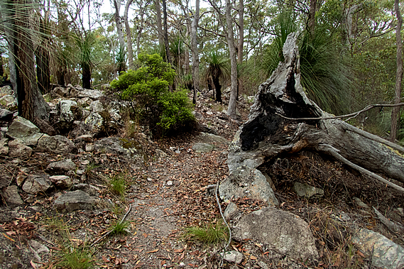
The little park where we set out had freshly mown grass under a couple of large gum trees and one that had been chopped down from the stump, but had been left there uncut with the inside of the trunk now rotting out. We set off along the broad track passing a fenced entrance into the Mapleton National Park. A wide firebreak track extended along the top of a long ridge extending north westward perpendicular to the Blackall Range. The bush here was quite thick, nearly passing as rainforest.
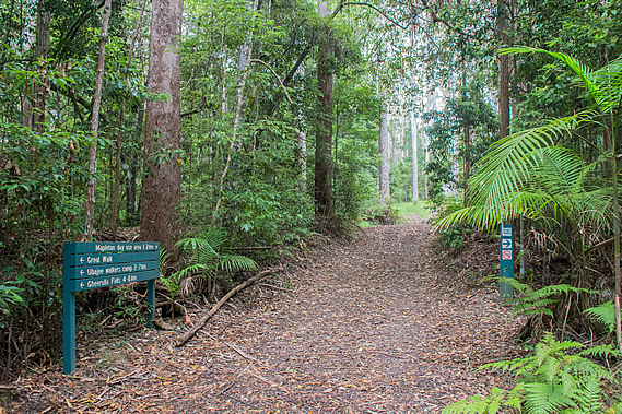
Only a couple minutes after starting, we reached the first junction. The main track continued along the ridge along the wide firebreak dirt road. A walking track led off to the left heading into the dense bush. From here we will continue along the firebreak going around a long circuit of around 27 kilometres before returning to this point in about 48 hours’ time to follow the other track roughly southward to the end of the track at Baroon Pocket, a total of 57 kilometres away. Being reasonably local, I had completed sections of the track in past day trips. The Great Walk links up between a number of popular shorter walks. Nearly everyone who comes up to the Blackall Range to hike just do one or two of the short walks. I was expecting these sections of the walk to be quite crowded, with the rest of the track being relatively quiet.
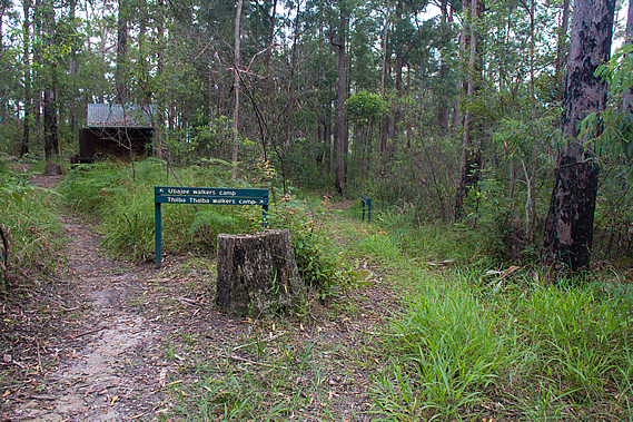
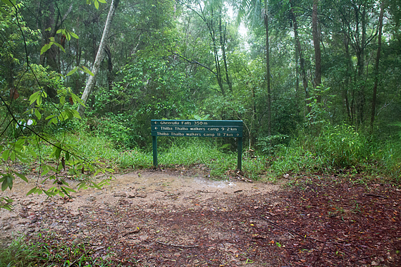
There were large sections of the track that I had never done, the biggest of these being almost the entire Gheerulla Circuit. These four days will be spent doing the entire great walk, so I will be filling in all the remaining gaps. Today we were heading towards the Thilba Thalba campsite, a good seventeen kilometres from here half way around the Gheerulla Circuit. Thilba Thalba wasn’t indicated on the sign, but the nearer campsite Ubajee where we will be staying tomorrow night after completing the circuit was 1.6 kilometres away, and the Gheerulla Falls on the circuit was 3.8 kilometres away.
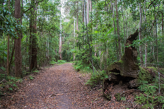
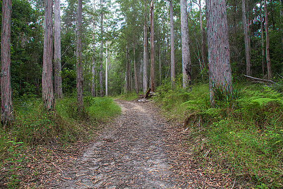
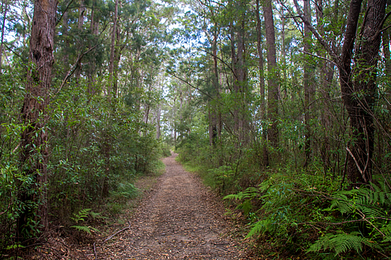
From the junction the wide track began ascending gradually. The bush quickly thinned revealing blackbutt forest - very tall grey gum trees towering a good thirty metres into the thick mist overhead. The name is given due to the regular bushfires in this type of forest leave the lower trunks almost permanently black from where the bark had been burnt into charcoal. Fortunately the bark of these trees is usually thick enough to protect the living tissue beneath. As we continued hiking along the ridge several firebreak tracks came off the main one. The first of these tracks was for cyclists only. The main track we were walking on was a shared one for walkers, cyclists and horses. A couple of ladies riding horses passed us coming the other way on their early morning ride. Shortly afterwards a cyclist overtook us and rode into one of the tracks descending off the main one.
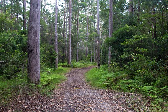
The foggy cloud briefly lifted and thinned enough for the sun to dimly shine through casting soft shadows from the soft slender trunks of the tall trees. This only lasted a few moments though, and once more the sun remained obscured behind thick cloud. About two kilometres along the track we reached a junction where the shared track descended to the left whilst the main walking track continued along the top of the ridge. This track was for walkers only now, so we won’t need to be sharing it with cyclists or horses.
The track narrowed and the bush thickened. The trees here weren’t as tall as those at the start of the track. The ridge now dropped off moderately in both directions as valleys formed on either side. A bit further along the ridge suddenly dipped into a small saddle. The track dropped along the top of the saddle before rising back to almost the same altitude. Just after the drop there was a small sign indicating Ubajee was just 600 metres away. Eventually we reached the entrance to the Ubajee Walkers’ Camp, where we will be staying tomorrow night upon completing the circuit. One track to the left led into the campsite whilst the main track to the right suddenly narrowed and gradually descended towards the end of the ridge which was just nearby.
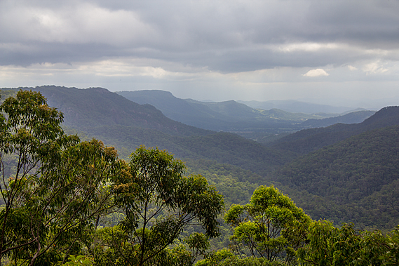
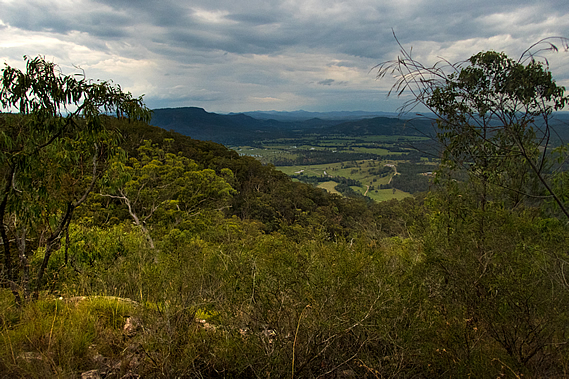
We followed the main track heading below the campsite before dropping to a junction where the track turned a hairpin bend. A short track continued from this bend to a lookout over the Gheerulla Valley. By now the drizzle had stopped falling and the cloud had lifted above the flat ridges on either side of the long valley that stretched out before us. Forested hills rose on either side to a very flat topped ridge on either side. The valley deepened for about seven kilometres to where either ridge suddenly ended and green farmland of the upper Mary Valley crossed over to a final backdrop of the Conondale Ranges and the distant Great Dividing Range.
From the lookout we followed a moderate descent down the end of the ridge into the Gheerulla Valley. After a hundred metres the track became a bit rougher with a sign indicating only experienced hikers should go here. Thick cloud suddenly enveloped us and light rain began falling. The open eucalypt forest clung against the side of the ridge for much of the descent only changing towards the bottom where it quickly changed to dry rainforest. About half way down we were overtaken by a couple of runners who were well equipped dressed as if they were running a serious race. They were clearly in a hurry to go around one of the circuits. Perhaps they were in training for some long distance run. Maybe this was just what they did for fitness and were just burning off their Christmas dinners.
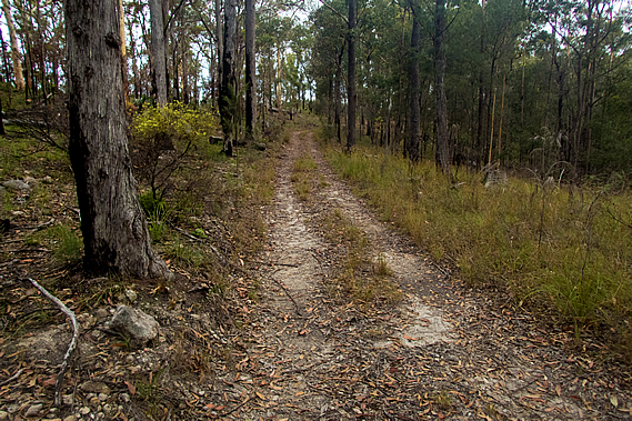
The track had been a fairly gentle descent until almost the very bottom where it became stairs for a few minutes before reaching an old logging track, a dirt road wide enough to drive a four wheel drive on. By now the misty rain had stopped falling. The track followed this road in either direction, making up the 21 kilometre Gheerulla loop which we will be completing tomorrow morning. A signpost at the junction indicated Gheerulla Falls was to the left and Thilba Thalba campsite we were staying tonight was about ten kilometres in either direction on the other side of the loop. We decided to take the track to the right heading downstream. Rain was forecast tonight so perhaps there will be more water flowing over the falls when we arrive there tomorrow.
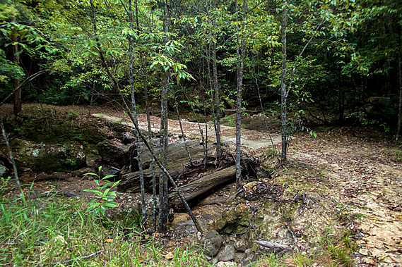
We followed the old dirt road above Gheerulla Creek. The rainforest was too thick to see or hear the creek below us. It descended at a fairly moderate rate with the occasional uphill going around small spurs. One gully had a substantial bridge constructed of a concrete ford laid directly over several large fallen trees that had washed down in past floods. I wondered how long this bridge would last with the huge tree trunks gradually rotting away. The side creek it crossed had no water flowing through it despite the rain that had fallen.
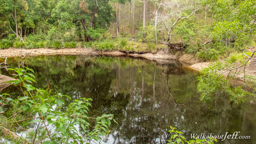
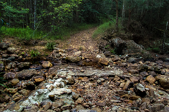
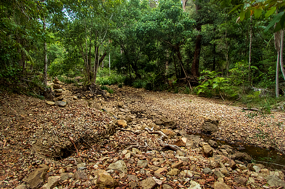
About half an hour passing through the rainforest from the junction we reached the first of three fords crossing Gheerulla Creek. The lateness of the summer rains had set the creek at an unusually low level expected only during the spring dry season. The creek had been reduced to a string of large puddles with almost no flow between them, only just enough of a trickle to keep the puddles full. Any water flowing downstream would be doing so under the boulders strewn along the riverbed.
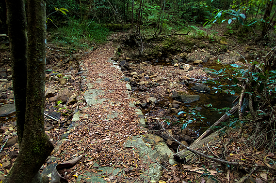
A concrete ford had been constructed across the creek at some time past, but now it had been reduced to rubble having been smashed hard from boulders carried down in past floods. Torrential downpours such as the huge storm last year would turn this nearly dry creek bed into a lethal torrent. Once across the stream the track steeply rose a few metres before continuing downstream through rainforest along a small flat. Upon reaching the next bend of the stream, another ford with a metre wide concrete platform crossed over to the flat on the other side.
Not long afterward we crossed the last of the three fords over the Gheerulla Creek. This ford was a well constructed concrete structure with culverts like the previous one. A large pool of tannin stained water stood upstream, but no water was flowing through the culvert. The gorge was beginning to widen with the vegetation along the dry side channels being pushed over from last years’ floods. It would have been very spectacular here during those floods, but they would have been impossible to reach.
The rainforest was gradually changing to dry eucalypt forest indicating we were now drawing near to the Mary Valley. Following the three fords of Gheerulla Creek the track suddenly changed from a wide forestry road to a narrow trail clinging to the edge of the gorge. Perhaps the forestry road had never been constructed through this part of the valley, or maybe it did once exist but had been completely washed away from the frequent flooding that occurs in this area.
This became first obvious when we reached a small bluff and a steep staircase headed up the hill. It was slow going with our packs in the hot humid air rising above the narrow tract of rainforest by the creek into the relatively sparse open eucalypt forest. The narrow track maintained altitude traversing high above the stream. Occasionally we reached a small gully where the rock was exposed by torrents of water that would sometimes crash through here stripping away the vegetation.
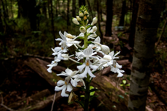
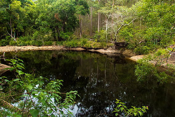
Eventually the track descended to follow close by the creek. The stream still remained little more than a trickle, but the ponds along its length were a lot bigger than the ones I had seen at the three fords. Platypus could sometimes be seen in the crepuscular hours of dawn and dusk. The mirror smooth water was black with tannin stain. The sky remained overcast and it was very humid, indicating rain was on the way. Rain is very hard to predict in these mountains. Sometimes huge storms strike almost without warning, Other times they completely pass you by. The track continued to traverse smooth rocky outcrops towering above the stream, sometimes rising substantially over long flights of stairs only to descend another set of stairs on the other side. Occasionally it would drop into a forested gully where the open eucalypt would become dry rainforest. The occasional white orchid was flowering, in its midsummer peak of spectacular flowers as was typical at this time of year. There was one spectacular specimen next to a cedar tree hidden just off the track. It had a flourish of perfectly formed white flowers with yellow stamens.
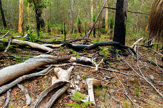
The forest undergrowth gradually became thinner with signs of a bushfire only a couple of years back. Patches of green grass were growing out of the tough soil, but the lower trunks of the trees were still blackened by the firestorm. The only area that didn’t seem to have been impacted was the area immediately around the stream. Here the very lush trees were now growing over a large black pool.
Shortly after the huge pool I reached a sign at the end of a thick forested flat. Ubajee was seven kilometres behind us. From there the stream had undercut the track in a past flood. We were guided around the edge of the stream by a couple of large cairns showing the way around a dry channel that had been carved out by the flooding.
After the cutting the track suddenly came back onto a dirt road again. We followed it up and down for a while as it approached the road end from the Mary Valley. A man passed us heading the other way. He was the first hiker we had seen since the two runners coming down the hill of Ubajee several hours ago. Although this is supposed too be the peak holiday season, very few people hike at this time of the year. From here the mostly young trees had very old gum trees interspersed amongst them. There were a number of burnt out trunks from what would have been a very old forest, but only some of the old trees were still standing.
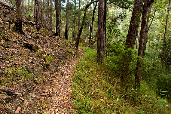
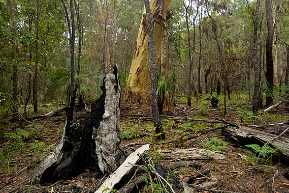
We reached a junction about a kilometre before the end of the dirt road. Although close to civilisation we will need to take the track heading up onto the long northern ridge of the creek for a little over five kilometres to the campsite. The track had been fairly level heading down the valley despite the usual obstacles that come from small landslides, undercutting and vegetation growth. Now that we were almost at the bottom of the valley we followed the great walk track gently around the nose of the range at the bottom of the Gheerulla Bluff. The bush at this end of the valley had by now changed to dry scribbly gum forest, with the tree trunks blackened by a bushfire that had swept through here a year or two ago. The forest floor was littered with fallen and burnt trees and branches.
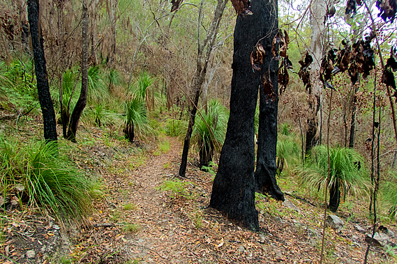
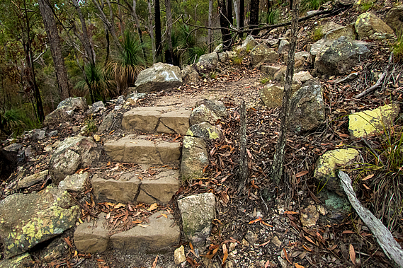
Grass trees grew in abundance around the burnt trees adding greenery to the otherwise struggling grass. Although grass trees are a lot shorter than the eucalypts they grow around, they are a lot older. The trunks grow only one centimetre per year. The grass trees growing around here were standing at a metre, being around a century old. The largest of the surrounding gum trees were no more than 50 years old. The track rose moderately crossing a couple of small gullies with completely dry creek beds. During flood conditions they would be cascading down the side of the hill, but little rain had fallen here of late. The track was mostly even but at one point there were a few concrete steps with deep patterns cast into them to provide better grip and to make them look natural in amongst the rock rubble. These were the first of many steps we’d see on the track.
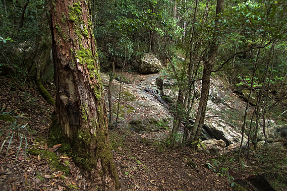
Eventually the track reached the first of what would be 29 switchbacks up the steep Gheerulla Bluff. The steep ascent of the Gheerulla Bluff would have normally been straight forward, but carry backpacks in the high humidity made the climb brutal. Slowly we edged our way up the slope sweating under the thick hot air. Fortunately we still had plenty of water. The track was broad but getting quite steep with concrete steps at each turn. The terrain gradually steepened until the track was negotiating itself between several near vertical rock faces. The rock here was very solid, hard enough to have withstood the millions of years of erosion of the surrounding valleys to allow the bluff to stand out dominant along with the unnamed bluff on the other side of Gheerulla Creek. The forest in between the bluffs remained the same thin open eucalypt with century old grass trees growing amongst them. Smaller trees grew out of the cracks in the bluffs, their growth stunted by the lack of soil. Dried out moss and lichen covered much of the rock faces, clinging onto life.
At one point along the steepest part of the bluff the track itself became a staircase of concrete steps, but fortunately this didn’t last long. The grade started easing off as we reached the tops of the low cliffs. There were a couple of spots where we had spectacular views over the upper Mary Valley across to the Conondale Ranges. The steepness of the terrain gradually eased off as we approached the summit of Gheerulla Bluff. The trees had changed markedly from the lowland eucalypts to the species with vibrant orange coloured bark found similar to those I had encountered in the Snowy Mountains earlier this year. It seemed strange to see these mountain gum trees growing here in such a humid environment, but the winters would be relatively harsh here on these exposed hills. The undergrowth here amongst the basalt rubble was almost non--existent. The rainfall must be a lot lower too being away from the Blackall Range where most of the prevailing rains fall on the other side. Nearby Kenilworth averages about 1500 millimetres of rain every year, a metre less than the top of the Blackall Range.
After the final hairpin bend the track headed straight over the summit of Gheerulla Bluff. Stunted trees grew out of the rubble of rocks making up the volcanic summit. This must have been a volcanic plug similar to the ones in the Glasshouse Mountains. Unlike the Glasshouse Mountains though, a ridgeline of the underlying rock still remained extending from here all the way back to the Blackall Range. The remaining three kilometre hike to Thilba Thalba Campsite would follow the top of this ridge. From the summit of Gheerulla Bluff the track headed down a short distance towards a small saddle. The vegetation very quickly thickened with century-old grass trees once more appearing and the withered paperbark gums standing ancient and dominant in their windswept state.
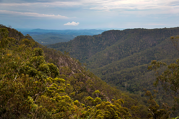
Huge scribbly gum trees covered the grassy fields that dropped steeply into the valleys on either side. The canopy was too thick to be able to see into the valley, but about half an hour and two saddles after reaching the Gheerulla Bluff summit, a side track led to the top of one of the hills. We climbed the side track through the forest to the edge of a vertical bluff from where I had spectacular views into the lower part of the Gheerulla Valley. I could see the creek snaking silently a good three hundred metres below. The forest covering the valley either side was very uniform, rising to the surprisingly flat ridge on the other side. Looking downstream I could see the Mary Valley opening out as it headed downstream under overcast skies. Beyond the valley I could see various hills and mountains all the way to the distant Great Dividing Range.
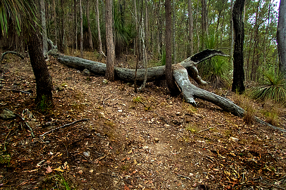
Looking across the Gheerulla Valley, the creek followed the winding valley floor through unbroken forest up to the top of the very flat ridge on the other side. Small storm clouds were passing by but fortunately they were missing this ridge line. The top of the ridge gradually broadened as we continued to approach Thilba Thalba. The track reached an old dirt road and followed it for about half an hour before turning off to continue supposedly a short cut, if it were not for a couple of trees that had fallen over it.
It was not long though before we saw the welcome sign of Thilba Thalba. A small solitary building stood in amongst the high grass and small tea trees. The building was a toilet with a water tank collecting the water from its roof. There were two camping areas. Near the toilet were several plots set up for smaller tents. On the other side of the track near the edge of the ridge were larger campsites for big groups. There was nobody else here and darkness will be falling soon, so we set up camp in the group area. I had my little one-person tent and the others shared a larger two person tent.
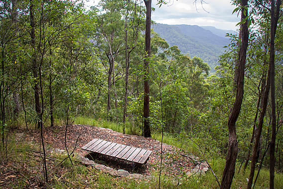
Once our tents were set up, we headed across to a nearby lookout at the edge of the camping area. Two large picnic tables sat at the end of what was effectively a cul-de-sac at the end of a dirt road that would be a service road to the campground. A short descent from the picnic tables down a narrow track led to a bean shaped low rock wall at the edge of a bluff with views down the Gheerulla Valley towards the Mary Valley and the Great Dividing Range under overcast skies. The sun was setting in the distance behind overcast skies. The clouds were quickly thickening so we quickly had dinner at the picnic tables before darkness set in. Nobody else arrived at the campsite, so we had it all to ourselves. That seemed strange being the peak season, but I figured most outdoors types would be crowding the beaches. The hiking types would no doubt be further south, most likely in New Zealand or Tasmania as most of the southern mainland can get extremely hot at this time of year with a severe bushfire risk.
It was about an hour after dark when drizzle started falling. With dinner finished there was nothing to do but for us to retreat to our respective tents. Fortunately we had good drainage around the tents. Although the ground was sloping downwards we had deliberately pitched them on slight rises in the middle of the small sites so water would run around them. There’s nothing worse than waking up in the darkness of night in a pool of water, so thankfully we had planned that well. Rain started falling moderately outside, falling onto the foliage above and large drops hammering the thin tent fly. It was too loud for me to fall asleep. I could hear distant thunder but fortunately it never approached. The rain gradually eased off over the next hour but large drips kept falling from the foliage above for several hours after that. It was about 11:00 when I finally fell asleep. |
||||||||||||||||||||||||||||||||||||||||||||||||||||||||||||||||||||||
|
||||||||||||||||||||||||||||||||||||||||||||||||||||||||||||||||||||||