|
||||||||||||||||||||||||||||||||||||||||||||||||||||||||||||||||||||||||||||||||||||||||||||||||||||||||||||||||||||||||||||||||||||||||||||||||||||||||||||||
|
||||||||||||||||||||||||||||||||||||||||||||||||||||||||||||||||||||||||||||||||||||||||||||||||||||||||||||||||||||||||||||||||||||||||||||||||||||||||||||||
Home > Treks > Australia > Sunshine Coast Hinterland > 4 |
||||||||||||||||||||||||||||||||||||||||||||||||||||||||||||||||||||||||||||||||||||||||||||||||||||||||||||||||||||||||||||||||||||||||||||||||||||||||||||||
|
||||||||||||||||||||||||||||||||||||||||||||||||||||||||||||||||||||||||||||||||||||||||||||||||||||||||||||||||||||||||||||||||||||||||||||||||||||||||||||||
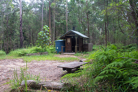
Introduction to today's journeyWe cultivated our land, but in a very different way from the white man. We endeavoured to live with the land; they seemed to live off it. I was taught to preserve, never to destroy. - Tom Dystra. Today's trek goes through the village of Flaxton before heading into the Kondalilla National Park and descending the spectacular Kondalilla Falls. The track continues downstream until reaching Obi Obi Creek, which the track follows upstream through a gorge to its end at Baroon Pocket Dam. Today's JourneyDistance trekked today: 16.1 kilometres. Total distance trekked to date: 54.9 kilometres. HEAVY rain had fallen throughout the night at the campsite, but fortunately the insides of our tents had remained dry and the excess water had run off the ridge down into the deep gullies below.
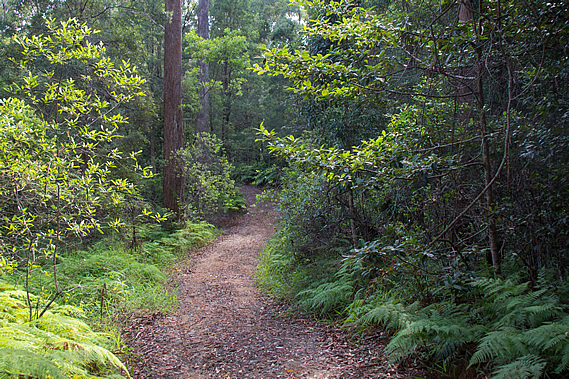
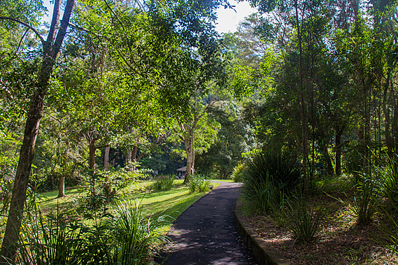
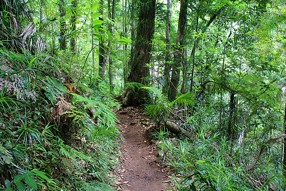
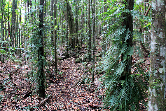
Perhaps this was why the three campsites along the trail were all on top of the ridges. If they were down in the valleys they would have been at risk of flooding, not to mention the rainforest vegetation is fast growing and the conditions very humid. The valleys are also inaccessible. Each campsite has a dirt service road making them easily accessible for maintenance. We packed up the tents drying them off as best we could before heading out of the camp and following the broad service road through the thick bracken. The road itself was clear and in good condition, covered in leaf litter.
The rain had stopped falling and the sun would occasionally come out brightly illuminating the wet foliage, but these periods of sunshine were very short lived. More rain was expected for later today according to one of the other campers who had been staying here last night. He was hiking onto Ubajee today. After half an hour I could see the gravel Flaxton Mill Road, named after a timber mill where the huge trees that had once covered the forests had been processed after being cut down.
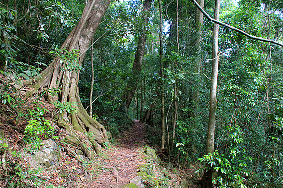
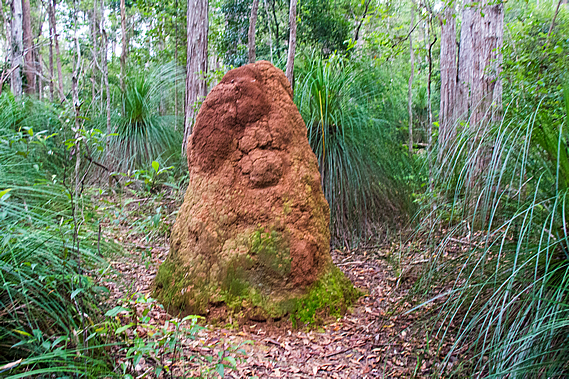
The service road went directly to the Flaxton Mill Road, but the track turned off following a narrow trail through the thick undergrowth to the left. After about two hundred metres it passed a huge termite mound standing about two metres high before climbing a short distance to a style at a small car park. This car park wasn’t one of the “official” ones. It was like the one where we had started at the beginning of Leafy Lane. We had travelled 1.2 kilometres from the campsite.
Green signpost arrows directed the great walk along the Flaxton Mill Road. At this point the gravel road became sealed and the bush gave way to a leafy residential area. Flaxton was one of the villages established along the top of the range in the 1880s when timber cutters discovered the rich resources of red cedar, blackbutt and tallowwood. The forest around here was heavily logged. This part of the top of the range is a small town with around 900 people living here.
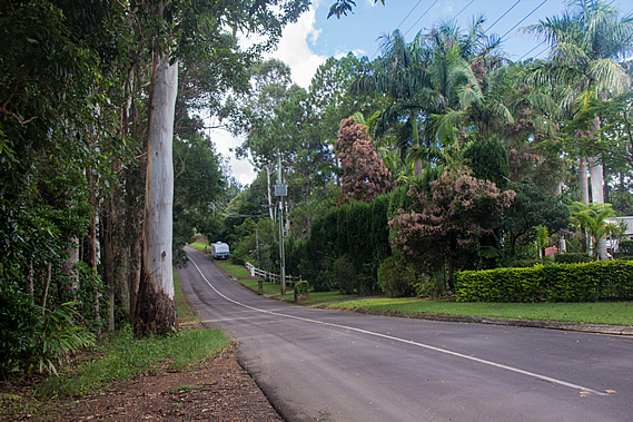
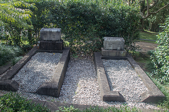
We followed the road into Flaxton. The absence of any footpath meant we had to follow the road, which fortunately was very quiet. Houses sat quietly set back in large well landscaped sections. The greenery was very fresh from the high rainfall the range receives. At one point we passed a tiny cemetery with two graves. They contained the remains of Joesph Dixon and his wife. They were the first landowners here from 1882 when they moved up from Buderim near the coast into their 160 acre holding. It remained bush for the first ten years before being cleared into a large banana and citrus plantation. He named the area Flaxton after Flaxton Hall Farm in the fens of Eastern England.
With the decline in forestry, the farming industry really picked up here and a fruit processing shed was built in 1931. The bananas and citrus has long gone, but there are still a number of avocado farms in the area. The farming has largely given way to restaurants, guest houses and art and craft galleries. The Flaxton Cemetery is considered the smallest in the world by many locals, with the two burial plots right next to each other. A tiny hedge backs the cemetery and the land surrounding it is only just big enough to fit the two graves. The stones were hardly legible, but they read: Joseph C Dixon 1841-1929 and Alice E Dixon 1850-1927.
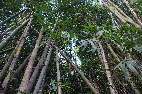
The road then widened and the marker poles crossed to the other side of the road passing more large houses on huge properties set in the bush. It was quite a pleasant walk through this residential area in the middle of Flaxton passing a couple of very interesting letter boxes and spectacular landscaping. Eventually we could see the main road that runs along the top of the range ahead of us. The track entered a grove of very tall bamboo before reaching a wide footpath running along the side of the road.
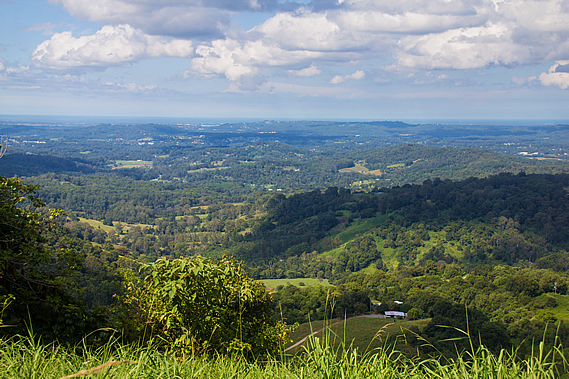
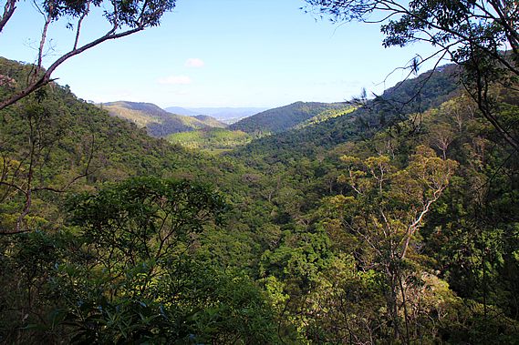
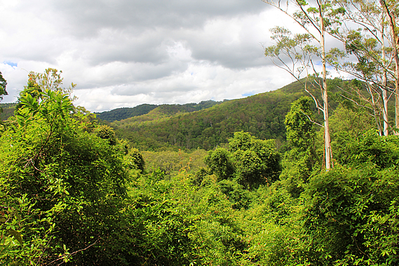
By now the cloud cover had reduced to scattered low cloud. We followed the road heading southwards along the top of the range. For the first time this hike we could see down the other side of the range, with views across to the Sunshine Coast, Bribie Island and even Moreton Island in the distance. The top of the Blackall Range marks the boundary between the tribes of the Mary Valley, and the Kabi tribe of the Sunshine Coast. Few Aboriginal people ever lived on the range. The range was their crossing point on their journey to Baroon Pocket, and back again to feast on the abundant supplies of seafood and fruit following the bunya corroboree.
During the long spells between the feasts, the Kabi were extremely possessive of their land and openly hostile to any trespassing intruders. During drought, the tribes of the Mary Valley refused to cross the range even though there were always abundant supplies of food on the other side. They would rather die from starvation than encounter the hostilities of the Kabi. The tribes of the Mary Valley and Fraser Island warned the early European settlers of the hostile tribe living along the Sunshine Coast. The Europeans moved in showing even greater levels of hostility, completely wiping out this tribe over sixty short years. Most of the stories have been lost to time, but one story tells of a massacre near Lake Weyba where dozens of curious aborigines were lured into a trap and brutally slaughtered. The stream running through the site has now been named Murdering Creek. History records around 700 Aboriginal people in the Noosa Valley in 1894. Ten years later there were none.
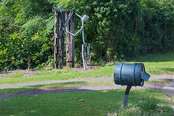
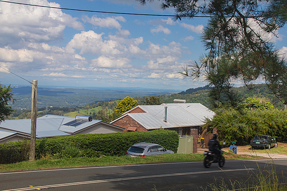
All that remains of this once prosperous tribe are some of the place names, many have a deep meaning and story now wiped from the historical record. The archaeological evidence of their habitation over many thousands of years is no more than the odd midden of sea shells and a few small relics, all to be washed away by the sands of time. On the other side of the roads sections fell down the steep slope holding houses that had the spectacular views from the exposed side of the range. Storms would really buffet this area. The houses were in many cases down below the road allowing for a clear view, and some had very interesting letterboxes.
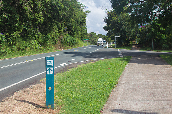
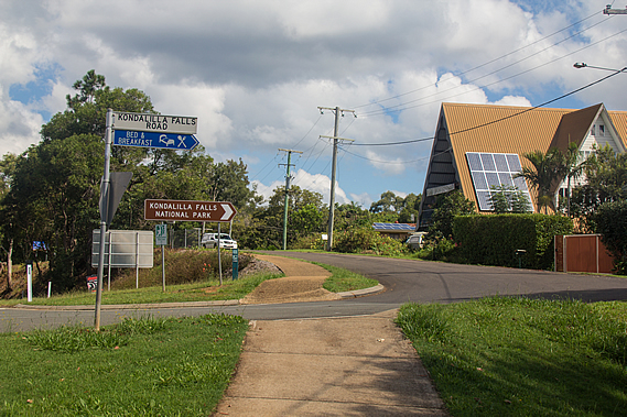
Countless colourful arrays of flowers were out in the weeds on the other side of our pathway. There were masses of yellow flowers on the mowed curb side of the track and on the other side, bushes with purple, red, yellow and white flowers making this the most colourful part of the hike. Although the native forests are beautiful, the variations in colour are very subtle. Here in civilisation where exotic genetically modified house plants prevail, the colours are so much more vibrant especially at this time of year when the flowers come out. Eventually we reached the Kondalilla Falls Road, where the road rose from the main road twisting over the low range top. The paved track crossed the road before following it towards the next forested part of the track.
The blocks in the residential area quickly became larger as the road followed the top of a spur opening up a valley between here and the Flaxton Mill Road spur. Just before dropping from the main range I could see a bank of cloud approaching from the south east. The sunny patchy cloud wasn’t going to last much longer. The spur ended dropping in a moderate gradient. The road continued following this and the track crossed the road remaining as a wide sealed path heading down towards Picnic Creek.
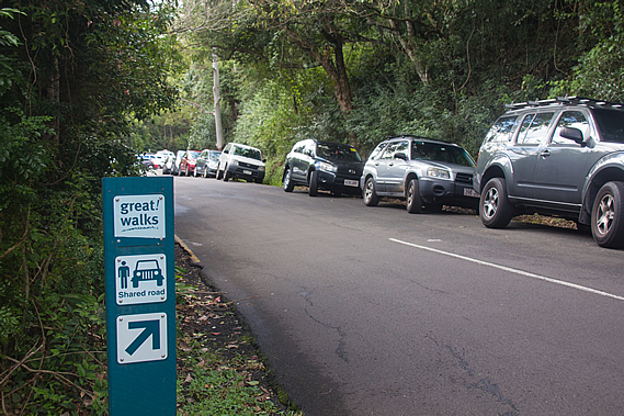
As we continued descending along the road, I could see a row of cars parked along the side of the road. The track crossed the road but didn’t continue. We had to walk past the cars parked along the road to the small car park – the second official one along the track. The car park was full, indicating this was a very popular short-walk area.
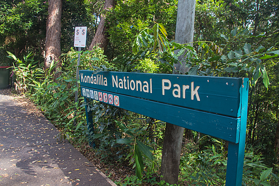
At the end of the car park was a large sign indicating the start of the Kondalilla National Park, the third and final park that the great walk goes through. By now we had hiked over four and a half kilometres from the campsite, with about eleven to go to Baroon Pocket.
From the park entrance a set of stairs descended the moderately steep forested bank to a footpath dropping rather steeply from the basalt capped plateau into a grassy area over much older and softer volcanic rhyolite where several barbeques were set up. There were quite a few people gathered there perhaps claiming their territory for the day for when it gets really crowded at lunch time. I pity the crowds. We were just passing through in favour of a much quieter spot for lunch.
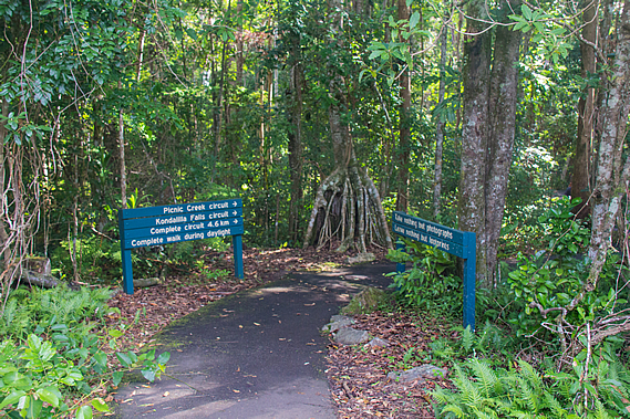
At the end of the grassy slope a curving stone wall directed the track into the forest. A large signboard gave information about the short walks here, namely the Picnic Creek Circuit and the Kondalilla Falls Circuit.
From here the Great Walk follows the Picnic Creek Circuit, a 2.4 kilometre 45 minute easy grade round trip easily geared for the inexperienced. The sign also gave directions about the longer Rock Pools Walk and the Kondalilla Falls Circuit, which the great walk also passes along. Despite the heavy logging in the area, people recognised the natural beauty here and tourists started visiting this area from the early 1900s. A 76 hectare area around here was set up as the Kondalilla Falls National Park in 1906. This turned the range into a tourist destination, marketed as a mountain retreat of cool mountain forests.
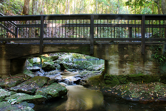
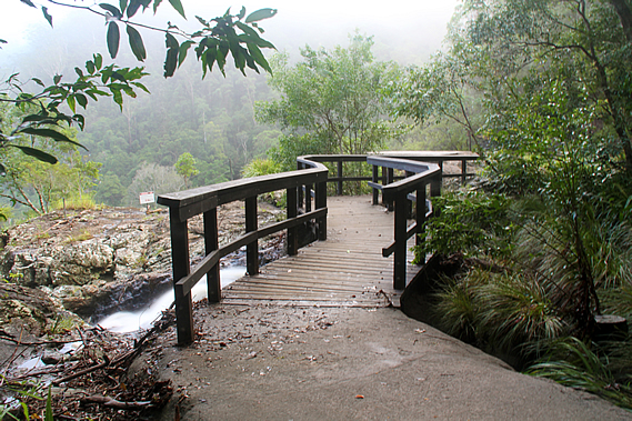
More land was added to the park in 1945, and eventually in 1998 it was combined with the nearby Obi Obi Gorge National Park in 1998 to form a constant protected reserve covering the rest of today’s hike. We entered the forest walking along the sealed track gradually descending through wet sclerophyll forest around a steep gully. I could hear the sound of rushing water ahead. About a hundred metres ahead a bridge crossed Picnic Creek before climbing some stairs over a small bluff on the other side. From the bridge the stream cascaded between dark foliage.
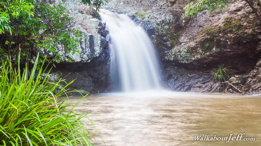
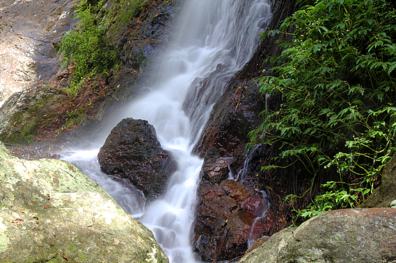
The sealed track was raised nearly half a metre above the ground, which I imagined would be quite swampy even though steep. We reached the bridge and stopped for a few moments as a small group of people talking very loudly in their mobile phones. Clearly they were city folk addicted to their little leashes totally not living in the now. Thankfully they moved on quickly giving us a few minutes of solitude on the bridge. Looking upstream a small waterfall cascading over the layers of basalt dropped into a dark pool. The overnight rain had raised the water level going over the waterfall to a reasonable level, substantial enough for me to get some very nice long exposure shots.
Moss and scrub covered either side of the waterfall, but the middle section had been stripped down to the bare rock from where heavy rain had fallen over the past year. The water didn’t cover this whole area this morning, but it was substantially more than what would have flowed through here before last night’s rain. This was the site of the discovery of the gastric brooding frog Rheobatrachus silus in 1972. It is very rare and hasn’t been seen here since 1979. The tadpoles of this unusual frog develop in the female’s stomach producing a substance preventing the female from secreting her gastric juices.
From the bridge we climbed the stairs to a junction in the track. From here it follows a circuit, one above Picnic Creek, and the other higher towards the ridge line. We followed the easier lower track through the cedar forest. By now it had mostly clouded over with only the occasional appearance by the sun. The weather was beginning to close again.
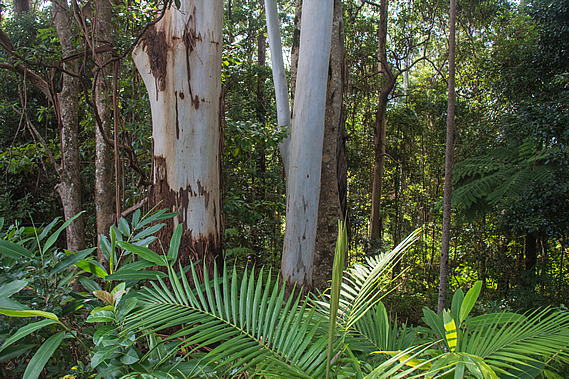
We took the upper track heading towards the top of the ridge. The thick undergrowth quickly thinned to a light coverage of bracken and the trees became mostly pink ash (Alphitonia petrei). Most of the track from the top of the stairs was a wide compacted soil track with the occasional section of boardwalk.
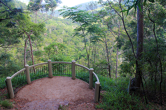
The forest continued to thin until the track reached the top of the descending ridge. A short side track led down some steps to a semi-circular lookout. Taking a break from the main track, we headed down to the lookout.
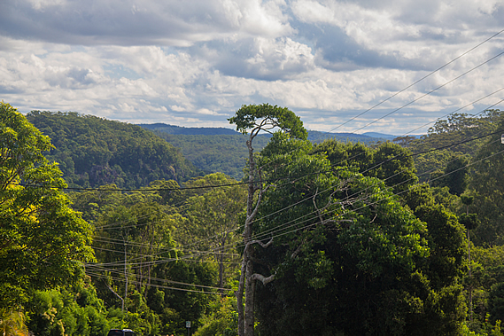
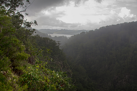
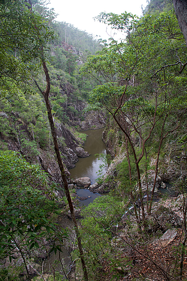
The sky had cleared enough to get a clear view down the valley of Skene Creek, where we will be following over the next two hours before rounding a point to the left to follow the Obi Obi Creek upstream to the end of the track. The valley itself was a two hundred metre drop from where we were, so there was a long descent ahead of us.
Although we couldn’t see any part of Skene Creek, we could hear it tumbling down the nearby Kondalilla Falls in amongst the screeching sounds of a few sulphur crested cockatoos flying above the trees overhead. From the Kondalilla Lookout we returned to the main Picnic Creek Circuit track and continued following it for about a hundred metres before reaching a junction to what would become the most interesting and spectacular parts of the hike. The main track continued around the hill heading back towards Picnic Creek to eventually close at the stairs above the bridge.
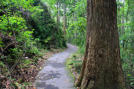
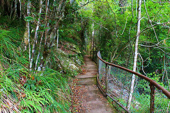
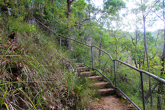
From the junction the great walk turned sharply to the right to begin descending towards the creek. The terrain suddenly steepened and a steel netting fence was on the downhill side of the track, sealed with concrete quite some time ago, long enough to show significant erosion. The forest floor changed from soil to solid rock with the vegetation perched on it growing in any cracks it could find. The track zig-zagged steeply down the rock face with the occasional flight of descending concrete steps similar to those we had encountered on previous days. There were over a hundred steps down to a junction to the rock pools at the top of the waterfall. The bank of cloud I had seen earlier had by now covered the sky overhead.
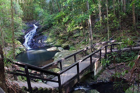
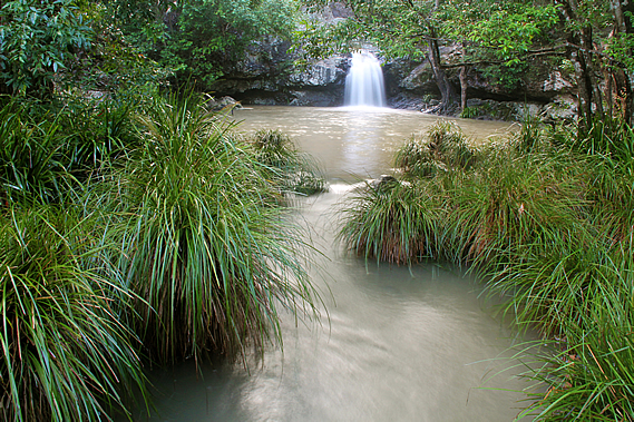
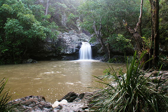
The track to the left led to a nearby rock pool. This was normally a very popular (and therefore crowded) swimming hole at this time of year. By chance a large group of people were leaving just as we arrived leaving only our group. This was perfect timing for photographing the pool with its small waterfall plunging two metres into it. Somewhere upstream Picnic Creek flows into the slightly larger Skenes Creek before plunging into this pool. Skenes Creek is named after the Skenes family who settled in nearby Montville in 1887 with ten other families. No doubt they were the settlers who discovered this pool.
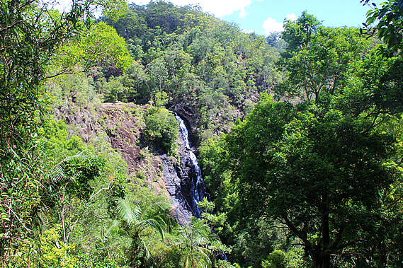
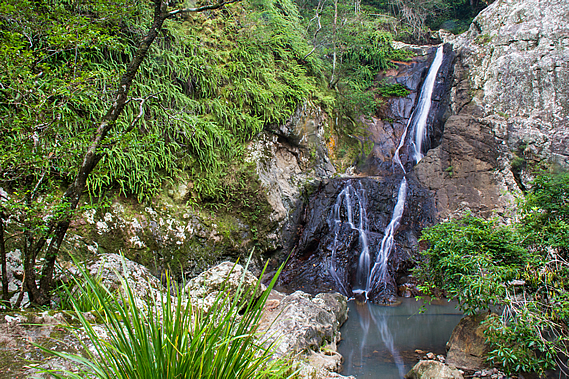
The water was running quite strong into the waterfall. I have been here in the past when the water was no more than a trickle. Fortunately last night’s rain had swollen the creek enough to produce a solid waterfall plunging into the large pool. The water in the pool was dirtier than usual though. From the pool the water flowed through a channel under a low bridge and rushed in twisting cascades to the edge of the cliff over which the Kondalilla Falls dropped into the valley below.
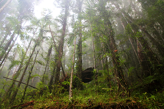
Kondalilla in the local Aboriginal language means rushing water, perfectly describing the cascades crossing the jagged layers of rhyolite and leaping into the softer layers below. By now we were well below the dark hard layers of basalt that had been laid in the eruptions of 28 million years ago, but now venturing through more volcanic layers of a much older eruption from an eruption that had occurred around 210 million years ago in the late Triassic. The cloud had descended over the ridge and quickly dropping into the valley, creating a damp fog. It briefly lifted as we continued along the side track up to a small lookout over the valley. Fortunately the foggy cloud cleared enough for us to see down to the bottom of the valley about a hundred metres below us.
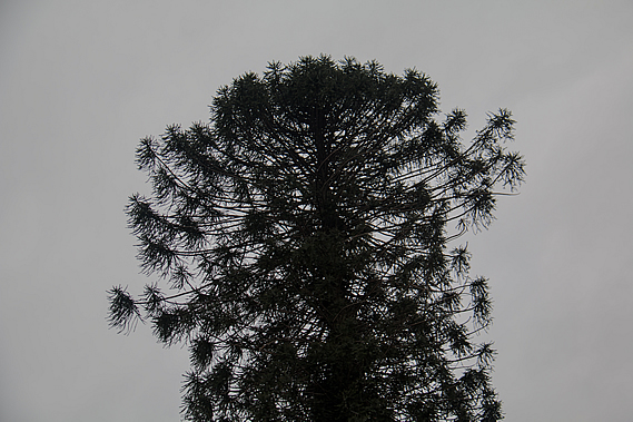
Looking into the valley we could see a stand of Bunya Pine (Araucaria bidwillii), a rare remnant of the great forests covering Australia and much of the rest of Gondwanaland over a hundred million years ago. This is the last of two surviving species of the Aracaria which was a widespread tree of the Mesozoic, appearing in the Jurassic at about the time the rhyolite and sandstone making up much of South East Queensland was deposited. They generally grow to 35-40 metres and will live for around five hundred years. Fossils of these trees from the Jurassic have been found in South America and in Europe.
The other surviving Araucaria is the Araucaria araucana, commonly known as the monkey puzzle tree. It is native to southern and central Chile, and to Argentina. The Bunya pine is often referred to as the false monkey puzzle. The Bunya pine produces large 20-35 centimetre diameter, soft shelled cones every few years. It is commonly accepted they fall every three years, but the actual germination is not so regular being anything from two to seven years. When the bunya nuts were ripening, the local tribe sends out messengers to the other tribes over hundreds of kilometres to let them know about the upcoming Bunya festival and for the visitors to meet at specific sites. Although the Bunya tree grew throughout South East Queensland, they only ever grew in high enough concentrations to support the corroboree in Baroon Pocket, and inland in the Bunya Mountains. They would be gathered from as far away as Charleville, Dubbo, Bundaberg and Grafton.
Somehow these trees know when to produce seeds to enable them to emerge in optimum climate conditions, or perhaps to minimise the chances of being affected by bushfire. They fall to the ground intact, their large size making them potentially lethal. When they hit the ground they remain there until eventually naturally splitting to disperse the 3-4 centimetre long seeds. Sometimes large birds like cockatoos break them open with their beaks. This seems to be an awkward method of seed dispersal indicating they had evolved to be dispersed by large herbivorous dinosaurs. When they died out 65 million years ago, the large mammals took over spreading the seeds. The cones take a long time to grow. The trees pollinate in September and October. The cones take seventeen to eighteen months to form and fall between late January and early March, during the height of the rainy season here.
The large native mammals died out in the first thousand years or so of Aboriginal settlement. The task of dispersing the seeds now seems to have been handed over to the bush rats and the short eared possums. They break the huge cones and carry the nuts to their stores along the ridgelines above the trees. New trees tend to germinate along ridgelines where the nuts are buried. The Aboriginal people never camped amongst the Bunya trees as they were considered sacred. It was also too dangerous with the heavy cones falling from the trees. The trees were so sacred some tribes forbade the cutting of them. Certain men of the local tribe were allocated particular trees. They had exclusive harvesting rights over the trees. The men climbed their trees using a carefully selected piece of vine. It had to be exactly the right length and thickness. They looped one end of the vine around their left hand, threw the other end around the tree and grabbed it with their right hand. They climbed by springing up the tree, leaning back so the vine supported his body weight and created enough friction against the tree to be sturdy. They could climb the tree quickly to knock ripe Buny’yi, as they called it, to the ground.
They would then transport the nuts to Baroon Pocket where it was roasted for the gathering. The seed take about six months to germinate. It initially forms an underground tuber before developing roots after about a year. Then aerial shoots appear as a dark brown rosette and turns green only when the first stem branch appears. The young leaves are soft, but these harden as the tree grows, eventually becoming very hard and sharp. The trees are difficult to cultivate, but once established they are rather hardy, growing in gardens as far south as Hobart and Christchurch. They also successfully grow in the northern hemisphere as far north as Ireland.
The Aboriginal people ate the nut either raw, roasted or boiled. They were also ground into a paste which was either eaten raw, or cooked in hot coals to make a form of bread. At times they were submerged into the mud of running creeks and left to sprout and ferment, eventually to be dug up and eaten as a delicacy. The nuts are said to be very nutritious, having a unique flavour resembling chestnut and starchy potato. When boiled in water, the nuts turn the water into a red nutty tea. The Aboriginal people also ate bunya shoots and stripped some of the bark as kindling.
In modern times, Bunya nuts are sold in grocery stalls around rural areas of southern Queensland. At least two companies use the Bunya timber for the soundboards of their acoustic guitars. Cabinet makers have also used the timber for over a hundred years. The scientific name is credited to English botanist John Bidwell who was famous for documenting flora in New Zealand, but moved to Australia in later life and discovered several new species, including the Bunya pine in 1843.
Before European settlement, the Bunya tree was widespread over South East Queensland. Clearing by settlement has reduced their distribution to a few small pockets on the Blackall Range, Bunya Mountains, and upper Brisbane and Mary Rivers. There are also a few small pockets about a thousand kilometres further up the coast. The fog quickly descended again as we returned to the pool. The track did continue to meet the great walk and return up the other side to complete the Kondalilla Falls Circuit.
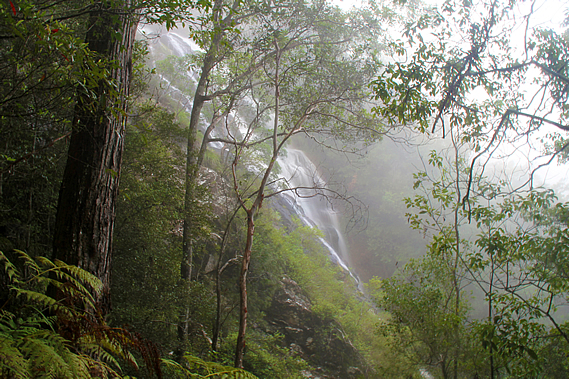
Crossing the small bridges over the creek we could see it dropping over the edge of the cliff in the mist down the Kondalilla Falls which we couldn’t see. The danger of the sheer drop was in sharp contrast to the tranquil pool on the other side. By now two more groups had arrived at the pool dipping in it to cool off. We returned to the junction and continued following the Great Walk. The track quickly became very steep descending a long staircase down an almost vertical bluff. By now thick cloud had completely enveloped us. The tall forest impossibly clinging to the steep terrain looked eerie in the thick mist. It was so thick I couldn’t see across to the other side of the gully, but at one point in a small clearing I could see across to the waterfall where the white water was tumbling down the rock face swirling the warm damp mist.
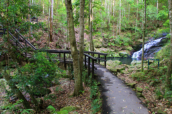
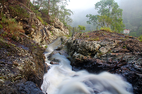
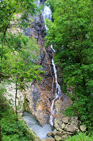
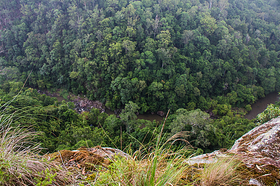
The track headed further out into the gully as it continued steeply descending the stairs. The thick bank of fog suddenly cleared as quickly as it had earlier arrived. At the next viewpoint there was some blue sky visible and the waterfall was completely clear of fog. The waterfall cascaded down the right hand side of the rock wall, leaping from the hard layer of basalt dropping into the softer rhyolite layers below. At this viewpoint I could only see the top half of the waterfall. The rest of it was hidden behind the dense foliage. The stairs stopped and the track continued to drop moderately to a hairpin bend doubling back towards the waterfall. It returned almost right back to the cliff face where it doubled back to head downstream again. By this point we were about thirty metres above the bottom of the waterfall. From here we could see all but the very top of it. The waterfall cascaded ninety metres down the solid rock face into a small grey pool sweeping back into the cliff. From there Skene Creek flowed down the valley.
We continued following the track downstream as the sun came out above the canopy and the forest changed to dense rainforest with its bright green undergrowth and piccabean palms. Once near the bottom of the valley, a stone staircase led down to a junction where the main track crossed the stream over a concrete ford structure whilst a side track headed upstream to the bottom of the waterfall.
We followed the side track which quickly became a bit of an obstacle course clambering over roots and boulders. That only lasted a few minutes though as we reached the waterfall, where enormous boulders flung down the cliff by tempests past blocked the view of the pool we had seen earlier. We found a quiet spot with a view of the bottom of the waterfall to rest. There were a few people nearby exploring the waterfall. After a couple of hours walking it was nice to relax at the bottom of the precipitous gorge under the rushing waters streaming down the falls from high above, hearing the water falling before plunging between the rocks from pool to pool as it headed downstream. I have a particular fascination for little lost world pockets, where you discover a place tucked away in a hidden gully or atop a mountain, misplaced in geological time.
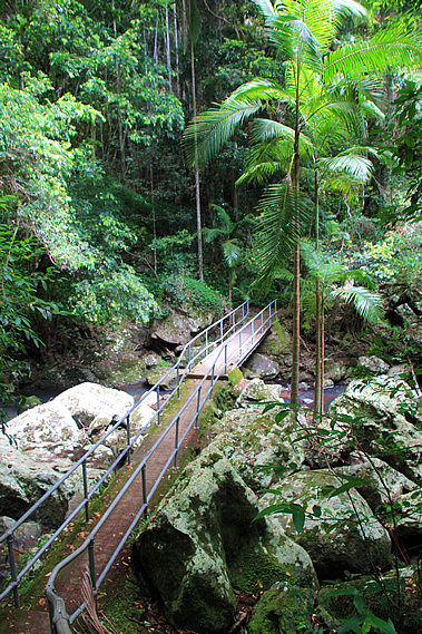
From the bottom of Kondalilla Falls we followed the track back to the junction, and crossed the concrete ford bridge across the rubble of huge moss covered boulders. Although the stream was running higher than usual, the water was almost completely concealed under the rocks. The ford itself had steel railing on either side to make for a safe passage across. The structure was built over several enormous truck sized boulders.
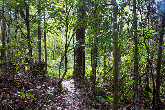
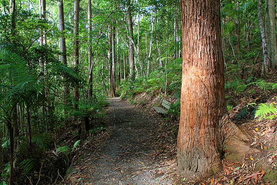
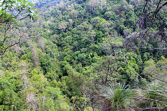
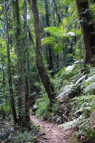
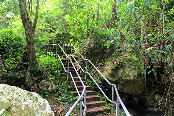
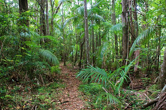
Once on the other side, a steep concrete staircase led through thick undergrowth over a small bluff and down another set of stairs to a fairly narrow dirt track heading across the face of the moderate slope to follow Skene Creek downstream through the dense rainforest containing over six hundred species of plant and animal, many of which were survivors of a completely different age many millions of years ago. Large boulders littered the forest floor having rolled down from the higher slopes of the gorge. Mosses and lichens covered the boulders and also the fallen trees helping the insects and snails to decompose them.
Surprisingly there wasn’t much leaf litter on the ground. All the rainforests I have been in to date have had a thick soft carpet of leaf litter covering the forest floor protecting it from erosion and providing a habitat for the small ground dwelling insects. Here there was not much at all. This was due to the huge metre long worms of the digaster genus. There are several different species of digaster earthworm in South East Queensland, but the ones here would have perhaps been the Digaster lumbricoides. These nocturnal creatures come out of their deep burrows at night, collect the fallen leaves and drag them back underground to eat. At the end of each night they clog the entrance to their tunnels with leaves. This explained the occasional pile of leaves sticking vertically out of the ground.
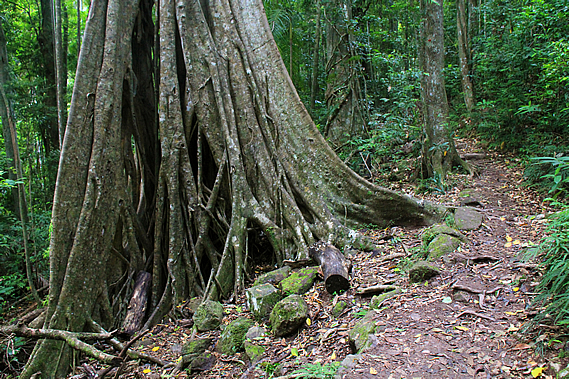
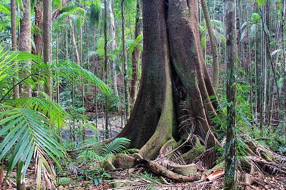
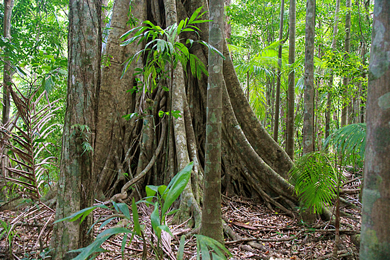
Huge strangler figs and buttressed trees towered into the sky in amongst the Bunya pines. Palm trees formed a middle canopy causing little sunlight to reach the rocky ground allowing the small ferns and mosses to flourish there. When looking closely at the ground, one realises there is an extensive variety of small mosses, filmy ferns and larger ground ferns. Cloud had covered the sky overhead again increasing the eerie darkness of the little rainforest tucked away deep in the gully. In amongst the Bunya trees was the Bolwarra (Eupomatia lauribo) with its distinctive zig-zag branches. These trees have been growing in this area for over eighty million years from when the dinosaurs were around.
The smaller trees had a climbing fern growing on them, no doubt creating entire ecosystems in the dark subcanopy. The track reached a junction to the circuit heading back over to the rock pools above the falls. This type of rainforest covered almost all of Australia twenty five million years ago, after the basalt eruption that created the plateau. As Australia moved northwards breaking further away from Antarctica, the Southern Ocean expanded creating the circumpolar current that began to cool earth into a series of ice ages that continue through to this day.
The rainforest supplied an abundant food supply. January to March was obviously the bunya nut season, with enough to feed the local tribe every year, and during an abundant harvest, enough to go around all the visiting tribes too. Bush honey from native bees was plentiful at that time of year too. Following the bunya nut season was the fruiting season, where many fruits were available from palm trees and other plants, along with turkeys and pigeons. At the beginning of this season all the visiting tribes travel eastwards over the Blackall Range to catch fish and live off the abundant harvests of the Sunshine Coast. The local tribes would return here for the remaining fruits over early winter. August and September provided a supply of turkey eggs. Throughout the year they collected fish, yabbies and eels from the streams, and marsupials, lizards, snakes and echidnas from the forest.
Occasionally the track would follow directly beside the stream. The clear water flowed gently between boulders into large pools of still water. As the track continued to head downstream the undergrowth began to thicken and the rainforest started to thin. Several runners suddenly appeared racing along the track towards Kondalilla, having run from Baroon Pocket on some sort of circuit. They passed us and disappeared as quickly as they had appeared.
A little later I brushed up against some native stinging plant causing my lower leg to painfully sting with the stabbing pain of needles for a while, but fortunately there was no immediate swelling or redness. There are six species of stinging tree growing along the east coast. One of these is the gympie gympie which can be lethal. Fortunately I was attacked by one of the less toxic varieties, but the neurotoxin it injected into my skin was painful enough. Towards the bottom of the valley the track rose along some broad steps over a small rise that would have perhaps been a river terrace at some time past. It followed the top of the terrace for a little while before descending into an open clearing.
Blue sky was visible between the clearing clouds. The trees were spaced well apart allowing for regenerating vegetation to create a very thick undergrowth. Through the clearing I could see out to the Flaxton Ridge where we had stayed last night. This side of the ridge was partly cleared pastureland. From the clearing the track turned southward heading away from the creek passing the junction where it meets Obi Obi Creek. The track crossed the grassy flat at the junction to start following the Obi Obi Creek upstream. the green trees were well spaced.
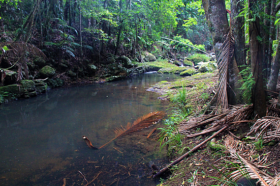
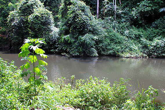
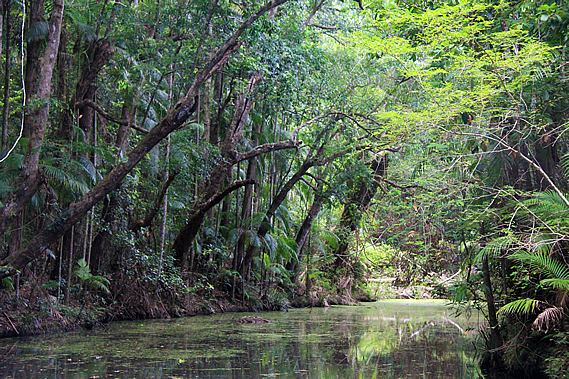
It was not long before we reached the Obi Obi Creek, a very long still channel of grey translucent water stretching up along the valley. There seemed to be little movement in the water despite all the rain overnight. The name of Obi Obi Creek is derived from Ubie Ubie, a well respected warrior chief of the Nalbo Clan who were based on the slopes of the other side of the Blackall Range in the first half of the 19th century. The clan was named due to their use of the hoop pine, where they constructed glue out of its gum.
After nearly half an hour we reached Flat Rock where we briefly stopped. Here the water ambled over a small rapid under a huge slab of rock. We sat down on the large block of rock for a few minutes. I checked the sting on my lower leg. There was still no redness or swelling and the pain had subsided to just a very mild sting. From Flat Rock the track began to ascend the young regenerating eucalypt forest over a small hill to bypass a winding Obi Obi Creek. The grass on either side of the track thickened and it was clear this section of the track hadn’t been cleared for a while. As we reached the top of the rise the trees opened out into large patches of grass which in some cases were almost entirely overgrown, leaving just a thin line through which the track ran.
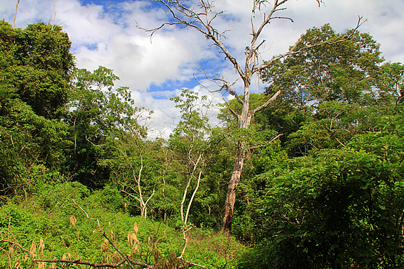
There was the occasional view across the fairly wide valley. The rugged hills on the other side were covered mostly in regenerating forest. This whole area must have been cleared at some stage, then absorbed into the Kondalilla National Park when it was combined with Obi Obi National Park which would have begun soon. The government buying this area of land allowed the two national parks to be joined together. The track began to steeply descend passing some large ghost gums with the bark stripped to about two metres off the ground. A group of four men passed us going the other way heading at quite a pace no doubt to reach the Flaxton Walker’s Camp later today.
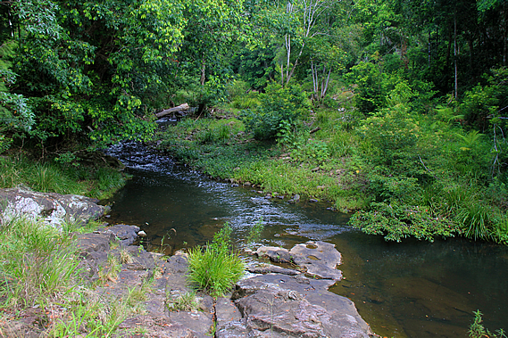
The descent took us through scrubby eucalypt forest before reaching the bottom of the valley in beautiful rainforest. There was a high concentration of palm trees down here. The Obi Obi Creek was just a few metres away cascading on the other side of the thick foliage. We found a spot near the end of the flat where we briefly stopped beside the stream for lunch.
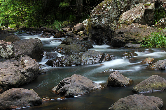
The water rushed over the large boulders under the overhangs of the large trees curling over it. The water was fairly clear given all the overnight rain. Perhaps not as much rain had fallen over this part of the park. Just upstream of the rapid a small stream flowed into the main creek. It was little more than a trickle, but upon heading a few metres upstream we realised this was just the slightest of overflows at the end of a long stagnant channel that had carried the main flow of the stream at some time past before a flood dammed off the end diverting the creek along its current path.
The still water of the channel looked mysterious with a row of trees overhanging about thirty degrees over the water. Returning to the main stream we stopped for lunch at some large boulders under an overhanging tree. We were making very good time with just a climb over the gorge before we reach the Baroon Dam. That will only take an hour or two and we had four hours before our scheduled pickup.
We relaxed as the water bubbled by, cascading through the gaps between the boulders in this secluded gorge, cut off completely from civilisation apart from the track that was hidden in the rainforest. The three camps we had stayed in were all on the ridges, so there had been little opportunity to hear the sound of rushing water. The camps had been set up on the ridges as they were more accessible and easier to maintain. There is a lot more wildlife in the rainforests, and the terrain in the gorges meant there were few natural terraces to establish a suitable campsite.
The sun quickly disappeared behind thick overhead cloud as we left the Obi Obi Creek and followed the thick rainforest, passing large trees and giant boulders having rolled down the side of the hill in the past. The track suddenly began an ascent, zig-zagging up the steep side of the hill at the beginning of the Obi Obi Gorge. The creek was well out of sight through the thick eucalypt forest. It was long moderately steep climb towards the top of the bluff as the forest started to thin and the clouds overhead quickly darkened showing signs of imminent rain as we headed out of the Cretaceous Lost World into the final leg of our journey. Upon reaching the top of the Obi Obi Gorge bluff a short side track lead to a lookout at the summit. From the lookout a cliff dropped a good hundred metres into the gorge. The stream snaked along the bottom of the gorge in one very long puddle. It was as if the entire gully had been carved out.
The cloud had grown thick and driving rain was beginning to fall. Thick misty cloud now covered both sides of the gorge, but fortunately there was still a good view along either way. Looking upstream a fine rain mist draped over the forested hills to Lake Baroon, the shores of which mark the end of the track just 2.2 kilometres walk away. Beyond the lake the hills continued towards the small town of Maleny.
The lake occupies what used to be the Baroon Pocket, where the Aboriginal people met for thousands of years for the bunya nut festival. This was recognised by the earliest European settlers to this region and in 1842 New South Wales governor George Gipps ordered this area to be an Aboriginal reserve, not to be touched by the settlers. This became known as the Bunya Proclamation. The reserve covered the entire Blackall Range down to its bottom at Mooloolah on the Sunshine Coast side. It covered everywhere where the Bunya tree grows. Any European settler attempting to live in these areas would be removed, and timber cutting was forbidden in these forests.
It looked like this area was going to be protected forever, but in 1859 Queensland achieved independence from New South Wales. The following year the Unoccupied Crown Lands occupation Act repealed the Bunya Proclamation providing licenses for squatters and timber cutters. This had been one of the first acts passed by the Queensland government and marked the beginning of the end of thousands of years of tradition for the local tribal people. From the gorge lookout we returned to the track which dropped moderately down the upstream side of the bluff. We passed another enormous two metre high termite mound as we were buffeted by the driving rain soaking the forest.
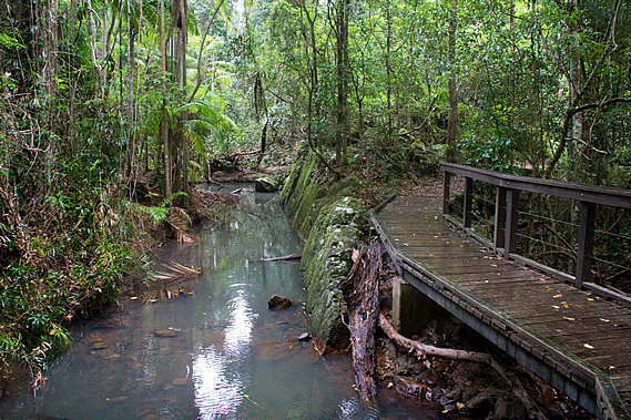
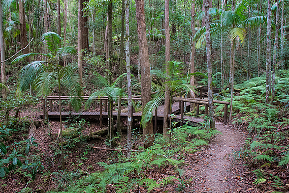
The track descended a spur before turning to the left into a gully where a step bridge crossed a stream. There was no water running through it, but a large grey puddle indicated some water had flowed through here in the heavier overnight rain. The track continued downhill until meeting a small stream flowing over large exposed rocks. We followed the creek downstream flowing in the opposite direction to Obi Obi Creek rather curiously. The track descended into a large patch of palm rainforest. A boardwalk led the way over the swampy forest floor.
At the end of the short boardwalk the track ascended a little as the creek headed off to the left. We then suddenly reached a small bridge crossing the creek which had turned completely around and was flowing towards us, before turning again going under the bridge to a small waterfall. About a hundred metres past the bridge was a junction. A short side track headed downhill to Narrows Gorge. We descended the track to a small lookout amongst rocks with a view obscured by vegetation of the gorge we had just passed. The stream flowed between high vertical walls of rock close to each other under the lookout we had earlier stopped at.
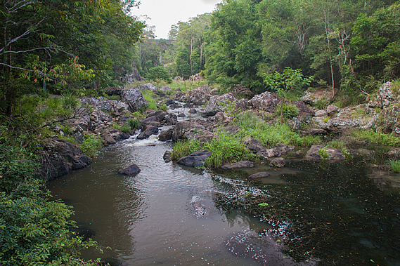
The creek was surprisingly still not moving at all in a deep pool in stark contrast to the vertical walls of rock on either side. In the dark waters of the gorge swim the Mary River Cod. This is one of the few areas where this fish continues to maintain a wild population. Nearby a small waterfall plunged a good twenty metres down into the main stream. This was the little creek we had followed.
From the lookout there was a cleared track down to the small creek. From there we could see the small waterfall plunging from just below the bridge we had crossed earlier. The waterfall ran into a small clear pool in amongst the jagged rocks before cascading over rocks to leap over the high waterfall into the ravine to meet the Obi Obi Creek. It was quite a spectacular gorge. Negotiating the terrain here must have been rather difficult for the Aboriginal people travelling upstream to Baroon Pocket from the Mary Valley.
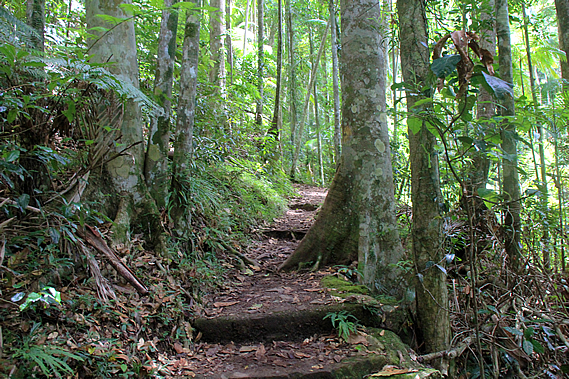
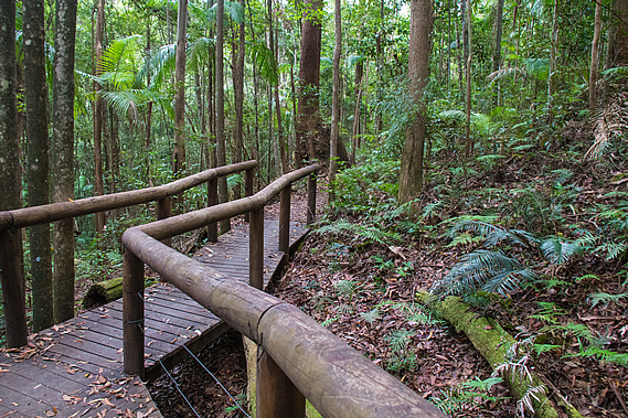
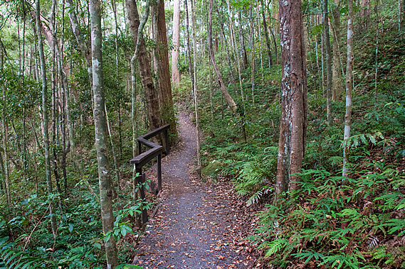
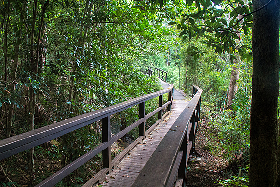
From the Narrows Lookout we returned to the main track and followed it for the final two kilometres through sclerophyll forest to Baroon Pocket. The lookout is quite popular, so the standard of the track suddenly improved in this section, either wide dirt track or boardwalk with wooden hand railing for the remainder of the track. The elevated boardwalks were built primarily to protect the habitat of the rare Australian marsupial frog Assa darlingtoni only found in the rainforests and wet sclerophyll forests of South East Queensland and northern New South Wales. It is about 2.5 centimetres long and perfectly camouflaged against the reddish brown soil. The male has a pouch on its hip where the tadpoles live after hatching and live there until they have morphed into frogs.
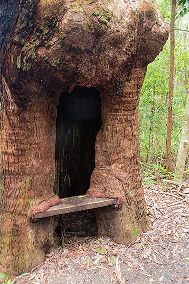
The rain had stopped falling now. The track was well above the creek passing through the palm rainforest heading around the back of a wide gully before heading out onto a spur. Near the end of the spur was a hollow tree with a bench seat set inside it.
Shortly after the tree seat we reached another junction. A wooden stairway led steeply down the hill to a swimming hole in the Obi Obi Creek. The water cascaded down the rocky stream bed into a large pool surrounded by sharp craggy rocks. Looking upstream I could see a huge rock wall. This was the Baroon Dam, just a few hundred metres away, towering fifty eight metres above the valley.
The name Baroon is derived from Barung, the Aboriginal term for the local rat kangaroo that forages the forests here. They look like rats, but they have huge back legs allowing them to hop like kangaroos. There are a number of species of rat kangaroo, but the name probably refers to the very large rabbit sized Rufous rat kangaroo. These creatures are nocturnal and graze the forests in herds, though the animals are spaced well apart. We returned up the steep stairs to the main track and followed it through the thinning eucalyptus forest further around the hill and across a double bridge spanning across a cascading stream split into two with each bridge going to a small island.
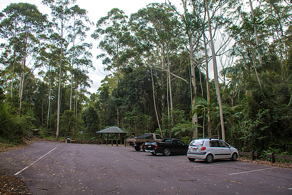
Once past the bridge, the track rose moderately for the final fifty metres to a large gazebo marking the end of the great walk. We had reached the main car park. The mobile phone reception here was quite weak, but we managed to check in on our friend who was about half an hour away, so we told him to meet us up at the dam.
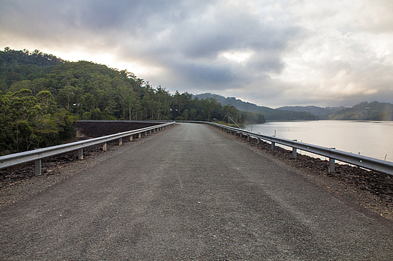
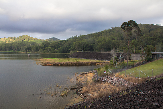
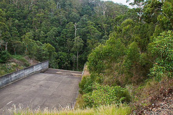
A concrete track steeply led up from the car park onto the top of the dam. From there we had sweeping views out across the lake. We followed the road along the dam, with contrasting views on either side. To our right the dam steeply dropped off into the forest where the Obi Obi Creek headed downstream. Several sulphur crested cockatoos were flying above the trees screeching. Large loose rocks covered the dam wall, looking like volcanic rubble reminding me very much of the darker slopes of Mount Ngauruhoe on New Zealand’s North Island.
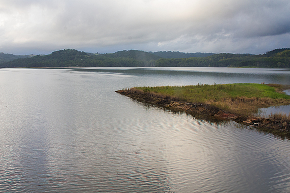
To the left the lake filled a large open valley that was once Baroon Pocket, where the Aboriginal people travelled from far and wide for the Bunya nut harvest. The dam wall under the road stretched out 370 metres across the valley standing fifty eight metres high. It holds about 716,000 cubic metres of water from a catchment of 72 square kilometres supplying part of the Sunshine Coast with fresh drinking water. What had once been the site of Australia’s largest gatherings is now submerged fifteen metres below the four by two kilometre lake. Shortly after the area was declared a refuge by the New South Wales government in 1842, the famous explorer Ludwig Leichhardt hiked through the area. He reported the small plain at Baroon Pocket was the rendezvous point for battles between the tribes, followed by the feasting of the Bunya nuts.
Two years later the 14 year old Tom Petrie travelled from Brisbane, which at the time was a fledgling colony, with a group of local Aboriginal people to Baroon Pocket. He described the gathering of about six hundred Aborigines partaking in the ceremony which lasted over a month. In a particularly good harvest the ceremony would last up to three months. They were catered for by a feast of nuts, plants and animals as they ran a political forum of the neighbouring tribes. For the six hundred people attending it was a time of celebration, where they shared tribal dreaming stories, sang, danced, played games and arranged marriages. Towards the end of the festival a huge fight broke out, but each tribe reaffirmed their friendship with each other and exchanged gifts of tools and ornaments before leaving. When all the visitors left, the local tribe stored the remaining Bunya nuts in mud along the banks of the Obi Obi Creek before walking across the range to the coast where they stayed for about a month eating the fish and fruit that was aplenty there. This allowed them to have a variable diet whilst the food resources of their homeland replenished itself after the stress of six hundred visitors.
Despite the loss of this culturally significant place, representatives from the Wakka Wakka, Githabul, Kabi Kabi, Jarowair, Gooreng Gooreng, Butchella, Quandamooka, Barrangum, Yiman, and Willi Willi indigenous groups continue to meet. There is nowhere to meet here with the loss of the Baroon Pocket. Instead they head inland to the Bunya Mountains, which, as the name suggests, contains a significant enough population of Bunya trees for them to continue their spiritual and cultural connections to their old customs. Fortunately Bunya Mountains is protected forever, so there will never be a repeat of what happened here. Following the formation of the Queensland Government, the land that made up the pocket was eventually subdivided into around ten farm plots between 1878 and 1887.
The farmers who lived in the pocket for nearly a century described the Obi Obi Creek as beautiful with sparkling waterfalls and cascading rapids between the large swimming lagoons. The soil here was very fertile allowing for fruit and vegetables to grow and many farm animals. Produce was carted out along the steep road up to Montville on top of the range, or to Maleny to the south near the headwaters of the creek. Towards the end much of the land grew kiwifruit, which thrived in the warm sheltered microclimate, 2040 millimetre per year rainfall and fertile soils of the valley.
The dam wall was completed in 1989. The water is collected from the intake tower we could see. From there it flows through a 2.5 metre diameter tunnel for two and a half kilometres through the Blackall Range to a water treatment plant. From there the water is distributed around the Maroochy and Caloundra areas of the Sunshine Coast. The dam swept around towards the other side of the valley. The far side of the dam had a spillway for flood water when the dam is too high. A permanent runoff keeps Obi Obi Creek flowing. Although still cloudy the sun was beginning to come out.
We had reached the end of the destination at the dam car park. We rested here for a few minutes before our friend arrived picking us up and heading back along the dam to the steep road rising out of the valley heading into Montville, then back along the range towards our homes in Brisbane. |
||||||||||||||||||||||||||||||||||||||||||||||||||||||||||||||||||||||||||||||||||||||||||||||||||||||||||||||||||||||||||||||||||||||||||||||||||||||||||||||
|
||||||||||||||||||||||||||||||||||||||||||||||||||||||||||||||||||||||||||||||||||||||||||||||||||||||||||||||||||||||||||||||||||||||||||||||||||||||||||||||