|
||||||||||||||||||||||||||||||||||||||||||||||||||||||||||||||||||||||||||||||||||||||||||||||||||||||||||||||||||||||||||||||
|
||||||||||||||||||||||||||||||||||||||||||||||||||||||||||||||||||||||||||||||||||||||||||||||||||||||||||||||||||||||||||||||
Home > Treks > Outside Australasia > Inca Trail > 3 |
||||||||||||||||||||||||||||||||||||||||||||||||||||||||||||||||||||||||||||||||||||||||||||||||||||||||||||||||||||||||||||||
|
||||||||||||||||||||||||||||||||||||||||||||||||||||||||||||||||||||||||||||||||||||||||||||||||||||||||||||||||||||||||||||||
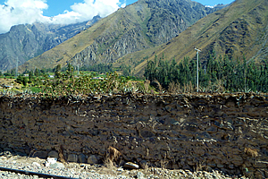
Introduction to today's journeyThe mountains are calling and I must go. - John Muir Today's journey starts with departing Ollantaytambo and travelling the short distance to the start of the Inca Trail. There we cross the Urubamba River and follow it downstream to the spectacular ruin of Llactapata from where we follow the Rio Chusichaca upstream to Wayllabamba. There we leave the valley and follow a stream up to Yunkachimpa where we set up camp for the night. Today's JourneyDistance trekked today: 16 kilometres. Total distance trekked to date: 21 kilometres. THE CRISP morning in Ollantaytambo dawned perfectly clear. You couldn’t have asked for a nicer morning. The air was crystal clear showing every tiny detail in the barren brown mountains towering precipitously above the village. The clear sky above was a strongly contrasting deep blue colour only found at mountain altitudes. I went downstairs had breakfast early as I was hungry. No one else from our group was there yet. Having been awake for a couple of hours already I was very hungry. It seemed my biological clock had settled on a four to five o’clock start every morning since arriving in South America nearly a week ago.
Breakfast was the horrible flat buns with butter and Fanny jam. Two nights ago after the trip briefing and eating guinea pig we had explored a few shops and to our horror discovered the main brand name for jams is "Fanny". That was a most unfortunate branding faux pax. I still couldn’t get over the brand name but in desperate times of hunger such as now (apparently) I had to overlook that rather glaring detail and just deal with it. There was also some fruit and aniseed tea which I was starting to take quite a liking to. Despite my hunger the dreary buns quickly took away my appetite though. Bread is obviously a big thing here in South America. As soon as I finished breakfast, Luis appeared with a couple of the others who needed to buy some gear for the trail. I decided to tag along too. Luis knew of a shop where all the porters bought their equipment. He used to be a guide on the trail before becoming a tour leader, so he knew all the trade secrets of the locals.
We walked down the road through town and across the large car park before entering an obscure street. We then entered an obscure mall that we most certainly would not have found ourselves. We walked upstairs to a very messy shop with tables absolutely covered and bursting with clothing and equipment. Now I needed a sunhat, so I started with buying one for less than a dollar. I needed a good lightweight parka. I also needed some rubber ends to my walking pole. I had gone to my camping store in Brisbane before coming over. The walking pole needed a large flat end for muddy ground, and a rubber tip for the end. I had lost the mud guard coming down off Mount Kinabalu earlier this year, and had managed to get a replacement one back home before coming here. They had run out of rubber tips though, and the camping store I had visited in Lima didn’t have any either. I continued looking through the store. The tables were insanely packed full of merchandise that shouldn’t possibly fit in there. I was amazed it didn’t all fall off them as people rummaged through everything. The shop keeper was crammed into a tiny alcove beside the door. The window of which was surrounded by so much merchandise I could hardly see him. Thankfully with Luis’ help I found a good lightweight green parka and an entire box full of rubber tips, so I bought two along with the jacket, taking it up to the tiny counter and paying a tiny fraction of what I would have paid back in Australia.
I don’t recall the way back to the hotel, except that we did pass the large cobbled parking area with the tiny supermarket we had visited last night. Perhaps I was not meant to know the location of the shop. After all it was mainly for the local guides and porters. The others were yet to have breakfast, so I took my time going back to the hotel, photographing the buildings with the precipitous walls of mountain towering behind them. The area was devoid of vegetation apart from the odd tall cactus plant. None of the mountains I could see had snow despite some towering well over two thousand metres above me to nearly five kilometres above sea level. It couldn’t have been a clearer morning. I returned to the hotel to see everyone else eating breakfast. I joined them briefly explaining that I have already eaten before heading upstairs to my room to pack while they ate their unappetising Fanny jam buns and drank their herbal tea. I brought my pack downstairs for storage during the hike. Our bags were placed in the van which will be returning to the hotel we had stayed in Cuzco once it had dropped us off at the start of the trail. I then returned and brought down my day pack and the duffel bag they had supplied for me to include my sleeping bag and spare clothes. Everyone else brought their bags down to be weighed as well. There was a six kilogramme limit for each bag. A few of the porters were there with a tiny spring scale weighing each bag. Mine came a little under at 5.6 kilogrammes, so it was fine. Almost everyone elses bag weighed in at over six kilogrammes, so they had to take things out to either put into their daypacks or back into their luggage for storage. Finally we were all under six kilogrammes each so the porters put them into their packs.
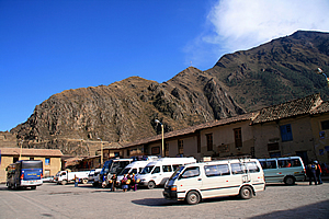
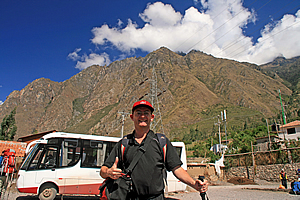
Once we were all loaded into the van, we waved goodbye to Luis. He was heading back to Cuzco for a couple of days to work. The driver took us through the remaining part of the village and out onto a gravel road that took us through cornfields. The road followed the railway line heading downstream towards Machu Picchu. There were now a few puffy clouds in what had only half an hour ago been a perfectly clear morning sky. Despite that we still had spectacular views of the mountains around us towering up to three vertical kilometres above us to their snow-capped summits clawing the deep blue sky above.
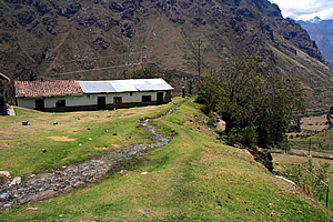
We finally pulled into a car park at the end of the road. This was the start of the Inca Trail. From here onwards we walk. Once out of the van we gathered around Wilbur for our final briefing. We would have liked to have met the porters properly, but they were too busy at the moment meticulously packing the large blue backpacks ready for the hike to the first camp. We were told to put on plenty of sunscreen and drink plenty of water. After all we were at the rather high altitude of two thousand six hundred metres above sea level despite being at the bottom of the valley. The thin air down here results in the radiation levels being a lot higher than one would expect. The porters provided us each with a packed lunch of snacks to fit into the tops of our daypacks. That was quite a bit of extra weight to carry on top of the warm clothing and camera gear in my day pack.
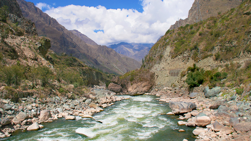
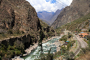
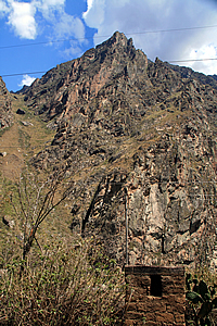
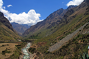
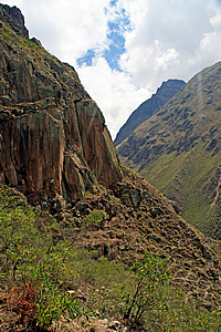
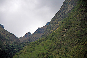
As we waited for the porters to finalise their packs, we looked out from the lookout at the end of the car park. The landscape in each direction was very different. Upstream, where we had come from, the landscape was a classic glacial U valley, with wide flat plains across the bottom of the valley and walls of rock towering over two kilometres high on either side. Looking downstream, the valley immediately closed off into walls of rock towering straight out of the cascading river with barely enough room for several shelf terraces marking what had at one time beenthe valley floor. The railway clung to one side about ten metres above the river. This really was the Andean landscape I had always imagined.
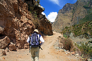
Finally we set off. Wilbur lead our group and Carlos took the rear. I walked with Wilbur at the front to start with, introducing myself properly and said telling him I had looked forward to this trek for such a long time.. We followed a fairly steep decline in the gravel until we were running parallel with the river next to the railway line. Fortunately no trains came as we followed it. We passed several people leading donkeys laden with produce. The porters took a lower track onto the grassy flat beside the river which tumbled in our direction cascading over giant boulders.
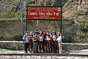
We reached a small railway station – the Piscacucho station, where we stopped and had our group photo taken under a sign marking the start of the Inca trail. A nearby sign showed we were at 2450 metres above sea level - about level with Machu Picchu and 1765 metres below the highest point of the trail which we will be crossing around this time tomorrow morning. We all gave our cameras to Wilbur and Carlos to get our group shot done. Little did I know at the time there was another photographer sitting inside the station taking our picture to put onto certificates that we would get at the end of the trek.
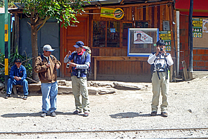
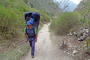
Wilbur had my big camera, but I still had my little camera, remembering the missed opportunity in the Amazon a couple of days ago when Luis had been laden with our cameras. Now the opportunity presented itself again and upon seeing how funny Wilbur and Carlos looked laden with all our cameras, I took a quick photo of them with my credit card camera. With our group shot done, we continued along the pathway as the railway line started ascending away from us. We almost immediately passed a small building below us where the porters had lined up to get their bags weighed. There were two groups of equal size down there. There was our group wearing navy blue and carrying the same colour packs. There was another group of porters coloured a bright orange red. It was a bit odd they were all looking the same apart from the very obvious differences in colour in their clothes.
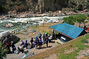
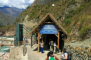
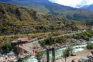
The porters needed to get their packs weighed because the park authorities had to ensure they were not carrying excessive weight. This was clearly not Mount Kinabalu where porters carried insane amounts of weight lugging things like washing machines up the mountain. Each porter had a weight limit of twenty five kilograms. If they weighed any more than that the tour company would be fined. That is why they had been so meticulous about packing. Just ahead of us the track stopped at the entrance of a thatched steep roof hut. A large wooden swing bridge crossed the river to the left from the hut. The trail then steeply ascended across the rock face on the other side. The hut was the checkpoint where we would get our passes. A large blue sign appeared on the gable of the hut saying:
Santuario Historico de Machupicchu Although most people considered this to be the start of the Inca Trail, we were actually eighty two kilometres along the original trail. The trail started in Cuzco, the ancient Incan Capital. In Incan times, all roads throughout the empire led from Cuzco. The trail we were walking on would follow the final forty six kilometre path towards the Incan emperor’s retreat in Machu Picchu.
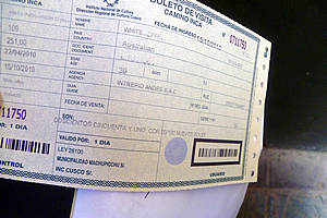
When my travel agent organised the registration of my Inca Trail pass ten months ago, I still had my old passport. That had become water damaged during the South East Asia and Borneo trips so I got a new one before this trip. The new passport had a different number on it, and the people who register the trekkers use the passport numbers at the time of booking. As a safeguard at the advice of my travel agent, I had photocopied my old passport before surrendering it. Now I was the only one in the group with this situation, so Wilbur let me through the hut at the track entrance first. He said some inspectors were okay, but others may be a bit anal about the change in passports.
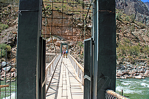
I crossed my fingers and arrived at the small wooden counter to show the inspector both my passport and the photocopy of the old one. They gave me a ticket and let me through straight away with little more than a grunt. Obviously he was one of the easy going inspectors. With my pass in hand, I was now in, I stepped onto the swingbridge and crossed over the roaring Urubamba River. The river barrelled over a whitewash of cascades over huge boulders. On either side of the river was a lot of bare rock indicating the power of the torrent during the floods of last January. Either side of the river were landslides of giant boulders that have rolled down the sides of the mountain during floods and earthquakes past. Once on the other side of the bridge, I waited for everyone else to pass through one by one as they had their passports inspected.
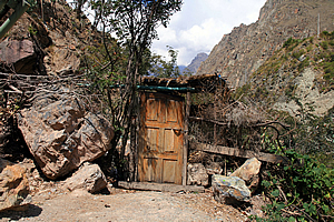
The ledge I was standing on was rather interesting. The track steeply rose above it indicating a slip had come down through here a few decades ago. There was a small wooden cross with a tiny white plastic vase in front filled with withering red flowers. Perhaps someone had recently died here. Looking downstream there was a derelict wooden front door in front of some thick scrub. This was the first indication that people lived here. It must be the entrance to somebody’s property, or perhaps a storage place. It looked intriguing and if it were not for the steep track leading from the platform, this could have just about passed as being an interesting start to the trail.
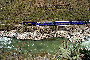
A large blue train passed on the other side of the river, clinging precariously to the side of the mountain above the hut and heading further downstream along the impossible railway line. Within five minutes our entire party had regrouped, so Wilbur gave us our final briefing. He told us that the porters have right of way, and when they do come to pass or overtake us, we need to move into the hill side of the track so they can pass us on the outside of the track. If they are approaching from behind, we need to call out ‘porter’ to let those in front know of their approach. We had to be good to them as they were each carrying twenty five kilogrammes. Wilbur led us up the steep section around a gate and onto the main path. Thankfully the steep section was very short. Ahead of us the trail was wide and smooth. The trail extending behind us towards Cuzco was little more than a goat trail worn away by centuries of farm activity. The start of the Inca Trail was wide and gravely, of a grade that a quad bike could easily travel on. As we climbed the steep section over the first bluff, I looked back at the view over the swing bridge. The group of red porters were coming across now, so very soon they will be passing us. Our blue porters were not far behind now standing in queue behind the ticket gate. No doubt they will be presenting tickets showing the weight of their packs.
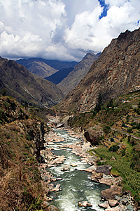
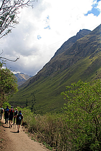
We continued walking along the track passing the occasional local farmer coming the other way herding his donkeys or alpacas. The animals were loaded with produce to take to the station or perhaps to a local market. The land immediately surrounding the trail was pretty barren with patches of gnarly scrub. The sun was starting to beat down on us. It wasn’t hot, but it was very strong thanks to the air at this altitude being so thin. It was hard to believe we were two thousand six hundred metres above sea level. After all were at the bottom of such a precipitous valley with a significant river just metres below us. The Urubamba River thundered below us, rushing down the now distinctively V shaped valley towards the Amazon. The sudden change in shape of the valley indicated we were now below the terminus of the huge glaciers from recent ice ages past.
The red group of porters caught up to our group within minutes of us leaving the swing bridge. I could hear someone behind calling out “porters” so we pulled over to the left hand side of the track towards the bank allowing them to pass. They walked at a surprisingly brisk pace considering they were heavily laden with their twenty five kilogramme packs. It was a bit disconcerting though with their packs being covered with red waterproof sheets and their legs covered with red waterproof rain trousers as if they were expecting heavy rain. There were more clouds in the sky now, so maybe they knew something that we didn’t. I certainly wasn’t expecting any rain after such a glorious start to the day.
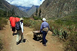
Though that being said we were in a very mountainous area. I recall a couple of hikes I have done in the Southern Alps of New Zealand in the mid-1990s when the weather would be perfectly fine and twenty five degrees one moment, then it would suddenly cloud over as an Antarctic front would pass bringing bitterly cold rain, with snow falling just a couple of hundred metres above me. Such changes in weather are very dangerous causing many unprepared hikers to lose their lives. Although we were a lot closer to the equator here, we were very high in the midst of one of the greatest mountain ranges on Earth, so sudden changes in weather would be inevitable here. Interestingly the porters were wearing shabby shoes, some only wearing sandals. They were certainly not wearing the footwear I would have expected professional porters to be wearing. Then again I should have expected they would be inadequately shod from my experience earlier this year of seeing the ragged porters climbing Mount Kinabalu. The red porters passed us and regrouped into a line of two porters wide marching ahead like soldiers. Curiously there was a farmer wheeling a wheelbarrow immediately behind the porters, giving the impression that his job was to carry anyone who collapsed behind the group.
Shortly afterwards someone behind me called out “porters” again so we moved over to the bank again to let them pass. This time the blue porters passed us. They were our group carrying our gear. They walked very fast despite carrying their heavy packs containing our food and equipment for the trek. Within seconds they walked past us and formed a fast marching group like the group ahead of them, though they didn’t have a wheelbarrow man behind them. Perhaps our group of porters were tougher than the red porters. So long as they can get us all to Machu Picchu in three days’ time that’s all that matters. This side of the valley suddenly opened into a small bowl. The wall of rock behind it towered a good one and a half kilometres high. Then I realised we were now high enough to be in a glacial area once more. A massive glacier would have come through here in an early ice age, but a more recent ice age would have carved a shorter glacier deeper into the valley up to the swing bridge now quite some distance behind us. In the tens of thousands of years since the last ice ages the river has continued to carve deeper into the granite valley.
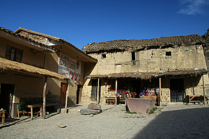
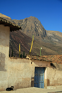
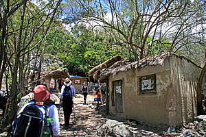
The giant wall of rock towering to our left revealed the giant folds of granite demonstrating the distinctive non-Newtonian fluid contortions typical of rock that had gone through massive geological uplift processes. Several small huts where the locals lived sat near the track nestled at the base of the massive wall of rock. The huts were made of stone or mud brick, or in some cases a combination of both. Wilbur told us the stones used to construct the houses were either from debris come down off the rock face above, or they had been picked up from the trail itself. This part of the trail had mostly worn away due to the excessive use by the villagers over the past five hundred years. The displaced rocks had been taken from the track and used to build their huts. I didn’t see anyone around the huts though. Perhaps they were all out working or maybe some of them were hiding inside their huts. The huts themselves were a bit hard to see though as they were surrounded by rustic natural looking walls constructed of stone and rough-hewn timber. Perhaps these walls had been built to maintain privacy from the five hundred tourists per day completing their once-in-a-lifetime pilgrimage and their porters who were supporting their dreams. Wherever the people who lived here were working or hiding, they were living a very bucolic existence typical of people who lived in remote alpine areas.
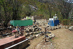
A little further up the track we reached a cemetery above the side of the trail extending up the gentle slope to our right. We stopped there as Wilbur explained the origins of the graves, and the nationalities of those buried there. Surprisingly one of the graves belonged to an Australian. The graveyard contained a number of terraces made from rows of loosely placed stones. The graves were large blocks of concrete no doubt encasing the remains of the dead. Some were very plain and derelict. Some had small crucifixes and flowers on top. The concrete sarcophaguses were painted either white or the blue used in the front doors of houses. Some were unpainted grey concrete starting to crumble apart. Surrounding the tombs were large rough stones rolled down from the massive wall of rock above the village, and scrubby windswept trees barely surviving in the harsh terrain.
Once finished at the graveyard, we walked further along the track watching another train pass on the other side of the river. It was full of people taking the easy way through the precipitous gorge to the Incan emperor’s retreat at Machu Picchu. We were taking the hard way, but we were doing real deal taking the genuine pilgrimage gradually extracting ourselves from twenty first Century civilisation travelling five hundred years back in time.
Wilbur stopped again to show us a cactus growing beside the track containing small berries. He picked one of them and crushed it between his fingers, explaining that it created a rotting blood red dye commonly used by the Inca five hundred years ago, but still used by the local people here. Indeed some of the bright purple dyes used in the alpaca wool in the village we had visited yesterday had been created from this berry. Scrubby trees draped with Spanish moss provided some shade from the strong sun as we passed another small village along the trail. This village was just like the previous one - drab huts made of stone and mud brick for the reclusive locals. At the end of the village, the track passed through some steep terrain passing a rather broken wall of rocks. It was hard to tell whether they were natural or man-made. There were no rocks on the track but the rubble rocks continued down the bank on the other side through the scrubby trees down towards the river now quite a long way below us.
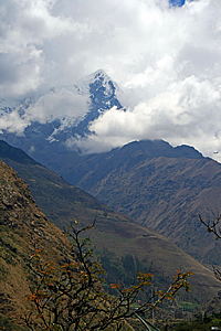
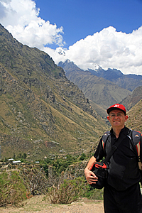
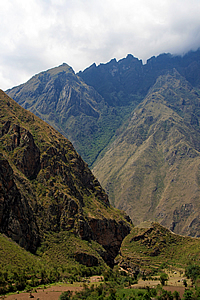
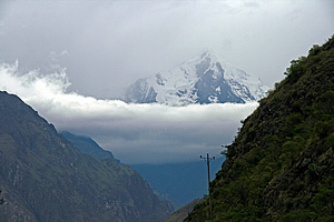
The snowy peak of Mount Veronica suddenly appeared behind us. This mountain towered over two kilometres above the valley floor to around five thousand seven hundred metres above sea level. It was covered in thick cloud but we could now see the summit and its precipitous rocky front face in a break in the clouds. It was named after the woman who was the first person to reach its summit. We walked a bit further before seeing a few more huts. The terrain was less steep now, but it was obvious this village sat on a large natural fan where rocks had tumbled down over thousands of years. The huts were perfectly nestled in amongst the rubble of the rocky fan as if they themselves were huge boulders fallen off the mountainside. The narrow dirt track passed in between the stone huts where people lived. As in previous villages we had passed through, there was very little activity here. It was evident though that people lived here. They must all be away perhaps in Ollantaytambo delivering produce, or trading in the other nearby villages, or maybe even working in one of the corn farms we had passed in the glacial valley before the start of the trail. Stone walls surrounded each house concealing much of it from view. Perhaps there were people inside these walls unseen observing the strange tourists walking past their houses day after day. Once past these huts there was a big enough gap in the trees to see the gully from which all the rubble has come down from. We could now see a long way up the mountain, to where near the ridge summit a huge rock was sticking out at a very unnatural forty five degrees about eighteen hundred metres above us. The rock looked like it could fall at any time, and if it did, it would be incredibly dramatic. The rock stuck out a good fifty to sixty metres and seemed to be about thirty metres wide.
A little further along the trail I saw the Incan ruin of Salapunku across the river just under the railway line. At first glance it would have passed as a partially demolished railway station, some thirty metres wide and perhaps five to ten metres across. However it was a genuine Incan ruin on a small grassy fan at the bottom of a very old landslide. The fan could very well have been used for agriculture. The name Salapunku is derived by a combination of the Spanish-Quechuan word for salon – a hall or room, and the Quechua word punku, which means door. The name therefore meant doorway of a hall. Another train passed us winding its way down the other side of the valley taking the easy way to Machu Picchu. Looking down the valley, the mountains were standing a bit further apart in a glacial U shaped valley as the river started to sweep around to the right. Cloud was building up over the tops of the mountains downstream.
Once past the village, we continued walking amongst the row of pylons that ran down the length of the valley. They carried electricity from some power station unseen in the distance up towards Cuzco. Here the terrain suddenly steepened and we started ascending a moderate incline against the two hundred metre high river bank. We continued following the river until deciding to rest at an embankment exposing obvious layers of stratification. These layers had been deposited during each of the ice age glaciations. From here the view back to the start of the track was stunning, with the river cascading towards us far below, and the towering pinnacle of Mount Veronica providing a strong backdrop.
The track continued going higher to the top of the river terrace upon where we reached another village. The houses here were all close together and built from stone. They were of better construction than the houses we had passed earlier. Unlike the previous villages we had passed, there were a few people here. The houses here were very close to the trail narrowing its width down to about a metre and a half. After five minutes of walking through the village, we found a dark rest area with benches built from rocks under the shade of a thick canopy of trees. Unlike down in the Amazon where the light was soft and filtered through the rainforest haze, the sunlight up here at high altitude was very harsh, creating huge contrasts between sunlight and shade. We stopped here for morning tea. The stone seating in this rest area wasn’t very comfortable and it was surprisingly dark under the thick canopy of trees just above our heads. Across the trail were a couple of stalls where a few people bought a drink.
A couple of us needed to use the toilet, so we left the rest area and followed the main track about twenty metres further before turning off on a goat track going across a grassy field where a stream ran along the middle of the ridge. The path of the stream was concealed with stones. It was strange seeing an otherwise natural looking stream running along the top of a ridge. That was a clear sign this was a man made channel. We reached the toilets and used them before returning to the rest of the group to set off to start the first substantial climb of the trek. Once rested at the dark rest area, we left not realising what was ahead of us. We had only walked a few metres when the trail split into two. The main trail started heading downhill, but we took a side track heading up the hill.
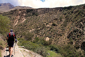
Initially we thought little of the climb until we came around a small spur and saw the track ascending into the back of a long gully, then up the other side. Even from here the climb appeared deceptively gentle, but it was quite a moderately steep climb. We all took it rather slowly as the thin air here at two thousand eight hundred metres above sea level started taking our breath away a lot faster than we were expecting. After what seemed like ages, I reached the back of the gully where a small stream trickled through thick scrub. From there the trail steepened making for a challenging climb up to the next ridge.
Finally I reached the top at about three thousand metres above sea level. Here I was rewarded with a small flat area with a tiny hut and seating for resting and admiring the spectacular view across the mountains in either direction. We regrouped and rested here for ten minutes before continuing. The track was reasonably flat from here as we went around a much smaller gully. The wall of an ancient ruin appeared over the grassy knoll ahead. There were a few steps up to the top of the next small plateau.
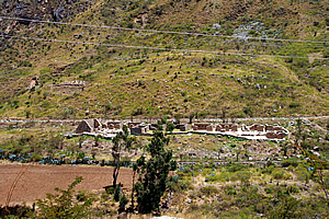
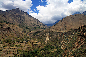
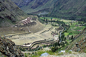
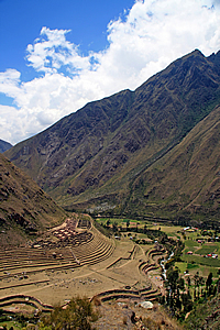
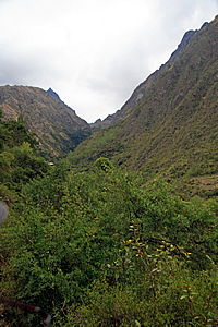
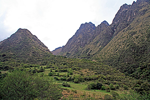
From the top I could see the track starting to descend into a small gap heading straight past the ruin. We turned right off the track to stop at a small flat grassy area. From the edge of the grassy flat was an amazing view down the Urubamba River. Below us the smaller Cusichaca River (Quechan for Happy River apparently) came out from a deep valley to the left to meet the main river. Both rivers slowly wound their way far below us at the bottom of the precipitous mountains surrounding us. Although we were high above the valley floor, we really were only a fraction of the way up the steep face of the mountain. The two rivers met at a fairly large flat area across the other side of the small river and on our side of the main river. The flat contained several terraces following the contours perfectly to create level fields for the farmers of the village that had once stood here hundreds of years ago. This village was called Patallacta, the town on the hillside. Each layer of terracing got smaller as the flat gradually merged into the hill. Towards the top of the terraces was the remains of a village, essentially a townhouse estate of stone buildings with their roofs missing. The roofing must have been a form of thatch that has long rotted away out of existence.
The village appeared deceptively small below us, but it would have covered a wide area. There was a track below us passing the village. This would have been the main route from the last village we had passed, Now I understood why we had climbed this route.. People walking along it would have only a fraction of the view that we had from up here. This would have been a thriving farming village in its day five hundred years ago, but it has long since been abandoned as an archaeological site. The villages which were currently inhabited were either behind us, or further up the small valley.
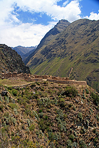
The track below us indicated we were going to be following the small valley upstream now. The terrain on either side of the Urubamba river must be about to get a lot rougher further downstream towards Machu Picchu. We stopped there for about fifteen minutes while Wilbur explained the history of this area, the village below us and the nearby fortification. The fortification was Huillca Raccay, strategically located above the rivers. This was used as a watchtower controlling the entrance of the Cusichaca Valley. The graves of soldiers have been discovered in small caves in the steep ridge towering above the fortification. These soldiers had holes in their skulls. These have been shown as evidence that the Inca had relatively sophisticated medical procedures in treating head trauma. The holes in the skull were surgical incisions to relieve the build-up of pressure from a traumatic blow to the head by enemy invaders. This procedure was often life-saving. Though in the cases of the soldiers discovered in these caves, the surgery had not succeeded.
In its time the village would have contained one hundred and fifteen dwellings serving as a stop for the Inca heading towards the retreat at Machu Picchu. The village was also used to house the local farmers and the soldiers who stood guard here at Huillca Raccay. The village is believed also to have been used for religious and ceremonial functions. Archaeologists say this small area produced enough agriculture to support up to five thousand people.
Pallacta was very instrumental in ensuring Machu Picchu was never discovered during the Spanish invasions. In order to hide it, Pallacta and several other settlements were burned by Manco Inca Yupanqui during his retreat from Cusco in 1536. The burning of the villages successfully discouraged the pursuit from the invading Spaniards at the time and Machu Picchu became no more than a mythical legend for hundreds of years before its rediscovery in 1911. Following the Spanish invasion, the land in this valley was left to dry returning to its barren state. Although fifteen families now farm the narrow terraces of this valley, they are barely able to scratch a living from it. Almost nothing can grow here during the five month dry season. The Inca on the other hand were very successful at farming the land. Unfortunately the key to the amazing success of the Incan farmers has been lost with time. From our lookout over Pallacta, we followed the track towards the Cusichaca Valley. Two minutes later we closely passed the granite block fortification of Huillca Raccay before commencing a steep descent into the Cusichaca Valley. Fortunately the descent was only steep for about five minutes before the dusty track turned off to the left to follow the valley upstream. The track continued gently downhill eventually meeting the main track along one of the narrow terraces just metres above the Cusichaca River.
The rock bluffs that towered vertically above the track were covered in bromeliads. They were a fairly plain species of bromeliad, but the plants were quite large with crowns about a metre wide. They seemed to be doing very well here perched on the small crevices in the cliff face they could lodge their roots into. Bromeliads also grew on the trees that littered the riverbank. The gravel track we walked along was now wide and of an easy grade. The river bank dropped about five to ten metres into the cascading river below us, cut into a deep burn. Above the bank on the other side was farmland perched on the valley floor terrace merging with the scrub covering the steep valley wall towering high up to the mountain. This valley had obviously been glacial during the major ice ages. Since the last ice age the river had cut a further ten metres into the valley floor. Occasionally the track would negotiate its way over a large rocky bluff the river had cut into the mountainside. A row of wooden power poles with two cables ran along the valley near the track to supply electricity to the villagers further upstream.
|
||||||||||||||||||||||||||||||||||||||||||||||||||||||||||||||||||||||||||||||||||||||||||||||||||||||||||||||||||||||||||||||
Cusichaca Valley |
The valley floor became increasingly scrubby as we continued upstream. There were some interesting succulent like fan plants with huge stems leading up to small seed heads. Perhaps this is a relative of the New Zealand flax?
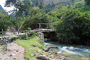
Bridge over the Cusichaca River |
We eventually reached a rickety wooden bridge crossing the river. Although it looked a bit suspect, it was very solid with two large logs spanning the width of the river banks. Upon these logs were large timber slats strong enough to hold a vehicle. The branches of fallen trees made up the framework and hand railing on either side of the bridge. Despite it looking so rickety, it was very stable providing an excellent walking surface to walk across with ease to the other side of the river.
Once across the river, we continued walking upstream along the trail. There was a small village ahead of us nestled deep in the valley with the precipitous mountains towering into the cloud that had covered over us in the past half an hour. This was the village of Wayllabamba, with a population of around four hundred people. I couldn’t imagine how so many people could live up in this remote village, and I had no idea what they did. After all the fifteen farmers living in the valley could barely support themselves with the poorly producing farmland yet alone be able to support the villagers. Perhaps some of the villagers were employed to maintain the trail and its campsites.
Standing ovation |
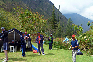
Once we were in the village, Wilbur suddenly turned off to the right and led us onto a small grassy patch. To our surprise, our blue porters were giving us a standing ovation as we arrived. Now that was a big surprise and very welcome. I’ve never received a standing ovation for completing a morning’s walk before. Walking is generally a thankless activity where it’s every man for himself. In Australia where everyone has a love affair with their cars, walking is almost considered criminal. It was therefore such a nice unexpected surprise to receive a standing ovation upon arrival.
The lunch tent |
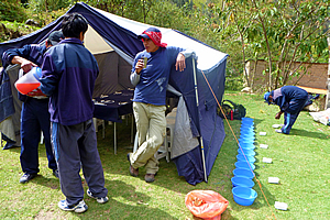
The porters’ backpacks were nicely laid out along the sides of the grassy clearing. Some of them had been unpacked with one large blue tent had been erected with a long plastic dining table running down the middle and plastic backless seats on either side. This was a most impressive effort.
To the right of the tent was a row of plastic bowls. One of the porters was pouring warm water from a large metal cooking pot into the bowls. A few off the other porters were cooking lunch nearby.
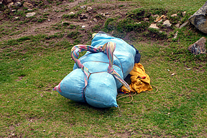
One of the porter's backpacks |
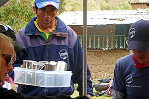
A porter directed us to the bowls of water and gave us each a small bar of soap to wash our hands in preparation for lunch. We all washed our hands in the bowls and sat on a large blue tarpaulin they had laid out for us. Here we sat and talked waiting for lunch to be served. A couple of porters poured some red cordial into plastic cups and gave them to us. The cloud overhead thickened and the humidity rose, but fortunately it wasn’t raining yet.
I took a few photos of the village. Some houses had thatch roofing but most were roofed had a patchwork of rusty corrugated iron with stones sitting on them to keep them in place in stormy weather.
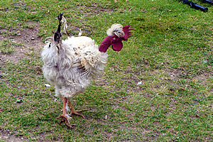
Chicken |
The memory card in my camera ran out of memory. Fortunately it was only the backup two gigabyte card, so I replaced it with the empty eight gigabyte card. This card should last me all the way to Machu Picchu. I’m sure none of the Inca had to contend with this sort of issue with technology, but I was intent on documenting this trip as best I could. That being said though, I only had three batteries with me to last me four full days until returning to Cuzco after visiting Machu Picchu. Luis had mentioned there is a place at our campsite on the night before going to Machu Picchu where we will be able to have our batteries recharged, but I wasn’t counting on his advice. That would be a great bonus, but what if the power wasn’t working there as is often the case in remote locations? These batteries had to last the entire hike.
Wilbur gestured to me and took my camera. He had obviously seen something. This had better be good – I had to make the camera last four days. I quickly followed him until he reached a small tree where a small hummingbird was hovering around its flowers. Wilbur took a few shots and fortunately one of them came out very well. It is very difficult to get a good picture of a hummingbird as they flap their wings so fast that they would appear a transparent blur unless you got the shot at precisely the right moment when the wings are fully open. There is no way you can develop the skills to get the right shot at the right moment. Wilbur had amazingly fluked the one in a hundred shot.
Inside the lunch tent |
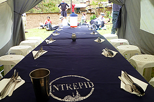
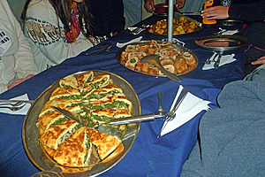
Wilbur and I returned to the tent. By now lunch was ready to be served, so we took our seats on the small backless plastic seats. The table had a blue Intrepid tablecloth on it – a clever little marketing gimmick to advertise the quality of the food served on their trips. On the tablecloth they had perfectly put folded serviettes and stainless steel cutlery – knife, fork and spoon. Suddenly we were taken from the remote alpine village hike to a classy restaurant. The porters served us chicken soup in small aluminium bowls. There were also a couple of large bowls containing fresh small buns – the South Americans obviously love their bread.
Riccardo the gormet chef |
Now Michael was on a special diet having come down with food poisoning in the Amazon a few days ago. He had seen a doctor in Cuzco and the porters had prepared special food for him to minimise the chances of his stomach getting upset again. He had managed to keep up with us this morning, though a little slow going up the hill from the village where we had rested in the shade. I’m sure the walk must be torture for him though.
Lunch! |
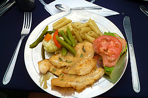
After soup, several large plates were put out along the length of the table. Now I would have expected reconstituted rice risotto and freeze dried meat as I had done in previous hikes. What we got was worlds away from that. Firstly came a large bowl of penne pasta. This was quickly followed by seasoned fried fish pieces. Then there were mixed vegetables – beans, carrot and cauliflower. Finally came a large bowl containing fresh lettuce and tomato salad. This was a full on restaurant meal. This was a huge bonus given we had just completed a long morning’s walk at high altitude.
It was apparent now this trek was going to be very luxurious.
Porters packing their backpacks |
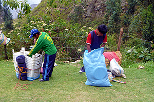
After lunch, we left the tent while the short stocky and well built porters quickly washed up and packed up. We watched them pack their backpacks as we lay down on a slope in the ground drinking more red cordial. Hopefully the red food colouring in the cordial here wasn’t going to keep us up all night. One porter had all the plastic seats stacked up with the space in between filled up with glasses and cutlery. He tied it all together with a rope and put it all into a large sugar sack.
Stormy weather back in the Urubamba River |
It was incredibly ingenious despite its crudeness. I hoped it was comfortable for him.
I looked down the valley which we had come from this morning. The glacial slopes of Mount Veronica were still visible above a very ominous looking black cloud now filling the valley. It would be raining in the Urubamba River along the Sacred Valley now. No doubt the rain will be coming up this valley very soon.
With lunch finished we set of along the track. We walked about two hundred metres before pulling over to let our porters past so they could hurry to where we were going to be camping overnight. They had packed up very quickly, but will they be able to set up our camp before our arrival?
Porter |
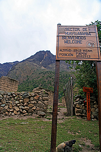
We continued following the valley passing an arid farm that separated the two halves of the village. Ten minutes passed before we reached the upper end of the village. There was a large natural terrace to our right at the base of a gully. On the terrace was a large campsite which Wilbur said most hikers stay the first night. He told us that we were going to go further today to give us a head start for tomorrow morning. We continued walking along the track past the campsite passing a sign that read “Sector De Huayllabamba, Bienvenidos welcome, Altitud 2912 M.S.N.M.”
The main campsite |
We crossed a bridge over a small stream. Another hummingbird was hovering through the scrubby trees concealing the stream which cascaded down large boulders. On the other side of the stream, the main track turned off to the right quite sharply. A much rougher track continued up the main river through the rest of the village towards more walking tracks into the Andean wilderness. These tracks included the rougher grade track continuing up the valley towards the base camp at the bottom of Salkantay, a major mountain in these parts which we hadn’t seen yet. The main track crossing this junction was the Mollepata Trail, which we will be following over the three passes towards Machu Picchu.
Just above the junction was a large circular rest area where we briefly rested. The rest area seemed to be the middle of the village perhaps where markets are regularly set up. The large common area was surrounded by two storey stucco brick rendered cream coloured buildings. One was a shop with a small opening in the wall where food could be bought, no doubt at very high prices. The large camping ground was only a hundred metres to our right so this shop would do very well. I knew our strategy of going up to the next campsite was a good move. It will allow us to better acclimatise to the high altitudes we will be scaling tomorrow, and will allow a shorter climb to the highest part of the track tomorrow morning.
Entrance to the Llulluchapampa Valley |
We briefly stopped at the junction and one of the ladies Amanda somehow realised she had left her altitude sickness medication back at the hotel. She got into a panic while Wilbur phoned Luis who phoned the hotel to check on her room. Wilbur got a phone call back about five minutes later. Unfortunately Amanda’s hotel room had been cleaned and there was no sign of the medication. Lesson here was never leave anything behind in a hotel otherwise you will never see it again.
It was then I realised perhaps I should have got some altitude sickness medication. Well it was too late now for me to do anything about it.
The track proceeded steeply for a couple of minutes before we reached a checkpoint. Once more we had to stop as Wilbur checked our passes. The porters were in the final stages of getting their bags weighed again. Our tour company will get fined if any porter goes over twenty five kilogrammes. Fortunately this was not the case. It took a while for Wilbur to process us though, so we sat on a long bamboo park bench at the side of the track opposite the wooden inspection station and waited.
Dead Woman Pass in the distance |
From there we could see the top end of the valley we were starting to climb – the Llulluchapampa Valley. At the end of the valley was Dead Woman Pass. I looked carefully at the shape of the rocks, and it didn’t take much imagination at all for me to see the shape of a dead woman lying on her back, with her withered face and bust. The pass ran just under the bust, perhaps where the bottom of the sternum should go.
Long climb ahead... |
The pass was a long way up though. It was a little over four thousand two hundred metres above sea level and we were only at two thousand nine hundred metres above sea level. There was a thirteen hundred metre climb to the top from here, and it was all uphill. This was going to slow us down a bit, but I was thankful that we were not camping here for the night, otherwise that would be one very long climb tomorrow morning.
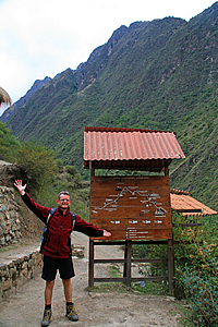
There was a large wooden map in front of us showing the trail, with about ten kilometres per day with a total of forty two kilometres to Machu Picchu from the start of the track. We had already travelled ten kilometres, but looking at the map those were the easy ten kilometres. From here on it was all going to be steep uphill or steep downhill across far more rugged terrain.
Finally we were processed and Wilbur let us go at our own pace towards the campsite. He told us to keep following the track uphill until we cross a wooden bridge. The camp is just a couple of minutes’ walk past the bridge to the right of the track.
Alpacas on the trail |
We followed the rather steep track towards our campsite, slowly starting our ascent from the checkpoint at two thousand nine hundred metres. It quickly became apparent that I was in the fast group. I was moving up at a slow but steady pace, as one by one the laggards in the group disappeared behind us.
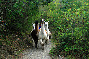
Suddenly ahead of us we saw some white alpacas barrelling towards us. I stepped to the bank of the track and watched them hurtle past, herded from behind by one of the local farmers.
Large sections of the track were now forested by small trees with gnarly branches covered in large bromeliads. The trees had orange coloured bark like layers of paper wrapped around them. These layers of bark were peeling off the trunks and hanging in strips. The trees reminded me of the New Zealand tree fuchsia only these were larger.
The upper valley |
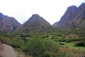
The trees suddenly cleared as the track rose above a large terrace with scattered trees amongst the grass. No doubt the valley floor here was quite swampy. Ahead of us the valley divided into two glacial valleys. In between the two valleys stood a triangular scrub covered hill. The old glaciers that had come down these valleys had combined in front of the hill and terminated at about the point where I was standing. The pass was on the right hand side of the hill, but the track was obviously heading towards the left hand side. Then I remembered Wilbur talking about the bridge. We were heading towards the gully to the left, crossing the stream before heading around the base of the hill ahead of us to where the campsite will be. The area was quite open indicating there had been glaciers through here during some of the ice ages. The hills on the far side of the valley were now very steep, rising to a dark razor sharp ridge steeply rising to around four thousand seven hundred metres above sea level.
The gradient of the track reduced as we passed above the glacial valley floor. It was still a good steady climb though. Another ten minutes passed before I could see the wooden bridge ahead nestled in amongst the trees. The bridge was made from rather crooked logs of about ten centimetres diameter. There were crooked hand rails on either side nailed to a couple of gnarly trees growing on either side of the stream but like the bridge we had crossed just before lunch, it was perfectly stable. The people who maintain the track obviously didn’t have the same skills as the Inca of five hundred years ago, but they certainly were very skilled at building rustic wooden bridges.
The upper valley |
There were only four of us in our group now keeping the pace. Everyone else was trailing further behind obviously not having the same fitness levels that I had.
After a quick photo stop, we continued following the track. Fortunately the track here was level as we left the stream walking out to a small spur in between the two glacial valleys I had seen earlier. When we reached the spur, we saw the small track leading off to our campsite at Three Rocks just as Wilbur had said. We followed it for a few seconds before seeing the same large blue tent that had been pitched at lunch time down the bottom of the valley. Here it appeared rather small under a couple of large gnarly trees spectacularly covered in bright red bromeliads. The porters saw us arriving and stopped what they were doing to give us a standing ovation.
What a nice way to end a long day’s trekking.
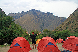
The campsite |
Our campsite stood on three small level terraces. The upper level where we arrived contained the two large blue tents under the large trees. Below that were two short narrow terraces where a number of small tents had been perfectly pitched. This was our accommodation for the night.
One of the porters took us to the pile of duffle bags where we had to work out which was ours. They were all the same navy blue colour. Finally we found our correct bags and the porter led us down to our tents. There were three tents pitched in the middle level and four in the lower level. Most of them were red for the couples, but two on the lower level were smaller yellow tents for us singles. I took the far single tent and settled in.
The tent was quite new and of a very high quality. It definitely would live up to anything the high altitudes would throw at it. There was a very nice warm yellow and blue sleeping bag set up inside. This was going to accommodate me very well.
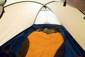
My tent |
Once unpacked I returned to the dining tent. By now the last of our group had just arrived to a standing ovation. We all settled in there for some hot chocolate and a very large aluminium platter of pop corn for a rather late afternoon tea as the sky quickly darkened.
Once we had finished afternoon tea, most of us went outside to do some stretching exercises. We were led by Kristen who worked for Jenny Craig back home on the Gold Coast. She obviously knew about exercise programs.
Following the stretching, I briefly returned to the tent to rummage around and find my head lamp. It had proven very useful up on Mount Kinabalu and in the Amazon, so now it was time to stretch it out for high altitude of the Andes. With little else to do and the temperature plummeting, I decided to return to the dining hut where everyone else was assembling. I needed to use the loo though, so I made my way about fifty metres down the hill towards a couple of long drops. There was another group camped out below us, but I don’t think they were as well set up as we were. They didn’t have a gourmet chef nor were their tents as good as ours.
I returned up the hill in the darkness guided by my head light. It was not long after afternoon tea but dinner was already almost ready to be served. Perhaps we had been a bit slow with the walk today. Then again we had walked quite a bit further than most people who would have camped out at the bottom of the valley. Who knows?
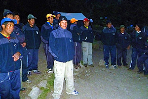
Meeting the porters |
Before going into the tent we formed a large circle with the porters, guides and cook and all introduced ourselves. The porters were all wearing their dark blue clothing – probably a uniform that was provided to them. The cook and porters all spoke Spanish – or perhaps some only spoke Quechuan. None of them spoke English. Fortunately Wilbur was fluent and Carlos spoke reasonable English, so they will be our interpreters for the trip. Wilbur did all the interpreting at this meeting.
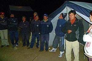
Meeting the porters |
Each of us travellers went around introducing ourselves, providing a brief explanation of who we were, where we were from, and why we have travelled so far to be here. For most of us it was the same spiel that we had given Luis back on the first day we had met way back in Lima. It was hard to believe that less than a week had passed since our initial meeting. Once we had introduced ourselves, the porters and cook introduced themselves, though their introductions were a lot briefer than ours. We remembered Ricardo the cook. His cooking had been fantastic so far and it turns out he was a gourmet chef. No wonder the food was so good.
Dinner |
By now we were all very hungry. We entered the tent dinner. By now the cloud outside was thickening and it was getting very humid – a cold dank humidity that came with the cooling evening as a sure sign that rain was nor far away. The sky was already dark but a quietly roaring gas lamp hanging from the ceiling illuminated the tent whilst we ate.
The first course was a yellow vegetable soup. This was followed by the main course which was served in a banquet style. The table was quickly covered with large platters of rice, broccoli, quiche, roast potatoes and meat roll. Michael was given a separate meal to accommodate his weak stomach. Then we were given pudding in a small aluminium bowl. At initial glance it looked like a raw egg, but whatever it was it was definitely a lot tastier than a raw egg. It had plenty of sugar in it no doubt to help us in the high altitude.
Once dinner was finished, we returned to our tents walking through the darkness guided by our head torches. My tent had been very well set up with a good flat surface for the sleeping mat. The sleeping bag was very comfortable even though the air outside was quite cold here at 3300 metres above sea level. Gentle rain started to pitter patter on my tent helping me to quickly fall asleep.
| Home | Photography | Diary | Travels | Treks | |
© 2001-2026 Walkabout Jeff - Copyright - Disclaimer - Who is Walkabout Jeff? |