|
||||||||||||||||||||||||||||||||||||||||||||||||||||||||||||||||||||||||||||||||||||||||||||||||||
|
||||||||||||||||||||||||||||||||||||||||||||||||||||||||||||||||||||||||||||||||||||||||||||||||||
Home > Treks > Outside Australasia > Inca Trail > 4 |
||||||||||||||||||||||||||||||||||||||||||||||||||||||||||||||||||||||||||||||||||||||||||||||||||
|
||||||||||||||||||||||||||||||||||||||||||||||||||||||||||||||||||||||||||||||||||||||||||||||||||
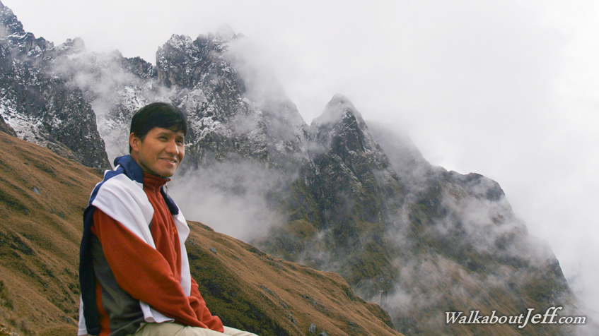
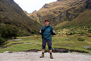
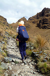
Introduction to today's journeyMay your trails be crooked, winding, lonesome, dangerous, leading to the most amazing view. May your mountains rise into and above the clouds. - Edward Abbey Today's trek continues from Yunkachimpa heading further up the valley to cross Dead Woman Pass, the highest point of the trail, before descending to Pakamayo Campsite for lunch. From there we follow a steep ridge to the second pass at Runkurakay before descending to the pre-Incan ruin of Sayacmarca where we stop at the nearby camping ground. Today's JourneyDistance trekked today: 12 kilometres. Total distance trekked to date: 33 kilometres. I WAS the first to wake up, pleased to have survived the night having slept in a tent at such high altitude. Thankfully the rain had by now stopped falling. I had woken up a couple of times during the night hearing rain falling heavily outside. Thankfully I had not needed to get up as it was very cold. I crawled out of the tent to view my surroundings. It was very overcast but the cloud had lifted to above the tops of most of the mountains. Looking back down the Llulluchapampa Valley, I could see some fresh snow on the mountain on the other side of the valley. I looked the other way. There was snow on the tops of the hills behind me, down to about four and a half thousand metres just below where the dark clouds were still concealing the tops of the hills. Thick cloud obscured Dead Woman Pass. Were we going to cross the highest passes of the trail without any views?
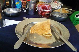
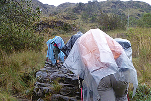
I returned inside my tent for a few minutes before two of the porters arrived offering a cup of tea. I recalled the sales person in my camping gear store who had done the Inca Trail before suggest I ask for two sugars every morning with my tea. That will give a boost of energy much needed at the high altitude. Now that really made sense as I didn’t have a lot of energy at the moment. Now I very rarely drink tea – almost never. In fact I bought a box of tea bags back in 2001 and have hardly gone through any at all. In fact I can’t recall why I bought them in the first place. Perhaps it was because I had visitors. Fortunately tea bags do last a long time, so I’m sure if any of my visitors had noticed they are so old. Tea seemed to be the only drink on offer, so I accepted it with two sugars. Instantly the sugar gave me a hit and I was wide awake. The porters went to the other tents to offer tea. Then one put a bowl of hot water with some soap by my tent so I could wash up a little. This started my association with drinking tea at high altitudes. From this day forward I have only drunken tea whilst above two thousand metres above sea level. I’m not sure if it is the best thing to be drinking at high altitude from a biochemical perspective. Tea is coloured by tannin, essentially the component of rotting vegetation that gives stagnant pools of water their discolouration. Ingested tannin reduces iron absorption into the body. This is not good as the iron you eat goes into your blood stream. It is the iron in your red blood cells that carries the oxygen you breath around your body. High altitudes create reduced oxygen input so you want to have as much iron in your blood as possible. Anything that reduces iron absorption (such as the tannin from tea) is not good. I was hoping my iron levels were high though. I had taken iron supplements in the two weeks before starting this trip. I had also taken calcium supplements to aid the iron absorption. So far during this trip I have been eating about twice the quantity of meat that I usually have to help maintain the high iron levels. Now I was hoping that by drinking tea I wasn’t undoing all this hard work. Along with the cup of tea, the porter had provided me with a small plastic bowl of hot water and a small bar of soap outside the tent. Once washed, I walked up to the main tent for breakfast. Marissa joined me and upon realising that I was in the tent next to hers, she asked me if I had farted last night. Gosh, what a question. She elaborated saying that she heard someone farting really loudly all through the night. I told her that I couldn’t prove anything, but no one has ever complained of me farting in my sleep before. Then I realised Michael and Julia had been sleeping in the tent on the other side of hers. I suggested that perhaps Michael was still having stomach problems giving him the flatulence problem. Marissa seemed to agree with that and therefore let me off the hook. Apparently one of the many effects of high altitude for some people is greatly increased flatulence. Obviously someone here was affected by it. We all entered the main tent to eat breakfast whilst our porters packed up our tents. Breakfast consisted of more hot tea and pancakes with jam and cream served on our aluminium plates. It was a very nice breakfast by any standards. We were a little quiet this morning though, probably because we were all in nervous anticipation of the climb that lay before us. We had two significant mountain passes to cross today. The first pass will break a higher altitude than I have ever been before. I recalled my climb up Mount Kinabalu earlier this year, and how thin the air had been as we had approached the summit, and how cold I became at the top. Will it be like that again today? It was definitely going to be cold with the snow having fallen to just a couple of hundred metres above the pass. Before setting off from the campsite Wilbur gave us our final briefing for the day as we assembled fine-tuning our hiking poles. He opened with the wonderful news that half of us had bags now over the six kilogram limit. Someone pointed out that this was probably due to the extra moisture from the damp air of the rainy night adding to the weight. Wilbur didn’t comment any further, but I guessed that some of us had lightened our day packs offloading extra stuff into our duffel bags. I had a clear conscience though. I knew my duffel bag didn’t contain any more gear than it had yesterday, so any extra weight would have been from moisture. We had passed the last weigh station yesterday before the final climb up to the camp (there are no more weigh stations along the trail), so Wilbur seemed okay with letting it go. We had two passes to climb today, the first being Warmiwanusca (Dead Woman’s Pass) the highest on the entire track. Once over the first pass we will drop steeply to another campsite where we will have lunch. Then we will steeply ascend to Rukuraqay, the second highest pass of the trek before dropping steeply down the other side to our campsite for the night. The dropping steeply parts didn’t appeal to me at all, but I focused my thoughts just on the first part of the trek – reaching the summit of Dead Woman pass and reaching new heights. Looking up towards the pass I could now see the cloud had cleared from the area, so there was a much better chance of getting a good view from the top. I crossed my fingers hoping the cloud would remain clear. Someone asked Wilbur whether there would be any problems with the snow, but he said it had fallen above the pass so we will be able to get through okay. He said there was one time when snow fell to about the level of the campsite, and the group he was leading had to turn back about half way to the pass because it was impossible to walk through the knee deep snow. We were fine today though as the snow had not come down to the level of the pass. Carlos led and Wilbur brought up the rear as we left our campsite. The track ran up thin forest, somewhat resembling the manuka forests of New Zealand or the paperbark wetland forests of Australia. What had been dirt track was now irregular cobblestone boulders perfectly assembled into a solid track. We were now away from the civilised area where the track had been worn out from centuries of use by farmers herding livestock. In this section of the trail the original track laid five hundred years ago was still intact, allowing us to follow in exactly the same footsteps of the Incan Emperor as he walked from the capital Cuzco to his retreat at Machu Picchu. The track ascended quite steeply alongside a cascading stream with ferny undergrowth.
About half way up the steep section we had a quick rest whilst waiting for Wilbur to catch up with the slower members of the party. When they caught up Wilbur decided the overall pace was a little slow, so he left Carlos with Derek and Avani (a young couple from London) and Amy (the young Asian lady with the same model camera as me) at their pace whilst he led the rest of us at a slightly faster pace to ascend slow step after slow step with the air becoming increasingly thin with the altitude. At least the faster group will be able to maintain a constant pace.
Fortunately it wasn’t raining even though it was still overcast. Soon we were out of the forest in a clearing, surrounded by scrubby plants with bright indigo coloured bell flowers. From here we could see the magical snow up ahead of us on the ragged ridges dusted like fine icing sugar. The ridges appeared a lot closer now. We could see the pass, but it still appeared quite distant. Looking back, we could see more of the mountains towering above us over the other side of the river now far below us. We kept going, and one by one the others started to drop back until only myself and Julia were keeping up with Wilbur. We were obviously the fittest ones in our group.
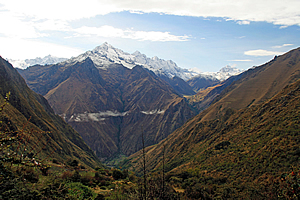
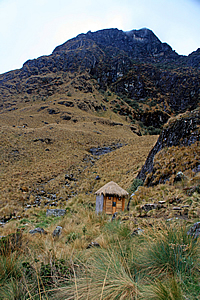
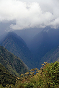
Looking back, we could see more of the mountains behind us, including more of Salkantay towering over 6300 metres high. The landscape behind us was getting more dramatic by the metre. We followed the trail to about twenty metres above the steep gully, hearing the stream cascading unseen below us. Then we entered thick scrub again for a few minutes before reaching the Ayapata campground at 3750 metres above sea level. This was the highest camp on the trail, level with New Zealand’s highest mountain. There were still some campers packing up, and one of the villagers from the bottom of the valley had climbed all the way up here this morning and set up a stand selling brightly coloured soft drink. This would be the last shop we would see until tomorrow lunch time. I walked out into the campsite. Across the stream stood a couple of small huts. They were just toilets and kitchen, but they were very cute buildings made from stone held together with mortar (a contemporary design) and with thatched roofing. To my surprise there was a medium sized white fluffy dog sitting alert in one of the one of the doorways. I crossed a tiny wooden bridge over the stream now crystal clear to reach a vantage point where I had a magnificent view of the Llulluchapampa Valley below me.
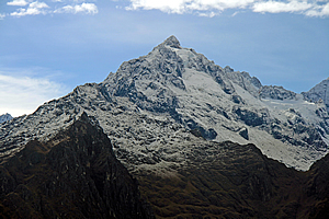
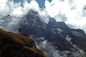
Small puddles of cloud hugged a few sections of the valley now eight hundred metres below me. I initially thought the clouds were stationary in the motionless air, but then I saw they were gradually rising up the gullies. The sharp ridges that had been high above us yesterday were now level with us. The village was just a few tiny dots far below us. Across the other side of the valley the snow-capped mountains towered much higher than where I was standing, most of them reaching heights of well over five kilometres above sea level. Salkantay was the highest mountain was to the right near the right hand ridge. At 6300 metres this was the highest mountain I had ever seen from standing on ground, although it was still around seven hundred metres short of Aconcagua which I had seen from the plane flying between Santiago and Lima.
Unlike Aconcagua though, Salkantay had some beautiful glaciers and a fascinating rock form. The rock was folded in such a way that the summit was actually at the bottom of what had once been a valley, with the sides eroded away revealing an upward facing concave rock formation, even though the mountain itself was almost a perfect triangle. It reminded me of Mount Cook in New Zealand, which has a summit that is said to once have been at the bottom of a valley. At 3750 metres that is hard to believe until you realise the Southern Alps have actually been uplifted over ten kilometres high. The dramatic climate there has caused most of the mountains to erode away though. Here it was a bit different as I had noticed the Andes haven’t shown the same degree of erosion as evident in the Southern Alps. The uplift of the Andes is a lot more recent.
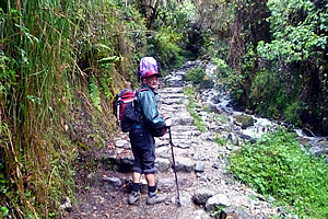
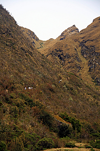
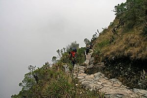
I looked back the other way to the track rising steeply across the side of the valley towards the pass which was still a very long way away. The sheer scale of the place was accentuated with a few tiny dots of people inching their way up. There was nearly five hundred metres of climbing to go, and about two thirds of the way up I will be heading into record territory, above the 4095 metres above sea level I had climbed on Mount Kinabalu earlier this year. Everything past that will be new territory for me. I knew the final assault along the steep pathway was going to be tough. I returned to the track. By now most people had arrived, apart from Amy, Derek and Avani. They were still further behind. I looked back across the gully towards the campsite toilets. The dog was gone but there we saw a family of alpaca, including one which had been born only a few days ago. Quarter of an hour had passed since leaving the rest point at Ayapata camp. Dead Woman Pass didn’t seem any closer and the air was noticeably thinner. The trail here was only moderately steep. At this altitude though it felt like a killer. The stones underfoot were irregular and becoming rather hard to walk on. I walked at a very slow pace to conserve energy, yet I was quickly catching up to the laggards of the next group in front of me.
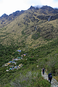
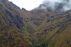
Julia was still keeping up at about ten metres behind me. Everyone else had already disappeared too far behind for me to see whenever I looked back. Wilbur had told us to go at our own pace, but to wait for everyone else at the top. I was happy with that arrangement. Going at your own pace no matter how slowly actually uses less energy than when walking together as a group at the pace of the slowest member. There was quite a substantial drop below the track now. There was no forest here, so I would have been above the tree line by now. The gully below had expanded into a large glacial basin, carved out by ice in recent ice ages. At the bottom of the wide valley was the remains of what had once been quite a large campsite - Llulluchapampa. All that was left now were the huge arrow shaped mounds used to bank up the flat areas of land. The campsite had now been abandoned in the interests of revegetation. Two streams meandered over the glacial basin like silver slivering snakes.
Thankfully the pass appeared to get closer and closer as I continued approaching it one step at a time getting up. I was passing people now, those who were struggling to have the will power to make it to the top. Fortunately no one was turning back. They were all determined to get to the top and complete the trail no matter how slow the going was. This place obviously attracts the tough. Although it was challenging enough for me to be huffing and puffing, this climb was not as difficult as the final climb to the summit of Mount Kinabalu. For a start it was daytime, and I could clearly see the pass. I had climbed Kinabalu at night. The towering ridges on either side here provided protection from the elements. I was getting quite close to the snow now. Upon looking back I didn’t see anyone else from our group. They were all climbing more slowly than I was. Even Julia was slipping further behind. I could see the clouds that clung into the gullies was quickly ascending, and once more I was starting to think that I would lose the view from the top, so that gave me more motivation to keep a reasonably fast pace.
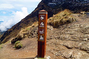
I took two brief rests to catch my breath and to take photos, but otherwise I kept a constant pace. The gully closed in a bit causing me to lose sight of the valley below. A large bank of cloud came in front of the mountains on the other side of the valley. The stones laid on the track were a bit dislodged from the wear and tear of the high altitude. Some sections were completely worn away with makeshift steps built from the few remaining rocks to minimise erosion. Finally I saw the top with people on it, including some of our porters who had quite easily walked past us with their heavy packs. I gathered just a bit more strength having gone to my highest yet, and paced myself up the final steps to the flat summit at the top. It was a huge relief to be at the highest point of the Inca Trail. A small sign welcomed me to 4215 metres above sea level, higher than I had ever been. The sign was nothing more than a large wooden post with a flattened triangular pyramid top. It had four squares with diagrams and words down its length. They read as follows: Warmiwanuska Abra (Image of two mountains with a track in between)
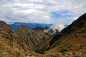
I very quickly regained my energy and felt invigorated in the fresh mountain air as I put my pack down on one of the stone ledges where our porters were sitting. The ground here was mostly gravel only because so many people have rested up here. Surrounding the gravel was a tussock like grass that grew well. The snow line was still a hundred metres above me. I looked down the other side of the pass, seeing where the track zig-zagged way down the valley to where we will be having lunch at a location unseen in Pacaymayu six hundred metres down the 2.1 kilometre long track, but I also saw the track going up the other side to the second pass, one that wasn’t as high as this at some 3900 metres above sea level. That pass appeared reasonably flat, but it was a long way away. The pass was only about a hundred metres below the surrounding peaks.
Beyond the yellow brown range, were another two ranges blue grey and very distant looking towards the great Amazon Basin unseen over the horizon through the clouds. Cloud was starting to pour into the valley below me, so the view in this direction wasn’t going to last much longer. Looking behind me, the clouds were ascending the Llulluchapampa Valley and there wasn’t much of a view left – just the arête valley containing the abandoned Llulluchapampa campsite. The ridges on either side were concealing our view. The gullies were all filled with brilliant white cloud, but the blackened spurs were still clear.
I could see the last campsite where we had stopped on our way up this morning, and in brief moments when the cloud cleared enough, there was a view of the village at the bottom of the gully now some thirteen hundred metres below me. To the left were all the red porters sitting on steps carved into the soil, and our blue porters were sitting on benches cut out into the dirt to my right, so I went and joined them. Several minutes later Julia arrived, and over the next half hour everyone else arrived one by one in the following order. Marissa arrived about ten minutes after Julia, then Hannah, Ryan and Kristen, Michael and finally Kathleen.
|
||||||||||||||||||||||||||||||||||||||||||||||||||||||||||||||||||||||||||||||||||||||||||||||||||

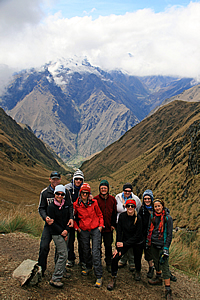
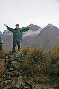
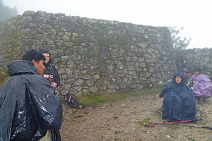
Achievement! Most of our group at the summit |
I climbed up to a small lookout at 4223 metres – eight metres above the summit. That was the highest place I will be travelling to on the trail. A few small stone cairns were atop the small platform where I stood. From there I could see our blue porters with the rest of the group directly below me, and the red porters with a few other porters sitting on the seats carved into the side of the hill on the other side of the pass. Additionally some of the porters who had been based at the camp at the bottom of the valley were now already starting to pass, no doubt having gone way ahead of their groups.
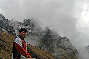
Wilbur in his element |
I returned to the rest of the group in just as Amanda arrived. Wilbur had arrived too so those of us who were up here posed for a group shot. At that stage Amy, Derek and Avani hadn’t arrived, but we had to keep moving to head down the hill for lunch. Carlos was looking after them anyway. Our porters had just left and by now the cloud was quickly ascending the valleys on either side of the pass, blocking much of the view.
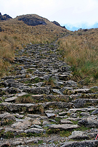
Now I can’t stand walking downhill at the best of times. By now it had dawned on me that the descent from the pass will be a lot steeper than the ascent. Fortunately the track here was all steps of large stones perfectly joined together by the Inca five hundred years ago. The track has been so well built that it has only required minimal maintenance since its initial construction. This was most unusual, but a testament to those who had built it so long ago.
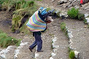
Toilet just below the pass |
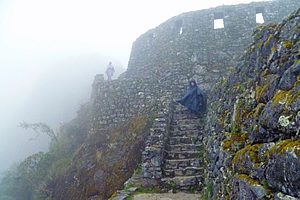
Stairs descending the pass |
Wilbur led the way. I closely followed him. By coming second I was hoping to be the one setting the pace on the long downhill. I used my walking pole with the rubber end to navigate my way down.
Long steep trail down the valley |
About five minutes below the pass we reached a stop where a small timber thatched toilet was about thirty metres off the track through the thick tussock like grass. A small stream passed the toilet hut from a gully coming off the rocky mountain top still not far above us at about four thousand six hundred metres above sea level. We stopped here for about five minutes whilst a couple of members of our group did their business.
We continued descending, passing through a small cave and weaving out the bottom. Wilbur explained to us that several people have died on this part of the trail. They were mainly porters who were taking the downhill a bit too fast and had tripped over to roll down the precipitously steep hill to their deaths. Perhaps after going uphill for so long they had forgotten about the extra precautions needed when going downhill.
Campsite and trail continuing up the hill |
The long stairway we followed led towards Pacaymayu, a small campsite far below us. There were small tufts of tussock grass growing in the cracks between the stones. No doubt these plants will be removed during the annual maintenance in February each year when the track is closed to tourists.
The track was very well maintained, thanks partly due to the track being closed during February each year when workers would conduct any clearing and other maintenance work. Another reason it was so well maintained was due to the Peruvian government setting a limit of five hundred people (including porters) each day. There was talk of reducing this number further as a measure to further reduce deterioration.
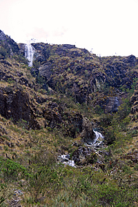
Waterfall |
Fortunately as the track was in such good condition we lost altitude very quickly. I could already feel the air thickening, but that was mainly due to the humidity rising as a small cloud enveloped us.
The cloud passed us and we continued heading down. The pass behind us was now shrouded in cloud, so I imagined Amy, Derek and Avani would be in the cloud when they reached the summit. They will be denied the spectacular view I had been rewarded with at the top.
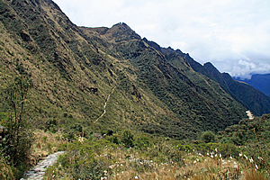
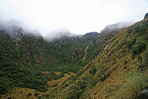
We reached a point where the glacial gully below us suddenly steepened, causing the track to now follow the side of the mountain towards some scrubby forest further down the valley now curving to the right. The track started to level, and now I could just make out the track that we will need to climb up after lunch, heading towards the second pass. Looking back up I could see where the track had gone through the caves and passed a large slip I had not previously seen. The slip was a scourge in the otherwise pristine mountain showing potentially how steep and treacherous it can be around the tops.
Trail |
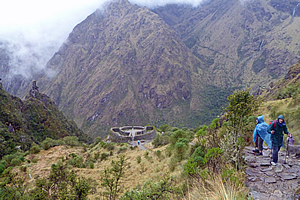
The descending trail suddenly steepened again into a staircase winding its way quite randomly down the gully. In the distance the track we will be going up in the afternoon, I could see a round ruin right by the track – the ruins of Runkuraqay. This was something to look forward to this afternoon as we will be passing it.
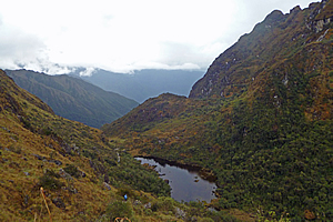
I saw a waterfall coming out of what had been a small glacial valley above us. It was part of a long cascade plunging from one hanging valley into the second hanging valley which we were travelling down. These were the headwaters of the Pacaymayu River. I could now see the Pacayamayu Campsite below at the bottom end of the hanging valley we were descending. We continued downhill until crossing the stream just above the campsite. It was fantastic to hear the sound of running water again after the desolate silence of the mountaintops. Further down the valley I could see the scrub was turning into a forest, this was the first sign of the perpetual forest of the Amazon into which these rivers drained into. We entered some very jumbled scrub that had bromeliads with dull red flowers growing on the thin branches.
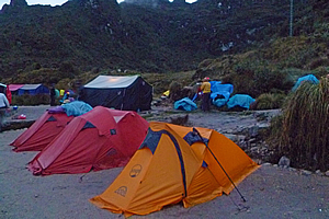
Campsite at the bottom of the valley |
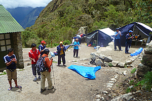
A group of tents suddenly appeared in a small clearing next to the trail. We continued walking another three minutes until we entered the campsite of Pacaymayu and were greeted with the standing ovation of the porters who had already set up the two large tents and had nearly finished cooking lunch. They must have run down from the pass.
Having arrived at our lunch stop, we washed our hands in the row of little blue bowls filled with warm water with a small cheap bar of soap as we had done in all previous meals to date. It was going to be a while before Sam, Avani and Amy were going to arrive, so we rested whilst awaiting their arrival. Time wasn’t an issue as Wilbur assured us we were a fast group and were running ahead of schedule.
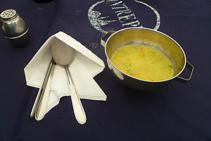
Soup |
From our vantage point on the grassy flat I could see back up the valley where the stream was plunging down cascading waterfalls. The pass had disappeared out of view by a steep spur. Looking downstream, the valley continued steeply downhill for a few more hundred metres before plunging into another old glacial valley. No doubt it was plunging down waterfalls again into the depths towards the Urubamba River only a few kilometres away yet around a thousand metres below us.
Main course |
Although the Urubamba River was completely concealed from view, I could see the mountains on the other side of it. The mountains rose dark and at this point I could just see Mount Veronica before it disappeared behind the black cloud that now covered the valley below it. No doubt it was raining down there.
Whilst awaiting the others to arrive for lunch, I crossed the stream to the small toilet block. On the way back I could hear some rowdy louts swimming in a small pool in the stream. Going by their accents they were definitely Australian. I briefly saw them on the way back to our camp.
Appcoaching storm |
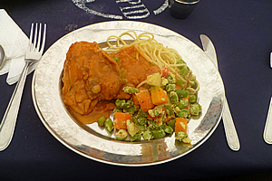
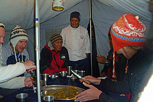
It was forty minutes after our arrival when Amy, Derek and Avani finally arrived. We joined the porters in giving them a standing ovation. The porters then announced lunch was ready, so we entered the tent and sat around the table for another gourmet meal. Once more Ricardo the chef delivered very well. He started with serving a vegetable soup. The main was a battered chicken with a vegetable mix of potato, beans and carrot, and noodles.
We left the tents to continue our hike only a few minutes after finishing eating. This was a bit too soon as our stomachs hadn’t settled yet. Perhaps Wilbur had been a little too optimistic in our progress earlier and figured if we left any later some of us would not arrive until after dark.
Upon leaving the tent I could see the cloud I had earlier seen down the valley was now advancing quickly towards us. The mountains on the other side of the Urubamba River were now completely hidden amongst the mass of black storm cloud. This was potentially going to make the traverse of the second pass more difficult than the first.
We left Pacaymayu climbing the steep stone stairway track around ridge and gully up towards the next pass. It was clouded over up there, and thick cloud was barrelling up the valley below us. Despite that I had only been walking for about ten minutes before reaching high enough to get another view of Dead Woman Pass towering surprisingly high above the campsite now tiny and perched in the gully below us. The waterfall bringing the stream that flowed through the camp plunged in two steps.
Ascending from the campsite |
Porter on the steep trail |
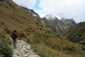
The landscape appeared a lot more dramatic from this side of the valley. The view must have been a bit intimidating for the Inca returning from Machu Picchu, seeing they had an enormous steep climb ahead of them. Through the thin haze I could see a dark line which I immediately recognised as the trail we had walked down from the pass. It looked rather ominous from here, but that was past history. This was a one way trail and I will never need to walk that section again. Now I had to concentrate on the climb ahead.
Cloud fills the valley |
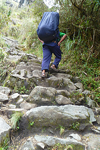
The path I was walking along was very narrow in places, making it difficult for our porters to pass us. I was amazed as how quickly they had packed up after lunch and now nimbly they were attacking the steep path even though some were only wearing sandals. In stark contrast here was me in my flash boots carrying only a day pack and camera bag huffing and puffing along at such a slow speed despite being at peak fitness.
I could see liverwort type ferns growing along the side of the trail for the first time, indicating the rainforest area was near. Despite that I knew we wouldn’t encounter forest until dropping over the other side of the pass, having remembered seeing this pass from the top at Dead Woman Pass and the terrain had been moderate grassland.
Runkuraqay |
The rapidly advancing cloud quickly filled the gully behind us, taking away our view of the campsite. Rounding spur and gully, the view below was that of back further along the track seeing my fellow travellers inching their way up the steep stairway. The mountains blackened under the approaching squall.
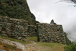
After nearly an hour of winding up the hill, we saw the round stone barrack of the lower part of Runkuraqay ahead of us further up. We walked up to it and grouped there. The thick cloud was very close to us still obscuring Pacaymayu below. A peel of thunder echoed in the steep slopes that surrounded us.
Precipitous terrain |
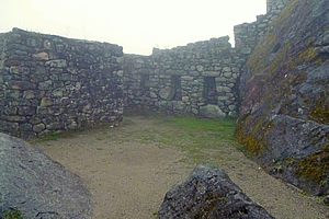
We assembled in the middle of the round temple and Wilbur began to explain the small ruin of Runkuraqay. The walls in the most part were a little over two metres high and inclined inwards to provide earthquake resistance. The walls around the front curve were about one point two metres high, a good height for admiring the view below. There were windows in the building pointing to the directions of all the paths of the empire. It would have had a large conical thatched roof held up by wooden poles. These had long decomposed leaving only the rocky walls.
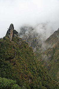
The camp was visible again, up to the waterfalls, but the higher slopes had disappeared behind the cloud cover rising the valley like the fluids in lava lamps. There was a small square building about fifty metres below us. Some of the walls had small plants growing out of the joins. To our left the mountainside was precipitously steep with needle sharp columns of rock protruding vertically from the steep spur.
The storm hits |
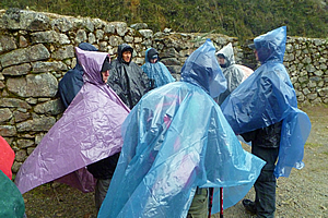
Then hail started falling and we quickly put on our rain capes and ponchos. It was suddenly very cold with swirling wind. There was no point in us staying here as there was nowhere to shelter, so we continued walking up the hill getting pelted by the small hailstones and buffeted by the strong cold mountain wind. I had put the waterproof cover over my camera bag.
The steep and narrow stone track above the Runkuraqay fortress was difficult going as the strong gusty wind buffeted us with hail flapping our rain capes around, although it wasn’t as difficult as this morning’s climb. The stone pavers we were walking on began to get a little slippery but we continued onward and upward as this was our only way to stay warm in this severe alpine squall.
Hail falls as we continue towards the pass |
I had remembered the hail storm the other day at the tiny Incan village between Cuzco and Ollyantaytambo. Thankfully this storm wasn’t as ferocious as that tempest, but I did remember how long that storm had lasted. The hailstones created an awful noise as they hit and scratched against the thin cape of my raincoat.
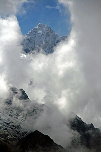
Fortunately it didn’t last long. The hail quickly changed to steady rain and the thick clouds began to abate, rewarding us with a view of the round Runkuraqay fortress now quite a long way below us. It appeared very small from up here, just two concentric circles of stone wall with a few radial rows of stone between them to create rooms. From up here it looked like a bunker to house a large cannon. The wildly swirling cloud cleared just enough to reward us with a translucent view glimpse back to the top of Dead Woman Pass. The weather would be pretty savage up there now, though perhaps no more so than it had been here.
Above Runkuraqay |
It was about here that the track’s steepness lessened. We were above the very steep terrain and above the scrubby bush now entering another glacial accumulation gully. The track rose over the lip of the valley reaching a small pass marked with several small stone cairns on the side of the track.
The trail descended for a couple of metres before rising again on the right hand side of the gully revealing a small tarn coloured deep ochre from the tannin that had leached from the surrounding grass. This was called Laguna Cochapata. The surface of the tanning stained tarn bubbled with the falling rain as we continued to ascend following the ridge.
Dead Woman Pass across the valley |
I looked back across the valley we had scaled today. The cloud had lifted significantly and thankfully the rain was easing. I now had a clear view across to Dead Woman Pass. Only the mountaintops were covered in cloud now. I could just see the track along the other side working its way steeply up the precipitous gully towards the pass.
Upon reaching the top of the glacial gully, we found ourselves walking across fairly flat terrain towards the nearby second pass. We walked around another tarn unnaturally sitting at the edge of the plunging slope. On the other side looking towards the Urubamba River I could just see the snow of some higher mountains that we had not previously seen. The summits were concealed in amongst the cloud, but I imagined these mountains to be at least six thousand metres high.
Ruin at the top of the pass |
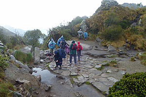
Finally we reached the top of Runkuraqay, at 3950 metres above sea level. It was a large round flat area about eight metres across surrounded by huge natural boulders. It was obviously man made into some kind of outdoor temple, perhaps an Incan Stonehenge. In the thick mist that occasionally engulfed us it looked like something out of Lord of the Rings, perhaps Weathertop. For the first time here I felt I was in a special spiritual place, although this was nothing compared to what we would discover over the next two days.
At the top of the pass |
The cobbled pathway passed through the middle of the round pass, but in the middle was a two metre wide circle of stones perhaps indicating a map of the local area. There were a few piles of rock surrounding the circular clearing, but it was hard to tell whether these were natural or man-made. Perhaps the jagged edges of the rocks surrounding the clearing had been carved into the shapes of the mountains.
Over the piles of rock to our left was a group of rounded mountain peaks enshrouded in mist. I had looked down on these peaks from Dead Woman Pass not thinking much of them at the time, but now they stood over us like giant sentinels.
The rain suddenly cleared and the clouds thinned a little so we decided to stop here for a rest for about five minutes. The clouds cleared from the other side giving us a view down the gully in which we were about to descend.
The stone stairway steeply dropped from the second pass at Runkuraqay into the gully below us. Thick mist suddenly enveloped us and squally rain started falling again. Fortunately though it quickly cleared away leaving only the thick layer of cloud cover a good one thousand metres above us.
Swamp at the bottom of the hanging valley |
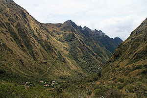
Below us I could see at the end of the gully a swampy tarn with black water stained with tannin leached from the surrounding vegetation. The bottom of the thick scrubby valley would be very swampy. Beyond the end of the lake the land dropped off very steeply into the Aobamba River hidden a good vertical kilometre further below. The other side of the valley rose into more mountains to the distance, not looking as steep as the mountains here. The Aobamba River drains into the Urubamba River at some distance below Machu Picchu. The combined river forms just one of the many tributaries of the Amazon.
I was walking with Wilbur at the front of the group. I asked him how long it would take him to do the trail if we were to do it alone. He didn’t know as he had never tried it before, but he said that Carlos had once completed the entire trail in twelve hours. He said the porters have an annual race running along the trail. It is not a well-known race though, and certainly not like the Kinabalu classic where anyone can enter. It must be amazing for the porters to be able to run the trail uninhibited by the heavy packs they had to carry, but carrying the packs on a regular basis along the trail would be a fantastic way to train for the race.
Looking back towards the pass |
We continued down the steep paved trail towards the swamp. The surrounding tussock grass gave way to very thin scrub once we were within a hundred metres from the bottom. Looking back up the mountain, it was obvious we had come down across the back of another small glacial valley with the back of it very steeply rising into the thick clouds above. The pass was once more engulfed with cloud. Anyone crossing the second pass from now on would not have any view at all. The cloud was definitely descending with the onset of night.
As we passed the lip of the swamp, thick scrub robbed us of most of our view apart from the occasional clearing from where we could see the perfectly mirror smooth tarn below us. Looking ahead, thick white cloud was quickly coming up the valley towards us. Soon we will be in thick fog.
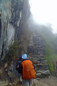
Stairway to Sayamarca |
We continued walking in amongst the thick scrub until reaching the end of a spur from where we were rewarded with an amazing view. Ahead of us was the walled village ruin of Sayamarca perched on the edge of the precipitous slope below us. Thick cloud covered the valley beneath the ruin and rising above the gully behind it. This really highlighted the dark mysterious ruin, giving the illusion that it was at an enormously high altitude. We followed the track towards it but very quickly it disappeared into the cloud, highlighting its alpine mysteriousness.
The swirling white fog cocooned us with a heavy cold dampness. I recognised what this meant having experienced similar conditions when hiking in New Zealand. The cold heavy dampness is an indication of the onset of prolonged rain. The spectacular view of Machu Picchu in about forty hours time was slipping away.
The track seemed to get narrower and more precarious as rain began to fall again. As expected it was a lot colder this time. We entered a dark forest of gnarly trees making conditions even more miserable. Then we suddenly arrived at an intersection. The main track doubled back in a hairpin bend continuing its gradual descent. A narrow stone stairway carved into the rock face with trees overhanging high above led up to what I presumed was the ruins of Sayamarca that I had seen just before it was enveloped in cloud.
Sayamarca |
Wilbur offered to take us up the narrow stairs, but anyone wanting to go to the camp was welcome to do so. The camp was only about ten minutes walk away. I thought of the next campsite where no doubt our tents were already pitched with a dry bed and hot chocolate awaiting us. Too bad, that can wait. I was here only once in my lifetime, so come hell or high water, I was going to see these mysterious ruins in the clouds.
I followed the rest of the group behind Wilbur as we walked up the slippery steps in the rain taking care not to trip on our rain capes.
The rain suddenly stopped falling just as we reached a large circular courtyard which appeared to be the top of the village. Thick mist enshrouded the village with a ghostly translucence. We were in a round temple area at the top of Sayacmarca, with a few levels dropping off diffusing into the thick fog. Visibility was only about twenty metres. The walls with gaps full of moss leant inwards perhaps to deflect the wind which fortunately wasn’t blowing today. It was deathly silent up here, but that was broken by Wilbur starting to explain the history of the village, and he pointed out a round brass plaque erected in 2005 marking this as a historic site. We listened intently as cold rain began to fall again.
Sayamarca |
He said that Sayacmarca means “Town in a Steep Place”, which was very true. The town is located on the tip of a very prominent ridge about a vertical kilometre above the Aobamba River. There was a track from here leading down into the valley below. The purpose of the village is unknown. It is not fortified, nor does it contain enough terracing to be self sufficient, let alone to produce agriculture. Even if it was big enough, the climate of this exposed location would not sustain crops. It was probably not used for religious purposes either, as the standard of construction here (as good as it was though) was not of the quality of any of the temples the Inca had constructed. Unlike most of the other temples in this part of Peru, this one was initially built in pre-Incan times by the Colla. The Inca improved the construction following their invasion of the Colla. Now that was interesting. I imagined this trail had initially been constructed by the Colla, and all the Inca needed to do was to put the stone pavers on the trail route.
Sayamarca |
Once Wilbur had finished his presentation, he told us that we could explore the village, before heading down to the camp at our leisure. By now I was starting to feel rather chilled and rain was falling again. Five minutes of stopping had made quite a difference. I explored the city in the very thick fog now reducing visibility to ten metres. After a few minutes I decided it was time to move on towards the warmth of the campsite. I carefully headed down the precarious stone staircase back onto the main trail. The others had decided to either go to the camp straight away, or were lingering a bit longer in the ruins in the clouds.
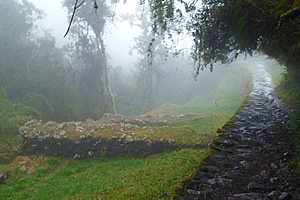
I walked along the track alone – the first time I had done so since the final stretch to Dead Woman Pass when the rest of the group had fallen behind. Even then I hadn’t been alone as I was walking with other people from other groups there. Now I was completely alone feeling the eerie serenity of the moss covered trees. The stone construction of this part of the track was amazing. It was held up by a one or two metre high retaining wall to the left, and the stones banked up against the side of the hill on the right. This trail had taken an enormous amount of work, and there was no way it was going to slip down the hill any time soon.
The rain had stopped falling and the fog was starting to thin. The light of the hidden sun was starting to increase so it was no longer dark.
Conchamarca |
I crossed a bridge perfectly formed on the trail, but with wooden handrails recently constructed no doubt for safety. Once across the stream, the trail followed it downstream passing several stone artificial terrace barriers that could have been used for growing produce or for creating irrigation channels, or to perhaps have stopped the stream eroding the ground near the trail. Above the terrace was the small tambo Conchamarca.
The track was going through cloud forest now. It was still rather stunted, but this was the first of the forest that would continue to expand and eventually merge in with the Amazon Rainforest far away down the valley. There was too much cloud here to see any view, and as I walked the trail alone, I wondered how much further it would be to the campsite.
It was quarter to five in the afternoon when suddenly the thick scrubby bush cleared in front of me. Just a few metres ahead to the right of the track was a large clearing where I saw the Conchamarca campsite, instantly recognising our tents. Several of our porters who were working nearby preparing our dinner turned around and gave me a standing ovation. Their standing ovation was somewhat a little wearied this time around, but given the cold rain and the fact that they would have had to hurry over the pass through rain and hail to get everything set up in time for us, I still very much appreciated the welcome.
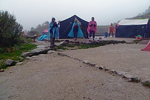
A most welcome standing ovation |
Our tents were on the first small flat area next to the track and the two large blue tents were on a slightly higher platform. Across the track about thirty metres distant was a stone toilet block. Further up the flat to our right were more terraces with more erected tents belonging to other groups.
It was still raining, but fortunately the clouds had lifted to about half way up the surrounding hills. It was a real relief to get my daypack into my tent which was still completely dry inside. I then walked the ten metres to meet some of the others who had not gone up to Sayamarca and come straight here. As soon as I sat down on one of the plastic seats Ricardo served us a large plate of popcorn. The rest of the group who had lingered in the ruins in the clouds arrived five minutes later. Another half an hour passed before Amy, Derek and Avani arrived just as the overcast sky was beginning to get dark with the onset of night. They hadn’t had the time to explore the ruins in the mist, plus they were too exhausted to explore them anyway.
By now it was raining heavily outside. Thankfully we had very good tents, and thankfully we had very professional porters who had packed them very well and erected them before our arrival in such a way as to keep them completely dry. The porters told us (in Spanish - Carlos was interpreting for us) that the other group who had stayed at our campsite last night become rather wet because their porters and equipment weren’t as good as ours.
Campsite |
The porters brought in another large platter of popcorn and pastry wraps for us to eat. It was a rather late afternoon tea, but we had been walking constantly since lunch time. Wilbur briefed us on tomorrow’s hike whilst we were eating. We will be crossing the third and final pass about an hour after leaving the campsite, although there will almost be no climb at all up to it. Then it will all be downhill for a couple of hours to the next campsite. We had hiked eight hours a day on both days so far, but tomorrow will only be about four hours. Tomorrow’s campsite will be only two or three hours away from Machu Picchu. That meant we had already covered two thirds of the trail. I wasn’t looking forward to the long downhill though. I recalled from memory that Machu Picchu was about 2400 metres above sea level, and we were a good 1300 metres above that. It was going to be a long way down.
Upon finishing afternoon tea, the rain briefly abated, so I photographed the gloomy mountains surrounding us, all enshrouded in thick cloud as the tropical alpine sky above continued to quickly darken. By now the rain had stopped falling and the clouds were at about the level of the conical peaks surrounding us. The slopes coming off the peaks were very steep, but grading into a level terrace upon which we were camping for the night. Below the terrace the valley dropped sharply for at least a vertical kilometre.
It was completely dark and raining again when we wandered back into the dining tent for dinner. On what should have been an absolutely miserable night, we were served with yet another amazing meal that kept our spirits elevated.
Despite the gas lamp giving off a fair bit of heat, we were all (including the Londoners) rugged up in our thermals and woollen hats.
Dinner |
We started off with a small chicken and vegetable noodle soup. Then the main course came out on several platters – baked potatoes, a very nice alpaca casserole with large pieces of alpaca meat, rice, and quiche. Michael was again given a special plate of food, though today it resembled something a bit closer to what the rest of us were eating as he was starting to feel better. He was definitely a trooper having climbed the two passes reasonably well given his stomach condition and the lack of food he had been eaten since the Amazon. For desert we had a large flat fruit pie.
The rain stopped falling as we ate. After dinner, we went outside the dining tent in the total darkness and did some stretching exercises. We didn’t do them adequately yesterday, so we decided to make up for it tonight by doing them properly. We were led by Kristen who worked for a large well known dieting company in Australia which apparently included a fitness program. Whether or not that qualified her, she was very good at leading us up there in the total darkness despite us falling over ourselves a bit.
Once stretched, we retired for the night as rain started falling again. I crawled into my sleeping bag and almost instantly fell asleep.
| Home | Photography | Diary | Travels | Treks | |
© 2001-2026 Walkabout Jeff - Copyright - Disclaimer - Who is Walkabout Jeff? |