|
||||||||||||||||||||||||||||||||||||||||||||||||||||||||||||||||||||||||||||||||||||||||||||
|
||||||||||||||||||||||||||||||||||||||||||||||||||||||||||||||||||||||||||||||||||||||||||||
Home > Treks > Outside Australasia > Inca Trail > 5 |
||||||||||||||||||||||||||||||||||||||||||||||||||||||||||||||||||||||||||||||||||||||||||||
|
||||||||||||||||||||||||||||||||||||||||||||||||||||||||||||||||||||||||||||||||||||||||||||
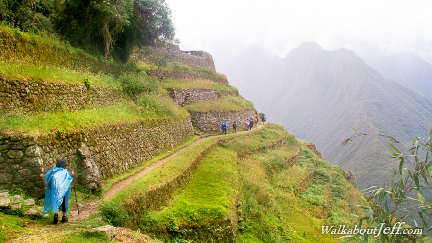
Introduction to today's journeyThere is a fountain of youth. It is your mind, your talents, the creativity you bring to your life and the lives of people you love. When you learn to tap this source you truly have defeated age. - Sophia Loren Today's trek starts with a level traverse from Sayacmarca to the third pass at Phuyupatamarca. From there we begin a 900 metre descent into the Sacred Valley eventually reaching the spectacular ruins at Winay Wayna and stay the night at the nearby camping ground. Today's JourneyDistance trekked today: 13 kilometres. Total distance trekked to date: 46 kilometres. IT WAS already light when I woke up the next morning following a long uninterrupted dreamless sleep. I left the tent and explored the area, but the cloud had set in again to about a hundred metres above where we were camped. The gullies were completely whitened out by the thick fluffy cloud, whilst the ridges were still translucent giving the eerie effect of smoke rising up the valleys. The wispy clouds hid the view across the large valley before me. I recalled Luis had told me a few days ago that from here I should see a mountain over six thousand metres high that was very dangerous to climb. So dangerous in fact that nobody who had ever attempted to climb to the summit has ever come back down alive. Today it eluded me.
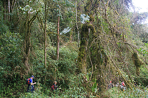
It was very quiet here with no one else up yet. I took some photos towards Sayacmara, the ruins I had explored in the fog yesterday, but there wasn’t much to see. The cloud was well above the ruins, but they were covered in moss to almost perfectly camouflage the ruin against the surrounding vegetation. Above the ruins were many sharp darkened peaks, through which I could just make out the second pass we had crossed yesterday. Far below us and hidden from view was the Aobamba River.
I returned to the tents to see two of the porters starting to wake everyone else up. They were well rugged up in blue polar fleece tops and woollen hats. I returned to my tent just as they reached my tent. They were a little surprised I was already up. After all they were supposed to be our alarm clocks. They were serving out the tea from a translucent plastic jug which I thought would have been more suited for cold water. As usual I asked for two sugars to give me a bit of an energy boost. With everyone else getting up now, we gradually meandered to breakfast in the main tent. The food was mostly cold, apart from cooked sausages. There were fritters and baked banana and hot chocolate. We were as jovial as ever despite the damp coldness of the morning. There was just one more pass to climb over today, and we were almost level with it already. Then it will all be downhill. I really wasn’t looking forward to that! The cobblestone trail going from the Conchamarca Campsite where we had stayed the night led for about two hundred metres across an elevated swamp. The swamp was contained in a narrow shelf between the steep hills towering to our right and the sharp drop plunging deep into the Aobamba valley below to the left. The track was built up over an impressive raised causeway over what would have otherwise been a very boggy trail through swamp. Clouds still covered the hills above us, but we could see the large granite outcrops near the top of the initial rises.
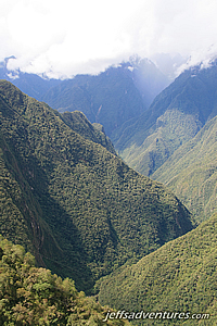
Our porters quickly overtook us as the track then ascended gently soon giving us a final view over the campsite, the Sayacmarca ruins beyond, and up the gully towards the second pass we had crossed yesterday, now just below the cloud line. Then we rounded the scrubby spur to proceed onto the next part of the trail. The scrub quickly turned into moss covered small trees, similar to the New Zealand kanuka (tea tree). Through a break in the trees we could see a small waterfall tumbling down in amongst the scrub in the middle of the next gully. The landform of the long valley below us didn’t show character like the spectacular mountains behind us, suggesting to us that we were approaching the end of the Andes, where all the watershed flows into the Amazon basin maybe a couple of hundred kilometres away. All the trails of the Inca seemed to be over the mountains and across the dry west coast. They didn’t seem to have any interest in the Amazon, or if they did, there was probably no evidence left of their civilisation due to the jungle taking over whatever had been built.
|
||||||||||||||||||||||||||||||||||||||||||||||||||||||||||||||||||||||||||||||||||||||||||||
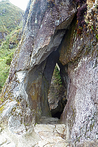
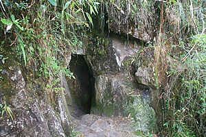
Inside the tunnel |
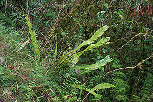
I started seeing cycad like plants growing in the scrub. Perhaps these were some kind of bromeliad.
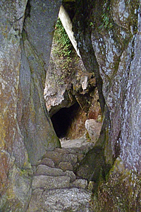
The track suddenly ended at the entrance to a granite cave. The entrance was an elongated triangular tear shape easy to walk in. The roof being safely above my head and the width rather cosy though not requiring me to squeeze myself at all. The tunnel had a natural feel about it, but it had been hewn out by the Inca as part of the construction of the trail. The tunnel wall was less than a metre thick, so they could have easily carved the track around its edge.
Approaching the pass |
One by one we entered the cave and followed a stairway carved into the rock for about sixteen metres until coming out at the bottom of the cave. By this stage my camera was quite badly fogged up thanks to the extremely high humidity here.
Upon passing the cave, the trail went further into the gully where the forest became thicker, with trees covered in thick carpets of moss. We continued about another two hundred metres before reaching the side of a tiny dirt clearing just to the right of the track where we each posed for some amazing cloud forest photos.
The terrain was very steep here being directly under the jagged peaks high above us. We passed very steep grey granite rock faces showing the amount of work that would have been done to have created the track five hundred years ago. Here large stones were set in large notches in the cliff face to create a stone surface wide enough to walk along. It was amazing that it had all held together for so long.
The track levelled off again as cloud began to surround the slopes just below us. Thick misty cloud enveloped us for a few moments before clearing again. More small clouds would come and go as we passed more scrub with strange tiny ferns growing off them as epiphytes.
At the pass |
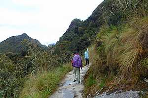
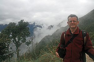
By now I was falling a minute or two behind the rest of the group with Michael and Julia just behind me. We were happy to go at a slightly slower pace and take pictures. Well I was happy to take pictures anyway. I think Michael was still having stomach problems even though he said he was feeling better now. His illness must have really taken it out of him but he had been determined to conquer the Inca Trail. Apparently the worst was behind us.
Mountaintop campsite |
There were a lot more mosses and ferns by the side of the track now, indicating we were getting closer to the permanent cloud forest. Tracts of forest were starting to cover the hills leaving only the bluffs running diagonally across the rounded knobbly tops. Then I noticed the track which had been level since the cave was starting to gradually rise again towards a very small pass.
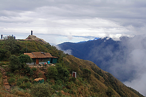
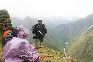
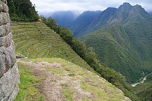
We reached the summit of the Phuyupatamarca Pass to be greeted with the most unusual sight of a large campsite straddling the side of the hill to the nearby summit. I thought this was a very exposed place to have a campsite, but the wind was calm up here. It was too exposed for trees or even scrub to grow, so it must be a pretty severe location. There were numerous tents with some campsites getting packed up. To the right was the Urubamba River draining the Sacred Valley where we had come from. To the left was the Aobamba River, both unseen over sixteen hundred metres altitude below me.
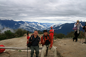
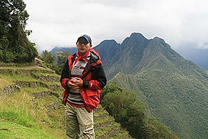
Wilbur and I at the campsite |
Looking down the side of the mountain to the right I could see through the cloud far below a small town beside the river. Wilbur told me this was the town of Aguas Calientes, where we will be having lunch tomorrow afternoon.
It was a long way down though – a very long way down. It would have been about sixteen hundred vertical metres down and perhaps only two or three kilometres away in the extremely steep terrain.
We walked the short distance between the top of the pass and the main lookout at the campsite called “Phuyupatamarka”, named after a ruin further along the trail. It was not exactly a catchy name by any stretch of the imagination. Here we rested for about ten minutes.
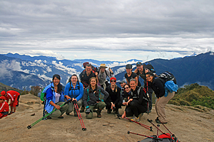
The whole group at the campsite |
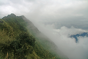
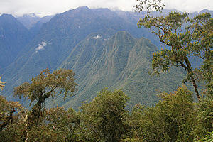
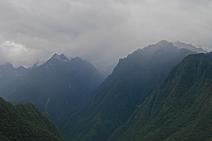
Looking further out the mountains gradually tapered off towards the great basin of the Amazon. All the mountain ranges for as far as the eye could see were covered in forest, getting bluer and more faded with distance. There was a lot of cloud in the valleys although the tops were all clear. I crossed my fingers hoping that Machu Picchu was not going to be cloudy like this tomorrow.
We rested at the campsite for about fifteen minutes. There were still people here packing up their tents preparing for today’s walk. Whether they were going to the same campsite we will be staying at tonight, or going all the way to Machu Picchu this afternoon, I didn’t know.
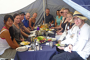
Before leaving, we posed for a few group and individual photos.
We followed the track downhill from the pass at Phuyupatamarka, dropping at a gentle slope into the thick moss covered cloud forest scrub. The forest took away much of the view of the very steep valley opening out below us.
Phuyupatamarka |
Phuyupatamarka |
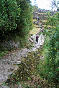
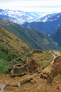
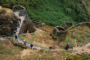
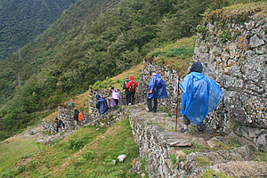
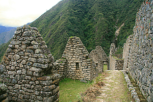
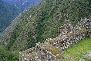
After ten minutes we briefly encountered a steep area where the track went down a stone stairway and a small opening appeared in the scrub directly ahead. Through the opening I could see the top of a group of terraces at another ruin just across the gully about two hundred metres ahead. The ruins straddled a steep spur with terraces on this side and what now appeared to be the ruins of a stone village on the other side.
We continued following the track around the dark gully in between the view and the village. The stonework here was amazing holding the track onto the side of the very steep slippery slope.
Phuyupatamarka |
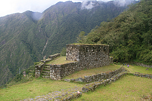
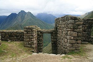
Upon crossing a small stream, the trail started heading uphill towards a stairway going up the stone walls of the terraces over the top of the village. A wooden sign said we were now in Phuyupatamarka, the same name as the pass we had just come down from.
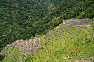
Phuyupatamarka was named as the Cloud Level Town. It would have accommodated a few hundred people in fifteen buildings, two plazas, bridges, stairways and observation buildings built perfectly into the rugged cliff-side contours of spurs and gullies. The lingering cloud formations below often gives the impression the town floats on the clouds, hence its name.
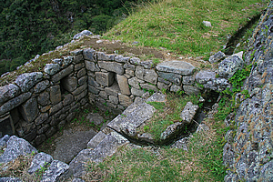
As we started climbing the short stairway, we passed a stone irrigation system with liturgical fountains – known as “baths” - to hold water for drinking and irrigation. There was still water trickling through the irrigation system as if it were built very recently even though it had been abandoned for nearly five hundred years.
Wilbur describes the construction techniques used here |
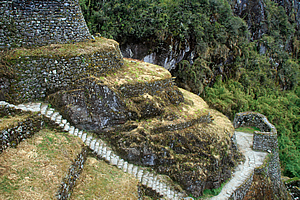
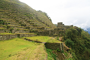
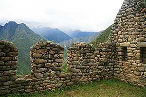
We reached the top of the village, from where we had a good view over the terraces down over the village on the far side which straddled across two small spurs and the miniature gully in between. The village was quite small, but it followed the steep contours of the mountain with numerous rounded structures jutting out. It was built in a rather complex split level arrangement with stone stairways linking between each level. There didn’t seem to be a main road through as the track we had entered came in over the top of the village and the track leaving left at the bottom. Travellers had to work out their own way down through the Dr Seuss style maze of stairways and house sites. The forest around Inipata had largely been cleared, but the ground was rather scrubby still and the stone walls had mosses, ferns, and grasses growing out of them.
Looking out from the village, there were many ranges of mountains, including some rather sharp pointed ones below us. There were numerous small clouds hugging the gullies of the surrounding mountains, but they were quickly clearing. It had obviously been raining through this area up till perhaps a couple of hours ago.
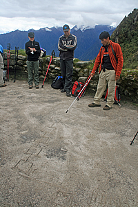
We descended into the village and walked to a temple courtyard where Wilbur drew diagrams in the dirt in a large flat area as we watched. He explained how the stone walls were constructed around the contours of the mountain and how the blocks joined together so well. Suddenly a hairy tarantula jumped onto Derek - that made us all jump. He quickly brushed it off his arm onto the dirt below. Wilbur quickly finished his presentation before we continued down the village to where the track continued at the bottom.
Machu Picchu Mountain |
From here Carlos pointed out a lopsided triangular mountain way below us which was now visible thanks to a small bank of cloud in front of us suddenly clearing. This was Cerro Machu Picchu – Machu Picchu Mountain. The ruins of Machu Picchu were on the other side of the mountain. At this village we were 3600 metres above sea level. The river was at 2000 metres above sea level and Machu Picchu was at two thousand four hundred metres above sea level. We had a twelve hundred metre drop to Machu Picchu. I was a bit over all the downhill we had done yesterday, with about six hundred metres drop from Dead Woman Pass, and another six hundred metres down from the second pass. The descent from here to Machu Picchu was just as long.
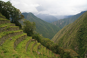
Looking around the mountain in the direction that we will be heading I could see the cloud forest will be thickening. There was one large clear patch in the forest over the front of a rounded spur which I noticed was covered in terraces. There didn’t seem to be the remains of any village there, but seeing the patchwork of terraces following the contours of the spur was quite amazing.
Trail at the bottom of the village |
Carlos told me this clearing was the agricultural terraces of Intipata.
We continued exploring the village heading downhill until reaching the trail at the bottom. From there we continued walking through the thickening forest, passing a stone bivouac under an overhanging rock that was just big enough to hold one person.
More cloud briefly enveloped us before we reached a break in the scrubby forest to see the Urubamba River rounding the bottom of Machu Picchu Mountain. The track was in pristine condition going through the very thick undergrowth in the very difficult terrain making our walk quite easy. The downhill wasn’t too bad here with the track now sloping gentle.
2nd Inca Tunnel |
We reached another break in the trees and across the other side of the river now unseen I could see a fascinating ridge. Forest went up the sides to almost the top to a very sharp erratic ridge that was picture perfect.
We reached another small ruin, a single rectangular stone building. Perhaps this was a resting place or a storage shed. It was at the top of a rather steep section of trail that twisted and turned its way down a steep stairway into a dark gully. Towards the bottom of the gully the track suddenly entered another cave, similar to the one we had walked through earlier this morning. We entered the dark elongated egg shaped entrance following the stairs down the slightly lopsided gallery to the other side some fifteen metres away.
Descending Trail |
Once through the cave, the track continued going steeply down the stairs (though not as steep as the section before the cave). The terrain here was very steep though, so the track had wooden handrails made from thin logs to stop us falling down the almost sheer drop below us.
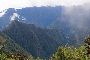
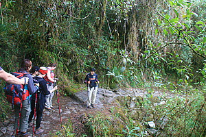
The trail levelled into a more gradual descent as we passed through the increasingly thickening cloud forest. The branches of almost all the gnarly moss covered trees were covered with bromeliads and tillansias. The moss growing on the trunks was very thick, very much reminding me of the trees in Fiordland in New Zealand. The thick forest was mostly quite dark, but when we did get a break in the trees, the view of the valley beyond was absolutely amazing. The clouds were beginning to lift now revealing the jagged peaks of the middle level granite mountains standing at around four thousand metres high above sea level.
Cloud Forest |
A small brown hairy caterpillar walked along the side of the path minding its own business as we passed. I had not seen many insects on the trail so far, but with going through cloud forest now I imagined we would be seeing a lot more.
From the next clearing we could see up the Urubamba River, seeing the precipitous forest covered valley in either direction fading away into the misty rain in the distance. The rain was quickly approaching. The trees in the cloud forest we were walking through was getting taller now creating quite an impenetrable forest. It was amazing that the Inca had managed to find a way down here, and that they had managed to find the remote Machu Picchu here at all. No wonder it had completely eluded the invasions of the Spanish inquisition.
Trail through the jungle |
We passed another small wall ruin by the side of the track, but this one was close to the encroaching forest. The ruins down here would be a lot harder to maintain here where the vegetation was so much more aggressive than along the first day of the trail in more arid conditions.
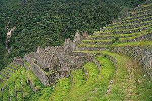
We were suddenly met with another small wooden signboard - We were at Intipata. We walked around the end of the spur we were straddling, and through a gap in the trees I saw the terraced field I had seen earlier.
Rain started to fall just as we left the thick cloud forest and entered the steep grassy terraces of Intipata. We briefly stopped to put on our rain capes before walking across one of the grassy terraces devoid of trees, looking like brightly coloured ghosts in the mists with our capes gently flapping in the slight cold breeze. The terraces followed the contours around ridge and gully.
Wilbur's rain dance |
Finally we stopped along the top where once more Wilbur explained the area, and once more it was raining. By now we had decided his presentations were a form of rain dance. This was especially apparent when he mentioned the name Intipata means “Sunny Place”. He explained the sunny microclimate here made this area well suited to the potatoes, sweet potato, maize and fruit had been grown here during Incan times.
Descending the stairs of Intipata |
There were no buildings here apart from a couple at the bottom which could have been used as storage barns and perhaps a small house for the farmer who tended the crops. The lack of buildings here meant Intipata served little residential or religious purpose, but it could have been used as a strategic location where communication could occur between Machu Picchu and settlements along the Urubamba River. A communications station had been set up on top of Cerro Machu Picchu and another one here. There would have been another one at Phuyupatamarka and others further along the trail back towards the upper Urubamba River.
View to tonight's campsite |
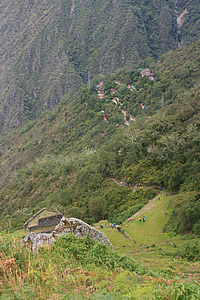
We walked across the terrace until reaching a stairway in the middle. We followed the steep stairway down to the ruins of the small buildings on the lowest terrace.
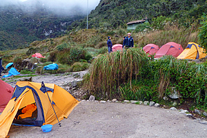
From the stairway we could now see our campsite perched on the hill in small clearings in the jungle in Winaywayna. It was still a fair way down, but Wilbur pointed out where our tents had already been pitched. The porters were very fast and organised. We had the bottom campsite with all our tents pitched in a row. A row of pylons crossed the camping area coming from a hydro electric power scheme unseen no doubt not too far away.
Beyond the camp was a hidden gully, and beyond that the steep mountainsides were covered in grass and scrub, so this must be near the end of the forest. There was a large slip in the distance reminding us of a severe storm that had struck at the beginning of the year closing the trail resulting in all the trekkers and porters having to be evacuated by helicopter. Fortunately we were blessed with better weather.
Intipata Farmhouse |
We continued single file following the rest of the way down the stairs. They were still in very good condition, but they were a little overgrown having grass and other weeds growing between the irregular joins.
Once we reached the bottom we passed the small triangular building that would have been a single house for the farmer or even a crop storage building. The building was atop a relatively wide terrace, but the slope dropped very steeply below into the forest.
Intipata |
The track heading towards the camping ground passed some small bell bottle flowers too brightly orange to appear natural, and numerous ferns. The standard of the track seemed to drop off a little with the stones being replaced by gravel as we seemed to go off the main stone route going moderately downhill towards the camp.
We arrived at a small greenish grey building with a sign saying massages were available at what I thought was a rather expensive price. We turned off just before the building and proceeded down the hill down a narrow track for a few terraces until we reached our terrace. Once more our porters stopped what they were doing and gave us the standing ovation. The terrace was about three metres wide and perhaps eighty long. It was curved into a slight gully. Most of if was covered in trees on both sides.
Stormy mountains |
The first two tents were the two big blue ones that we had used for meals and for cooking. The dining tent was at the front with the preparation one behind.
A very narrow track at the edge of the steep drop gave access past the two tents to all our other tents. All the double tents were next, and finally the two yellow tents for Marissa and I were at the end. I walked all the way to the end and to the furthest tent.
It was a bit of a precarious walk to my tent along the very narrow trail passing all the other tents, but it was well worth while. Most of the other tents had their view blocked off by thick vegetation. The last three tents, including mine, had a spectacular view across the river. The only potential issue was from here I could see it was a precipitous drop of about five hundred metres into the river. Thank goodness I’m no sleepwalker.
No details are missed! |
The view was of the forested mountains towering precipitously above the river into jagged peaks. Some were a little higher than our campsite, and the ones progressively further behind were steeper and steeper. The rain had stopped falling here, but it was obviously still raining on the other side of the river. The mountains nearby were green, whereas the more distant mountains faded into a misty bluish grey colour. Thick fog clung to the higher peaks that I could see, adding to the mysteriousness of the scene. To the left on this side of the river looking up I could see the fields of Intipata against the otherwise unbroken lines of forest. The only thing unnatural here were the pylons and their cables stretching steeply over the trees perhaps just thirty metres away.
Lunch |
I could see parts of the Urubamba River below, and could just hear the roaring of the cascading water. I could also just hear the sound of a train crawling down below taking tourists up to Machu Picchu still hiding behind the other side of Machu Picchu Mountain, now dominating the left hand landscape downstream.
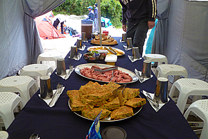
I unzipped the tent and unpacked as the sky suddenly cleared around us letting the sun shine through into the valley. It was still raining up in the mountaintops though, as mountains are good at attracting cloud. Then we all edged our way back to the dining tent and had lunch.
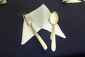
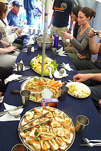
As usual the dining tent was set up with the blue Intrepid table cloth and a folded serviette with a metal fork and spoon, all professionally laid out in a manner you’d only expect in a good restaurant. Once more we were transferred from the world of tired legs into gourmet dining. We were all in quite high spirits, perhaps because there was no more hiking to do today – apart from a small side trip this afternoon.
Lunch |
We started with a yellow vegetable and rice soup. This was followed by platters of food. Ricardo the chef amazed me. This was our third day of hiking, and still he was delivering fresh food from the backpacks the porters had been carrying. There were interesting tiny half buns with avocado and pumpkin on them. The next tray had fried rice with several vegetables intricately carved into complex floral designs. The next plate had a lettuce and egg salad, also very intricately presented. The final platter had olives, cheeses, and vegetable nibbles. It made for a very nice meal by any standards, and absolutely exceptional for a meal that had been carried almost a marathon distance over some of the world’s most rugged mountains.
Once lunch was finished, we relaxed. The porters were having a lot of fun now and one got pushed over the edge and slipped his way into the vegetation below. They all had a good laugh about it, not that I was sure what the joke was about. Obviously these guys are very tough.
The sunshine was short lived though. The clouds came back over and we had a couple of brief rain showers whilst we relaxed.
Once rested, we went up to the building in the middle of the afternoon. It was a rather crude hall with a restaurant where you could buy food and alcohol and even have a (rather expensive) massage.
Fern beside the trail |
Wilbur had earlier told me there was a place here where I could get camera batteries charged. I had been very careful up till now with conserving battery power, but was getting concerned now that they were starting to run low and that I would have to be very conservative when going through Machu Picchu though, and I was already down to the last of my three batteries.
I found the stall in the main hall where a middle aged lady took my battery and charger, and hooked it up to a power board. Luckily I had my Australia to South America pin adapter with me. She charged for a rather expensive five dollars for the privilege. Then again there was nowhere else around here that had an electricity supply, so why not take advantage of your monopoly? Anyway having an empty battery charged will set me up really well for photography tomorrow when we arrive at Machu Picchu.
Looking towards Machu Picchu |
We walked around a balcony along the edge of the building seeing people there drinking beer from the small bar. Unbelievable I thought. There were the two bogans who I had recalled seeing at our lunch stop yesterday having a drunken swim in the stream.
The rest of the group arrived and Wilbur led us out the other side of the building where we walked along a level stone path. On either side were numerous variegated leaf birds nest ferns in the undergrowth. We followed the dark forest for about five minutes before it suddenly cleared revealing the huge ruin of Winaywayna
I had not seen a ruin this big before – except perhaps Patallacta from up the hill on the first day, but that had been quite some distance away. With this one we were walking right into the midst of it.
There were numerous terraces going in an arc across the gully to the next spur up the forty degree slope. Each terrace was almost perfectly flat faithfully following the contours of the hill. At the far end on the spur was the remains of a village divided into two sections. A small group of buildings stood at the top of the terraces, and a much larger group of stone buildings occupied the bottom, with a flight of stone stairs connecting them up the many terraces. The upper buildings seemed to have flat roofing whilst the lower buildings had steep gables. Beyond the village was a forested gully. The slope continued upwards a good five to seven hundred metres up to the ridge we had climbed over in the last pass this morning. Below us we could hear the faint roar of the river and the occasional train full of tourists meandering its way up to Machu Picchu.
Carlos talking about the history of Winay Wayna |
We walked across the terrace towards the upper village. The terrace we walked on seemed to be a main route, wider than the other terraces below. There was a two to three metre high wall to the right holding up the next terrace above us.
Once almost reaching the stairway between the two parts of the village, we all sat down and Carlos explained the history of the place. We were happy that Wilbur wasn’t doing the presentation. By now we had established that whenever Wilbur does a speech, rain or hail falls from the sky. Perhaps he was an Incan rain dancer. Carlos apparently wasn’t as jinxed as it had by now stopped raining.
Terraces of Winay Wayna |
Carlos did a fantastic job in his presentation especially as his English was still very limited. He explained the village’s name Winaywayna means “Forever Young”. This was actually a variety of pink orchid that grew here. He described how the terraces each had their own microclimate and how the farmers would plant certain species in different locations based on the climate. We all gave him a round of applause as he had done a fantastic job despite his poor English.
Carlos then let us go to have a look at the ruins taking as long as we needed as the campsite was only ten minutes away. I went uphill to look at the round temple before heading down to look at the residential village.
Entrance of the temple |
I walked around the terrace before heading up though and saw a porter from another group fast asleep on the grass, tired from three days hiking carrying twenty five kilogrammes some forty kilometres at high altitude. He certainly needed the rest more than I did, so I left him there and headed up the short set of stone stairs to the village temple.
The entrance to the temple was a staircase going through an enclosed stone doorway. A large slab of rock perfectly shaped into a lintel closed off the top of the doorway. The stairs were perfectly locked in place as if laid just yesterday. It was hard to believe this village had been built five hundred years ago.
The fountain of youth |
Once up in the temple, I looked around. Like most Incan temples, this one was round. It had numerous windows in the rock wall. The tops of the windows were narrower than their bottoms. Behind the temple were a few square buildings with small square windows, and behind that were about ten more layers of terracing.
Looking down towards the residential village, I could see that it was quite narrow extending out onto what had been a flat terrace jutting out over the gully below. This made the village area relatively long and narrow.
Residential Area |
Amy, Amanda and I took pictures of each other before we plodded down the steep stairway towards the village area. Beside the staircase was a number of small buildings with a trickle of water running down between each building. Perhaps this was the fountain of youth – after all they call this place “Forever Young”.
“Forever Young” actually refers to a variety of orchid that grows around here. The rainy season hadn’t started yet, so it was far too early to see it blooming yet. It would have been great to have seen the orchids here, but that would have most likely been at the expense of the amazing views I have had of the mountains throughout most of the trek. At these altitudes it would have been so easy to have been completely enveloped in cloud.
Residential Area |
There was an exit going across the stairway at each terrace level. I realised this was the irrigation system they had built to water their crops. There would have been more water coming from the gully running down here, and someone would have controlled some gates that were no longer here to ensure each layer of terracing was getting enough water from the fountain of youth. Perhaps I should have drunken some.
The houses were all very close knitted together in a layout similar to a modern townhouse complex. From there you could see all the terraced fields. It would have been pretty amazing here when the village was in full swing with vegetables growing on all the terraces, and with the amazing views of the valley and mountain from their homes. The village area was by no means flat, so there was a maze of stairways between the different buildings that would be easy to get lost in despite the very small size of the village. It would have been rather crowded living in this village, though I have no idea what the population of this village would have been.
Terraces |
Looking up from the village, I could see the terraces immediately above me rotated in a dome shape around the contours of the ridge all the way up to the temple.
The fields of Winaywayna would have produced enough crops to support a reasonable population of perhaps thirty to a hundred people, but I imagined a lot of the produce from here and other farm areas carved into the mountainside would have gone to the much larger Machu Picchu city which apparently didn’t have enough fields to support the population it would have accommodated.
Residential Area |
Most of the buildings here had small windows. Assuming every building was covered with a thick layer of thatching, the houses would have been rather dark and claustrophobic. The houses next to the edge of the main valley had larger windows in their walls to give their residents spectacular views across the valley. Perhaps these had wooden window shutters to prevent storm weather from getting in. As in the other ruins I had been to, the rocks were perfectly jointed together, very skilfully crafted.
From the bottom of the village a very steep stairway continued straight down the mountain to the lowest terraces to the forest below. I didn’t go down there.
Some of the walls were off-plumb, now leaning over from hundreds of years of sitting on uneven surfacing millimetre by millimetre sliding down the steep mountainside under the strain of gravity. Despite that all the walls seemed to be standing solid. There were some rocks that were sticking out, or hollows that indicated these were used to hold up timber logs supporting the thatching perhaps.
The cloud was beginning to lower onto the top of the mountain directly opposite the river. That was a shame. It was such an attractive mountain. The mountains behind it were all covered over as well, so the view wasn’t as dramatic as it had been earlier today. It’s amazing what a difference it makes when jagged peaks are concealed.
Residential Area |
The tops of the stone walls were filled with sand and soil, and appeared very flat. I was amazed there was almost no vegetation growing there apart from a flat mat of some sort of ground cover, so this area must be very frequently maintained. To my surprise the grass here was pretty short. It wasn’t a mown short, but had the slightly erratic look of having been grazed, indicating there must be some alpaca or llama that graze here. I hadn’t seen any though.
From the end of the village I could see a small cascade going over a huge boulder in the bottom of the gully. The rest of the gully was too heavily forested to see the water that I could hear bubbling downhill. This must be the source of the fountain of youth.
Instead of heading up the stairs, I walked out along one of the flat grassy terraces. It made for very easy walking in the otherwise very steep terrain. The view back to the village was fascinating, giving the impression of a religious nave style, but not as good as the view looking down from the upper terrace we had arrived along. Michael and Julia had taken the stairs down from the village that I had not taken. Everyone else had by now left returning to the camp, no doubt still tired from the three days hiking we had just done.
Winay Wayna |
There was quite a stark difference between the lush yellow green grass in the foreground, the greyness of the buildings and terrace walls in the mid distance, and the bLuish grey green of the forest in the background perfectly framing the village.
I returned to the stairway and walked up to the main terrace, then back along the track through the forest to the building. Michael and Julia were about five minutes behind me.
Five minutes later I returned to the restaurant building where I saw the rest of the group sitting around drinking beer with the two bogans we had seen earlier. They were from Mackay, about a thousand kilometres north of Brisbane. I had no idea what they were saying as they were speaking the slang and drunken nasal twang of the working class rural Australian, but they seemed to be recounting some stories of wild boar hunting somewhere inland of Mackay (a city about a thousand kilometres north of Brisbane) where they lived.
I entered the dining hall to pick up my battery charger. There was a different person at the office now and it took quite a while for me to communicate that I had a battery that was being charged. She said there were no batteries getting charged here. Gosh. I had just taken a lot more than my original quota of photos at Winaywayna on the understanding that there was going to be a fully charged battery to take photos galore at Machu Picchu tomorrow. If we couldn’t locate it, I was going to be screwed with being rationed to about fifty photos over the entire day. That was far too tight for exploring one of the world’s most amazing archaeological sites.
Finally after much rummaging around she did manage to find my battery about a metre away from where she was sitting still being charged under the paperwork. Fortunately the light was green now indicating it was fully charged. What a relief.
I was pretty tired by now so I decided to return to the campsite and rest at my tent admiring the spectacular view from the entrance until dinner time.
Thanks to the train timetable, the only cheap train that the porters could afford to travel on departed down the bottom of the valley at five thirty each morning after dropping off the first load of tourists. Obviously no tourist would want to go back to Cuzco in the return journey so there were plenty of cheap seats available for porters. Unfortunately this train was due to pick them up a good half an hour before sunrise. They will need to prepare us breakfast, pack up the entire campsite, then walk briskly down the path I had seen from the ruins yesterday towards the station on the other side of the river in time to catch their train. That meant we had to get up at four o’clock tomorrow morning for a quick breakfast before leaving the camp area quickly to allow them to pack up. That also meant that every other group’s porters had to leave very early, so there was going to be a mad rush down the mountain for them whilst every tourist at this campsite would have to sit up here and wait for the gate to the track leading to Machu Picchu to open.
Caption |
That of course meant there will be no time for us to say goodbye to our amazing chef and porters tomorrow morning, so Wilbur scheduled our porters’ farewell tonight.
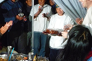
We had dinner, and this was no ordinary dinner. Derek was celebrating his twenty ninth birthday today, so we decided to make a bit of a celebration out of it.
We started with a chicken and vegetable soup served in the small stainless steel soup bowls. This was followed by a main of pizza that the porters had cooked. Then there was a huge platter of rice, another one of vegetables, one containing a large lasagne, a beef casserole, and the last one containing boiled potatoes.
Finally our amazing porters brought in a large chocolate birthday cake for Derek. This was a big surprise to all of us. They had carried it all the way here! Now that was really impressive. Derek came to the entrance and took the cake, with a single candle lit on it and white writing “Feliz Compleano Derek.” He was wearing the trademark floppy hat that he had been wearing throughout the trip. The cake had Turkish delight jelly blocks around the outside and hundreds and thousands lightly sprinkled on top. How the porters had managed to secretly lug this amazing cake over the mountains for three days and still keep it in perfect condition and keep it fresh as well amazed me.
We ate about half of the cake before deciding to give the rest to the porters to thank them for lugging it so many miles here in the far. They had been living in relative hardship cooking all the best food for us and only eating what was left, pitching our amazing tents whilst they slept huddled up in the dining tent at night, carrying all our gear for three days. They more than deserved it.
Caption |
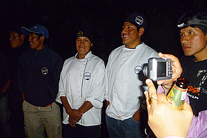
Once dinner was finished, we went outside the tents to the large space between the large blue tents and the smaller sleeping tents. There we gathered in a circle and under the light of a gas lamp we bade our porters farewell.
We had collected a tip for them earlier in the day. We had paid them pretty generously, but by the time it was divvied up with Wilbur getting the biggest tip, Carlos getting about two thirds of Wilbur’s, Ricardo the chef getting less again, and all the porters getting what was left. I don’t think they got much each. No doubt they weren’t paid much to work here either.
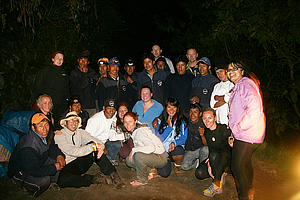
Farewelling the porters |
Yet they were very gracious when Marissa presented it to them as we all gave brief speeches on how much we had enjoyed our journey. Of course all speeches had to be translated into Spanish for some of our porters, then again into Quechuan for some of the other porters. Once the speeches were over, we had a bit of a dance to some percussive music put on by some of the porters.
The dancing was short lived though as we all needed to turn in for an early night for the big day tomorrow. We stood in a circle as the porters went around us and all warmly shook our hands to say good bye.
Finally we got a group shot. Sadly the person who took our photo with my camera moved it causing it to blur. One has to hold a camera very still in the darkness of a moonless night.
With all formalities complete, we all hurried off to bed to get as much sleep as possible in anticipation of the big day tomorrow.
| Home | Photography | Diary | Travels | Treks | |
© 2001-2020 walkaboutjeff.com - Copyright - Disclaimer - Who is Walkabout Jeff? |