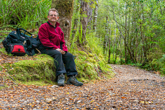
Introduction to today's journey
There is an uphill for every downhill, and a downhill for every uphill.
- Turkish Proverb
HIGHWAYS are notoriously expensive to build in New Zealand's rugged terrain. One of these highways was the Lewis Pass Road crossing the Southern Alps between Nelson and Christchurch. It was surveyed and built during the great depression as was some of New Zealand's other greatest highway construction achievements. After surveying the Lewis Pass Road, Charles Lewis (who Lewis Pass was named after) was commissioned to survey the proposed highway to link Golden Bay with the West Coast over the Heaphy Track. The problem with this road lay in the remoteness and tiny size of the settlements at either end. Both Golden Bay and Karamea are tiny settlements cut off from the rest of the South Island by mountainous passes. Few people would live in these communities even if the prohibitively expensive Heaphy Road were to be built. Although the settlement at the mouth of the Heaphy River was proposed in 1907, it was not until 1929 were the plants of the Heaphy Road legalised by the Lands and Survey Department. Over the years the plan never eventuated. The track fell into a bad state of disrepair until it was rebuilt in the 1960s upon formation of the North West Nelson State Forest Park. The road idea was considered again during the 1990s but ongoing maintenance of it would end up costing about $30 per vehicle predicted to use it. Once more the plan was abandoned, and the likelihood of a highway being constructed here at any time in future is looking very remote.
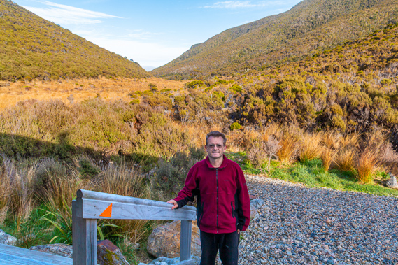
Today's trek starts at Perry Saddle, gradually ascending to the main track's highest point at Flanagan's Corner, before moderately descending past Aorere Shelter dropping over 700 metres to the end of the track at Brown Hut near the Aorere River.
Today's Journey
Distance trekked today: 17.3 kilometres.
Total distance trekked to date: 84.2 kilometres.
 |
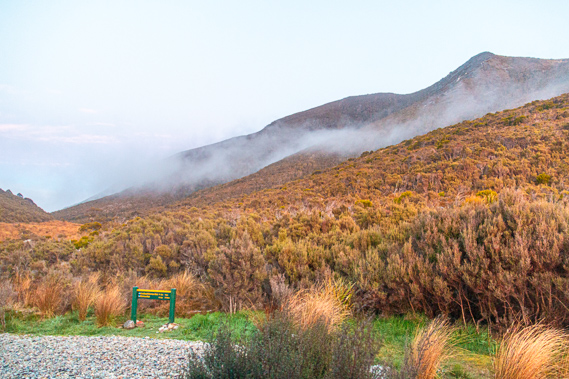
05:36 - Looking out the hut window, Perry Saddle is enveloped in thick cloud blowing through the narrow gap between the mountains from Gouland Downs. The sky is just beginning to get light but for a while it looks like there isn’t going to be any sunrise. Perhaps the Heaphy is only going to give me two sunrises out of the five mornings I have been here. After all some of the guys in the hut had yesterday told me rain is forecast from today onwards. I head outside to the large balcony overlooking Gorge Creek and the Aorere Valley. The hut shelters me from the worst of the wind, but it is still very cold. It is a different kind of coldness than I had experienced over the past two mornings. The cold of the previous two mornings was sharp and biting in the still conditions of sub-zero temperatures. This morning’s cold is a wind chill sucking all the energy out of me.
|
 |
05:46 - The fog is now quickly clearing. Patches of cloud still cling to the gullies. I walk around the hut to get a view of Mount Perry. Past the edge of the hut the wind blows strong and very cold. The cloud suddenly enveloped me again completely cutting off the view. The cloud is very short lived though. The sky clears to the east where bright light illuminates the sky above a thin layer of cloud hovering at perhaps three thousand metres. It is moving quickly to the south east, confirming another north westerly weather system is on its way from the Tasman Sea - the same direction from where all the rain on the coastal part of the trek came from.
|
 |
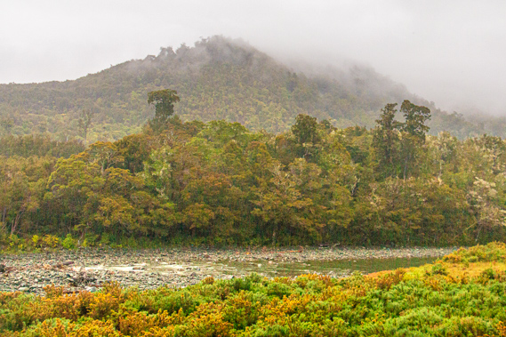
05:51 - The cloud is thin and patchy, but I know it will soon thicken up to produce the same rain bearing cloud I had encountered on my first day on the track back when heading up the coast. At least this time I’ll be in the relative shelter of the Aorere Valley. Another bank of cloud brushes past Mount Peel, and over the side of Mount Brown. Mount Peel is once more completely enveloped in cloud as is the valley behind it. I guess the cloud has banked against the Gouland Range and perhaps the Gouland Downs is covered in thick misty cloud. I see the layer of cloud hovering below the bottom of the valley. It will be a while before cloud covers the coast, but I know it will definitely happen sometime this morning. The fluffy cloud over Mount Brown quickly clears for just enough time to see the thin crescent of the moon and Venus about three degrees apart to the west. They both hover low over Brown Mountain in the gaps between the purplish red haze. The spectacle is short lived before the cloud covers Venus and the moon again.
|
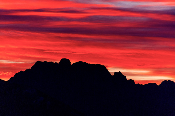 |
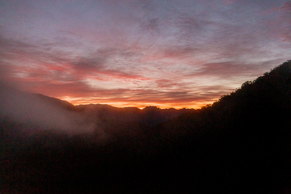
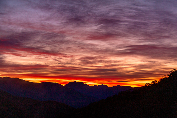
05:52 - The cinnabar streaks of red drift across the undersides of the silky clouds. They really stand out against the dark purple shaded sides. It is not long before all the clouds passing over the jagged mountains of Devil's Teeth are brilliant red. The sunrise that almost didn’t happen is more brilliant than the yesterday morning’s sunrise. |
 |
05:53 - The brilliant red gradually peels back into a soft dirty orange colour as the sun continues rising towards the horizon. The colours quickly drop off as the sun rises to above the bottoms of the clouds. Rather chilled from the sunrise I return into the hut and crawl back into my sleeping bag. I need some more sleep, but the hut is otherwise silent. Everyone else has missed a spectacular sunrise. I find it is a common thing with most travellers only rising when the warm breath of daylight has heated the air to an acceptable temperature. Photographers looking for the best shots have to be crepuscular by nature, rising just before the first hint of dawn, and being active till the end of the morning golden hour, then coming back out when the afternoon golden hour begins when they will click away again until the last lick of light has faded beneath the western horizon. |
 |
06:16 - That being said I don’t have the luxury of taking all my photos during the two golden hours. My second day on the track with the overcast conditions was completely absent of any golden hour morning or evening. There were long hikes to cover each day, so much of my photography on this trip (and in previous trips) has been during the middle of the day when the landscape was a complete wash of blues and greens, completely stripped of the vibrant yellows, oranges and reds of the golden hour. It is not long after sunrise when everyone else begins to rise. They are all heading off to James Mackay so it will be a long day for them. I am not going as far – just going “Down to Brown”. Everyone else staying here climbed the long hill yesterday, but for me it is going to be downhill all day.
|
 |
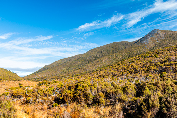
07:17 - Eventually I do get up. The young lady who had stayed in the same bunkroom as me has left, heading out on her solitary venture across the downs. Most of the others who stayed in the other bunkrooms overnight are still here. The middle aged group from Nelson are ready to leave, and ask me to get a picture of them on their little camera. I get them to return the favour. To my surprise the cloud has almost completely cleared from the mountains and from the gap into Gouland Downs, and the wind has largely calmed down. There is still some high cloud in the sky similar to that of yesterday afternoon, but otherwise the weather is looking clear. Perhaps the forecast rain isn’t going to come after all. Then again these are the mountains. Mountain weather in New Zealand can change in an instant.
|
 |
08:01 - I have a closer look after our photography session and there is still a thick layer of dark cloud over the downs. The group leave and starts trudging their way along the trail on their descent into the downs. Seeing the dark cloud in the downs indicates to me they aren’t going to get the same sweeping views that I had encountered over the past two days. Everyone else leaves the hut on the start of their journey across the downs today leaving me alone in the hut. There is just the young couple camping outside. Their tent is still up and they are not showing any sign of life. I’ve found from camping in the past it is more difficult to get motivated to get up when you are staying in the tight confines of a tent. In a hut at least you have standing room.
|
 |
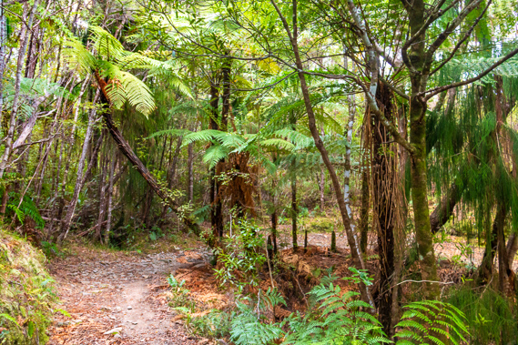
08:07 - Most of the cloud has cleared by the time I leave the hut. This time yesterday I was close to Boot Pole Corner nearly half way to the hut, but decide to take it easier today. I would have left later but want to get to Brown before the rain starts falling. The track quickly enters the forest on a gradual ascent. Most maps of the track showing the elevation shows the Perry Saddle as the highest point of the track, with a gradual downhill from the saddle down to the Brown River. There is one map which shows the track continuing to ascend once past the saddle. This is the correct map as the saddle isn't the highest point of the track. |
 |
08:12 - The surface of the track is quite rocky, perhaps due to frequent snowfalls here during winter. After a few minutes following the track I reach a small clearing where I can see back to Perry Saddle, and the deep cut of Gorge Creek turning just below the saddle having come out of a deep cut gully on the other side of the valley. From here I see Gorge Creek would have once flowed through the saddle through the valley towards Gouland downs. At some point though, erosion from the much steeper gully leading into the Aorere undercut Gorge Creek diverting it the other way with the saddle being left exposed to preserve the old valley.
|
 |
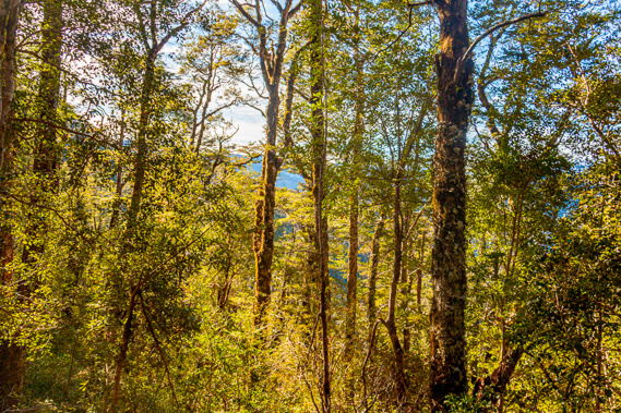
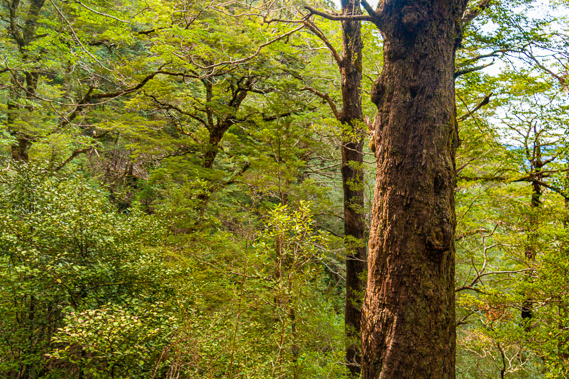
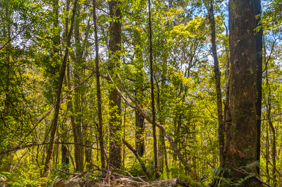
08:13 - There are no more clear views through the thick beech forest. The mountain beech and scattered mountain spiderwood stands tall and lanky in the dark shadow of the mountain. Most of the small gullies have dried up following several days of clear weather. The forest here is close to what it would have been back in Gondwana times, with similar varieties still growing in Australia and South America. I have explored forests of Antarctic beech (Nothofagus mooreii), not to confuse with the similar Nothofagus Antarctica found in South America. These are both very closely related to the New Zealand silver beech, and all ancient remnants of the beech forests that once covered much of Gondwanaland as evident in fossils found throughout New Zealand, Australia, South America and Antarctica. These are trees the dinosaurs had lived amongst, munching on the ferny undergrowth.
|
 |
08:16 - I have not always appreciated these amazing geological processes. Throughout this hike I have been amazed by all the incredible landforms, flora and fauna of this unique corner of New Zealand that has evolved over countless millions of years with Zealandia breaking off from Gondwanaland and becoming almost completely submerged before re-emerging as these islands torn apart by the ring of fire. Previous times I had completed the track around twenty years ago I had subscribed to a completely different theory where somehow everything was instantly created around six thousand years ago and somehow these complete ecosystems worked themselves out (though the dinosaurs didn’t last long). Believing that the universe was so young gave me a blinding arrogance and ignorance to the uniqueness of this place.
|
 |
08:31 - In the twenty years since I was last here, I have grown to appreciate that this is all hundreds of millions, not thousands of years old. If there is an almighty creator, then surely they would not just build everything to perfection in an instant, but rather they would create a set of rules and put them into play so the universe would naturally create and mature itself over time. This would give nature the breathing space to balance itself and respond to changing conditions, as intended. An instantly created universe would be too delicate to survive any length of time. |
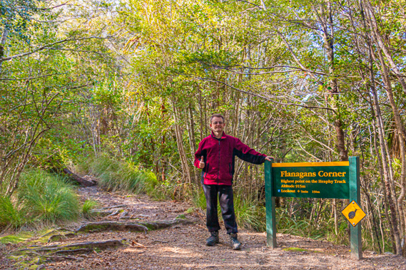 |
08:47 - I reach Flanagan’s Corner, the highest point of the main track at 915 metres above sea level. From here the track turns northward and begins the long descent into Golden Bay. |
 |
08:48 - Flanagan’s Corner is a tiny saddle from which a rough side track heads uphill into the forest. I follow the track winding my way up between the roots of the trees for about a hundred metres before reaching a picnic table marking a viewpoint. |
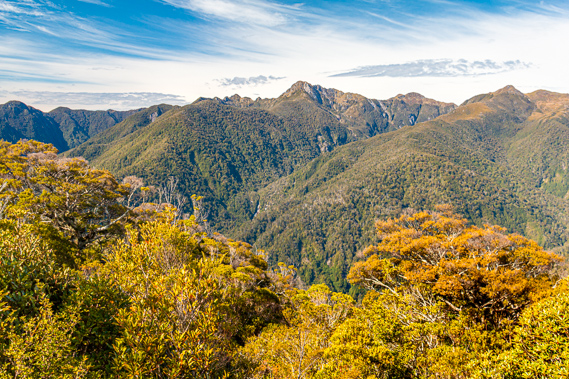 |
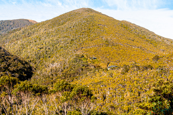
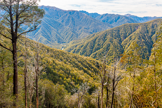
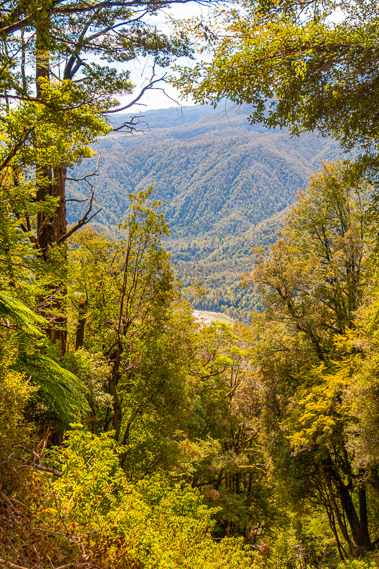
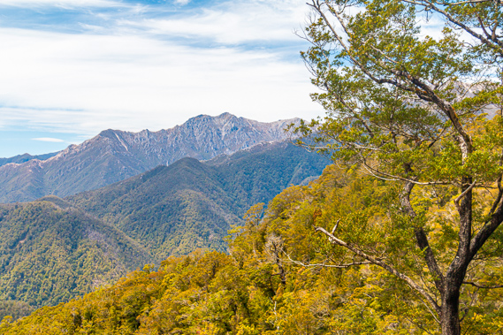
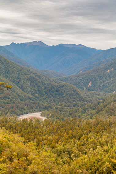
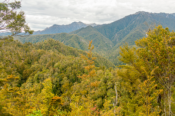
08:57 - The view is largely blocked by scrubby trees having overgrown the area. I can still see through the gaps though to where the mountains on the other side towered above the deeply cut Aorere Valley. The bottom of the valley is hidden away far below me under the folds of forested mountainside. Deeply cut gullies drop from the mountaintops on the other side of Gorge Creek, one of which has a significant waterfall plunging through the forest. Although the view is quite spectacular, it is nothing compared to the sweeping vistas I saw yesterday from the top of Mount Perry. The only exception is the 1519 metre high Mount Olympus standing bold and quite tall from here. Reading the intentions book at Perry Saddle yesterday, there had been quite a few comments about the lack of a view from here. This is because the scrub is overgrown blocking much of the view. A thin layer of high cloud has by now covered part of the sky dimming the view a bit. I return to Flanagan’s Corner. From here it is all going to be downhill dropping 775 metres down to 140 metres above sea level at Brown Hut
|
 |
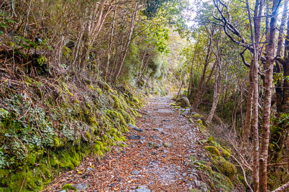
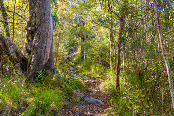
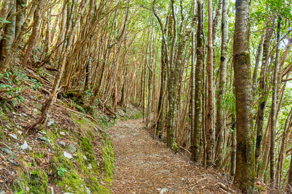
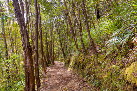
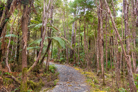
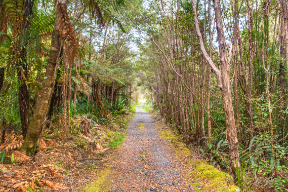
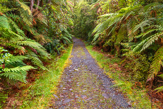
09:16 - The standard of the Heaphy Track is a lot higher than most of New Zealand’s other walkways. It is even of a higher standard than the other great walks, with all rises and falls of an easily moderate grade. The dark trunks of the mountain beech trees and the smaller mahoe mottles the sunlight onto the almost smooth track comfortable enough for a four wheel drive vehicle to navigate with reasonable ease. A quad bike would easily navigate the track.
|
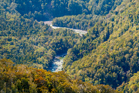 |
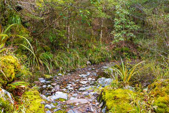
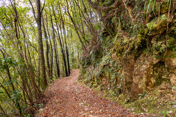
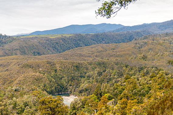
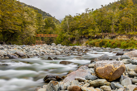
09:17 - This is a far cry from the original track blazed through by the Maori in times past, and is in much better condition than most other tracks in New Zealand. Sure it was upgraded when designated a great walk, but the track just follows the original road through the mountains cut in the early 1890s. The road that was never built crosses a couple of crystal clear streams before reaching the first of several clearings over what had once been some landslides. Far below I could see the Aorere River snaking its way between the mountains a good six or seven hundred metres below me, reminding me of how far I had to descend. With each clearing I would hopefully see the river getting closer. The river was completely inaudible from this altitude, but I could just see it was roaring down the forested valley cascading past large boulders gradually being swept out towards the sea.
|
 |
09:26 - The valley is vee shaped, unlike the many U shaped valleys common throughout the South Island. This valley is free from past glacial activity, or if there ever has been glaciers through here, the U valleys would have long eroded into the V shaped valleys with their triangular mountains.
|
 |
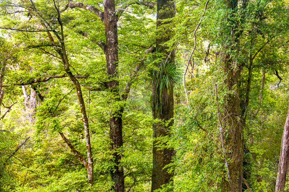
09:29 - In the forest above me I can just see a family of weka foraging amongst the bush. These completely fend for themselves unlike the fat wekas at each hut. In each gully the trees become larger, with huge centuries old red and silver beech trees mingling amongst the otherwise monotonous stands of mountain beech. The gullies are followed by spurs of spindly mountain beech leaning out slightly towards the valley following the gradient of the thick canopy overhead.
|
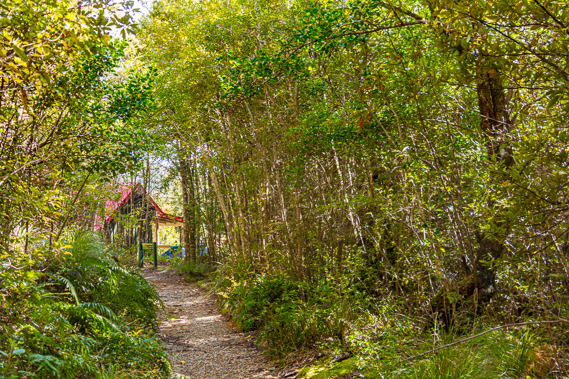 |
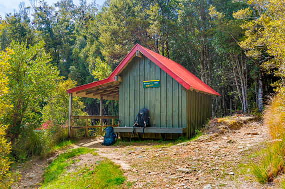
09:57 - I pass one old landslide where several trees have fallen and had been cut into large blocks for firewood. Around the next bend the forest reduces to thick scrub and upon a flat spur ahead is the small red roof of the Aorere Shelter. I reach the shelter just as another group arrives having hiked up from Brown in the early morning. They have taken a far less leisurely pace than I had done (I have been going very slowly with all the photography I've been doing), but tired from the climb, they need a break. They take a picnic table in a flat area below and to the left of the shelter. I take my pack off on a bench alongside the shelter. Like all other huts and shelters along the track, this has recently been repainted to look brand new even though I have seen it in the previous times I have walked through here. Above where I am sitting is the sign indicating “Aorere Shelter” and under it “800m”. I have already dropped 115 metres from Flanagan’s Corner, so there was another 660 metres to drop before reaching Brown Hut.
|
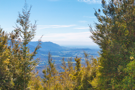 |
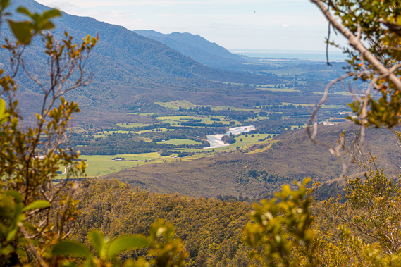
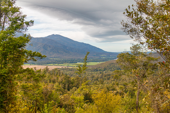
09:59 - The track runs behind the shelter. The front of the shelter opens out into a verandah overlooking some small trees. The last few times I have been here there has been a clear view out over Golden Bay. The trees have completely blocked the view, but there is a gap several metres along the track to where I see the valley far below me, all the way out to the estuary behind Collingwood. Beyond the estuary are the pristine blue waters of Golden Bay and the narrow sweeping sandbar of Farewell Spit. Beyond the spit is the rugged Tasman Sea heading towards Mount Taranaki which is completely obscured by the thin layers of cloud drifting in from the ocean. It is still sunny here, but I imagine the cloud will be building up over the next few hours in preparation for the forecast rain.
|
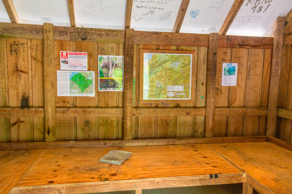 |
10:00 - There are several trees growing below the view. Within five years these trees will completely block out the view, leaving this little clearing completely enclosed. The timbers around the wall of the shelter are stained and old obviously being the original shelter erected here long ago. I pass under the verandah to the open entrance of the shelter. It is exactly the same design as the Kohaihai and Katipo Shelters with its open entrance and sleeping benches around the walls. On the back wall are a map and a few more signs, including yet another 1080 poison sign. The ceiling panels are painted white, but it is covered in the scrawls on it of people who had signed their names, no doubt thinking the intentions book doesn’t have enough space in it. The wooden panels inside the hut also have a lot of writing on them. Some of the initials are dated back to as far as 1993, before the first time I passed through here. I guess most of the inscriptions were made by people who had hiked up here but realised they were running too late to be reaching the Perry Saddle Hut, so sheltered here the night. There is a small campsite below where the family are now eating lunch, but the shelter itself is for emergencies only – essentially for people who underestimate how long it takes to reach the hut and how quickly it gets dark.
|
 |
10:15 - A young lady arrives having hiked up from Brown. It is getting quite crowded now, so I bid them farewell and start the long descent along the road that never was, down towards Brown Hut. |
 |
10:22 - From Aorere Shelter the track continues its long steady descent through the increasingly thickening forest of mahoe and beech. It is not long before I enter a small gully with a stream flowing through the rubble of what has been a fairly recent landslide but fortunately the track is clear. The occasional view through gaps in the tall forest give me a good idea of how much further down the river is. It doesn’t seem to be getting any closer though, I think partly because I am heading downstream. The river cascading between the mountains is dropping at a definite gradient, though less than that of the track.
|
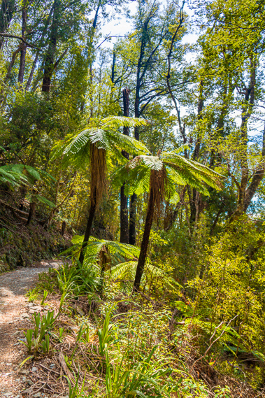 |
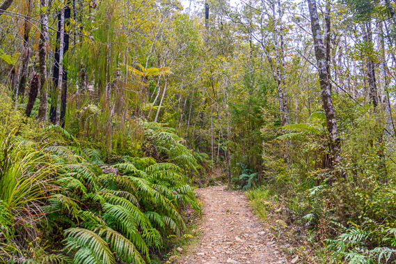
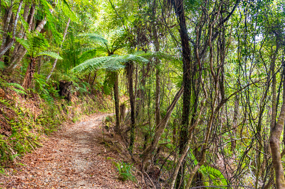
10:23 - About half an hour after leaving the shelter I reach the first stand of black tree ferns. They grow to around 700 metres above sea level in the northern South Island. The stand is at the entrance to a dark gully where a small waterfall is plunging from. Yesterday I had looked down on the flat top of Mount Brown from Mount Perry. Now I am far enough down Mount Brown to be crossing permanent streams.
|
 |
11:24 - The track continues on its even grade down the mountain, having been very well surveyed. The sky overhead is still blue though there is some cloud cover to the west but the cloud to the north is still a bit scant. I reach what had once been a large landslide where the trees have been stripped away and scrub is beginning to regenerate where the trees once grew. |
 |
11:32 - The mountain ridges are now tapering off down into Golden Bay. These northernmost mountains of the south island are diminishing. As I head further around Mount Brown, I again see the Wakamarama Range running parallel to the quietly meandering Aorere River along its lower reaches. On either side of the river are patches of bright green farmland alternating with patches of scrub. |
 |
11:52 - The occasional stand of black beech now starts. This is the first time I have seen black beech on this trip. The west coast is too wet for these trees. They are very distinctive in having a thick layer of charcoal black fungus growing on their trunks, giving the tree its name. The fungus is fairly loose and the ground surrounding the tree is covered in black debris fallen off the tree. Why this fungus only grows on this tree and not other beech trees I do not know. The black beech trees have a very distinctive sweet smell – it is like honey only stronger and far sweeter. This is due to a small bug that lives in the fungus. The bug produces a short stem that has a single drop of the honey secretion. The drop of honeydew attracts small insects which become trapped in the dilute honey and drown to become food for the honeydew bug.
|
 |
11:59 - The track continues descending the mountain until at one point in the thick forest it suddenly turns in a hairpin bend doubling back towards the river heading upstream. At this stage I have gone a fair way around Mount Brown, and can just hear the Aorere (or perhaps Brown) River cascading a long way below.
|
 |
12:10 - From the bend the track continues through the mixed beech forest. Looking through the gaps the river is now blocked by a cluster of what seems to be randomly placed hills. Perhaps these hills were the terminus of a glacier that had once flowed through here, but since the ice ages the valley has deepened into a V shape. I had seen these hills from higher up. They seem to mark a definite transition between the cascading river plunging down the very deep valley between the forested mountains, and the meandering river through the wide valley below them. |
 |
12:30 - I am level with the tops of these hills now and the vegetation is changing again. The mixed beech forest suddenly changes to rimu forest similar to what I had encountered above Lewis Hut a few days ago. The steep terrain suddenly flattens upon entering these hills, perhaps making the ground swampy enough for the rimu to grow. I also see the similar miro tree growing here. The rimu forest suddenly gives way to small regenerating trees. There is no middle canopy of tree ferns, but the ground either side of the track is covered in large ground ferns, suited perhaps to a drier climate than that on the other side of the mountains. It would appear these hills were once cleared for farmland a long time ago, but has since revegetated.
|
 |
12:33 - The track continues descending to the top of a small saddle between two of the hills. I rest at the top of the 465 metre high saddle before continuing to head downhill. By now the sky has completely clouded over with a thick featureless layer of high cloud. This indicates the rain is finally approaching, and that it will most likely be raining on the west coast already. The track winds around the hill to eventually go in the same direction as it had been earlier before the hairpin bend once more heading downstream. Large tree ferns with supplejack vines intertwining in between them suddenly appear ahead of me, indicating older forest. A quick gap through the trees reveales the river is a lot closer than it was at the last viewpoint above the hairpin bend. There are just a couple of hundred metres to drop now.
|
 |
12:54 - A few minutes later I reach the junction to Shakespeare Flat. A track about half the width of the Heaphy gradually descends from this point towards the river at a point around the end of the hills called Shakespeare Flat. The flat is quite a well known fishing spot.
The cloud cover is continuing to thicken. Rain will no doubt begin falling soon, so I need to hurry to Brown Hut. As the track continues rounding the hill I have more views of the valley below. It still seems to be a good two hundred and fifty metres down to the valley floor. The narrow pockets of farmland are still a long way below. |
 |
12:56 - Over the years there have been many proposals to create a road over what is now the Heaphy Track.
Highways are extremely expensive to build, especially these days with the cost of labour. People working on highways expect to be paid well. We are a long way away from the days of cheap labour, like during the Great Depression of the 1930s when people would do anything to get any job. Some of the greatest roading highways were built during the Great Depression, including the Lewis Pass Road crossing the Southern Alps half way between Nelson and Christchurch. This road was originally surveyed by Charles Lewis, the same Lewis of Lewis Hut fame, before he surveyed the Heaphy Track. A rough horse track had been constructed over the Lewis Pass, but it was during the Great Depression when construction began at both ends. Building the highway was very impressive, but fortunately the labour costs during the great depression had been very low.
|
 |
13:02 - It is a totally different story now. Building any new road in New Zealand would be prohibitively expensive. Any new road between two population centres would have to have enough population to generate enough traffic to make it viable. The Heaphy Track stands between two of the most remote parts of New Zealand. Karamea, where I had passed through before starting the track, has about 450 people tucked away separated from the rest of the South Island by the Mohikinui Bluff. When the road across the bluff is blocked, the tiny community is completely isolated. At the other end is Golden Bay. At one stage Collingwood was set to become the capital of New Zealand but this never happened. Collingwood is now a sleepy hollow of just a couple of hundred people. Beyond that is Takaka with a couple of thousand people. All up Golden Bay has around ten thousand people. Golden Bay was blocked off from the rest of the South Island by the Takaka Hill, New Zealand’s biggest mountain drive.
|
 |
13:06 - Connecting two isolated communities with a very small population by a highway would be ridiculous. What about the tourism? Well most of the tourists head west from Christchurch to Greymouth, then head south. Most tourists never head north so the demand for a tourist highway was very minimal. Building a 77 kilometre highway across a hill that would be even bigger than the Takaka Hill would be incredibly uneconomic. That being said building a new highway would greatly benefit the people of Golden Bay and Karamea in the extra traffic that it would bring, but the benefit would be miniscule compared to the cost of the highway – both the initial build cost over the existing Heaphy Track (remember the proposed highway was the reason it was surveyed in the first place).
|
 |
13:31 - Over history there have been big plans to build the road. At the James Mackay hut I had seen a copy of a sketch plan of a road running from Collingwood to Mohikinui drawn in July 1891 from Saxon’s survey in 1885. The plan had some figures showing construction would cost around 35,000 pounds. This included the road along the steep bluffy country between Kohaihai and the Heaphy Bluff, which James Mackay had said in 1860 upon his return from purchasing the West Coast would be completely impossible. The following year the explorer Julius von Haast confirmed the road along the coast would be too expensive. That was a lot of money back then, and as it couldn’t be raised, they did the next best thing building a stock track along the route of the road, completing it to the mouth of the Heaphy River in 1893.
|
 |
13:43 - When the proposed town at the mouth of the Heaphy was surveyed in 1907, interest in construction of the Heaphy Road was renewed. At that stage the only way to the mouth of the Heaphy River was along the stock route from Collingwood, and along the beach and over the roughest of tracks over the Kohaihai Bluff to Oparara half way to Karamea where the road had been constructed to at the time. It was not until 1929 when the plan of the Heaphy Road was legalised by the Lands and Survey Department. There was serious talk at the time of the track being closed forever in favour of the construction of a permanent road. Two years later the road from Karamea to Oparara was extended out to Kohaihai and a track was built over the Kohaihai Bluff. This stimulated renewed interest in pushing for the Heaphy Road to be constructed from both ends. By then the track was in very poor condition.
|
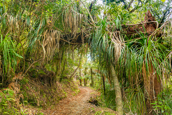 |
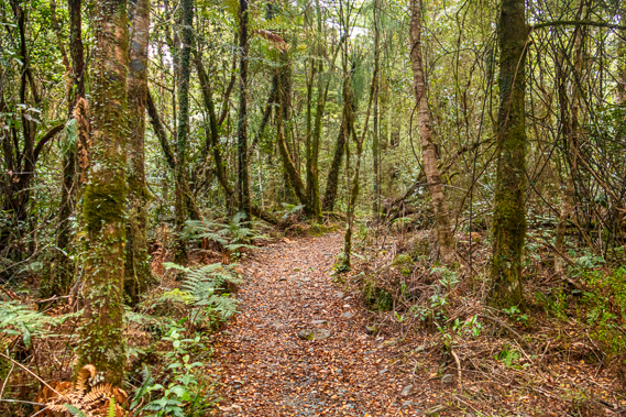
13:49 - A large landslide has come down the back of a gully, but fortunately the track has been cleared. This looks quite recent, perhaps from the rains of last April’s cyclone. The large trees largely give way to mahoe, and various forms of tall scrub. I also encounter the odd rata tree gnarled and leaning over covered in epiphytes. I have not seen these since the Lewis River. Although there is still some drop to go before the Lewis River, this area is definitely lowland forest. |
 |
13:59 - The plan never did eventuate and in 1965 the New Zealand Forest Service formed the North West Nelson Forest Park and took over jurisdiction of the track from the Buller and Collingwood Councils. Construction of the road was looked at once every few years even after the forest park had been established. The proposed highway would follow the track up to about the James Mackay Hut before diverting away from the existing track. The first three days of the hike I had taken would be completely destroyed by the road, and the remaining track would only be half the length of the current track. This would cause the track to completely lose its appeal. The Heaphy was considered one of the last strongholds of the New Zealand wilderness that was easily accessible and now the best known track in the country second only to the Milford Track.
|
 |
14:12 - After crossing another small stream a clear view down the valley shows I have now passed the hills where I had rounded the saddle, and the valley below is widening. The river meanders in a shallow gorge almost completely hidden in the dense forest. The hills are a lot flatter now rolling into the main valley, towards the Wakamarama Range where a fault line marks where the mountains have been uplifted during the mountain forming of the past million years. |
 |
14:16 - A group called the “Save the Heaphy Organisation” was formed, joining the increasing numbers of hikers to put pressure on the New Zealand Forest Service to upgrade the track and leave it exclusively for hikers. The road idea was considered again during the 1990s. By then it was prohibitively expensive. Estimates put the ongoing maintenance of the road to cost about thirty dollars per vehicle travelling along it. Constructing the road would cost about 15 million dollars, about five dollars per New Zealander.
|
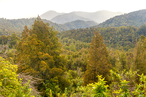 |
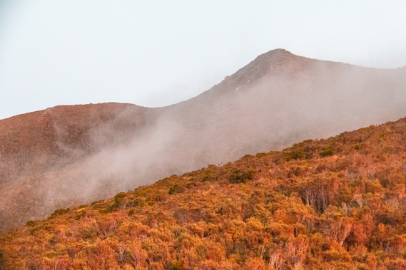
14:31 - The track begins to round the hill and face up the length of the Brown Valley. The headwaters of this valley starts under Mount Perry creating a substantial valley with a small river running through it. Some of the highest hills towards the back of the valley are starting to become a little faded out near their summits indicating a very light rain is beginning to fall. |
 |
14:35 - The forest suddenly clears to kanuka scrub, another pocket of land that has been cleared in the past, but farming never succeeded. The standard of the track suddenly improves with a new layer of gravel. For the first time since Flanagan’s Corner, the track briefly climbs uphill before continuing its descent. There is still another forty or fifty metres of descent to go, but it isn’t far to go now. Just ahead is the one kilometre post – I am almost there! A clear view up the forests of the Brown Valley (though no sign of the river) shows most of Mount Perry is enveloped in misty rain. It will not be long before rain starts falling down here.
|
 |
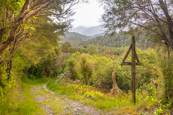
14:38 - A little further along I see a grassy clearing. Perhaps this was part of a farm. A couple of minutes later I pass through a gate in the track into what was once a farm paddock. The track begins to descend passing a navigational triangle mounted on a pole. It is something I would have expected in a marine environment, not way up a river. The track descends into an old beech forest upon a flat area of land where the track gradually turns to a large wooden bridge crossing the Brown River. The five person bridge starts as a flat bridge that protrudes out high above the water before reaching a long arch crossing to the bank on the other side.
|
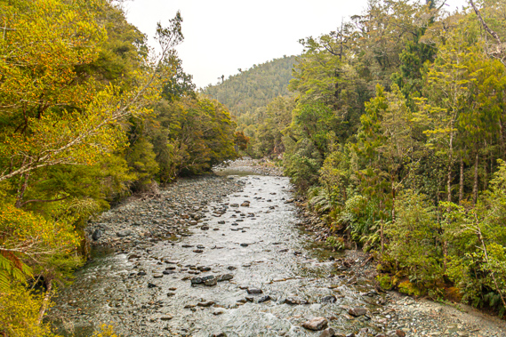 |
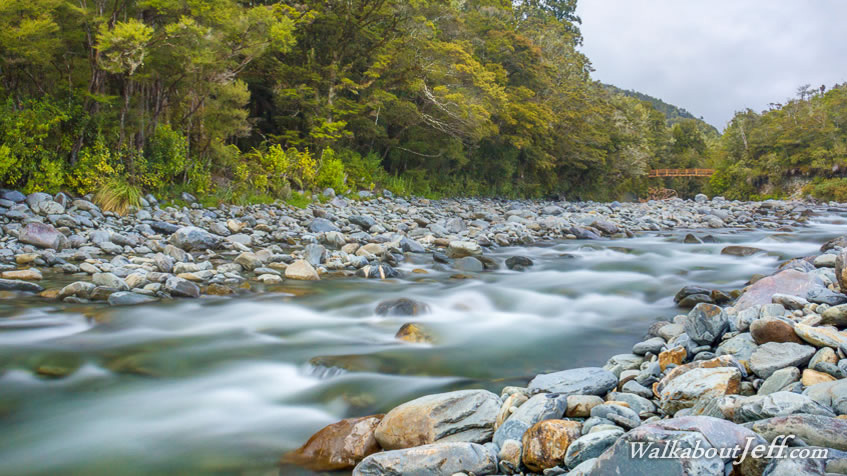
14:42 - About eight metres below the Brown River flows peacefully over boulders from the clouded valley above. The higher hills are all covered in thick cloud now and quickly descending as the rain approachs. Brown River is the biggest river crossing since the Heaphy River. Since the Lewis Hut the track has been following close to the ridgelines all the way over the mountains to this point. Gold was discovered a few kilometres downstream along the Aorere River in October 1856. Edward James and John Ellis, two of the valley’s earliest settlers, were mustering cattle and stopped by a small stream when Edward found a few specks of gold. The news of the find quickly spread, and George Lightbrand, a digger from the Australian goldfields, arrived in the valley to do some prospecting. He found enough gold here to justify what would quickly become New Zealand’s first gold rush.
|
 |
14:43 - Tall stands of beech forest tower over either riverbank. Although less than a kilometre from the end of the track the river seems to be very remote. Looking downstream the river continues flowing swiftly past a small scrubby flat above which, on the other side, I see Brown Hut, my destination for tonight. I cross to the other side of the river entering thick forest again. The track briefly meanders around the huge trees before setting off on a dead straight line to the grassy flat where I presume the hut stands. The track is a four wheel drive road with thick carpets of moss on either side.
|
 |
14:44 - Just before reaching the clearing, the track reaches the edge of the high riverbank. From here the valley is wide enough to see up into the mountains. The green and brown mountains of earlier today are now faded and grey from rain. Spits of rain are falling here, so I hurry the final few metres to the hut. |
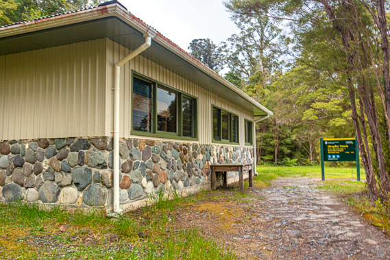 |
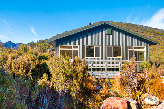
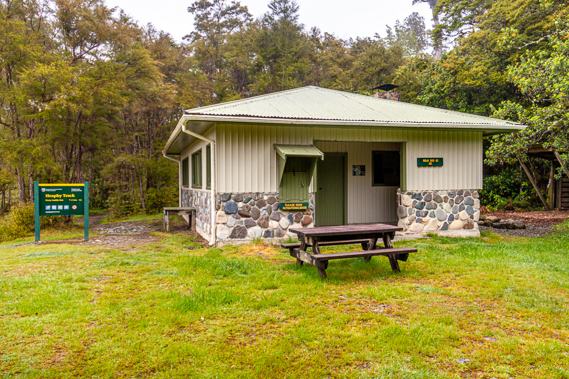
14:46 - Brown Hut was built in 1971. The lower metre is a rock wall built from boulders from the river sealed together with concrete mortar. Above the stone wall is cladding of some sort of plastic, with plenty of windows facing out to the river. The entrance of the hut is on the far side, where the intentions book is placed in a hinged door. Past the book is the main entrance with a partially open alcove where a broom and a working free telephone are. From here you can phone for transport, but my ride is coming tomorrow morning. Above the phone is a notice board with advertisements for transport companies and accommodation in Collingwood.
|
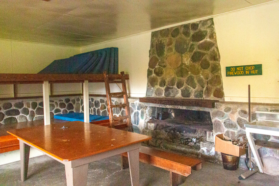 |
14:47 - I pass through the heavy door of the main entrance. There is nobody else in the hut. To the right beside the door are a couple of stainless steel benches. Half way along the wall is a huge open fireplace. There are a couple of huge old wooden tables, one in the middle of the room and the other to the left near the windows. The back wall has bunks for about 16 people. I set up a mattress in the lower bunk nearest the window. The table under the windows has a couple of folders with heaps of information, but nothing new that I haven’t seen at the Perry Saddle or James Mackay huts. Although the hut is quite old, it has (like every other hut on the track) been recently repainted. Rain begins falling outside. It is not long before the picnic table outside the main entrance is soaking wet. Only the hill immediately on the other side of the river is still visible. All the other hills and mountains have disappeared in the thick grey cloud that has now enveloped the entire region. The north westerly rain has settled in.
|
 |
15:27 - As I rest in the hut, the cloud quickly settles to about two hundred metres overhead. Anyone still hiking on the track will now be deep within the thick cocoon of fog. This is the dry and sheltered side of the mountains, so it is likely raining substantially on the West Coast. All the people I have passed on the track over the past few days are now denied of any of the spectacular views. Those still heading across the downs today will also be battling driving rain from strong head winds.
|
 |
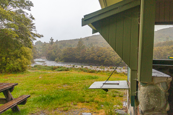
15:29 - The clear waters of the Brown River swiftly negotiate their way down the naturally formed channel along the bed of boulders. This creates a peaceful backdrop as I finish my afternoon tea in the hut. From here there is just a couple of hundred metres to the end of the track with a pickup to Takaka. I’ve never lingered during my past visits to Brown Hut. I would either be passing through starting at this end of the track to head straight up towards Perry Saddle. The one time I had completed the track coming this direction, I had arrived in the late morning and walked up to the road to start hitching across to Wainui Bay at the start of the Abel Tasman National Park 82 kilometres away. Despite the remoteness of this part of the country I had no problems getting across. I had arrived at Wainui in the middle of the afternoon, from where I hiked a further 110 kilometres along the inland and coastal tracks of the Abel Tasman.
|
 |
15:36 - With time to spare, I head down to the river and do some long exposure shots of the water rushing over the huge boulders before the sandflies get too bad. Although I have plenty of insect repellent on, they are aggressively biting me. Eventually I have no choice but to return to the hut to pack up. |
 |
15:46 - The cloud has lifted from the hills just on the other side of the river, and there is even a patch of blue sky. I have just finished packing up and the rain stopped falling when a bearded man arrives. He has hiked down from Gouland Downs today having been following me a day behind. He is catching the same bus as me today, and getting dropped off at Nelson Airport to fly back to Palmerston North to head home to Wanganui. A large ute suddenly arrives, with a couple of DOC workers and a load of firewood to supply the hut for a few more weeks.
|
 |
15:47 - After chatting for a while at the picnic table we head off together along the final three hundred metres of track to the car park, where we find one of the picnic tables at the picnic area and wait for the bus to arrive.
|
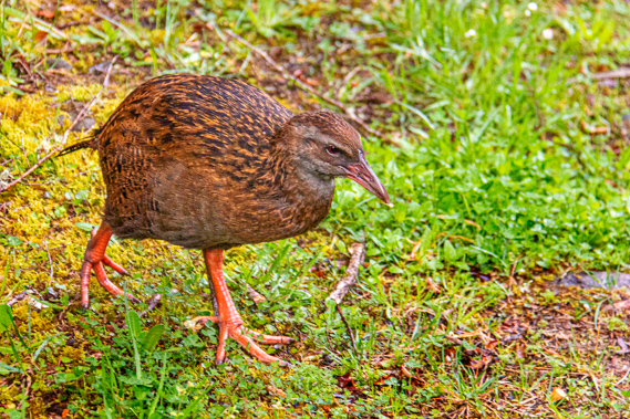 |
15:49 - A family of weka were foraging amongst the newly formed puddles from the overnight rain. There is a mother, father and small chick no doubt closely guarding their territory patiently awaiting the pickings of leftovers from picnickers who frequent this spot. Next to the gate is a red shed no doubt for storing track maintenance equipment. |
 |
15:51 - I have officially completed the track, in seven days. This is the longest I have ever taken, but unlike previous times I have taken a leisurely pace exploring and photographing my way along. Previous hikes have taken me three or four days, but even that isn’t fast. Derry who I met yesterday does the entire track in a day and a half upon dropping each client’s car off at Kohahihai. Some people are even faster. There was a group from Christchurch a few years ago who ran the entire 78 kilometres in nine hours. Starting from this end, they actually arrived at Kohaihai before their support vehicle had driven around the 428 kilometres to pick them up.
The van and trailer pulls up right on schedule at 4:00. The driver is the same guy who had taken me to Kohaihai a week ago. To my surprise Derry is twith him, picking up another car to take around to Kohaihai tomorrow morning and walk all the way back here again arriving late the following afternoon. Once our packs are stored in the trailer, we are ready to head back into civilisation, leaving behind the greyness of the cloud encased mountains.
|
 |
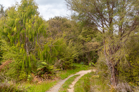
16:17 - From the end of the Heaphy Track, the van follows a gravel road crossing several streams over very narrow wooden bridges. These were built just recently. In past years the streams were crossed by fords which were fine most of the time, but whenever it flooded the roads became impassable. Before the bridges were built there was a local farmer who would give people a ride across the three fords on his tractor when water levels were running high. With the bridges now installed there is no longer any need for lifts in his tractor. The valley quickly widens into bright green grassy paddocks under the dark forested hills of the Wakamarama Range, the northernmost range of the South Island I had looked along from the top of Mount Perry just yesterday. Cloud now covers the tops of these mountains. It is not long before the gravel ends and we are on sealed road, the first I have seen since Karamea. We continue travelling through farmland and pass the occasional small homestead as we follow the Aorere River downstream. It is not long before the farmland gives way to swampland and the large estuary where Collingwood village stands on its sandbar.
|
 |
16:50 - Upon almost reaching Collingwood the narrow road meets the start of highway 60, the main road through Golden Bay and the only road linking the bay with the rest of the South Island, eventually ending in Richmond, just short of Nelson. From here we pass in front of the Tasman Mountains concealing some of the old goldfields hidden in the hills. The road follows the rolling hills of farmland until crossing the Takaka River and heading into Takaka, the largest town in Golden Bay. The remoteness of Takaka lends itself as the alternative lifestyle capital of New Zealand. It is regarded as the Nimbin or Woodstock of New Zealand. This marks our return to civilisation, but not the end of today's journey. Today I continue to Motueka just over the Takaka Hill from where the next trek begins.
|
|