This week in South East Queensland
12 - 18 November
AS SUMMER approaches, the humidity rises and afternoon storm activity increases. The long cloudless days of the dry winter and early spring are now over, but sunrises and sunsets over the bay are often spectacular thanks to the increased cloud cover. Although the afternoons are often stormy, the mornings are usually calm making for very pleasant beach conditions.
Today's trek takes me down the length of the Redcliffe Peninsula along which was an old convict colony, passing its pristine golden beaches. Upon reaching the bottom of the peninsula, I cross a long bridge across the estuaries of the mouth of the Pine Rivers onto a smaller peninsula, passing the historic Sandgate ending at the popular Shorncliffe Pier.
Today's Journey
Distance hiked today: 22.2km
Total distance hiked to date: 359.2km
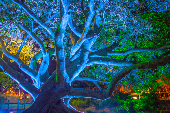 |
04:06 - Brilliant blue tree fig tree illuminated outside the Scarborough Resort. |
 |
04:15 - First light viewed to the north east from the southern end of the resort. |
 |
04:31 - Entering Queens Beach as I head southward along the peninsula. The red glow of the port of Brisbane lights are now visible in the distance as a cruise ship heads out of the port on the horizon. |
 |
04:46 - Waves quietly break on the golden sand as I look back around Queens Beach. |
 |
04:47 - The tide is out revealing rocky shore below the beach. Deadly stonefish often lurk amongst the rocks but swimming in the middle of the beach away from the rocks is safe. |
 |
04:50 - The lookout at Osbourne Point as the sun rises. Thick cloud covers the other side of the bay, completely obscurring Moreton Island and the rising sun. |
 |
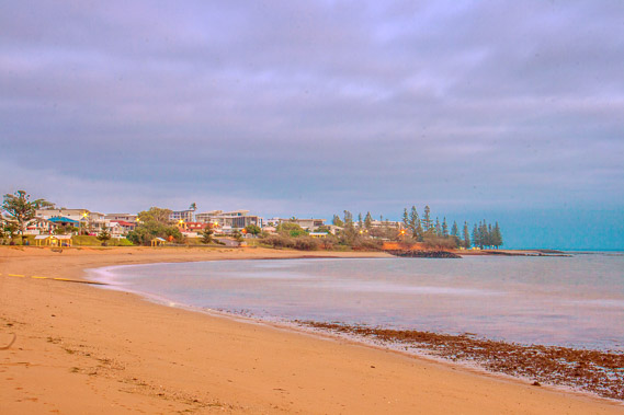
05:00 - Following the golden beach on this peaceful humid late spring morning. Redcliffe is coming into view. |
 |
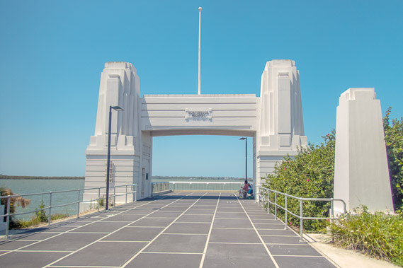
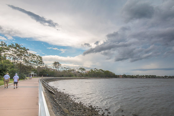
05:41 - At the entrance of the Redcliffe Pier. The cloud has by now almost completely covered the sky. It is 6:00AM yet there are quite a few people out here on their early morning walks before the heat of the day and forecast afternoon rain sets in. |
 |
05:48 - View south from the pier across calm waters of the bay. |
 |
05:56 - Beejees lane - they apparently lived here for a while before moving to England. The lane just across the road from the beach near the pier stands as a monument to their music and Australian roots. |
 |
06:01 - Back on the beach on the boardwalk in front of the central part of Redcliffe. There is one stop I need to make before continuing along the beach. |
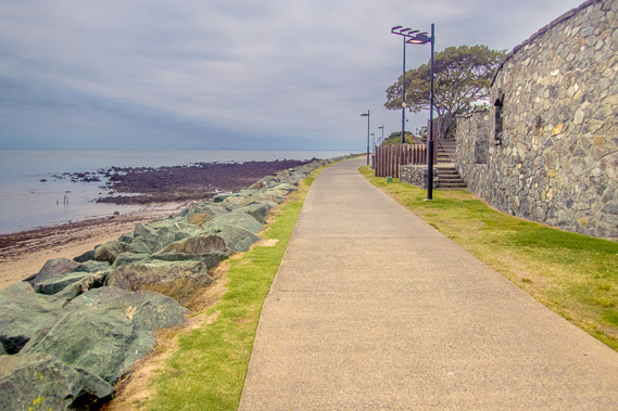 |
06:27 - Passing an old tower near the Settlement Cove Lagoon, a remnant of the convict colony once set up here before it is moved into Brisbane. |
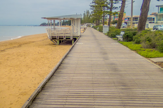 |
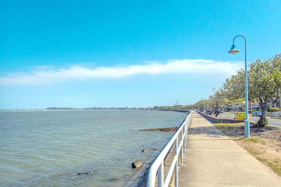
06:50 - Once around the point, a boardwalk follows the entire length of Sutton's Beach, protecting both the beach to the left and the vegetation to the right. |
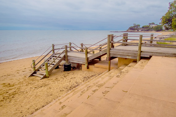 |
07:33 - The occasional staircase leads down onto the beach. It is still early morning and the beach is quiet, but later today it will be crowded. I find the early morning to be the best time for exploring beaches. |
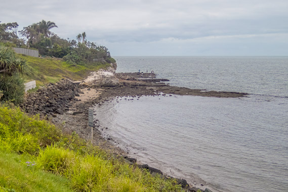 |
07:46 - Crossing Scott's Point. It is completely overcast and the offshore islands are hidden from view. |
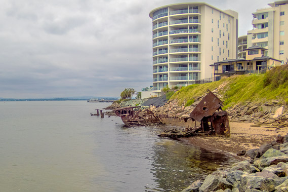 |
08:05 - High rise apartment blocks towering over the Woody Point with a rusting shipwreck below them. |
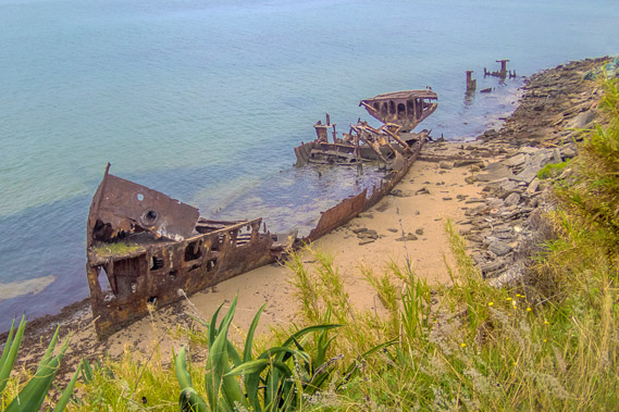 |
08:14 - This is the first intact shipwreck I see on this trek. I have already passed the sites of numerous shipwrecks, but they have all been removed or completely decayed. This one remains. The HMQS Gayndah was commissioned in 1884 as a gunboat for the navy before becoming a sand and gavel barge in 1921. Following its retirement, it was deliberately run aground here in 1958 to serve as a breakwater. |
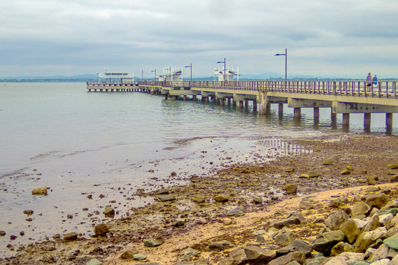 |
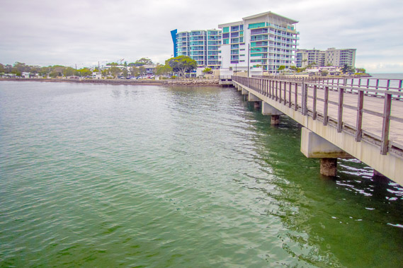
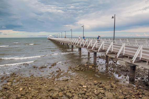
08:23 - A short hike over the hill behind the apartment towers leads to the Woody Point Jetty. |
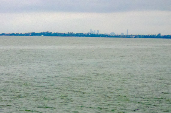 |
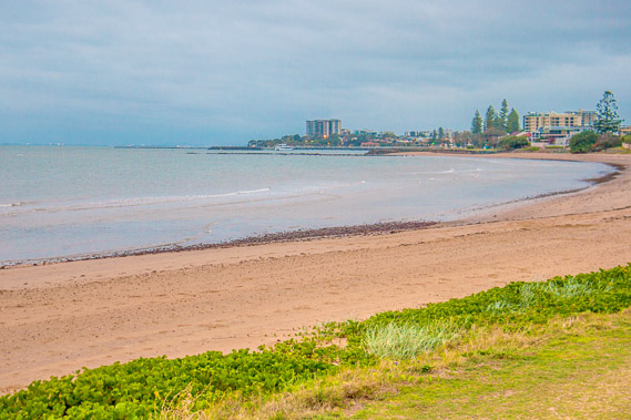
09:04 - View of the city from the end of the jetty. This is the first I have seen the city since the southern end of Bribie Island. The buildings rise over the smaller Shorncliffe Peninsula, which I hope to get to the end of later today. |
 |
09:10 - Looking back from the end of the jetty. |
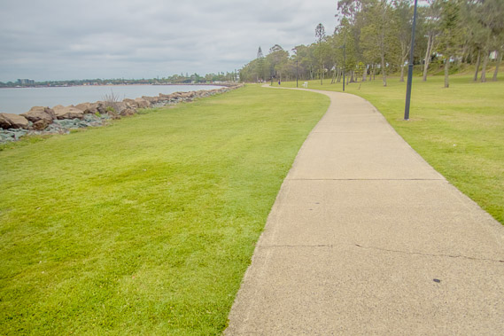 |
09:42 - The coast dramatically turns to the west as the sealed path follows the southern shore of the peninsula towards the mouth of Pine River. |
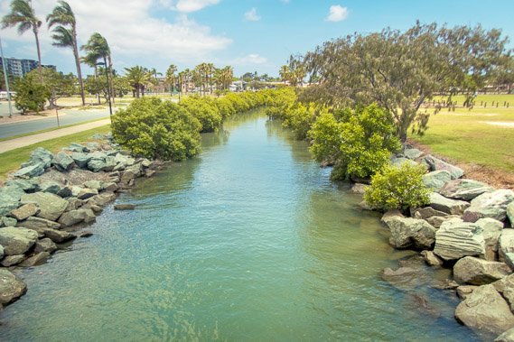 |
10:27 - Crossing a small tidal stream as the cloud suddenly starts clearing from the north as the sea breeze starts. |
 |
10:39 - Resting on the beach at under the shade of a tree as the cloud quickly clears to a hot day. |
 |
11:46 - The track rises towards the start of the impressively long bridge across the Pine River. The two kilometre long bridge provides a nice shortcut across what would be a very long mangrove hike up and down Hays Inlet, and the North and South Pine Rivers. This is a welcome shortcut as I'm nearly a day behind schedule now. A sea breeze begins cooling things down a bit. |
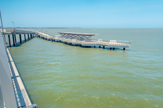 |
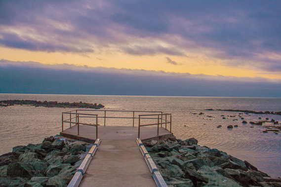
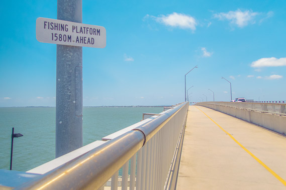
12:45 - The fishing platform looking back to the now distant Redcliffe Peninsula. This is out from the entrance of the Pine Rivers, the southern limit of the Gubbi Gubbi tribal lands which I have been crossing since the start of the trek at Rainbow Beach. |
 |
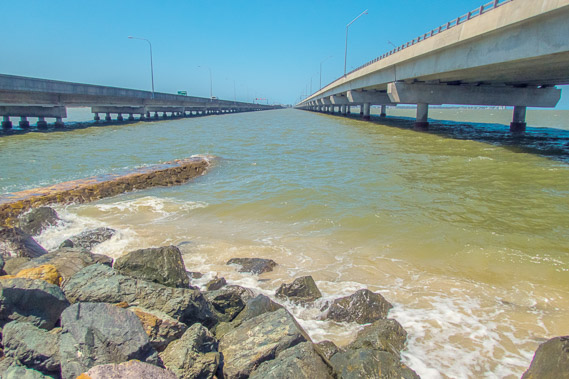
13:05 - Reaching the far side of the bridge where large waves are breaking with the sea breeze now blowing strong. This marks my entrance into the Brisbane metropolitan area, and the northern end of the Yuggera tribal lands stretching south to the Logan River. |
 |
13:12 - On the shore between the two bridges of the Houghton Highway. |
 |
13:14 - Remains of the first bridge to cross this wide estuary. This bridge has been dismantled with only the end remaining as a memorial to this crucial link between Brisbane and the Redcliffe Peninsula. |
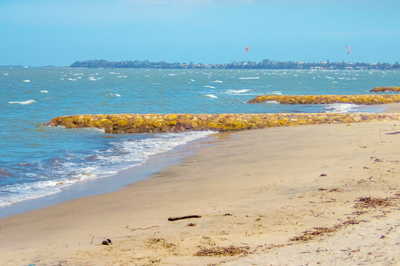 |
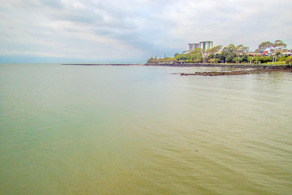
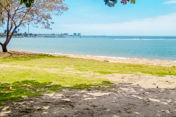
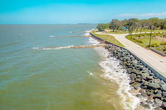
13:47 - Following the coast at Brighton looking towards the Shorncliffe Peninsula. |
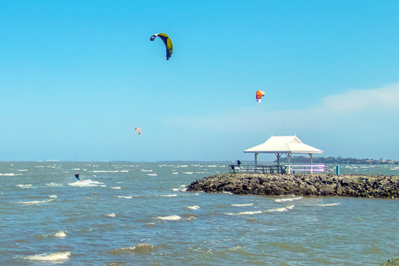 |
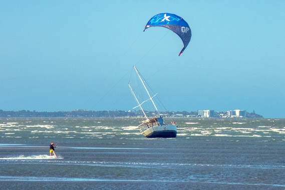
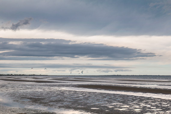
13:57 - Parasurfing the foreshore making the most of the strong sea breeze. |
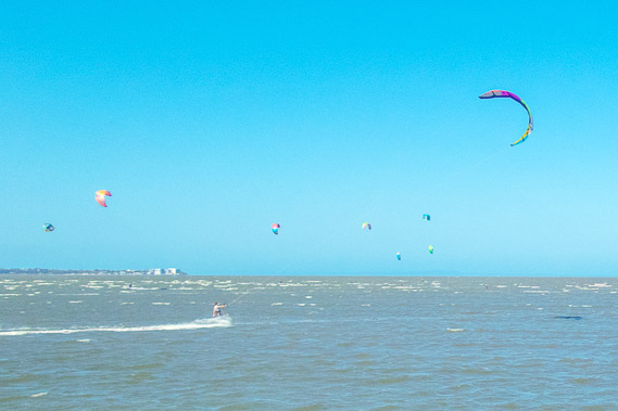 |
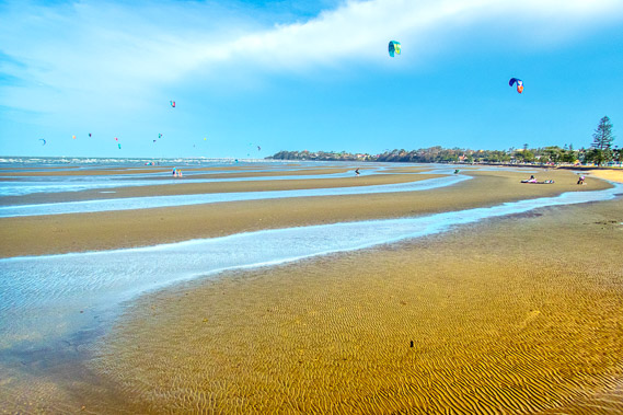
14:15 - There is quite a crowd here today on the very shallow water making the most of the strong sea breeze. The numbers only increase. |
 |
14:46 - Looking ahead, a large storm is approaching as I follow the coast along Brighton. It doesn't look like much through the humid haze, but looking at the weather radar it does look threatening. |
 |
15:34 - A yacht has been washed ashore from a previous storm. Does this qualify as shipwreck 2? |
 |
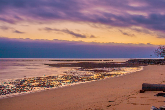
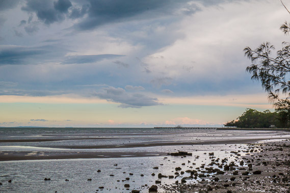
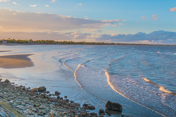
15:38 - Reaching Sandgate as the tide is now far enough out to reveal the sand banks holding water. The storm is getting closer but fortunately the radar is indicating it isn't as severe as it was earlier. |
 |
15:57 - Following the Sandgate foreshore path as the storm gets very close covering the sky to the west and to the south and already swinging around to the north. I need to find shelter. |
 |
16:24 - The storm quickly passes overhead swallowing up the blue sky. Fortunately it is not as serious as I thought it was going to be. I head to shelter under a small roof over a picnic table. |
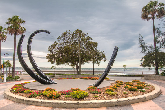 |
16:39 - A sculpture viewed from the shelter as rain starts falling. |
 |
17:10 - The storm continues, but the rain does eventually stop, so I start following the path along the shore along the Shorncliffe Peninsula. From here I can still see the blue sky where the storm hasn't reached the middle of the bay yet. |
 |
17:13 - The storm has mostly passed and it looks quite onimous to the north where it is rapidly heading Although there isn't much wind now, some storms like this one travel at over a hundred kilometres per hour pushed by the strong jet streams constantly flowing around 6 kilometres above sea level. |
 |
17:25 - The high altitude jet stream opens up some blue sky as the storm continues moving northward. |
 |
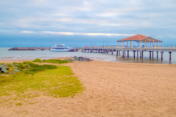
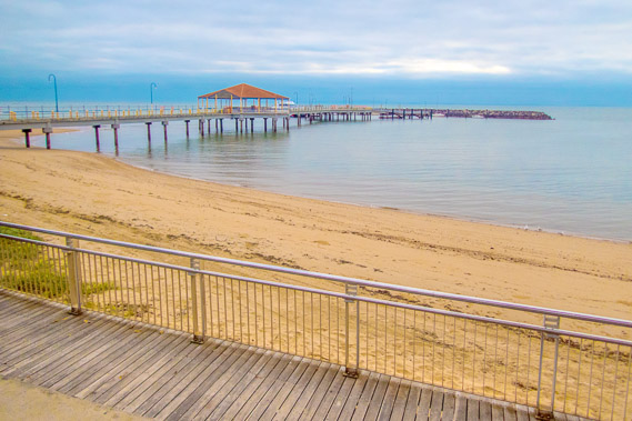
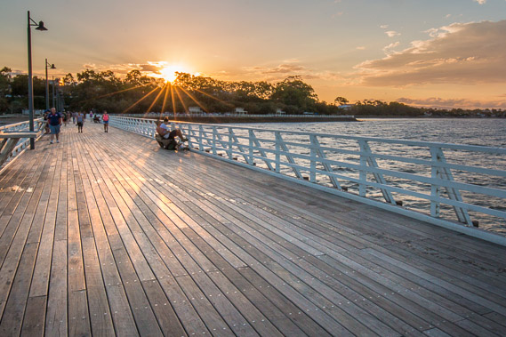
17:31 - I approach the Shorncliffe Pier out on the end of the Shorncliffe Peninsula. The last of the rain has stopped falling, so it is safe to go out onto the pier. |
 |
17:51 - The sky is quickly clearing allowing the sun to shine through as it prepares to set. |
 |
18:01 - The sun briefly shines brightly before disappearing behind the peninsula. |
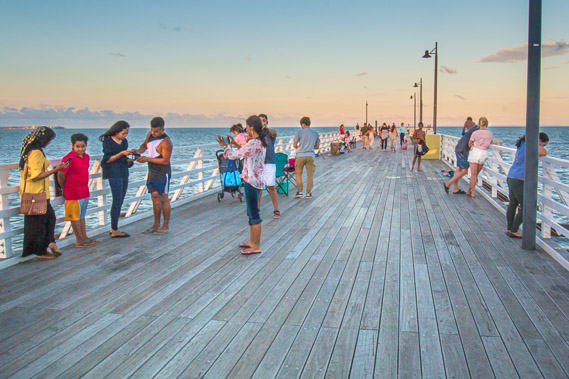 |
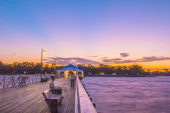
18:02 - Now the storm has cleared, a lot of local people are now on this popular pier. |
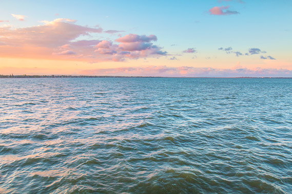 |
18:14 - Colors across the bay. The sunlight is illuminating the almost non-existant remnants of the storm. |
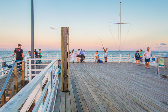 |
18:17 - People fishing at the end of the pier as the sun sets behind the hill. |
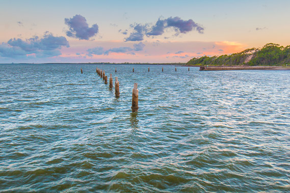 |
18:22 - Poles of the old pier from where passenger boats would sail up to the Redcliffe peninsula before the first bridge was put in. |
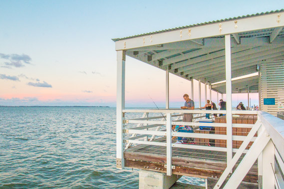 |
18:24 - Fishing under the shelter. |
 |
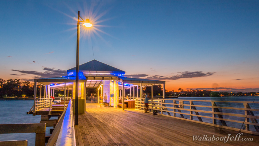
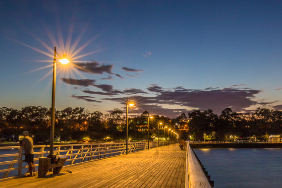
19:03 - Long exposure capturing the last of the light. Some are resting, others are restless appearing as faint blurs. |
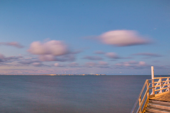 |
19:16 - Lights of the Redcliffe Peninsula come on in the distance as the sky darkens. |
 |
19:26 - Looking towards the port of Brisbane brightly illuminated. |
 |
19:29 - The very last of the light before I return to shore. Although the sky is mostly clear, a bigger storm is on its way so I need to seek shelter for the night. |
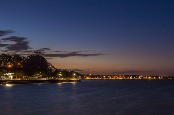 |
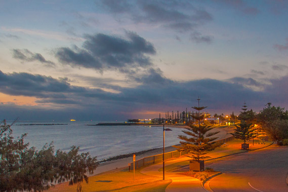
19:36 - Lights of Sandgate as the last light of the dusk disappears. |
|