Facebook    YouTube   
 

| Home | Photography | Diary | Treks |

 
PreviousNext

Part D - North Brisbane

Part D - North Brisbane
Home > Treks > SE Qld Coast > D - North Brisbane


About this Page

Date:


Location:

Country:


Latitude:

Longitude:

Altitude:

22 Oct - 25 Nov


Brisbane

Australia


27°20'S
153°10'E

0 - 26m ASL


Google Maps Link


Introduction to North Brisbane

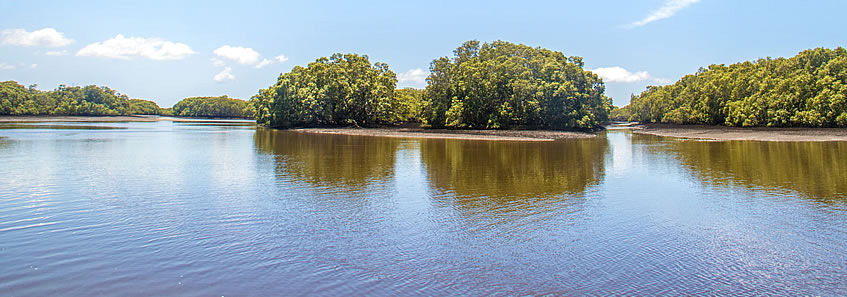
SHELTERED by its offshore islands, the waters of Moreton Bay are relatively calm. The long sweeping golden beaches extending from Rainbow Beach down to the bottom of Bribie Island have now given way to mosquito infested mangrove wetlands. The shallow bay has permanently flooded from rising sea levels at the end of the last ice age, turning once fertile plains into a maze of submerged sand banks.

The northern suburbs of Brisbane are largely inland due to the swampy nature of the Moreton Bay foreshore. There are a few peninsulas extending out into the bay, upon which residential areas have been built. In between these peninsulas are the meandering streams and rivers draining from the D'Aguilar Range into the swampy coast, so despite being near the city, much of the coast I follow feels remote.

From Sandstone Point, I follow the coast around the many peninsulas through the mangroves above the extensive mudflats of northern Moreton Bay. Eventually the coast reaches the Brisbane Airport, from where I head inland outside its boundary to reach the lower reaches of the Brisbane River after trekking 86 kilometres.


15 - Rustic villages by the seashore

Hiking south from Sandstone Point into Deception Bay passing Beachmere and reaching the mouth of... more...


16 - Rivers of Deception Bay

Crossing the Caboolture River and Burpengary Creek into the Deception Bay Conservation Park and around the... more...


17 - Wetlands and marinas

Starting from the beginning of the Moreton Bay Cycleway at Deception Bay and following it up to Scarborough Resort... more...


18 - Two peninsulas

Following the path down the length of Redcliffe Peninsula and crossing the long bridge over the estuary to... more...


19 - Motorways through wetlands

Heading into Boondall Wetlands and Nudgee Beach before following the Jim Soorley Bikeway bypassing the... more...


PreviousNext


| Home | Photography | Diary | Treks | Archive |

 
© 2001-2020 walkaboutjeff.com - Copyright - Disclaimer - Who is Walkabout Jeff?