This week in South East Queensland
3 - 9 December
THE EARLIEST sunrises happen this week, with the first light of dawn occurring shortly after 3:00 AM and the bright sun rising over the horizon by 4:45. The early starts and early sunsets (it gets dark just after 7:00PM) along with the hot days explains why a lot of the locals here get up around 4:00 or 5:00 in the morning. Being early summer most people aim to do as much as possible before the heat sets in after around 8:00.
Today's hike takes me from the Queen Street Mall, returning to the river where I continue following the path upstream. I pass the inner western suburbs under Mount Coot-tha. The track remains beside the river for much of the morning, but it is not long before these end and I have to follow footpaths along roads as inaccessible private properties line much of the riverbank as I head further upstream.
Today's Journey
Distance hiked today: 22.4km
Total distance hiked to date: 472.0km
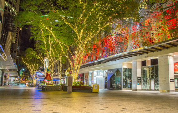 |
01:48 - Queen Street Mall in the very early hours of the morning showing its Christmas decorations in full glory. |
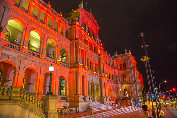 |
03:07 - Heading past the brightly illuminated treasury building on the way back to the river. |
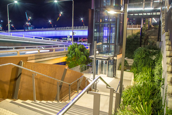 |
03:13 - The stairs down from the end of Queen Street towards the river. At one time this would have been a simple path down to the docks where ships were berthed. Now a major arterial road runs up the length of the river carrying traffic from the city southward. The astronomical twilight will be starting now, but the thick cloud and bright city lights will make the dawn impossible to see for about another hour. |
 |
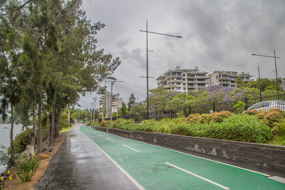
03:17 - Continuing along the track and bikeway further upstream. It is quite noisy here with the traffic flowing on the motorway overhead. Hopefully there aren't any suspicious characters hiding behind the motorway pillars. |
 |
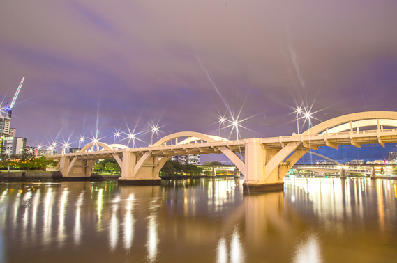
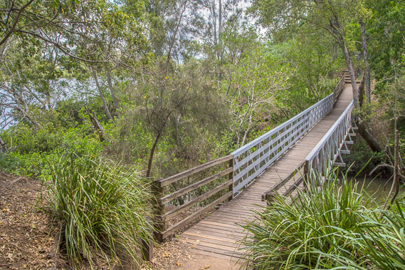
03:29 - Reaching the Kirilpa walking bridge just at what should be first light, but the sky is covered in thickening cloud and it feels like rain is coming. I'm hoping to watch the New Year in from the lookout on the bridge to the right. The bridge was only built a few years ago giving pedestrians access from the upper city across to Southbank and West End. |
 |
03:59 - At a small lookout on the track looking back to Kirilpa Bridge and the more distant (purple) Victoria Bridge. This is an ideal spot to what the sky lighten, but this isn't happening this morning with rain now starting to fall. |
 |
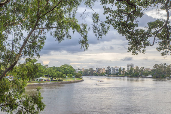
04:00 - I continue following the track around the river as it turns into the next meander. Here the river carves into the volcanic tuff starting from around here down to New Farm. It is amazing how the river has carved its way through the middle of this ancient extinct volcano instead of bypassing through the softer sandstone surrounding it. |
 |
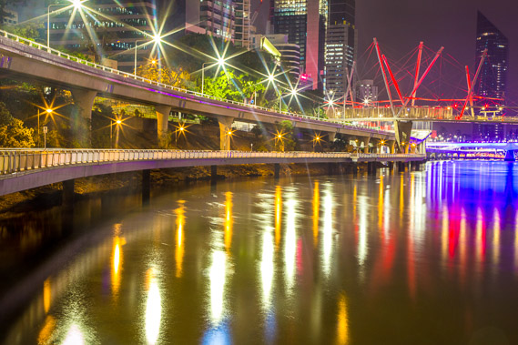
04:16 - William Jolly Bridge linking from the upper city across to Southbank. The sky overhead is starting to lighten with a break in the rain. |
 |
04:20 - For a few moments the cloud looks like it is going to break, but very quickly closes in again with the humid northerly blowing in from the tropics. |
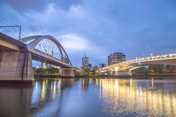 |
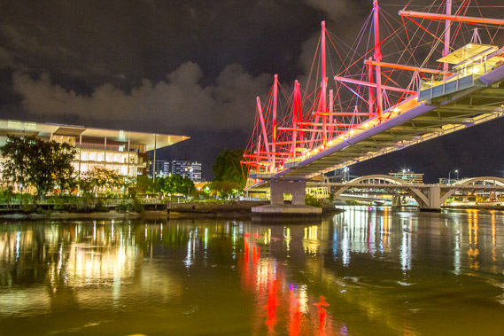
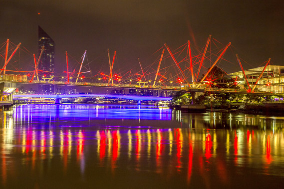
04:29 - The rail bridge and the new Go Between bridge as the sky continues to lighten. The rail bridge takes the train line from the city heading southwards towards the Gold Coast. Numerous high rise apartment blocks are being constructed in South Bank. |
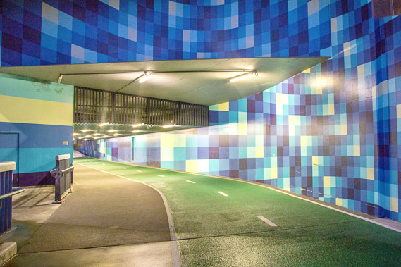 |
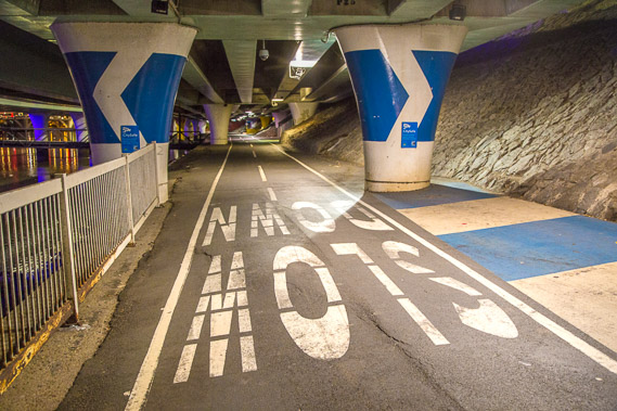
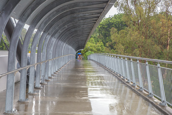
04:31 - Walkway tunnel under the Go Between bridge with optical illusion tiles. |
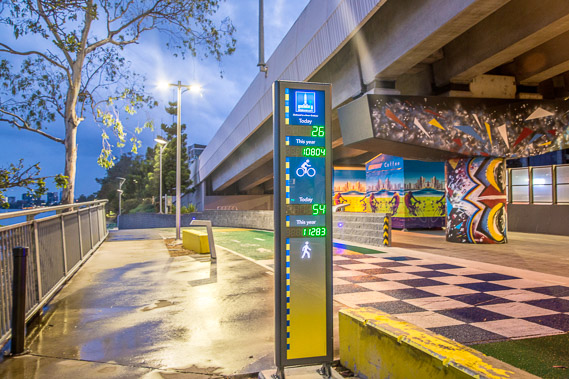 |
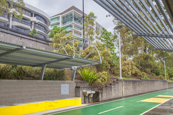
04:35 - An indicator showing how many pedestrians and cyclists have passed here. Interestingly there have already been 26 cyclists and 54 pedestrians pass here already today and it's only 5:00 AM and rain has settled in. 11283 pedestrians and 10804 cyclists have passed this year. |
 |
04:43 - More apartment buildings being constructed on the other side of the river at Westend. There are so many apartments being built around the city there's expected to be a glut in the supply in a year or two down the track, dragging the market down. |
 |
04:44 - A sheet of rain comes across the city obscurring the buildings and the sun which is rising above the horizon now. This is going to be a very wet morning, even though fine weather is forecast this afternoon. |
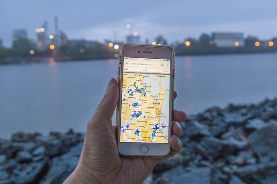 |
05:01 - The weather radar (which I will be passing in ten days) showing where the rain is falling. It has been coming from the north, but is turning around to come from the south east, from the Tasman Sea where much of our rain comes from. |
 |
05:18 - Apartment and business buildings of Milton's IT district. Few people are walking along the path now due to the now persistent rain. |
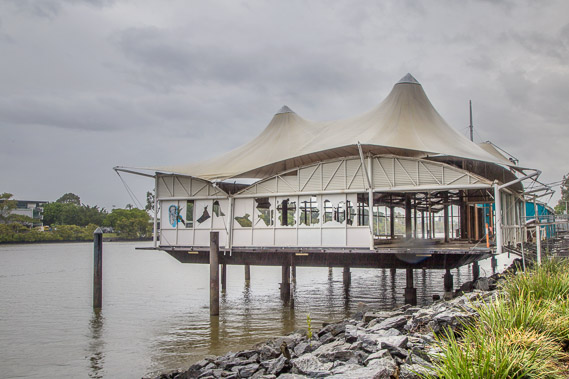 |
05:38 - What used to be a restaurant wrecked in the 2011 floods when the river here rose about five metres when 467mm fell here in one day. |
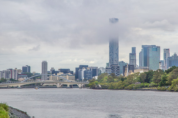 |
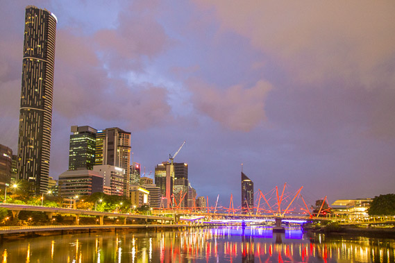
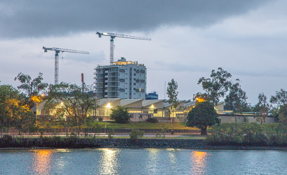
06:00 - The 89 storey residential tower pokes through the lower cloud. People living in its upper floors won't have much of a view this morning. Rain cloud often covers the tops of the tallest buildings at this time of year. Fog often covers the middle levels of these buildings in winter, leaving the tops above the clouds making for some spectacular sunrises. |
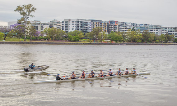 |
06:16 - Looking across the river to new apartments in West End as morning row boats pass. The river provides ideal training for rowers and I know I'll see a lot more of these boats this morning. |
 |
06:18 - Heading into Auchenflower as humid rain continues to fall. |
 |
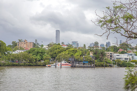
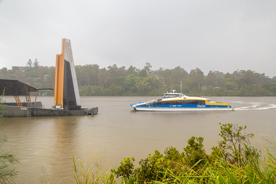
06:26 - One of the new Citycat terminals. Most of these were washed away in the 2011 flood and needed to be rebuilt. These terminals now float at the level of the water. |
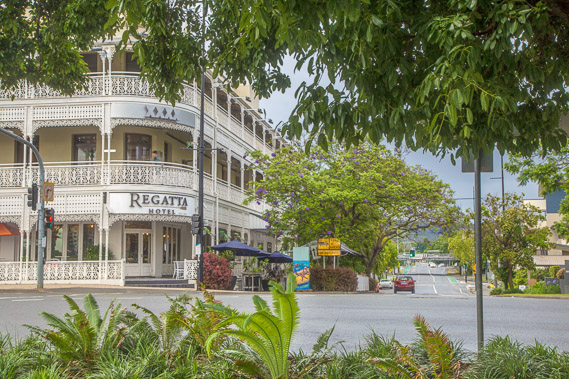 |
06:27 - Looking from the track across the road to the colonial Regatta Hotel in Taringa. |
 |
06:43 - The track heads inland behind a few waterfront buildings into Toowong. After about ten minutes the track turns to the left back towards the river. |
 |
06:49 - Looking across the river as it turns around Orleigh Park with the buildings in St Lucia now visible. The rain seems to be clearing now. |
 |
07:18 - Heading into St Lucia as the hill of West End blocks the city leaving only the tallest buildings poking above the hill. |
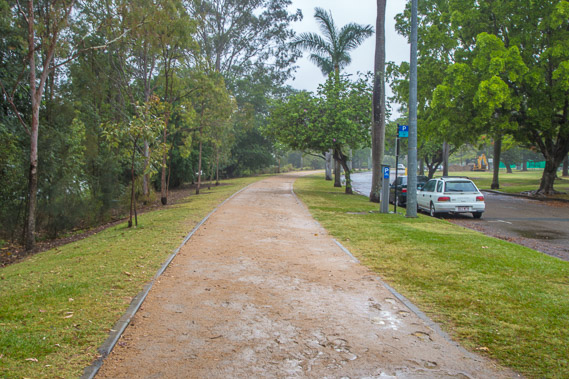 |
07:57 - The sealed track changes to compacted sand as it continues following the river passing the University of Queensland campus occupying the St Lucia peninsula. |
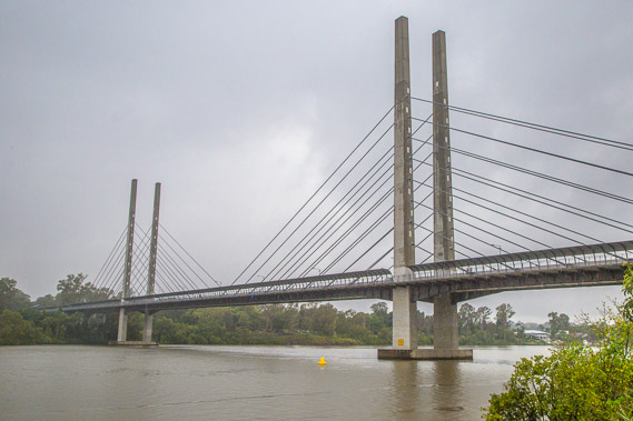 |
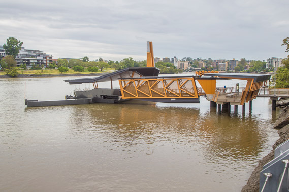
08:16 - The spectacular Eleanor Schonell Bridge crossing between St Lucia and Dutton Park on the other side of the river. Opened in 2006 it is exclusively for buses, cyclists and pedestrians. |
 |
08:18 - Citycat turning around at its most upstream point and pulling into the new UQ terminal. I have been following the citycats since first light yesterday at Hamilton, seeing them buzzing along the river every ten or fifteen minutes. I won't be seeing them any more as none of the passenger services go past here. In times past boats used to head a lot further upstream. |
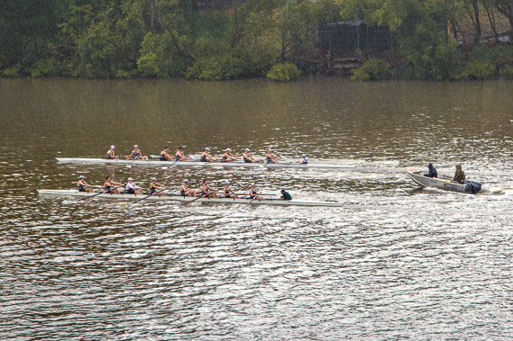 |
08:29 - Undeterred by the heavy rain now falling, more rowers train up and down the river. There are a lot of them out on the water today and quite a few spectactors braving the rain to watch them. |
 |
08:40 - On the bridge (mainly to shelter from the rain). The summer rainy season which starts from now taking over from the storm season which has now largely finished. The rainy season will continue until around Easter. Fortunately the rain isn't at all cold and very rarely does it rain for a full day. |
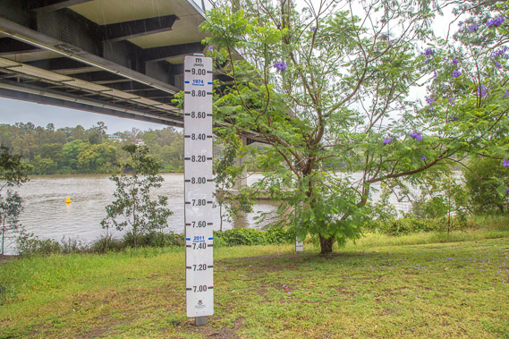 |
09:05 - When the rain eases, I head off hte bridge and continue upstream. This indicator near the bridge shows how high the river has flooded. Today's rain will hardly raise the water level, but spectacular falls in the past along the Brisbane River has brought floodwaters downstream to here several days later after the rain event. Here it rose 7.45 metres in the 2011 flood, and 8.9 metres in the bigger 1974 flood. Even larger flood events occurred in the late nineteeth century when it would have risen well over ten metres. The Wivenhoe Dam built upstream was designed and built in the late 1970s so floods the size of the 1974 event can never happen again. |
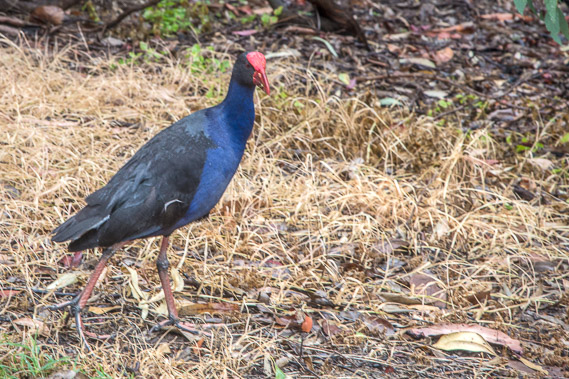 |
09:26 - A swamp hen making the most of the rain. New Zealanders would recognise this as the Pukeko. It is the same species, but somehow self-introduced from Australia where they are originally from. |
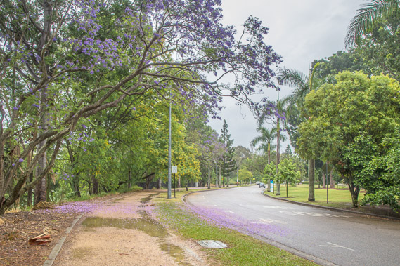 |
10:02 - Once past the bridge, the river continues turning to the right around a 150 degree arc. The pathway follows its bank through bright green vegetation and jacurandas which are now past their peak but still in flower. The rain is starting to ease off now. |
 |
11:06 - The rain stops falling and I now see a small break of blue sky looking through a gap in the trees towards the river some distance past the university. |
 |
11:46 - The roads turn off over the hill but a walking track continues to follow the river. The rain has completely stopped falling giving the dense vegetation a freshness only seen during the rainy season. |
 |
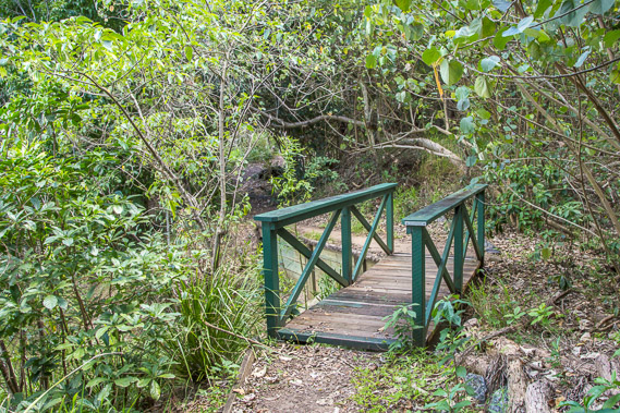
11:48 - A bridge crossing a stream draining into the river. |
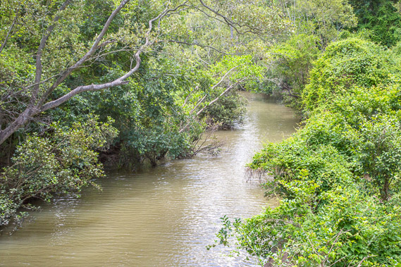 |
11:49 - The stream is brown from the rainwater. Thick vegetation grows over the banks as it does the river, making river views and landing points almost non-existent on this overgrown stretch. |
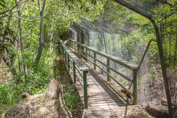 |
11:53 - The sun comes out as I start passing the Indooroopilly golf course. The netting stops golf balls from hitting people. |
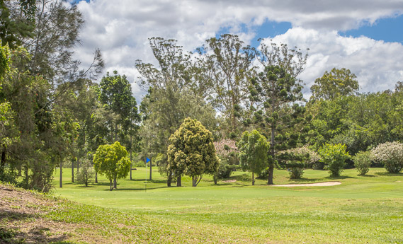 |
12:07 - Reaching a park near the golf course. The cloud is breaking up very nicely now. Most rain events even at this time of year do not last longer than a few hours. The hot sun comes out quickly turning the air quite steamy. |
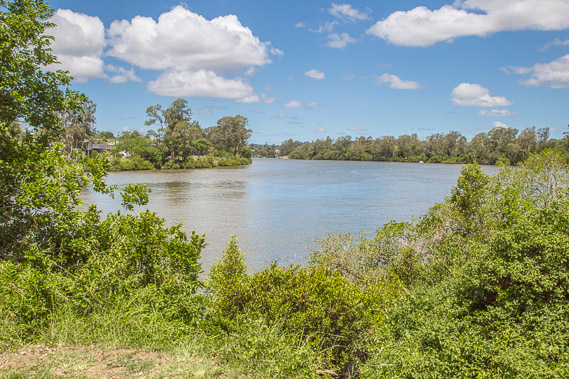 |
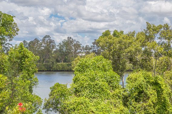
13:21 - View of the river near the golf course. The river swings back in the other direction along one of its countless meanders. |
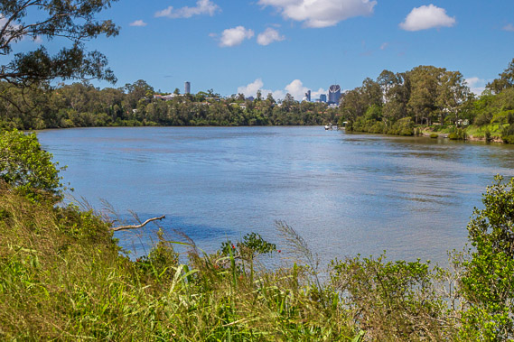 |
13:42 - Another brief view of the city through a gap through the vegetation. The clouds continue to dissolve as this morning's rain is all but forgotten and the city centre now quite distant. |
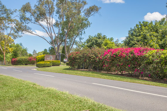 |
14:08 - Entrance to the Indooroopilly golf course. Bougainvilleas brightly colour the entrance. From the golf course I follow a long road across a peninsula towards Indooroopilly. |
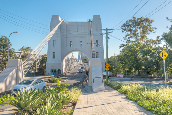 |
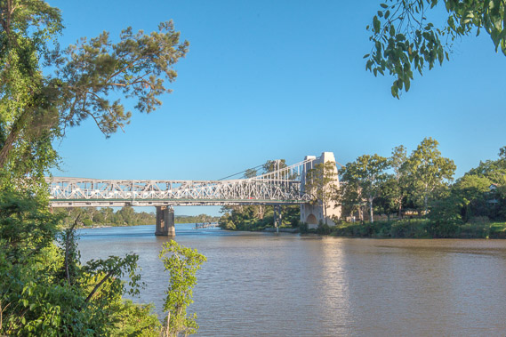
16:07 - Albert Bridge at Indooroopilly. A small apartment is above the arch at this end of the bridge where the family who once collected tolls lived. I follow to the right of the bridge to a track heading further up the river, which I haven't seen since the golf course. |
 |
16:21 - The narrow track and road precariously sidling around the bluff above the river. |
 |
16:33 - Looking back from the end of the bluff to the bridge through a gap in the thick vegetation. |
 |
16:45 - Continuing upstream along the river with residential housing on either side. The views from these houses would be spectacular, but they are prone to flooding. |
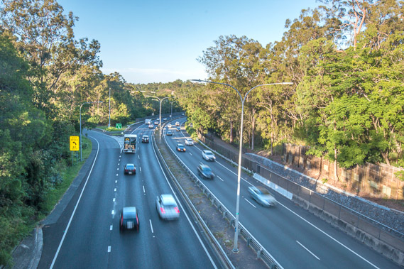 |
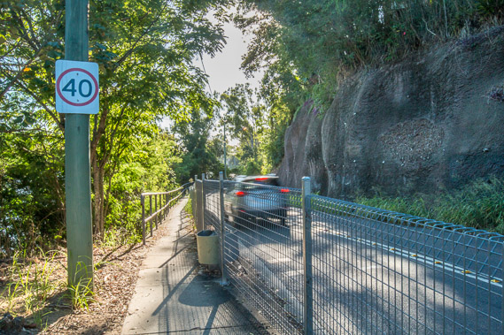
17:14 - The track heads inland over a peninsula crossing the main motorway from the city heading out to the western suburbs. This road will reach the Centennial Bridge where I am currently aiming for sunset. |
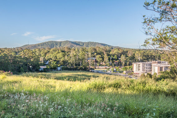 |
17:38 - Before reaching the bridge, the track continues heading up the hill to this nice viewpoint of Mount Coot-tha, the main hill at the end of the D'Aguilar Range just above the city. The city lookout is to the right end of the top of the hill. I'm now about thirty kilometres inland and climbing hills - hardly a "coastal walk" now. |
 |
18:02 - From the viewpoint the road continues through tall open eucalyptus forest following the top of another peninsula. A sunset over the river is now eluding me. |
 |
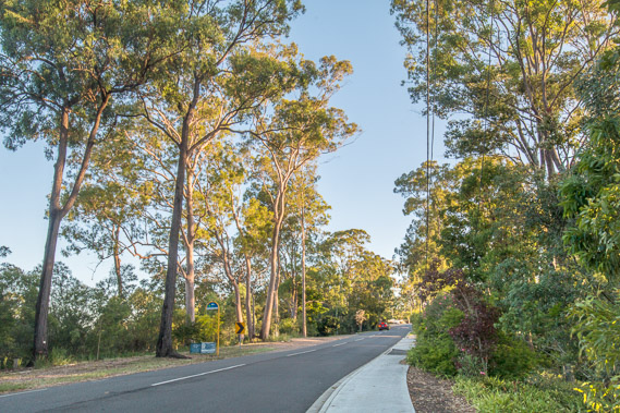
18:27 - Fortunately the road does eventually reach the river near the Centennial Bridge with the sun still hovering above the horizon. When Brisbane was first settled, the riverbank would have looked like this with tall eucalyptus trees and thick vegetation encroaching over the wide banks on either side. |
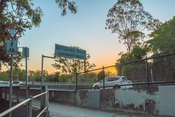 |
18:29 - The track goes up onto Centennial Bridge. |
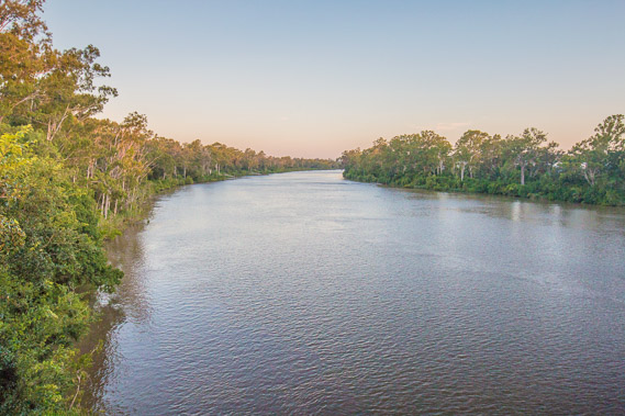 |
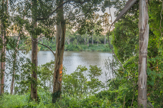
18:30 - I head part way along the bridge out into the river. The forest on either side shows what it would have looked like before settlement. |
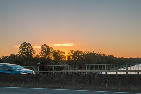 |
18:34 - The sun sets undrammatically over the other side of the bridge. Unfortunately there is no walkway on the other side to give me a clearer view of the sunset over the river. From here I return to the northern bank of the river where I had started crossing the bridge, as I'm planning to head further upstream. |
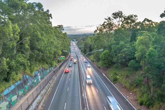 |
19:16 - I head back up the hill and cross the motorway over a road bridge. The Centennary Bridge is visible further down the road. The forest is so thick you can't see the river. I continue following the road further up into the hills. |
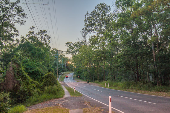 |
19:34 - At last light I'm still following the road as it climbs over hills through the forest with no views of the river. After a couple of hours I stop somewhere in Pinjarra Hills knowing I'm not going to see any more of the river tonight. |
|