This week in South East Queensland
31 December - 6 January
WITH a week of recovery after Christmas, New Year is another big celebration here in Australia (and all around the world). Officially marking the summer solstice (even though it happened nearly two weeks ago), it is time for everyone to gather and watch the fireworks at Southbank and make all those well intentioned New Years Resolutions to completely change your life for the first couple of days of the new year before we all slip back into our old habits again. This week also marks the perihelion, the closest Earth gets to the sun in its slightly elliptical orbit.
Today's trek takes me from Southbank heading further downstream around the Kangaroo Point Cliffs before passing residential areas then onto the start of the Port of Brisbane at the Gateway Bridge.
Today's Journey
Distance hiked today: 28.0km
Total distance hiked to date: 535.7km
 |
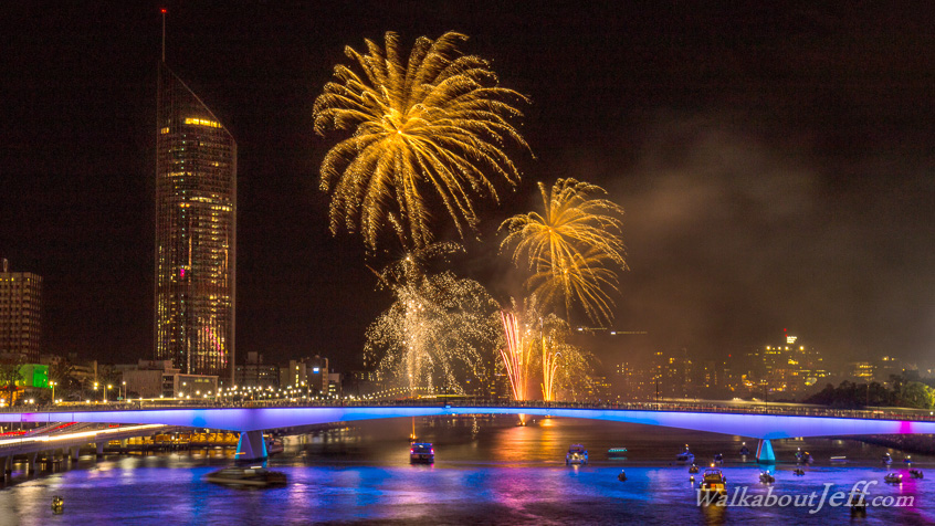
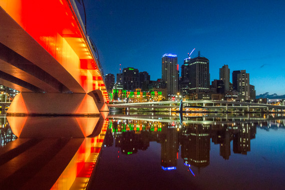
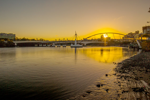
00:02 - The new year comes in with a bang. Looking over Victoria Bridge from the top of the Kirilpa walking bridge. |
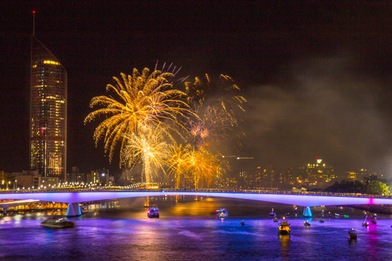 |
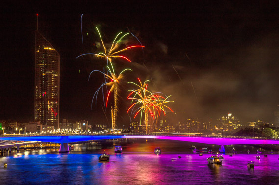
00:06 - Brilliantly coloured pyrotechnics fire off for several minutes leaving a cloud of smoke slowly drifting to the south. The new year has arrived. This is one of serveral fireworks displays to go on the Brisbane River each year whenever the city is celebrating The other major event is Riverfire which occurs in September. |
 |
02:42 - The crowds quickly clear from the Kirilpa Bridge as I begin to head back onto Southbank. |
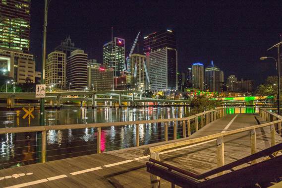 |
02:55 - The boardwalk heading into Southbank now very quiet with the crowds gone. |
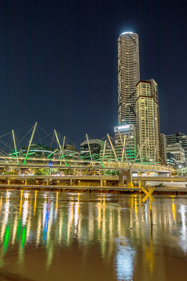 |
03:07 - Looking back on the Kiripla Bridge with its high rises looking over it. |
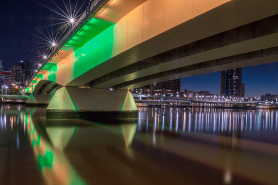 |
03:54 - Crossing under the Victoria Bridge as first light begins to show on the north eastern horizon. |
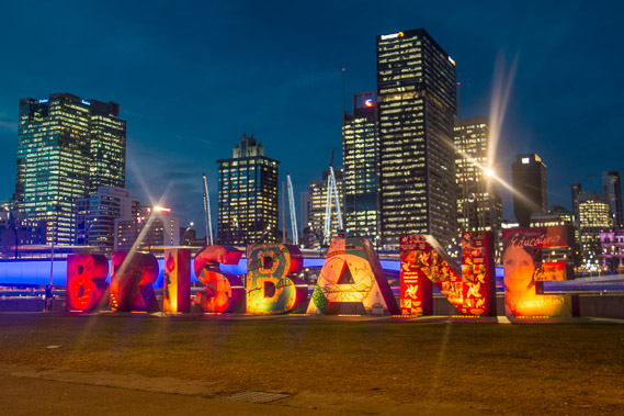 |
04:05 - The big Brisbane sign on Southbank just downstream from the Victoria Bridge. |
 |
04:22 - The light of dawn appearing over the city. Time to start heading downstream. |
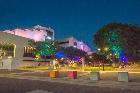 |
04:31 - The Southbank cultural centre, the hub of stage performances. |
 |
04:41 - The sky quickly lightens over the city on this perfectly still, humid morning. |
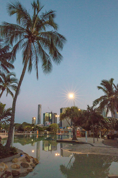 |
04:47 - Southbank pool very quiet now all the revellers have gone home. |
 |
05:04 - The sun quietly rises above the Kangaroo Point Cliffs through the Goodwill Bridge ten minutes after sunrise but few cyclists and pedestrians cross it this early in the morning. |
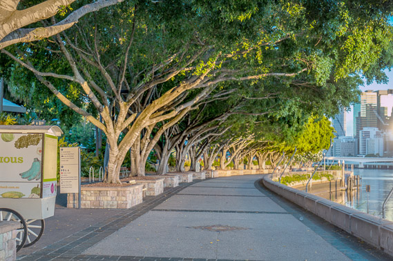 |
05:09 - The path above the river with the trees capturing the first rays of sunlight. |
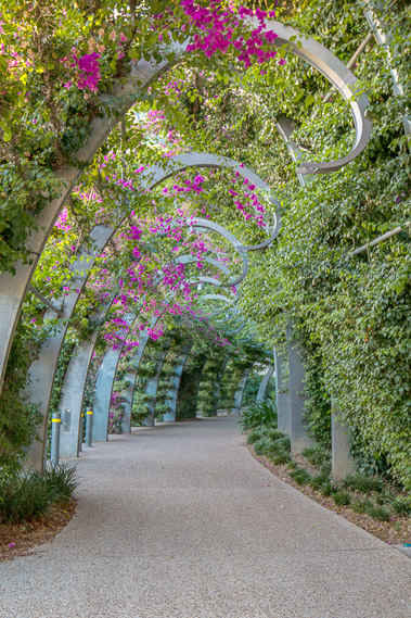 |
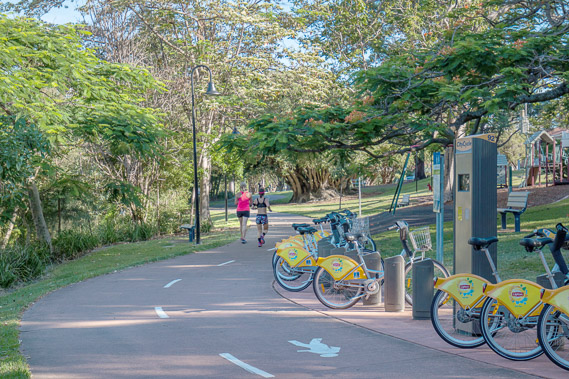
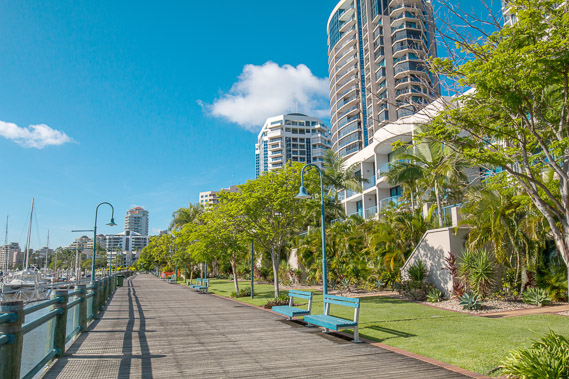
05:20 - The beautiful kilometre long bougainvillea walk winding its way along the length of Southbank. |
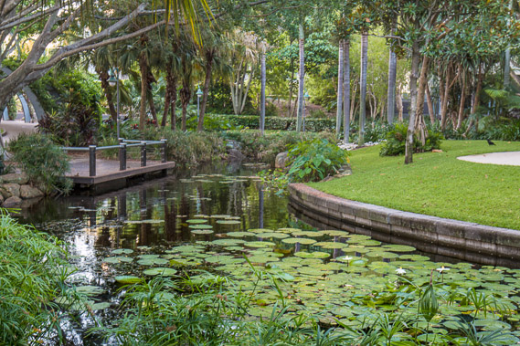 |
05:31 - A peaceful pond along the bougainvillea walk. A few early morning runners are making an appearance now. |
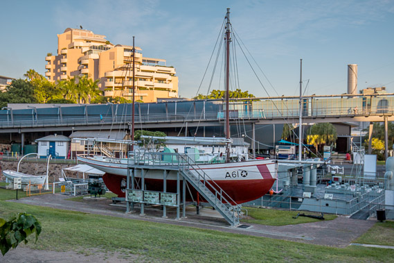 |
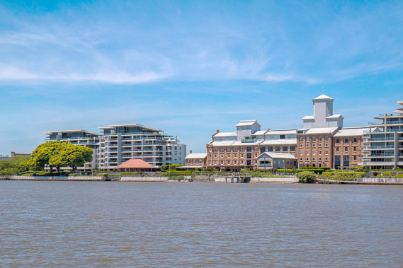
05:40 - Returning to the river at the maritime museum with the Goodwill Bridge rising on the other side. Southbank was once a substantial port where freighter ships would dock and unload. Much of what is now Southbank Parklands was a large railway yard from where the freight would be distributed around Queensland. The port and railway yards have long been abandoned and moved to near the mouth of the river, where I'm heading towards. |
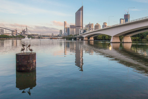 |
05:45 - An old pier pile with metal sculptured pelicans, and the Captain Cook Bridge on the other side bringing traffic from the southside into the city. The pile is one of very few remnants left of the port. |
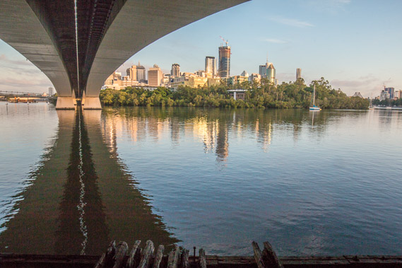 |
05:49 - Under the Captain Cook Bridge looking over the Gardens Point Botanical Gardens I walked through just a few days ago. The city towers over the gardens on its narrow peninsula around which the river turns 150 degrees. |
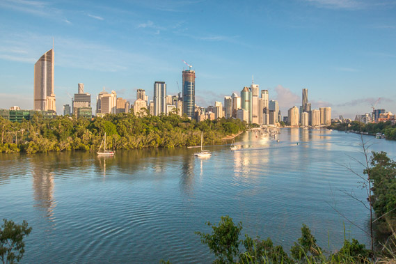 |
06:04 - View of the city from climbing the steep stairs on the downstream side of the Captain Cook Bridge. I'm now on top of the remnant volcano through which the river has carved its path through, creating a spectacular vista. |
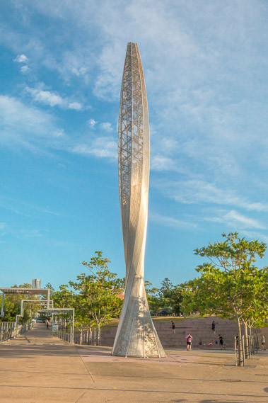 |
06:18 - Venus Rising sculpture on top of the Kangaroo Point cliffs, acting as a portal between the sea and and the sky at the eastern end of the park. |
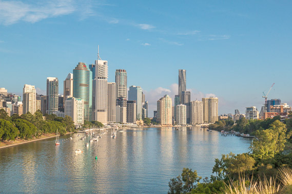 |
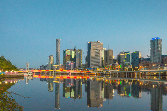
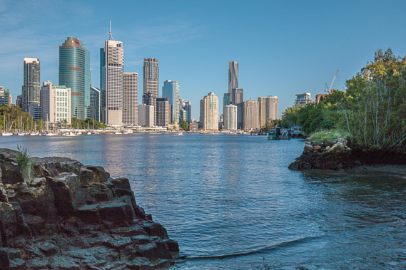
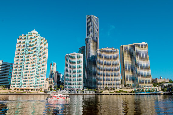
06:37 - Classic city view with morning light on the high rises reflected in the ruffled river. Boats sit quietly moored beside the botanical gardens. |
 |
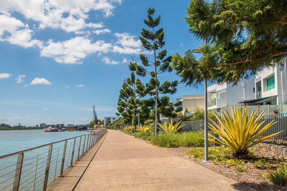
06:57 - Back down the river level at the start of the Kangaroo Point cliffs walkway. A new 90 storey residential tower is going up soon to become Brisbane's tallest building. The view from the crane would be amazing. When I first moved to Brisbane in the late 1990s, the tallest buildings were only forty storeys high. This young and vibrant city is ever changing as it grows. |
 |
07:05 - Following the river downstream to an old overgrown stone wharf from there the rock quarried from the cliff was transported across the river for the convicts to build the older buildings. |
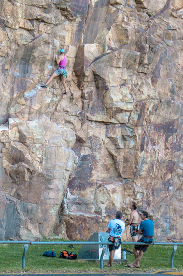 |
07:07 - Climbing the Kangaroo Point Cliffs, the remains of the old quarry where the very hard volcanic rock was extracted. The quarry is long gone, but left is a long line of vertical cliffs popular with local climbers. |
 |
07:34 - The little port of the old quarry. From here the extracted blocks of volcanic tuff were transported across the river to build the government buildings, most of which still stand. |
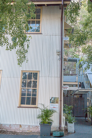 |
07:45 - Old building beside the river showing the levels of the 1974 and 1883 floods. The Wivenhoe Dam was built in the late 1970s to ensure water levels never get this high again. |
 |
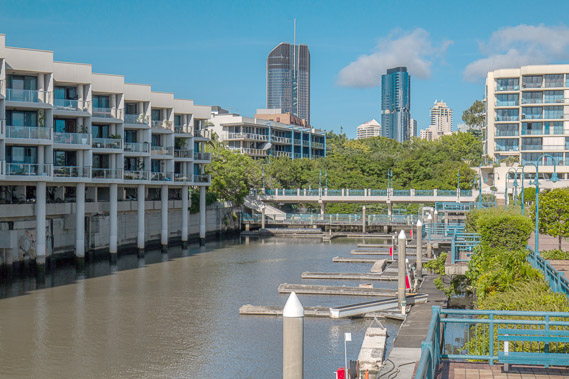
07:50 - One of numerous jetties along the river with the buildings gleaming on the other side. These jetties are remnants of the old port running along the length of this side of the river, but are used mostly as observation points along the walkway and for the occasional mooring of pleasure craft. |
 |
08:00 - Heading into the Kangaroo Point parklands. I'm assuming the point was named for the kangaroos which once occupied it. There are no signs of kangaroos now. Perhaps though this is a reflection of the real meaning of kangaroo - which is "I don't understand". |
 |
08:14 - Looking across the river to the towering blocks of apartment buildings. |
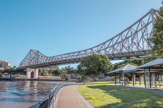 |
08:15 - The Storey Bridge at the end of Kangaroo Point spanning across the river. A walkway on the far side of the bridge allows access across the river, but you would have to walk back quite some distance behind here to access the watlkway. |
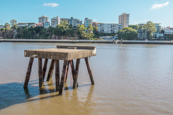 |
08:27 - An old port crane foundation still left from the old port. Now it is a disused structure still standing in the river near the Storey Bridge and surrounded by residential apartments on both sides of the river. |
 |
08:46 - Pleasant parklands down the other side of Kangaroo Point with the cliffs just a couple of hundred metres inland. Under the bridge, the river turns a full 180 degrees to go in the opposite direction downstream. |
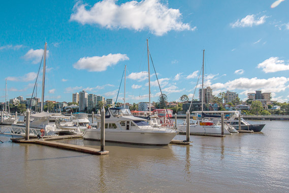 |
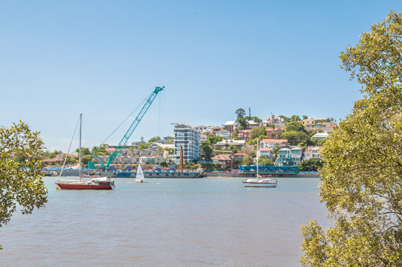
08:59 - Kangaroo Point marina, where yachts sit moored in the dirty water of the Brisbane River as it quickly fills with the incoming tide. |
 |
09:26 - The old dry dock now with apartments over it. The inner city appears to be just behind the apartments but that is because the river has spun around 180 degrees. |
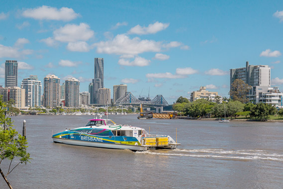 |
10:44 - The track heads inland for a little while before returning to the river about half a kilometre upstream at Norman Creek. A citycat heads past on its way into the city. The tide is very full now. |
 |
12:51 - The track heads inland for some distance going over a hill and returns to the river at Hawthorn Park, from where I can see the old warehouses of New Farm. The tide is very full, almost flooding the park on this side of the river. |
 |
13:46 - The track continues following the river downstream passing residential apartments of Bulimba towards the next bend opposite where Breakfast Creeks comes out. |
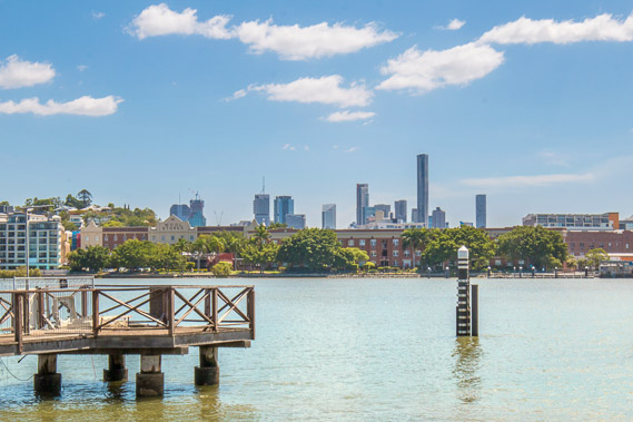 |
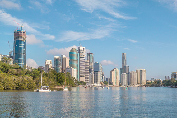
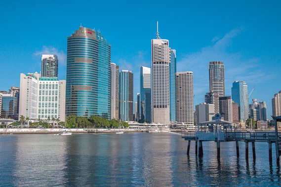
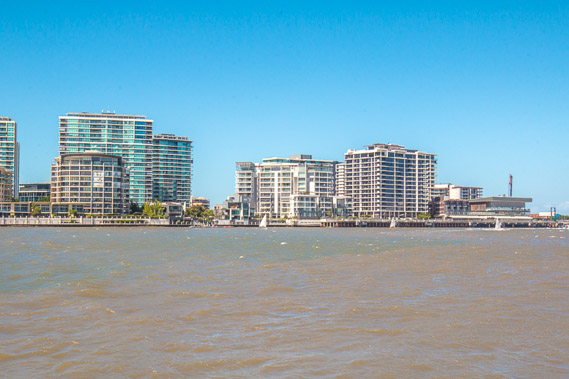
13:51 - View of the city over New Farm from a jetty. The river is getting very wide now and the city centre more distant. |
 |
14:09 - At the end of the point looking across to Hamilton and the new road being built on the river. |
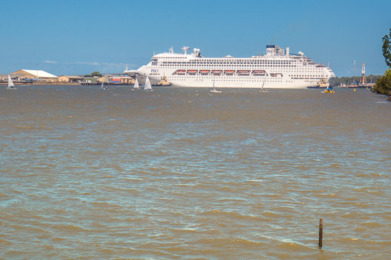 |
14:31 - Reaching a short wharf from where I see a cruise ship being tugged out and turned around at the start of a voyage across to New Zealand. |
 |
14:32 - The cruise terminal I had passed several mornings ago from where the ship has just departed. |
 |
15:19 - From the wharf the track heads inland to a major road going 0ver a couple of hills around a large naval base. Towards the end of the base the road crosses a canal draining into the river. |
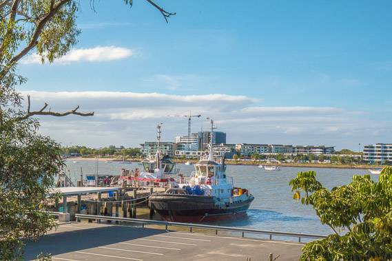 |
16:18 - Reaching the river again where the tug boats are docking after having successfully launched the cruise ship down the river and now heading out into Moreton Bay. |
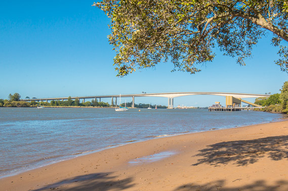 |
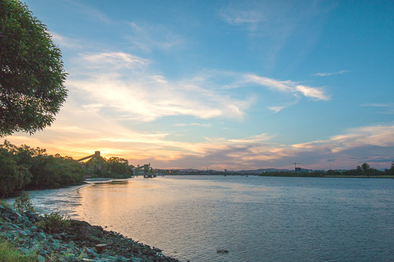
16:25 - At the beach with the Gateway Bridge towering high above the river. |
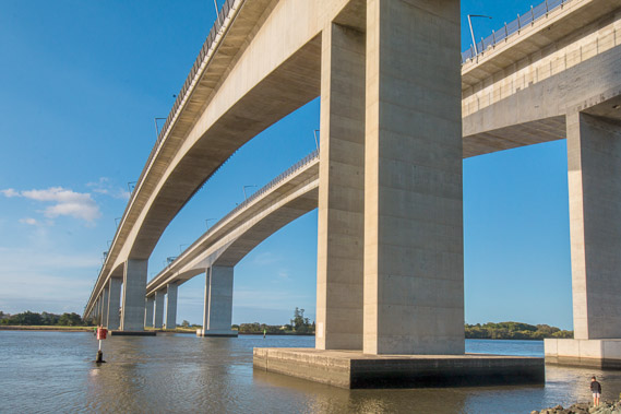 |
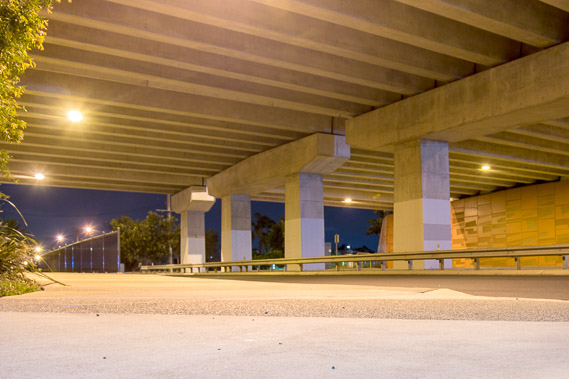
17:39 - The track goes under the enormous bridge. This was a tricky design problem as it had to be high enough for large cruise ships to clear at high tide, but not be any more than 65 metres high due to its close proximity to the airport with the runway just a couple of kilometres away. |
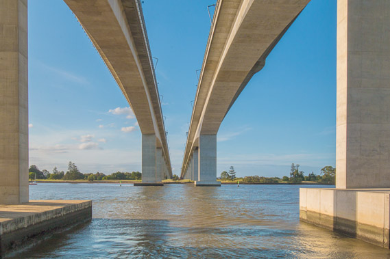 |
17:44 - There are two bridges. The original Gateway Bridge to the left was opened in 1986. The other was built in 2010 to cope with the heavy traffic. It was renamed the Sir Leo Hielscher Bridge, but locals still call it the Gateway Bridge. |
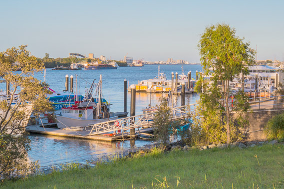 |
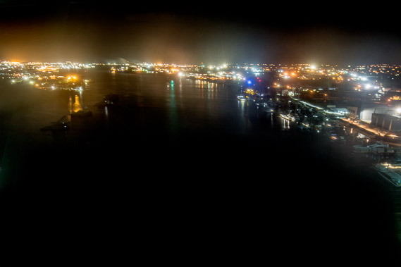
18:18 - Small port just downstream from the bridge. This is where the citycats are moored at night. |
 |
18:47 - The sun sets. |
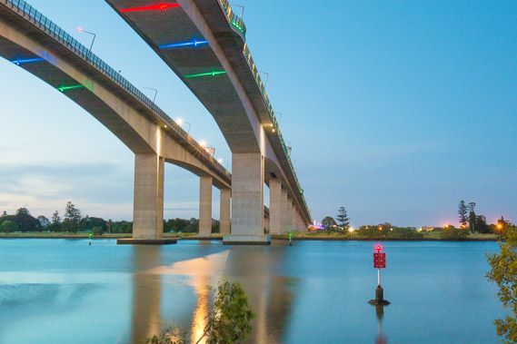 |
19:17 - The navigation lights come on under the bridge. |
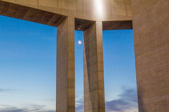 |
19:27 - The moon between two of its surprisingly narrow columns. |
 |
19:41 - Darkness falls leaving only the purple halo of the northern suburbs. The longest span of the bridges stretches 260 metres between their concrete posts, the longest concrete span when the first bridge was opened. |
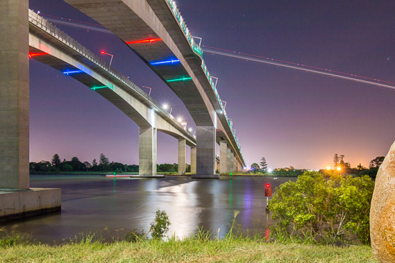 |
19:52 - Long exposure shot of the trail of an A380 taking off from the airport at the start of a 14 hour flight to Dubai. The traffic roars as it continues heading over the bridge. At the time the first bridge was built, this was the world's longest concrete span. |
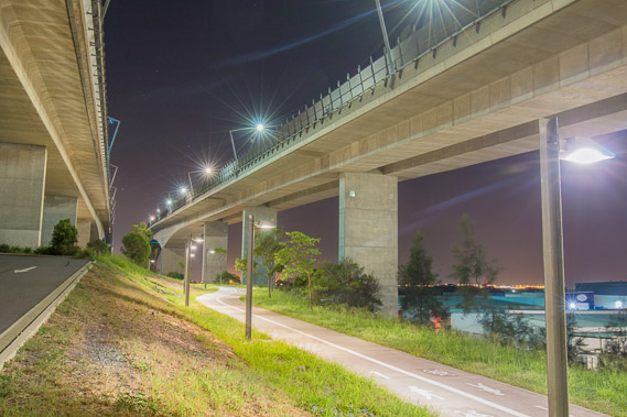 |
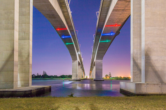
20:44 - I continue following the track going between the spans of the bridge. |
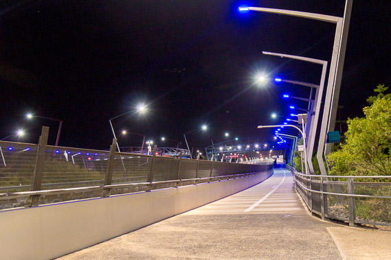 |
21:02 - Eventually the walkway joins the bridge bikeway. I follow the walkway towards the top of the bridge. |
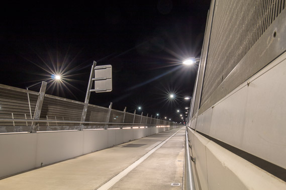 |
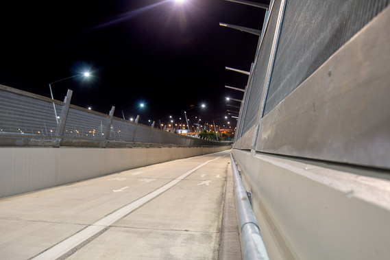
21:09 - This reminds me of being in a maximum security prison. The high fences were built after people started jumping off the bridge into the river. |
 |
21:14 - Unfortunately this maximum security look means looking through very thin bars most of the way up. |
 |
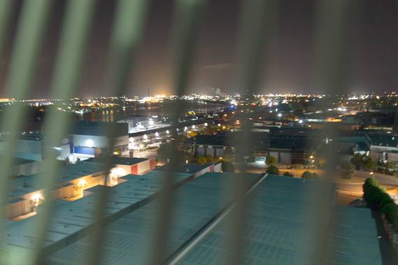
21:24 - The only break from looking through bars happens through a very dirty perspex window dirtier than the windows of a Pyongyang hotel, giving terrible photos. |
 |
21:33 - Eventually I reach the top and continue heading down the other side of the long bridge. |
 |
21:55 - I finally reach the other side of the bridge, where I stay nearby on my final night on the Brisbane northside. |
|