--- Archive files ---
Home > Treks > Stewart > Day 3 > 3.1 |
Walk beside the Inlet
The morning dawned cold and overcast. The house where I was staying didn’t have heating, so it felt very cold. Well to me it did anyway. Then again this was the middle of summer so this must be quite warm for the locals here in Stewart Island.
Towards the head of Patterson Inlet |
After breakfast I put on my polar fleece top and headed outside. I had another tour later today with the same guide I had yesterday but I was not due to meet her until lunch time. That gave me the morning to explore this end of Patterson Inlet.
I walked down the road to the main village before walking along the road that we had taken to the wharf to get the boat to Ulva Island yesterday. The moderate wind was damp indicating rain was near. Lucky I had my parka in my day pack.
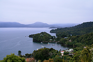
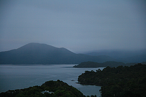
Patterson Inlet |
At the top of the hill there was a small lookout. From there I had sweeping views over the steely greyness of the huge inlet. A range of coal coloured rolling hills framed the other side of the inlet in the distance. To the left the low standing Ulva Island swept across the middle of the inlet. The island was completely covered in thick forest with just a few thin strips of golden beach at the waterline. Looking to the right the cloud and rain mist was sweeping down onto the distant hills of the remote Southern Arm.
Below me the small bays swept along the quiet coastline. Small houses were dotted amongst the otherwise unbroken native forest which almost touched the water.
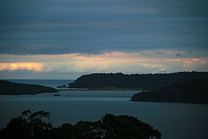
Mouth of Patterson Inlet |
Looking left I could see to the narrow entrance of Patterson Inlet. It was still overcast in that direction, but the distant clouds were orange from where the sun was shining on them. It must be a bit clearer out in that direction.
I continued walking down the road from the lookout until eventually reaching the start of a track. I climbed over a pig style and started following a track leading through the thick rainforest.
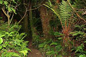
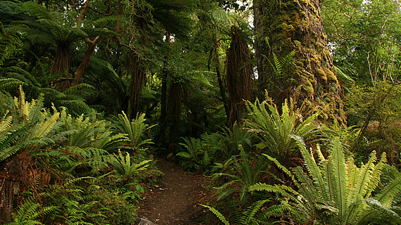
Trail through dark forest |
It had been rather dark under the thick cloud, but the thick cloud forest with an undercanopy of tree ferns made for a surprisingly dark walk. It wasn’t as dark as night, but it was definitely dark.
There were a lot of birds here though. Not as many as in Ulva Island, but they were definitely prevalent here. Amongst the birdsound I recognised the distinctive chirping of the tiny rifleman, which had made its way here from Ulva Island.
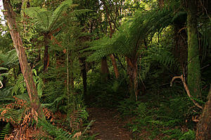
Trail through dark forest |
The narrow boardwalk created easy access across what could have otherwise been a rather muddy path. It had been well maintained with the thick vegetation cleared on either side. Ferns covered the ground under a middle canopy of tree ferns with crowns just above my head. Taller trees with epiphytes covering their trunks rose to seal off much of the dim light of the overcast morning.
The boardwalk turned to steps in the steeper sections. Most trees were fairly short but occasionally I saw an enormous tree that would have been thousands of years old.
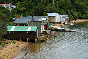
Boat sheds |
The track looped at the back of the gully and returned to where I started. From there I continued walking down the road passing a small bay where several boat sheds sat about a metre above the rippled waters of Patterson Inlet. They were all fairly crudely built from leftover building materials perhaps not taken back to the mainland after houses had been built here. Although they were a bit rugged, they had a lot of character to them, as did everything else here so it seems. The bay was set deep at the back of a side channel at the side of the inlet.
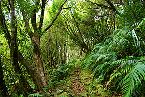
Forest beside the inlet |
Eventually the road ended at another pig style. I climbed over it at the start of a long track running along the edge of the Patterson Inlet. The trail here was quite rough, with its surface covered in the small roots of the surrounding trees making for a slippery surface to walk upon.
After about half an hour I crossed a small bridge going over a small bubbling stream. The stream drained into a sandy channel going out into the inlet. From there the undergrowth roughened and the track turned to boardwalk to avoid the mud that otherwise would be churned up here. The small inlet channel was crystal clear and mirror smooth.
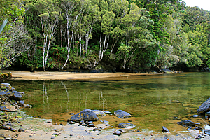
Crystal clear waters of Patterson Inlet |
From here the forest became very scrubby. There had once been a great forest here, but some time ago the timber had been milled to build the town that was now far behind me. Otherwise it was very remote and lonely here. There were occasional views through the scrub out into the enormous grey inlet. The distant hills at the far end of the in inlet were still shrouded in veils of misty rain, but it was still dry here. There were numerous small islands sitting offshore from the headlands further up the coast.
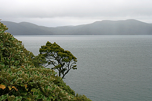
Patterson Inlet |
Eventually there came a point where I had to turn back. I could have walked for hours on end, but I had to return to the town to catch a plane to the other side of the island, ironically in the direction I had been heading all morning so far.
I returned to the road and followed it over the top. I found another short track and followed it. The forest here was amazing with magnificent tree ferns. The entire track was well constructed boardwalk with bird netting covering the wood to prevent slippage.
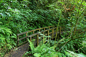
Bridge in the forest |
Steps led down steeply into the gully where a small bridge crossed a stream. The ragged orange trunks of tree fuchsia draped low overhead having fallen under their own weight, or perhaps by one of the many ferocious storms that regularly hit here. The papery bark hung off the trunk in shreds.
A small friendly fantail followed me closely. My walking motion passing the ground ferns disturbed the insects giving the fantail a free meal.
The track reached a road at the bottom of the gully. I walked along it until eventually reaching the town centre. From here I returned to the hotel to rest.
<< Previous | Next >> |
|
||
About this Page
|
||
|
|
|
Where is Walkabout Jeff? |
|
|

|
|
What is happening in Walkabout Jeff's hometown?
|
|
|

|
|
Who is Walkabout Jeff?Any normal person's idea of going out involves going to the local pub for a drink with a few mates. Walkabout Jeff isn't normal.
|
|
|

|
Follow Walkabout Jeff |
|