|
||||||||||||||||||||||||||||||||||||||||||||||||||||||
|
||||||||||||||||||||||||||||||||||||||||||||||||||||||
Home > Treks > Australia > Mount Kosciuszko > 1 |
||||||||||||||||||||||||||||||||||||||||||||||||||||||
|
||||||||||||||||||||||||||||||||||||||||||||||||||||||
Introduction to today's journeyWHEN the great architect, Sir Christopher Wren, was inspecting the building of St Paul’s Cathedral, he asked three masons in turn what they were doing. The first man said “I am earning a living”. The second man said “I am dressing stone”. The third man said “I am building a cathedral.” let us all, from the pick and shovel men to the top bosses, look at our work in the same manner that the third man did, keeping before us all the time that we are building the greatest work ever contemplated in this country and one which the Nation needs. - Sir William Hudson. Today's journey takes us from Canberra to Cooma on the southern highlands before heading up to Jindabyne where we explore the lake and the lower slopes of the Snowy Mountains. Today's JourneyDistance trekked today: 2.5 kilometres. Total distance trekked to date: 2.5 kilometres. AUSTRALIA'S greatest engineering success is hidden deep within its highest mountains.
Last night we arrived in Australia’s capital city. Canberra is a relatively small city nestled deep in Australia’s Great Dividing Range sitting about half way between Sydney and Melbourne. When the powers that be decided to join the colony states together into a single Federal Government, there was much discussion over whether it should occur in Sydney or in Melbourne. They realised it had to be neither, so a large plot of land was purchased in a valley in the Great Dividing Range where the government could be based. They named the city Canberra, after the local aboriginal word “meeting place”. There the Federal Government was established to unify Australia. This has been in place for over a century now, but there is still a long way to go.
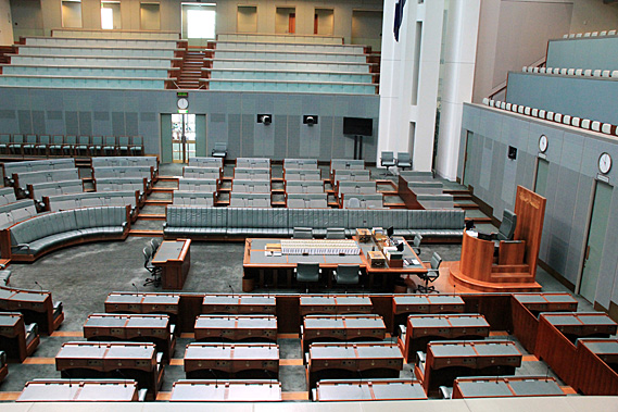
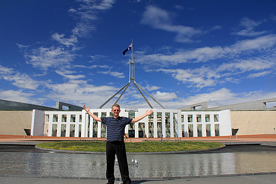
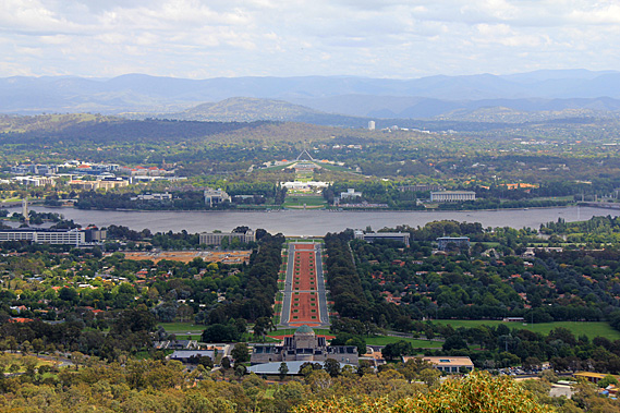
We started our trip exploring Parliament House, an enormously extravagant building set into a hill like a massively over-sided hobbit hole. No expense was spared here with the most decadent building materials that could be obtained were used for this 1.1 billion dollar extravagance to show off to the rest of the world. Following a tour around the building we climbed to the grassy hill on top of the building where a giant Australian flag was flying on top of a massive aluminium structure. The flag was flying at half-mast today as the Saudi Arabian king had died overnight.
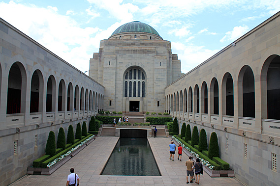
From the Parliament House we crossed over Lake Burley-Griffin to the Australian War Memorial, where the names of every Australian soldier killed in action had their names displayed along two very long bronze plaques on galleries leading to a central domed temple standing a Above a large pool where people were dropping coins in remembrance of those who fought other people’s wars. Below the memorial was a large museum containing all sorts of military artefacts and history, particularly covering World War 1 as this year was the ANZAC centenary. Behind the museum was Mount Ainslie. A memorial trail led the way to the summit. Along the way were a number of plaques covering different parts of the Kokoda Trail in Papua New Guinea. This was a significant part of Australia’s war history because it was there that the Australians defeated the Japanese who were on their way to invade Australia. This is one trail I’d like to attempt in future, but this weekend I had another one to do.
From the summit of Mount Ainslie I had clear views across Canberra with its sleepy city nestled in the valleys around the lake. Directly below was the dome of the war memorial with an avenue heading straight out across the lake to the massive Parliament House. Otherwise there was little in the way of high rise buildings. Black Mountain stood to the right with its spinning top style observation deck and communications tower standing alone at the top of the hill in the forest. Nestled in the valley between here and Black mountain was a cluster of five to ten storey government buildings where bureaucrats do the country’s rubber stamping and paperwork.
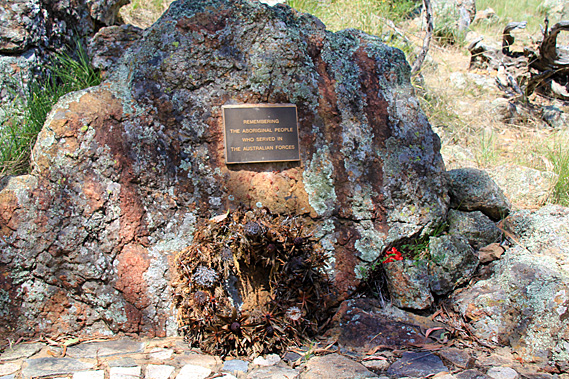
I returned down the trail to a small diversion at the end. I followed this diversion to a boulder with a small bronze plague simply commemorating the Aboriginal people who had lost their lives in the wars. It was very simple and separated away from the museum as if it perhaps didn’t even belong here. That seemed a bit weird to me as the Aboriginal people had lived here since a time before time. The Europeans settled here in 1788. The Aboriginal people arrived so long ago that no one knows for sure, perhaps around 50,000 years ago.
Some of the indigenous people had been sent overseas to give their lives to battles that had nothing to do with them. As I was soon to discover, they were a peaceful people with countless generations of history deeply ingrained in their relationship with the land. Here in the city it wasn’t apparent, apart from the clues of Canberra being named “the meeting place” (with a painting in Parliament House to reinforce it) and this most simple of memorials here at the base of Mount Ainslie.
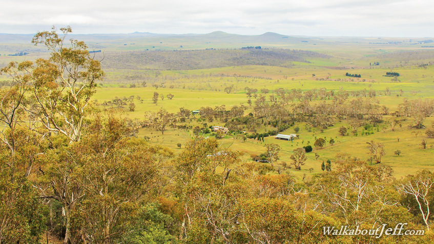
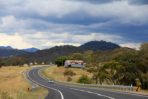
Cloud was already covering much of the sky when we departed Canberra heading southwards. We followed a valley running between mountains of the Great Dividing Range. The Great Dividing Range runs 3500 kilometres down almost the entire length of Australia’s East Coast from the sub-equatorial Cape York down to the sub-Antarctic shores of the Southern Ocean near Melbourne. We were a lot closer to the latter, in the highland temperate zones where exotic deciduous trees lined the avenues of suburban Canberra along with the native gum trees. It was not long though before the deciduous trees were behind us as we travelled through fertile farmland.
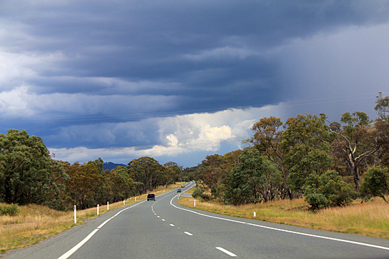
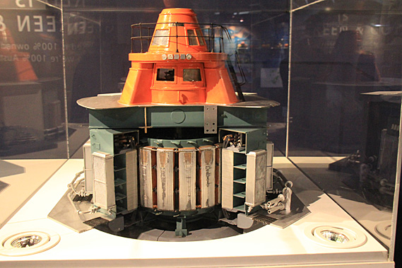
A summer thunderstorm was approaching. A blanket of rain was falling from the cloud. Gradually we got closer to it until the storm enveloped us. Heavy rain fell,, but only for a few minutes before we emerged out of the other side. Looking ahead, there was a much larger cloud bank with rain falling. The climb up the mountain tomorrow was looking doubtful. After an hour of travelling through remote farmland we reached the sleepy town of Cooma. At the entrance of the town was a large grey building, being the museum for the Snowy River Hydro Scheme. This was quite an eye opener for the recent history of this mountainous area.
Most of Australia’s electricity is generated by coal fuelled power stations. In a couple of short centuries we are burning up all the deposits of swamps that had been deposited over the past 500 million years. This is hardly a picture of sustainability. We are introducing solar and wind power with very limited success. Before this, the only feasible source of renewable energy was through harnessing the power of water. New Zealand does hydro-electricity very well. I recalled entering the Manapouri Power Station several years ago. I had travelled about a kilometre into a tunnel through a mountain to the massive power station some 173 metres below a large lake. This was just one of many hydro-electric power stations in New Zealand. Most of Australia does not have the luxury of high rainfall or mountainous gorges as New Zealand does. Being the driest and flattest continent in the world doesn’t lend itself to hydro power schemes capturing the power of large rivers, so it was surprising that the largest hydro power scheme imaginable began construction in 1949 at a time when Australia was still recovering from the economic quagmires of two world wars and the great depression.
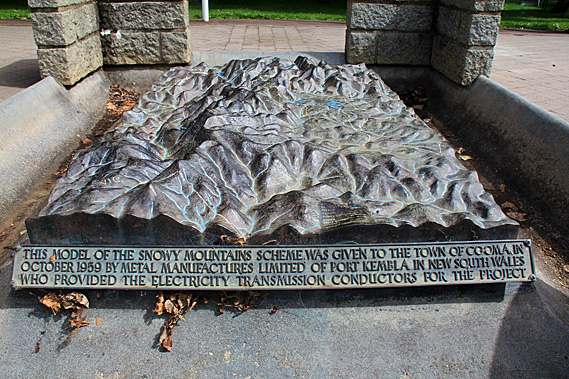
Tens of thousands of workers were hired from all around the world to settle in the area. Cooma quickly transformed from a quiet farming service town to one of the main centres. Several new towns were built from scratch and over a hundred temporary camps were established to house this huge workforce. Of the 100,000 people employed on the scheme, 60,000 came from 30 different countries from all around the world. The scheme is now recognised as the birthplace of multiculturalism in Australia. The scheme was led by New Zealander William Hudson. He was a man of high standards both for himself and for others, expecting complete dedication, loyalty and hard work. Through his strong leadership the project was successfully completed in 1974. The seasonal rivers that would normally dry up during the long dry spells began to flow permanently feeding a $3 billion dollar a year farming industry. 16 major dams, 1 pumping station, 145 kilometres of tunnels, and 80 kilometres of aqueduct had been constructed to produce 4,500 gigawatt hours of electricity per year. The lakes store about 7000 cubic kilometres of water between them allowing both irrigation and power generation to be consistent throughout the year.
Cloud seeding is used to further help the consistent supply of water. Minute concentrations of Silver Iodide is sprayed across a propane flame, rising into the clouds to cause moisture to freeze and create crystals large enough to fall as snow. Not only does this produce more water for the scheme, but it provides deeper snow on the mountaintops to benefit the rare pygmy possum which requires at least a metre of snow to protect it from predators during its winter hibernation. The cloud seeding also benefits the ski season tourism. In spring the snow melts providing more water feeding into the lakes for the power scheme. After the scheme finished in 1974, many of the workers stayed in the area. The country lifestyle was ideal for raising their families, so they maintained employment by buying shops and helping to start the fledgling tourism industry in this area. Many of the towns that were built for the scheme have continued to thrive to this day.
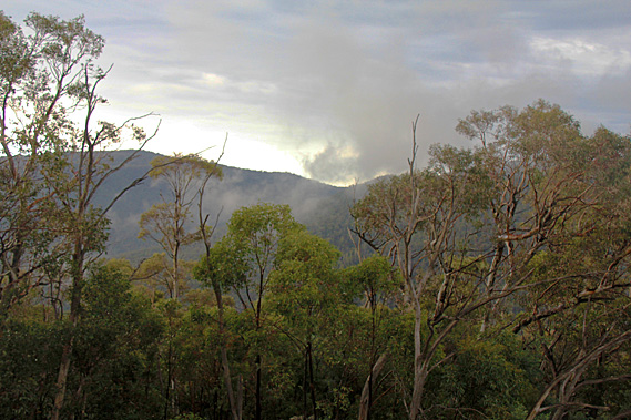
The Snowy Mountain Power Scheme is now one of the seven engineering wonders of the modern world. After exploring the museum, we passed through the sleepy town of Cooma continuing to head up towards the Snowy Mountains. The terrain suddenly became rougher with large outcrops of limestone remnant of a shallow ocean that covered this area during the Carboniferous period 350 million years ago before the Great Dividing Range was uplifted around 80 to a hundred million years ago. The mountains were very rounded and low due to 300 million years of erosion. We were close to a thousand metres above sea level and the scattered trees in the brown grassy paddocks became increasingly gnarly and windswept as we continued our approach to the Snowy Mountains. The storm was just beginning to clear when we arrived at our cabin beside Lake Jindabyne. It had completely stopped falling and the thunder could no longer be heard by the time we had settled into our cabin.
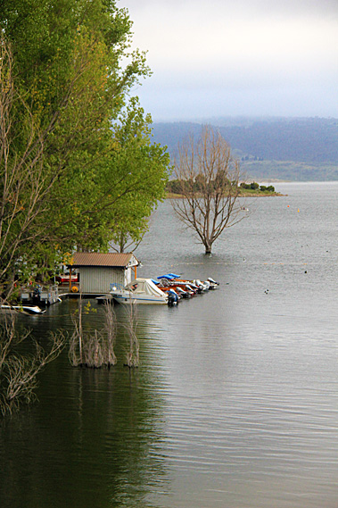
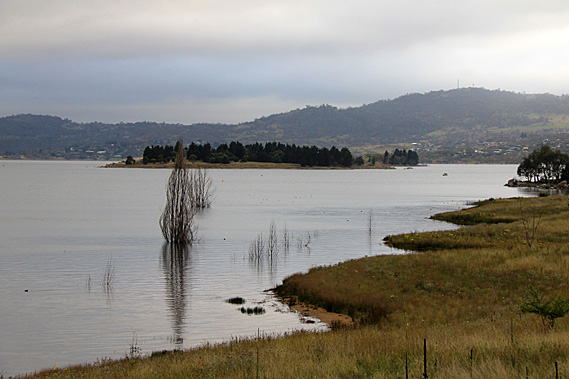
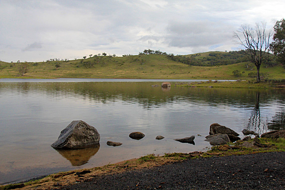
The air was a little chill, but that would be expected at this altitude of around 900 metres. The montane trees were different to those I was familiar with at lower altitudes. These were taller and gnarlier than I’m used to. The snow gums were exhibiting very beautiful colours. With the weather now clear we quickly explored the nearby lake. Some of the trees were growing in the water indicating the lake level was higher than usual. Perhaps this was a by-product of the spring melt. Maybe more snow had fallen in the mountains than usual. Several kilometres away the valley was blocked by the Jindabyne Dam which had been built as part of the power scheme in 1967. The town was originally a camp for the workers who built the town, but has since thrived as a tourist destination. Although this was clearly the off-peak, the town was still quite busy.
The town had to be relocated in the 1960s due to its original location getting flooded by the lake behind the dam. The town’s name is derived from the local Aboriginal word for “Valley”. The clouds were beginning to break. Hopefully this was a good sign that the mountaintops were going to be clear tomorrow. We decided to explore the area so we continued along the road towards Charlotte’s Pass. Almost immediately the farmland gave way to forest which covered the rolling hills. Cloud still draped the mountaintops keeping them elusive from view. The rugged snow gums were very colourful.
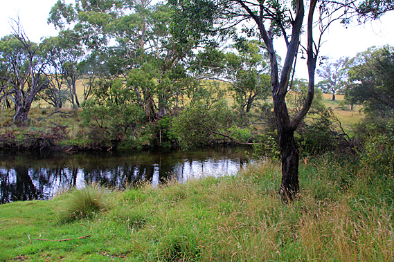
We turned off to the left into a small rest area at the Threadbo River just above where it meets the lake. We will be going up this valley tomorrow, but here there was a walkway which we started doing. The river silently sliced past the edge of the Threadbo River Picnic Area. The grassy patch was surrounded by the montane forest and low hills at the base of the Snowy Mountains. The Threadbo River follows a fault line from a place called The Big Boggy Plain quite some distance upstream. The fault line was created when the mountains were uplifted between 80 and 100 million years ago no doubt creating a spectacular mountain range which has now worn down.
The river valley served as an Aboriginal path to the high country for their summer ceremonies. People from different tribes near and far came here to the highest parts of the Snowy Mountains (which they know as Tidbillaga) for special ceremonies. This site marks one of their campsites they had used on the way to the mountains. The other local campsites are now submerged beneath Lake Jindabyne. The trails were also used for hunting and gathering food in the higher forests.
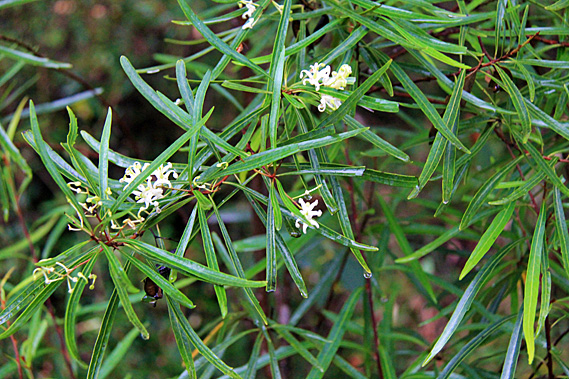
The herbs gathered from the high forests and alpine zone were considered to have particular spiritual and healing properties. Perhaps this was because they were growing in the realm of the spirit world, which the Aboriginal people considered to be on the mountaintops and in the skies above. The plants were brought back to their camps in the lower altitudes and planted in spiritual herb gardens they called Irramba. The Pallaibo Track began at the end of the river heading upstream. This would have no doubt been one of the original trails the Aboriginal people used to head up to the mountaintops. The track followed the river to Sawpit Creek 5.8 kilometres upstream. Darkness will be falling soon so there was nowhere near enough time to do the return trip.
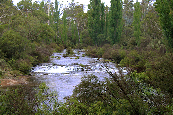
The river passing the picnic ground was deep and mirror flat, but a short distance upstream the water was shallow and cascading over rocks. The track was a bit rough negotiating its way through debris and terrain left by recent flooding. A burrow appeared by the side of the track perhaps dug by a rabbit or possibly by a platypus. The different animal species that live here inspire Aboriginal ceremonies, stories and laws. Few people know the stories in full. You have to earn the right for a senior tribal elder to tell such stories.
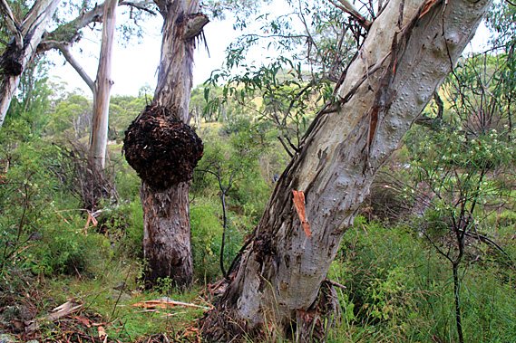
As people travelled across the land from tribe to tribe, they connected with the different groups, stories and ceremonies that were unique to each tribal group. The gum forest here was unlike any of the gum forests I’m familiar with around Brisbane. The species here were a lot tougher, built for the cool temperate summers and the snows of winter. At first glance all the trees appeared to be the same, but I quickly realised there were quite a few different species growing here, all different to those I was familiar with back home. Soon the valley began to close and limestone bluffs began to tower overhead. The track became rougher and the air suddenly dampened with the threat of more rain. I suggested we turn back.
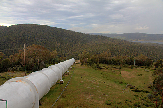
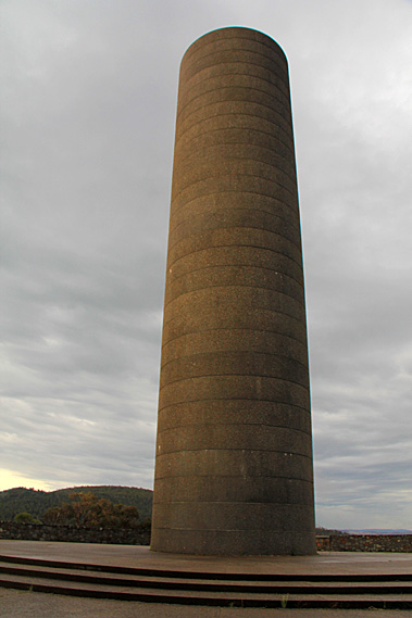
Upon reaching the car rain began falling just as I had expected. Did we just experience a temporary break in a large weather system that was closing in again to threaten our climb tomorrow? From Threadbo River we continued following the surprisingly well maintained road ascending higher into the mountain. It was not long before we could see the lake sprawled out below us. Rounding a corner there suddenly appeared a tall cylindrical chimney-like structure at the end of the spur beside the road. We continued a short distance further up the road before realising we were heading towards a toll booth near the ski fields. We turned back and stopped at the cylindrical tower.
The tower turned out to be a pumping station surge tank. From the surge tank a large white pipeline headed down the mountain to the Jindabyne Pumping station. During off-peak periods, the excess electricity generated by the scheme is sent to the pumping station to pump water to the nearby Geehi Reservoir. When water is needed from the reservoir, the pump is turned off and water is allowed to naturally flow down the mountain through the pipe. The surge tank helps regulate the flow of water between the reservoir and the pumping station especially when the direction of the water changes.
In front of the surge tower was a lookout over the Snowy River across the forested rolling hills gradually rising to the tops behind. By now it had stopped raining but there was still a lot of cloud around. Lake Jindabyne filled the valley below. Long headlands and small islands spread out intermittently across the lake towards the barrier of a low range of hills on the other side. Looking directly in front of me, giant granite boulders stood amongst the ancient montane gum forest. Behind us the rounded mountain continued rising towards the alpine zone. With increasing altitude the trees become smaller as the climate gets colder and wetter. Eventually at around 1850 metres it becomes too cold and wet for the trees to grow at all. Wisps of mist began rolling down over the nearby ridges and large drops of rain began falling again, so we returned to the car and continued heading down the hill.
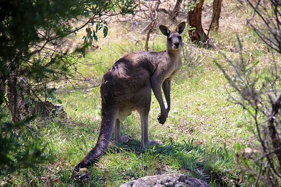
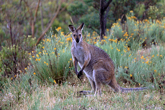
We turned off the main road along a side route towards the lake. Almost immediately we began to see large number of large kangaroos grazing on the grassy verge along the side of the road. These crepuscular animals were making the most of the cool of the evening. I had never seen so many large kangaroos in one place before. The grey kangaroos watched us closely as we cautiously passed them. We didn’t want to hit them. Such a large animal could cause a lot of damage.
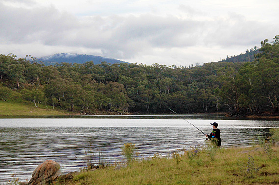
Eventually we reached the lake. The water was almost mirror-smooth. Only the slightest ruffling in the water blurred the reflection of the low hills draping the other side. A kangaroo was lurking in the forest above the lake’s edge. Upon seeing us it fixed its gaze for a few moments before hopping off through the grassy forest. We walked around the edge of the lake to a low point where several large boulders stuck out of the water lapping at the grassy edge. It seemed the water level was rising from the recent rain. Just around the point a young man was fishing in the peaceful solitude.
Upon leaving the lake we encountered a lot more kangaroos foraging the grassy undergrowth. Some just stood there watching us go by. Others hopped away bounding effortlessly balanced by their powerful tails. When Australia separated from the other continents the mammals evolved independently. One unique characteristic kangaroos have is the way they travel by hopping on their powerful hind legs. Most other mammals walk or run on four legs. The kangaroo’s hopping seems to be more efficient, allowing them to jump over uneven terrain. The sun was setting as we arrived back in Jindabyne. A brilliant yellow sunset asserted the end of the day. Will this mean rain or sunshine for tomorrow’s attempt at scaling Australia’s highest mountain? Only time will tell. |
||||||||||||||||||||||||||||||||||||||||||||||||||||||
|
||||||||||||||||||||||||||||||||||||||||||||||||||||||