|
||||||||||||||||||||||||||||||||||||||||||||||||||||||||||||||||||||||||||||||||||||||||||||||||||||||||||||||||||||||||||||
|
||||||||||||||||||||||||||||||||||||||||||||||||||||||||||||||||||||||||||||||||||||||||||||||||||||||||||||||||||||||||||||
Home > Treks > Australia > Sunshine Coast Hinterland > 3 |
||||||||||||||||||||||||||||||||||||||||||||||||||||||||||||||||||||||||||||||||||||||||||||||||||||||||||||||||||||||||||||
|
||||||||||||||||||||||||||||||||||||||||||||||||||||||||||||||||||||||||||||||||||||||||||||||||||||||||||||||||||||||||||||
Introduction to today's journeyOur spirituality is a oneness and an interconnectedness with all that lives and breathes, even with all that does not live or breathe. - Mudrooroo. Today's trek departs the Ubajee walker's camp returning towards the start of the track but diverting into the Linda Garrett Reserve to Mapleton Falls and descending deep into the next gully to Baxter Creek Falls before ascending the other side to Flaxton Walkers' Camp. Today's JourneyDistance trekked today: 13.1 kilometres. Total distance trekked to date: 38.8 kilometres. DENSE rainforest jungle had once covered the valleys along the coast and hinterland. Eucalypt covered the drier exposed ridges and inland forests. Much of this was lost with the arrival of the white settlers who cleared much of the land for timber, agriculture, and the development of the rapidly expanding towns and cities. It became apparent that these vast tracts of rainforest were going to be lost forever, but fortunately some dedicated conservationists stepped in to create the national parks and reserves that remain preserved to this day and beyond.
The morning dawned clear at Ubajee. Before breakfast we walked out to the lookout. There was a thin layer of low scattered cloud overhead but otherwise our final view back down the Gheerulla Valley was very clear this morning. The cloud was quickly moving from the south east though, so more rain could be on the way. I returned to the campsite where the sun was filtering through the trees overhead. Thankfully our tents were completely dry this morning, unlike yesterday when they had been damp when we rolled them up. The bellbirds were making their eerie sounds this morning. I had not heard much birdsong over the past two days in the Gheerulla Valley. The birdsong, even with the unusualness of the bellbirds, was a welcome morning sound.
Today we will return to almost where we had started the other day before turning off and heading down a southward direction leaving the Mapleton National Park, then passing through the much smaller Mapleton Falls National Park, before descending off the plateau into Baxter’s Creek. There we will enter Kondalilla National Park before climbing the ridge to the Flaxton Walkers’ Camp. We had plenty of time and were in no great hurry to set off, so we cooked a nice breakfast at the campsite. The couple in the other tent were just getting up now and will be returning to where they had parked at Mapleton Falls. Before hiking back though, they will be heading down to Gheerulla Falls, the little trickle we had seen running down the rock face yesterday. They set off just as we were packing our tents.
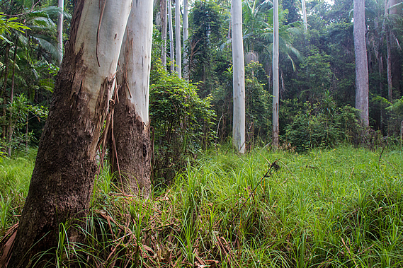
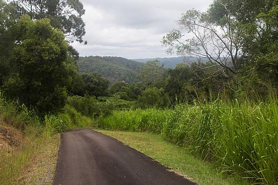
Fortunately the weather had remained dry last night, so the tents had completely dried out. This made for lighter packs today. Once packed up we headed out of the camp hiking back along Leafy Lane. It was very different today. The other day when we had been hiking along this section of track it had been misty and drizzly. This morning is was clear with the sun shining through highlighting the fresh summer growth of the gum trees.
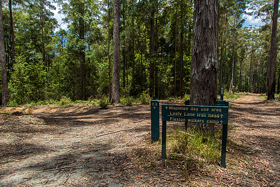
The air quickly warmed up as the summer sun climbed in the sky, but about two thirds of the way along the track the cloud overhead thickened. Nearly an hour had passed after leaving the campsite when we reached the junction just two hundred metres short of where we had started out two mornings ago. We had completed the backtracking and from now on we will be covering new territory.
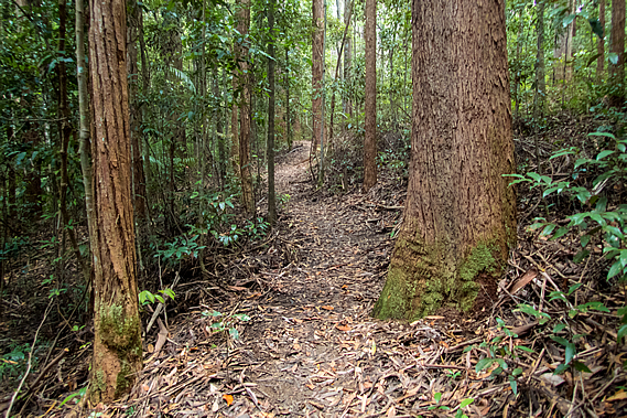
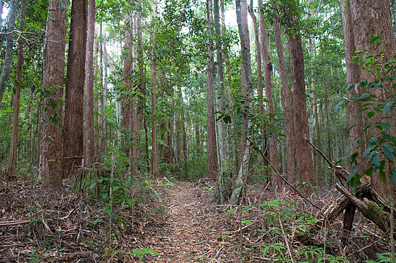
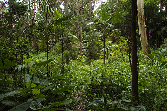
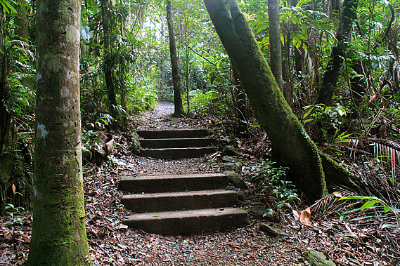
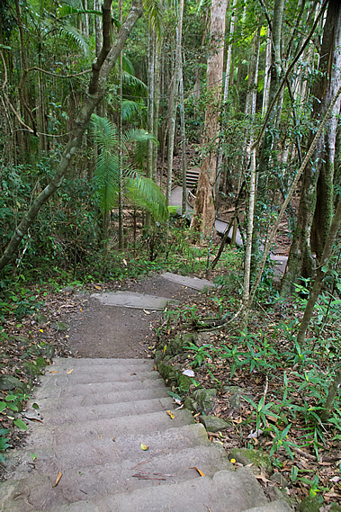
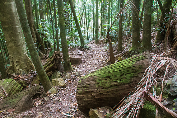
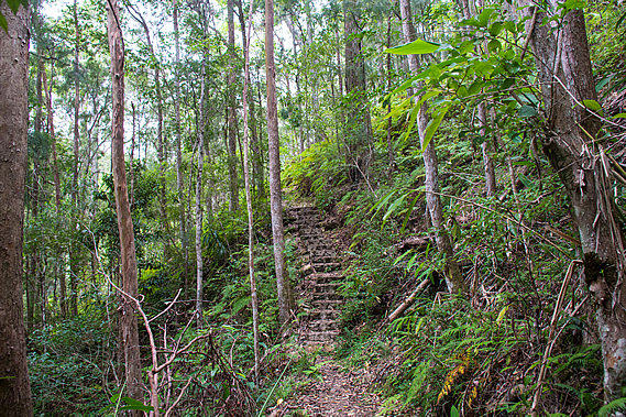
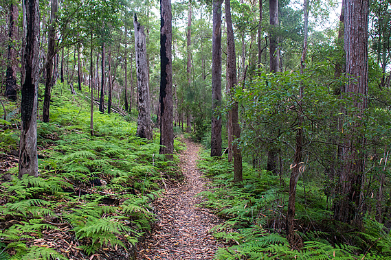
The narrow track headed off to the right of the main wide firebreak track into the Linda Garratt Reserve. Although fairly narrow, the track we were now following was very well formed descending through the thickening gum forest towards a gully of one of the tributaries of the Gheerulla Stream.
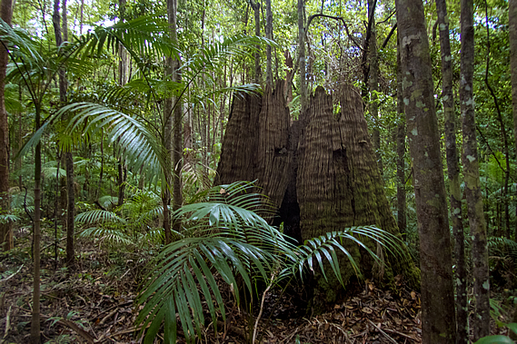
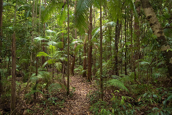
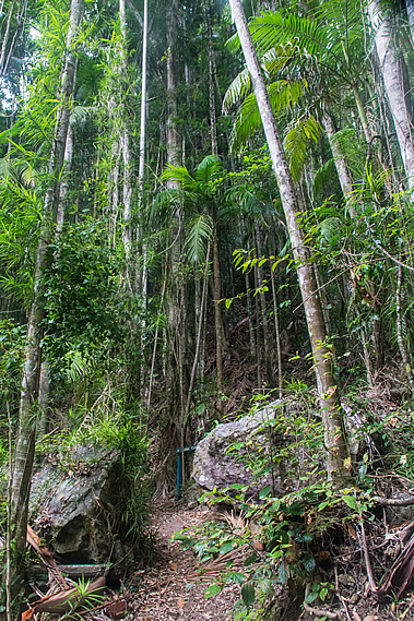
As we dropped altitude we entered a rainforest area of piccabean palms growing in amongst young trees. Scattered amongst them were the stumps of what had been enormous trees cut down during the logging days of well over a hundred years ago. Despite a century having passed, the stumps were still largely intact with the notches still cut in them from where small planks were placed to give the woodcutters enough height to cut through the trunk above the large buttress roots that supported the giant trees.
When the range was initially settled by Europeans, timber cutting was the main industry. The forests needed to be cleared to make way for the pastures of the farming industry which was to follow. Timber was needed to build the houses of the fledgling towns. The settlers saw the rainforests as a great source of timber. The enormous trees abounded plentiful so they were systematically cut down further and further away from the mills where the timber was processed. Eventually whole forests disappeared. Despite that, the Australian forest recovers quickly, so when the wood cutters left the forest began its quick recovery.
Although fully functioning, it will be hundreds of years before the trees grow back to the forest giants that once dominated high above the floor. It was not long before we reached the bottom of the valley where a dried up tributary of the Gheerulla Stream stood deep in amongst the rainforest. I imagined during heavy rain this dry channel would become a raging torrent, perhaps impassable, but today it was just a dry dirt creek bed.
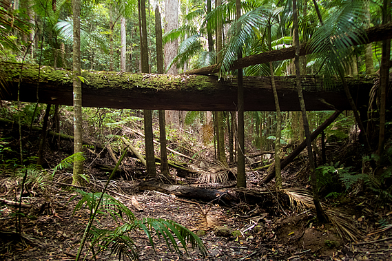
A few metres downstream from our crossing point was a large fallen tree creating a natural bridge about four metres above the creek bed. Although it was covered in moss, it could have been a good bridge to cross had there been a torrent flowing through the gully.
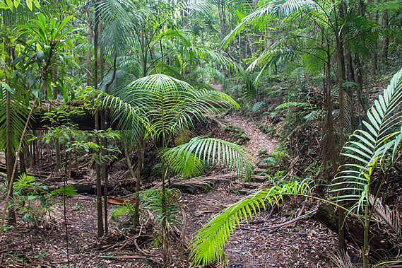
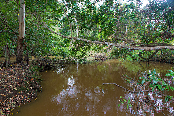
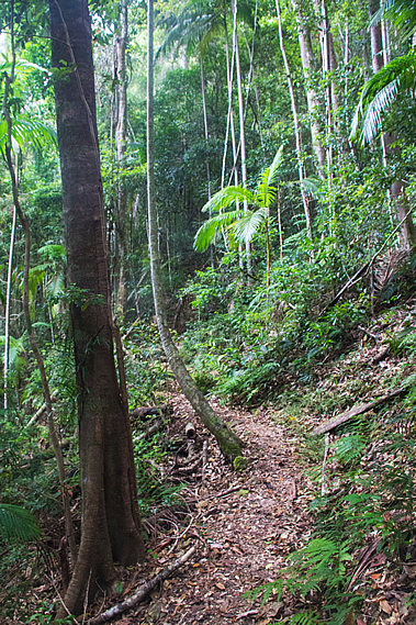
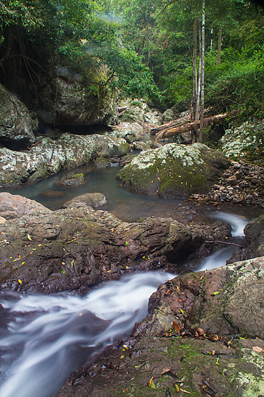
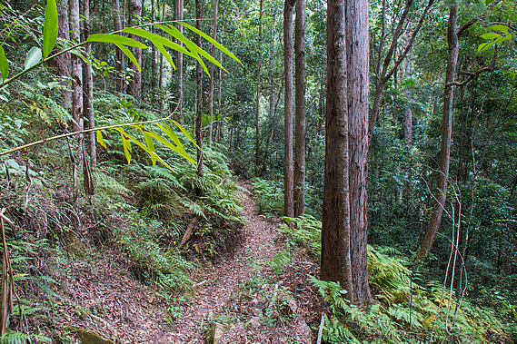
Once across the dry creek bed, the track steeply ascended the bank on the other side before gently rising through a forest of very tall but thin trees. From there it descended to a firebreak track which crossed the main tributary of the Gheerulla Stream. On either side of the culvert was a long black pool with fallen trees across its width under more trees leaning across the water. There was not a breath of wind in the air under the now completely overcast skies, so the water was still, perfectly reflecting the low rainforest growing above it. The forest here was a mixture of blackbutt, terpentine, brush box, flooded gums and piccabean palms.
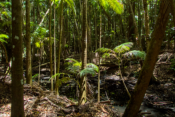
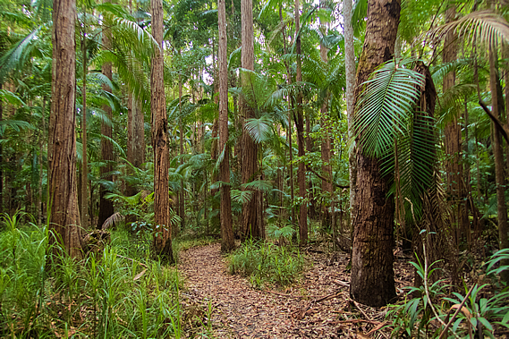
Once across the stream the very well graded track left the firebreak to follow the creek upstream. The dark water stood still in a series of long puddles just as we had seen downstream in the Gheerulla Valley. The only difference was there were no rocks and the puddles were smaller. After a few hundred metres, the track left the stream ascending over a low hill which the stream doubled around. The thick rainforest gradually changed to a dense eucalypt forest before crossing the top of a small saddle. From there the track descended back into rainforest following the creek once more.
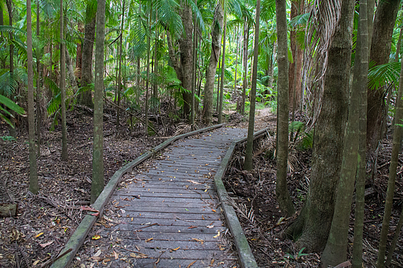
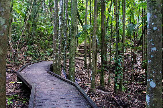
Downstream from here the creek diverts winding its way around a gap around the hill we had just climbed over. The track continued upstream following close beside the winding stream following a wide gully of rainforest. The trunks of a couple of huge trees lay across the creek forming natural bridges over the black still water. Although the water level was at least a metre below the track, we were often walking on boardwalks indicating the gully does often flood and the ground becomes muddy.
The rainforest surrounding the creek was stunningly beautiful. It always has been, but was very nearly destroyed forever by developers as part of the expansion of nearby Mapleton in the late 1980s. Developers had bought the 44.6 hectare block and earmarked it for a large residential development, but local resident Linda Garratt purchased the land for half a million dollars and donated it back to the Mapleton community for preservation.
The reserve is one of the few remaining habitats for two highly endangered frog species, Mixophytes iterates – the giant barred frog, and Litoria pearsoniana – the cascade treefrog. There are also the elusive bush wallabies that I could hear foraging the undergrowth nearby, along with the myriads of birds that live in the canopy. Linda Garratt donated the land 21 years ago in 1994 on the condition it be forever preserved as a conservation park.
The only development that has occurred here since the forestry days were the walking tracks, a circuit that we were now approaching, and the Great Walk extension back to Leafy Lane. Otherwise it remains perfectly preserved to regenerate back into the towering forest that once stood here before the timber cutters came. There are a few other reserves along the Blackall Range. Some have been subsumed by the national parks, others remain as standalone reserves. Another example is the Mary Cairncross Reserve at the far end of the range near Melany. Right on the end of the range facing the Glasshouse Mountains, this reserve was named after one of Queensland’s first conservationists. The impressive rainforest reserve is a tribute to her conservation efforts.
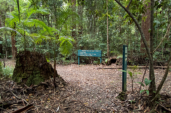
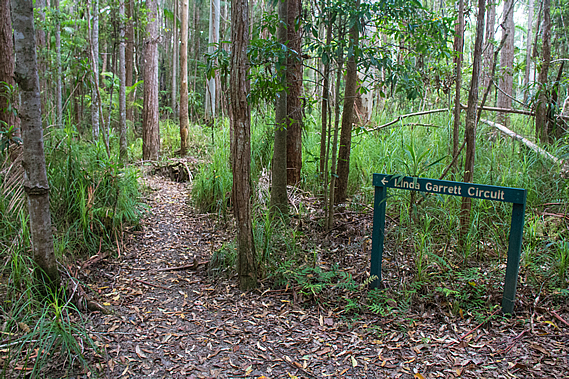
The track left the creek briefly before reaching a junction where the Linda Garratt Circuit reached its furthermost point from its start less than a kilometre away. The main track continued heading straight through the rainforest whilst the other track returned to the side of the creek. With plenty of time we decided to walk the longer route along the side of the creek. At one point a wooden seat looked over a long black pool of the creek. The circuit didn’t quite reach the source of the creek, which seemed to come from a large pond in the middle of Mapleton, about two kilometres away. Although we were so close to the town, we seemed to be a world away in the dense rainforest.
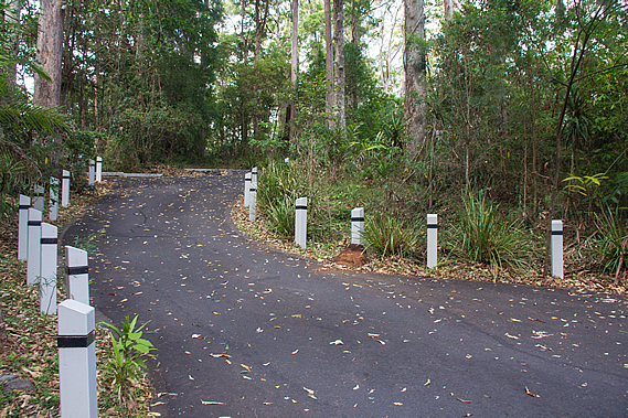
The track diverted away from the creek heading to a small swampy clearing of grass surrounded by ghost gums with their brilliant smooth white trunks. From there the track gradually rose through the forest to complete the circuit meeting the main track again. A short distance from the circuit we reached a large square gazebo with a small car park on the other side. This was one of the official car parks of the great walk. A stone wall had been set up on either side of the gazebo, with the legs of the right hand side sitting on top of the wall and the legs of the other side sitting on the ground in front of the other wall.
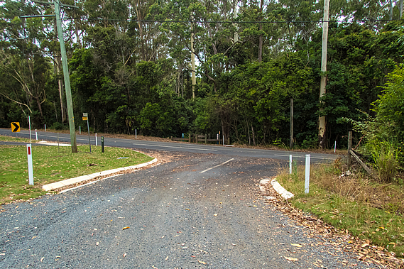
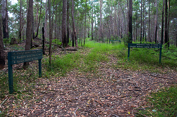
There were no cars parked here, even though there often are. The park has parking for about 10 cars set off a gravel road. This was Delicia Road, the same road we had followed for a while between Thilba Thalba and Gheerulla Falls. From the saddle above the falls the road rises steeply going up and down a couple of times before reaching this point and continuing for a couple of kilometres into Mapleton. There was no sign of civilisation here apart from a small cemetery on the other side of the road. A small number of very old gravestones stood heavily weathered amongst short recently mowed grass, each grave containing the remains of someone who would have milled the forest up here.
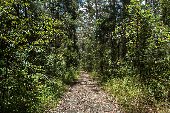
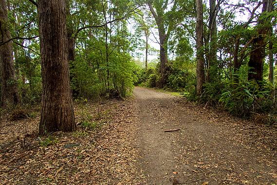
The track continued through the forest roughly parallel to the road heading back towards Thilba Thalba. It entered the bush passing some interesting yellow puffy bracket fungus and a huge termite mound standing about two metres high. Thick broadleaf undergrowth grew under the piccabean palms and rainforest trees. After about five hundred metres the track turned and climbed gradually back to the road at a small pigsty, to the edge of Mapleton National Park where the town of Mapleton began on a low ridge that had been cleared before the conservationists could intervene. Most national parks I have explored over the years have occupied tens of thousands of hectares, covering vast wilderness areas taking days to hike through. Some national parks on this side of the Tasman are very small, and Mapleton Falls National Park would have to be the smallest one I have ever encountered.
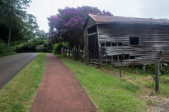
Once across Delicia Road, the track followed a side road heading moderately up towards the top of a low hill. The seal on Daymar Road only lasted a few metres on either side before the road became gravel. There were houses on either side. An old lady was gardening outside one of these cottages, asking us if we had plenty of water, which we did, having collected and treated it from the small water supply at Ubajee earlier this morning. After a couple of houses the area suddenly looked rather rural with mowed grass growing on the side of the road A row of power poles delivered electricity to the shabby rural houses further along the short road.
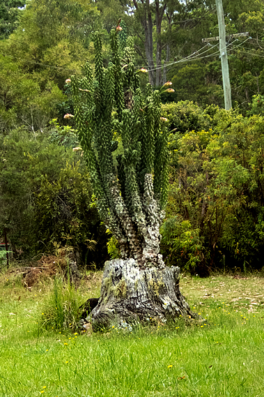
The stump of what had been quite a large tree sat about two metres off the side of the road. A huge cactus towering nearly four metres high grew from the inside of the trunk. It had a lot of large flowers that were just about to bloom. The road ended just past the last property in a dirt track covered in leaf litter entering the eucalypt forest. This was the top of the hill. From here the dirt road descended to a gate marking the start of the Mapleton Falls National Park.
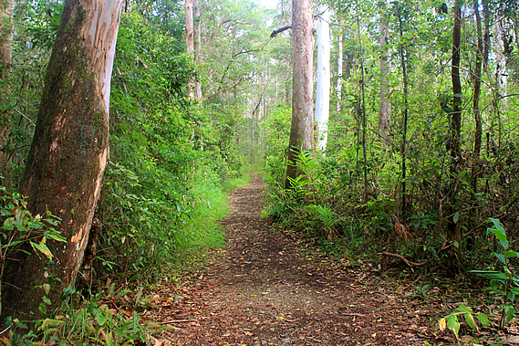
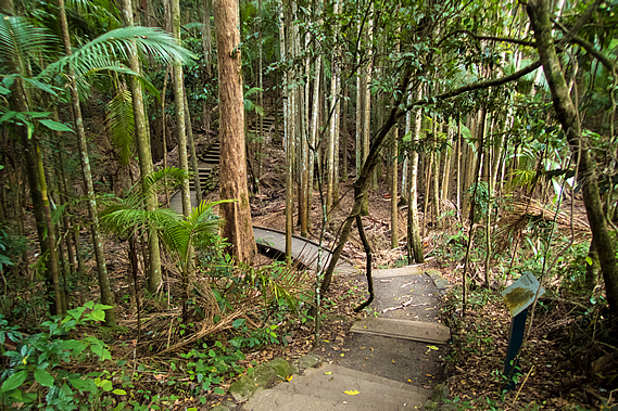
At twenty six hectares, the national park is tiny. It is a rectangular block over terrain too steep and rugged to ever clear. Despite its tiny size, it is a great representation of the vast forests that once covered the top of the Blackall Range. Unlike the other forests we have hiked through so far, this forest remains completely untouched by the timber industry of the nineteenth and twentieth centuries. This tiny pocket of forest remains home to hundreds of plant and animal species. The track didn’t narrow, but continued heading down the top of the ridge through the thickening forest, reaching a junction of the Wompoo Circuit, a short thirteen hundred metre track starting from the Mapleton Falls car park.
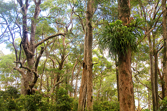
The trees through here were spectacular, untouched by the milling that had occurred throughout the rest of the Blackall Range. Some had huge epiphytes of staghorns, elkhorns and birds nest ferns growing in them. As we headed out along the ridge, the thick undergrowth changed to an alternating combination of grass and bracken. The trees became smaller as we approached the end of the ridge, the track gradually turning to double back. Although there was plenty of space between the trees, most of them had large epiphytes of staghorn and elkhorn fern, and of many orchids similar to those I had seen in the Gheerulla Valley the other day. They grow in the trees to catch the stronger sunlight that simply doesn’t reach the forest floor.
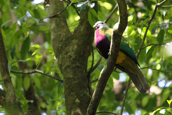
The Wompoo Circuit is named after the wompoo (Ptilinopus magnificus) – a large colourful fruit dove that lives in the rainforests of Australia and Papua New Guinea. I could see one hear them with its distinctive “wollack-wa-hoo” sound resonating through the forest. Then I saw one. Unlike most other doves, the wompoo has beautiful purple plumage around its neck, chest and upper belly. Its lower belly is yellow with green underparts. They grow to around 35-45 centimetres.
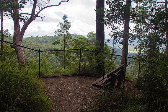
This was just one of the 107 species of bird that live amongst the forests of the Blackall Range. At the end of the ridge was a short gradually descending side track to the Peregrine Lookout, named after the peregrine falcon Falco peregrinus which rests on the cliff faces below the lookout. They are often seen flying around the gorge between August and December. I couldn’t see any today, so perhaps they had already left the area. They are considered vulnerable so it is a locally important species.
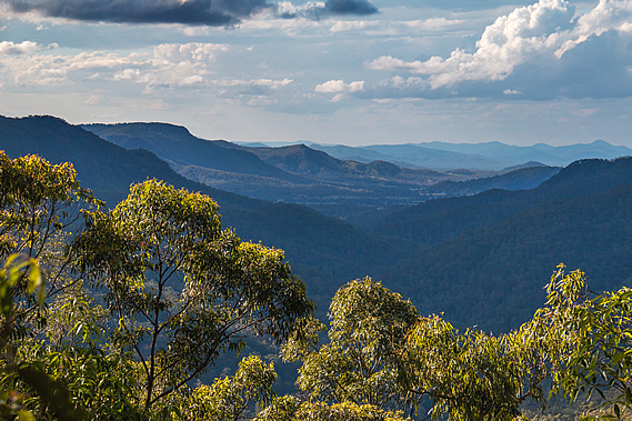
Fortunately the falcons fly above the trees so are easily able to travel from one area of forest to another. Many other species will never leave the forest. Much of the forest has been cleared now forcing some species to be restricted to the small isolated patches of forest with no vegetation corridors to move into adjoining forests if needed. There wasn’t much of a view as it was largely overgrown, but we were at the top of a 120 metre high cliff looking down into the forested Pencil Creek Valley running into the cleared pastoral lands of the Obi Obi Valley before heading up the slopes of the now distant Conondale Range under the still overcast skies.
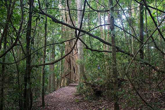
From the lookout the track doubled back below the ridgeline quickly entering rainforest. It descended to the junction of the Wompoo Circuit at a huge fig tree with a seat on a boardwalk beside it. The strangler fig starts life as a seed deposited by bats or birds high up in a tree, usually at a junction of two branches. From there it slowly extends a root down the side of the trunk as its leafy top grows. Eventually the root reaches the ground where its growth is suddenly accelerated sending down more roots gradually covering the tree’s trunk. A large crown of leaves mingles in with the tree’s own foliage, then the fig gradually smothers the host tree until it dies and rots away, providing an enormous boost of nutrients for the fig turning it into an enormous tree in its own right.
We decided to stop here and explore the short circuit where stairs and boardwalks led through the rainforest passing buttressed trees, and huge tangles of vines. Many rainforest trees have large spreading buttress roots. Scientists haven’t determined exactly why they form the roots, but they may include an aid to help the trees absorb oxygen from the air due to the roots often growing in shallow waterlogged soil. Other reasons include assisting the tree to stand strong during strong winds, and to help retain the leaf litter around the base of the tree to provide nutrients. The reality is probably a combination of the three, where natural selection has determined wide buttress roots gives the tree a significant advantage over other trees that aren’t buttressed.
The rainforest was rather dark under the overcast skies. The thick canopy towering overhead, along with the sub-canopy of palm trees caused very little light to reach the damp ground. Temperature and humidity vary a lot less on the forest floor than up in the canopy. The forest regulates the temperature very well. This has forced some plants to adapt to live in these conditions. Some of the trees had lichens growing on them. These are very strange plants, in fact a symbiosis between the much larger fungus and an algae. The lichen absorbs water and nutrients for the algae, and provide it a safe home. The algae in return produces food for the fungus.
After a few minutes we reached the junction we had passed earlier, so returned down the Wompoo Circuit back to the huge fig tree. There were a couple of macadamia trees growing here. Otherwise known as the bopple nut or Macadamia ternifolia, it is commonly assumed to be from Hawaii, where it is very successfully grown commercially. The macadamia is in fact a native to the rainforests of Australia. With the clearing of the rainforests though, it is now at risk of extinction in the wild.
From the circuit the track followed a concrete stairway into a gully. There was no water flowing through the gully but it was filled with piccabean palms indicating the soil here is rather swampy. Their thirsty worm-like roots drink large quantities of water so they only grow in wet gullies. They were beginning to produce the red fruits and will continue to do so until May. This provides food particularly for the topknot pigeons. With much of the rainforest cleared though, these birds are seldom seen these days. When they are seen, they are only in small flocks. Before the rainforests were cleared the pioneers often reported them flying in flocks of several thousand birds.
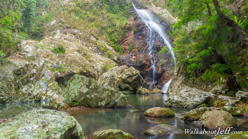
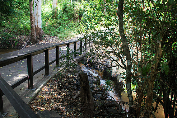
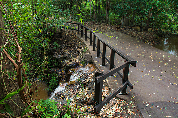
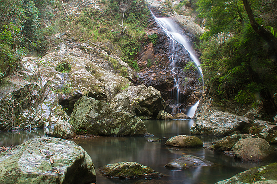
From the gully the track rose on concrete stairs out of the rainforest into a small grassy area. At the end of the grass a ford crossed Pencil Creek. Upstream it was dammed into a still pond. Downstream the water cascaded out of the culvert into a pool at the start of a small rapid leading to the Mapleton Falls. Pencil Creek was named after the native pencil cedars that grow along its banks. Once across the ford the paved track steeply rose to the Mapleton Falls Carpark, the second of the four official starting points of the track. The narrow road edged its way around several tall trees with car parks hidden away in a few nooks.
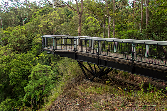
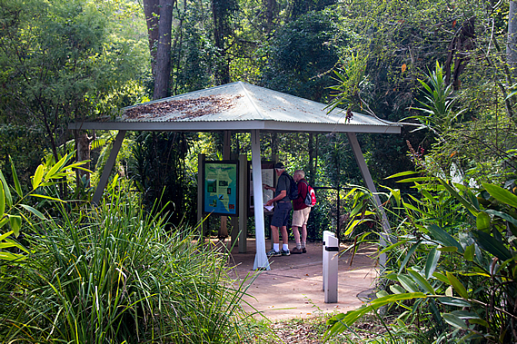
Upon reaching the road there was a small pergola with a few displays about the national park, similar to the one I had seen at the other car park. Just past the pergola was a cantilevered walkway heading out over the edge of the gorge. The cantilevered walkway was closed and had been since the huge storm earlier this year. A small landslide at its base had made it unstable. Fortunately I did go out onto it some time before it closed and managed to get some good shots of the waterfall tumbling off the edge of the cliff below the ford we had crossed a few minutes ago.
Mapleton Falls was originally named Baroon Falls, after the Baroon Pocket of the legendary corroboree where we will be arriving at the end of the hike late tomorrow. The name was changed to Mapleton Falls in 1915 after the nearby town. Baroon Pocket is quite a long way away so the name change did make sense. A flying fox with a viewing cage was erected across the falls in 1919 as it was otherwise difficult to see them from the edge of the cliff. Although quite popular, it was eventually removed due to safety issues. The anchor belts are still installed at the giant brush box tree next to the current lookout.
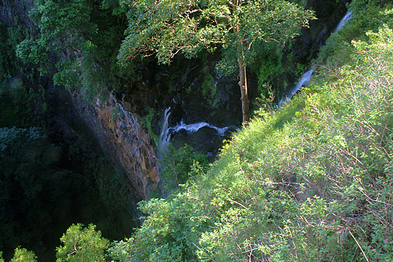
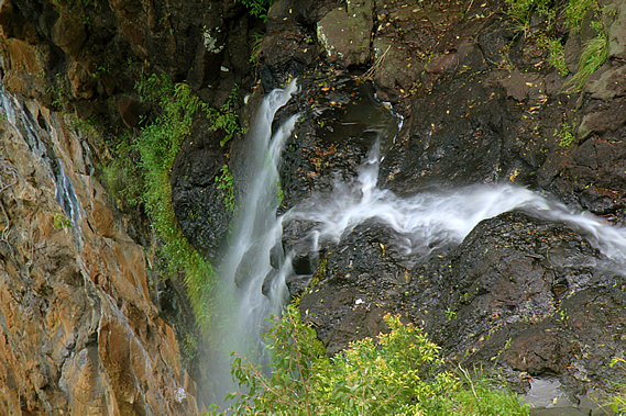
Eventually a cantilevered lookout was constructed, but it was eventually closed in 1995 after becoming unstable following a small landslide. The current lookout was erected shortly afterward. This has remained open until the huge storm in April this year created another small slip rendering it unsafe to access. The land around here must be rather unstable as would be expected at the edge of a high cliff. Today we couldn’t see the waterfall, but I had been out on the platform about a year ago and got some good long exposure shots of the cascading creek dropping down the cliff in a fine spray of mist.
The waterfall mist dropped a hundred and twenty metres into the rainforest gorge below. The vertical cliff had a layer of hard black basalt at the top, and cream coloured softer rhyolite and sandstone underneath. Around 25 million years ago the Eastern Australia volcanic hotspot lay directly beneath this area. The Australian continent has been moving northward for the past 60 million years over the hotspot, so there is a row of volcanoes stretching along much of the eastern coast down to its current location off the west coast of Tasmania.
I have previously completed a superblog on the Tweed Volcano, a massive shield volcano a couple of hundred kilometres to the south inland from the Gold Coast. That volcano formed about 23 million years ago, so two million years earlier, the hotspot was sitting under the Sunshine Coast hinterland. The volcanism was very different up here. Down in the Gold Coast two enormous shield volcanoes were formed, firstly the Focal Peak volcano, then the Tweed Volcano centred at Mount Warning. Up here a large cluster of volcanoes formed. Several lava tubes cut through weak points in the Earth’s crust spilling out basalt that filled in the existing sandstone valleys. The sandstone had been laid here during the Jurassic period around 150 million years ago. The sandstone was subsequently uplifted when a large fault line now located in the middle of the Tasman Sea ruptured around 80 million years ago splitting Zealandia off from Australia as part of the breakup of the Gondwana supercontinent. The volcanoes broke through the sandstone and filled the valleys with basalt lava.
The volcanism to the south of here created the Glasshouse Mountains, where the volcanoes and the sandstone they sat on top of has completely eroded leaving only the mysterious plugs that fed the volcanoes. When each volcano stopped erupting the magma in the chambers cooled very slowly insulated by the surrounding rock. The slow cooling allowed the rock to solidify very hard causing these plugs to remain standing even though the surrounding sandstone has eroded. Here on the Blackall Range, the erupting basalt didn’t form cones. Instead it just filled the valleys with a very hard layer of rock. Over the 25 million years following the volcanism, the softer rock of the ranges eroded down to the level of the basalt, then continued to erode to create the valleys we now see.
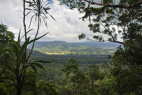
This creates a very interesting phenomena. On our first day we had hiked along the bottom of the Gheerulla Valley, which would have once been under the top of a long ridge. The ridge extending back from Gheerulla Bluff would have been one of the valleys filled with basalt, but now standing high above the eroded sandstone valley. This would explain why the top of the Blackall Range is rather flat – certainly flat enough for several towns to be built. The range could very well have been the bottom of a long valley and now stands as a range over four hundred metres above sea level. Some of the erosion though would have been through softer layers of basalt, so it’s now not possible to confirm whether the valleys were once the tops of ridges.
I could see the distinctive hexagonal columns of rock in the black basalt up near the bridge. When liquid basalt solidifies, it shrinks and cracks into long hexagonal columns. Once at the bottom of the waterfall, Pencil Creek continued following the valley through the dense rainforest until meeting the lush green grassy pastures of the Obi Obi Valley. Although from here the valley is wide, further upstream it will narrow into a spectacular gorge creating an ominous barrier to Baroon Pocket. The track will be navigating its way through this gorge.
Although tiny at just 26 hectares, Mapleton Falls National Park had a stunning variety from dense rainforest to eucalyptus forest, all nestled at the edge of a dramatic cliff dropping over a hundred metres into the valley below. We left Mapleton Falls following the steep road winding between the trees heading towards Mapleton. From here we had just under six kilometres to go to the Flaxton Walkers’ Camp, our destination tonight and our final campsite on this trip. This was going to take us a good three hours.
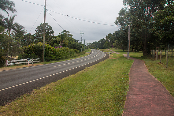
From the park entrance a wide scoria red path led the track beside the road towards the southern end of Mapleton. It was semi-rural out here with long driveways crossing grassy paddocks to their homesteads. There were a couple of heavily weathered wooden sheds looking ready to collapse under their own weight. Mapleton was initially established in the 1880s as a timber milling town, where wood coppers would go into the forest to cut down trees high in demand, namely the red cedar, blackbutt and tallowwood. As the forests gradually became cleared, the exposed land was used by settlers to grow vegetable crops and fruit. By the 1930s Mapleton became a leading citrus growing area.
From the early 1900s Mapleton began to attract tourists. The stunning views and cooler climes of the elevated forests attracted visitors. A 2 foot gauge railway was constructed from Nambour, the main town at the bottom of the range, up to Mapleton to carry timber, tourists and other goods into the town. The railway opened in 1915 and continued to run until 1944. Once at the top of the rise, the road ran into the Mapleton – Kenilworth Road, which behind us drops steeply towards the Mary Valley, at one point each lane separating to negotiate its way down the precarious side of the range.
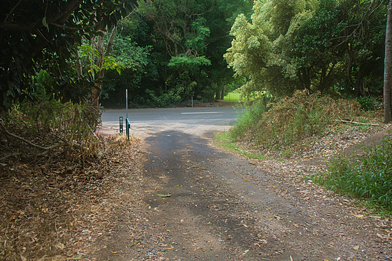
The track followed the road towards Mapleton for a good kilometre or two along the very wide grassy verge before eventually crossing over and going up a steep single lane side road to a few private properties before reaching a gate. We passed through the gate closing it behind us and continued along the gravel road before it became asphalt sealed and steeply dropping through lush grass towards the forest. From here we could see a ridge in the distance. The flat top of the ridge was where we were heading today – Flaxton Walker’s Camp. We had maintained a steady altitude at around four hundred metres above sea level so far today, but to get to the camp we will need to descend deep into the Baxter Gully.
Near the end of the narrow road a sign pointed into a rough track with a sign indicating only experienced hikers should walk through here. The track did look very rough compared to the wide red path we had walked along earlier, but it was still in very good condition so far as walking tracks go. The sign led into the Baxter Bluff Environmental Reserve, a protected plot of land covering the northern side of the creek.
After leaving the road the track descended moderately into dry rainforest. The air was becoming very muggy and light rain was beginning to fall. We descended through thickening forest where several very large birds nest ferns were growing on the ground. As we continued descending the forest undergrowth continued to thicken until we were in full rainforest. By now the terrain was very steep and the track rather narrow winding its way across the face of an old landslide. A hairpin bend narrowly missed a very recent landslide which no doubt came down during the huge storm earlier this year.
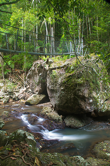
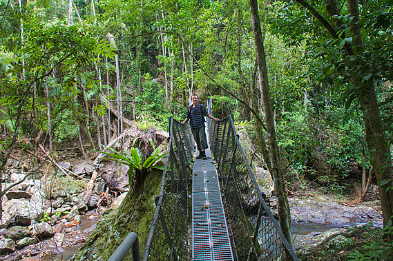
Then I could hear the sound of Baxter Creek flowing unseen down the steep bank. One more switch back and I could see the swing bridge ahead of me. This was the first bridge we had seen throughout the trip so far. We had dropped a good two hundred metres below the ridge. The stream was flowing clear and strong, cascading between large boulders. There must have been a lot more rain over this part of the park the other night, otherwise this would have been running very slow like the Gheerulla Creek.
The swing bridge spanned between two enormous boulders about four metres above the stream. The boulders around the stream were covered in lichen, but otherwise there was no vegetation at all to about two metres above the creek bed indicating last year’s major storms had wiped out the vegetation. Today though, the stream was flowing low, low enough to cross reasonably safely even if there wasn’t a swing bridge. The stream marked the end of the Baxter Bluff Environmental Reserve, and the northernmost boundary of the Kondalilla National Park, the third of the three national parks that the walk goes through. This part of the park isn’t very well known at all. We’ll be walking through it for the rest of today, and much of tomorrow, where we will be passing the more popular parts of the park and reaching the southern end at Baroon Pocket at the end of the trek.
By now the drizzle had stopped falling, so we rested on a large rock almost under the swing bridge. There we discovered our unwelcome passengers. There were several small brown leeches gorging blood on our legs. Despite having bitten through our skin to a good blood vein, we had hardly felt them at all. When they bite they quickly inject an anaesthetic eliminating any pain. Then they inject an anticoagulant to prevent your blood from clotting as you would expect in a minor wound. Once attached they take 15-40 minutes to drink enough blood to fill them, expanding their body size by many times. The blood will feed their eggs allowing them to reproduce.
Once they are full they will drop off. With a bit of effort they could be pulled off, but this could tear at the skin creating an infection. Fortunately one of the guys had some salt with him, so upon sprinkling that on the leeches, they quickly dropped off. Thanks to the anticoagulant, streaks of blood began to run down our legs. Normally the wounds would clot after a few minutes but they won’t stop bleeding for several hours. We crossed the bouncy swing bridge one at a time. A sign said the safe load was either two adults or one adult and two children. On the other side, the main track steeply rose into a gully heading towards the Flaxton Walker’s Camp on the top of the next ridge. A side track headed upstream just above the creek, so we took off our packs and headed upstream.
The side track roughly climbed over the boulders in the forest until stopping just short of Baxter Falls. We couldn’t see the falls too well from the end of the track, but hopping out onto the boulders gave us a clear view of the water tumbling down a crevice in the large exposed rock face. Rain started falling again whilst we were resting at the falls, so we decided to press on. As we were heading back along the rough track we could see a couple crossing the swing bridge making their way back to Ubajee. They were running a bit late today no doubt only having left Flaxton about an hour ago. They were the only people with backpacks we had seen all day.
From the Baxter Creek swing bridge we followed the main track climbing steeply through the rainforest up a gully. Almost immediately the rainforest changed to open eucalypt as we left the humidity of the creek and started rising along the sunny side of the ridge. The sky was still completely overcast and light drizzle was still falling. The track turned left out of the gully traversing across a bluffy area with small cliffs above us. The ascent was steep rising on a concrete staircase before continuing along a narrow track rising moderately following above the creek upstream.
The undergrowth was now thick bracken, but fortunately the track was clear and well maintained. It continued climbing for nearly half an hour before reaching a large hairpin bend redirecting the route to the end of the ridge. As we continued climbing higher we had the occasional partial view across to the other side of the valley. It was all forested apart from one homestead I could see towards the head of the creek near Mapleton.
As we approached the end of the ridge, the undergrowth disappeared almost completely and the acrid smell of old smoke filled the air. The trees and ground were burnt from a fairly recent bushfire. The dry eucalypt forests have evolved to not only withstand, but to thrive on fire. As Australia broke off from Antarctica and moved northwards towards the equator, the continent once covered in rainforest dried out and retreated to the relatively mountainous east coast. The forest in the interior of the country gradually adapted into the eucalypt forests we see today. As the country continued to dry up the dry eucalypt forests continued to retreat towards the coast taking over much of the disappearing rainforest, and the centre turned to desert.
A combination of the eucalypt forest’s dry grassy ground cover, dry leaf litter and eucalyptus oils made the forest very susceptible to bushfires. Before humans arrived bushfires were often started by lightning strikes from large non-rain bearing clouds. Although initially destructive, the fires cleaned up the forest and created fertiliser for the trees to continue growing. The thick bark ensured they survived most fires, and even their seeds adapted to the point they would not germinate until burnt in a bushfire to give them the best chance to sprout into a healthy tree.
When the Aboriginal people started settling in these areas the eucalypt forests, they would deliberately burn off large sections of forest to help them regenerate and provide food and other resources for them. Even today areas of forest are deliberately burnt every few years in order to maintain the ground litter and prevent the spread of any naturally generated bushfires. Rainforest species are unable to survive bushfires, hence the huge difference in species between the rainforests and the eucalypt forests. I had noticed the transitions between the different forest types to be very quick.
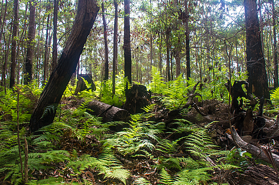
Just before the end of the ridge, the track doubled back continuing to rise moderately. The burnt area quickly ended with plenty of lush bracken growing in amongst the trees. There were quite a few trees that had been fallen and chopped into sections no doubt from the logging days. Eventually we reached a wide firebreak on top of the ridge. There were a couple of signs indicating directions and distances. We had hiked 12.7 kilometres from Ubajee with just 400 metres to go to Flaxton Camp. We had 16.3 kilometres to go to Baroon Pocket tomorrow, our final day of the trip.
The track followed the firebreak dirt road along the top of the ridge through the tall forest and thick bracken on either side to a junction where a bush split the track into a three way roundabout. We took the right hand side track towards the campsite. Almost immediately we could see the little toilet shed ahead of us. We were the first to arrive at the campsite. Unlike the last two campsites there were no views at all, so there won’t be any sunsets or sunrises tonight. That being said the rain was starting to set in, so we quickly put up our tents in what seemed to be the driest campsites available. The forest contained small trees but there were the stumps of what had once been enormous trees that had been cut down and transported to a nearby timber mill.
Blood was still running down my legs from the two leech bites I had coming down Baxter Bluff. Two solo hikers arrived a little later having hiked from Baroon. They set up their tents in the secluded campsites a little down the gully away from ours.
It was not long afterwards when the rain started falling. We quickly finished our early dinner and retreated to our tents for the night. Although the rain was light, the weather forecast was for areas of heavy rain overnight, so we were careful not to pitch the tents in hollows, or under any dead branches. With the rain drumming down on the tent it was going to be a restless night, but fortunately tomorrow night I’ll be back home in the comfort of my own bed. |
||||||||||||||||||||||||||||||||||||||||||||||||||||||||||||||||||||||||||||||||||||||||||||||||||||||||||||||||||||||||||||
|
||||||||||||||||||||||||||||||||||||||||||||||||||||||||||||||||||||||||||||||||||||||||||||||||||||||||||||||||||||||||||||