This week in South East Queensland
22 - 28 April
IT'S HARD to believe in this day and age, but once whaling was a major industry. A large whaling station was set up at what is now Tangalooma Resort, from where ships would venture out into the open waters of the east coast where the whales migrate up and down every year from Antarctica to the warm waters of Hervey Bay and other northern sheltered areas to give birth. At the end of the season, they would return down the coast to their abundant feeding grounds around Antarctica. Fortunately the whaling station is a distant memory and the whales are now protected.
Today's trek takes me along the coast from Big Sandhills passing Shark Point and Tangalooma Resort to the next major camping area at The Wrecks.
Today's Journey
Distance hiked today: 13.7km
Total distance hiked to date: 910.3km
 |
05:41 - The tide is already most of the way in when I leave the camping ground in the early morning. It was nice to wake up to the gentle sound of the waves lapping on the foreshore. |
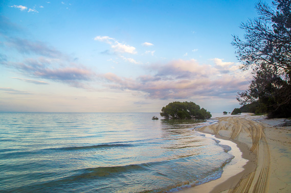 |
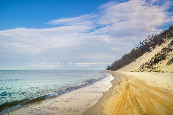
06:07 - Following the narrow beach as the tide continues to creep in and the sun rises on the other side of the island. The four wheel drive track is almost completely submerged making it impossible to drive along for most of the morning. For me this means a peaceful hike for the first few hours. I left the camping ground before anyone else there had woken up. |
 |
06:11 - The sun would be above the horizon now on the other side of the tall sandhills of the island. Looking along the coast towards the first of the points approching Shark Spit. |
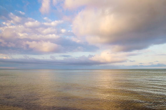 |
06:18 - The sun is softly capturing the clouds over the calm waters of the bay. Here the bay is so wide the other side the city is nowhere to be seen. On a clearer morning the high rises of the central city would be just visible from here. |
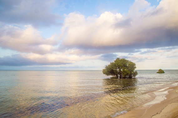 |
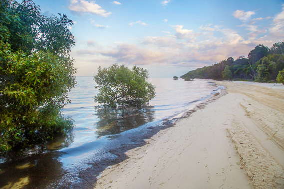
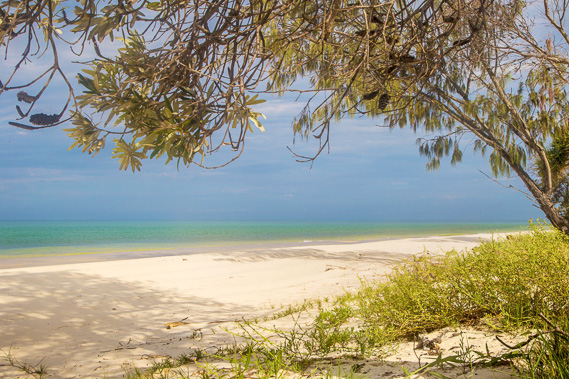
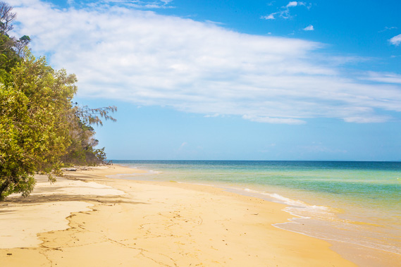
06:24 - Reaching the last of the mangroves on the eastern side of Moreton Bay. Although the water does look inviting, I don't take a swim around here as this coastline is notorious for its large sharks. |
 |
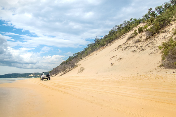
06:48 - Heading around a point where a high sand hill towers above me. In the distance ahead are the rusting remains of a ship. |
 |
7:00 - Getting closer to the wreck, I see the wreckage is actually two ships. Here the tide is almost lapping at the bottom of the sandhills. |
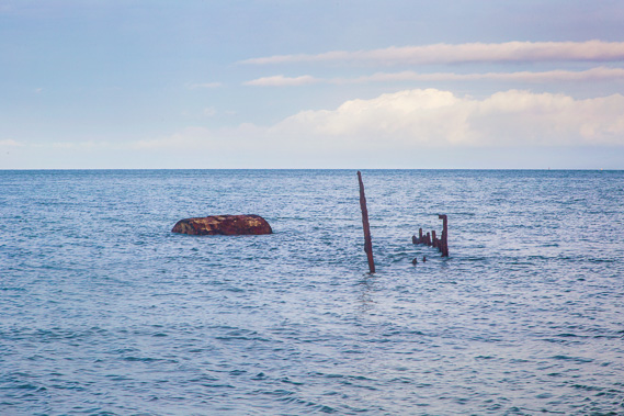 |
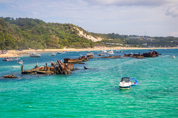
07:12 - The boiler and some of the framework of the first of the two ships. This is the 98 tonne Normanby which was scuttled here in the mid 1930s. High and dry at low tide, the water has mostly submerged what is left of this ship. |
 |
07:22 - Looking back along the length of the ship. Apparently the boilers are the strongest and most corrosion resistant part of the ship, so they are the last components to deteriorate. |
 |
07:27 - Looking to the second ship with its boiler and more framework showing. This is the 315 tonne Fairlight which was scuttled here in the mid 1930s at about the same time as the Normanby. |
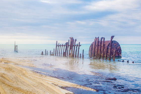 |
07:30 - This is quite an impressive ship skeleton rusting away in the sea water. |
 |
07:51 - Looking past the sand blows towards Shark Spit. |
 |
08:50 - Relaxing at my first resting point of the day. The clouds cover the sky but no rain falls. They don't carry as much moisture in this cool time of year. |
 |
09:50 - The cloud briefly clears to the south revealing the now distant North Stradbroke Island hills. |
 |
10:06 - Reaching Shark Spit, apparently well named, but I'm not going to try my luck and find out here in this very lonely place. The waves have almost reached the grass making it almost impossible to drive along. The soft wet sand would quickly bog any vehicle trying to negotiate this coast. |
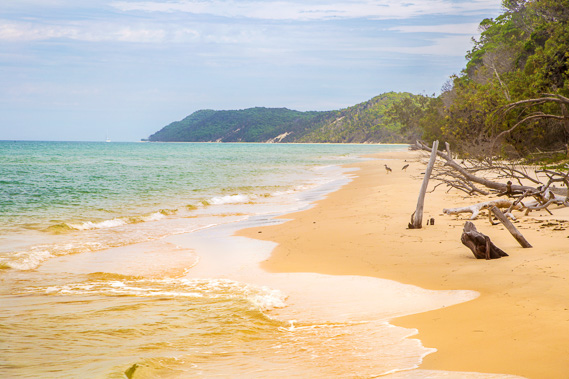 |
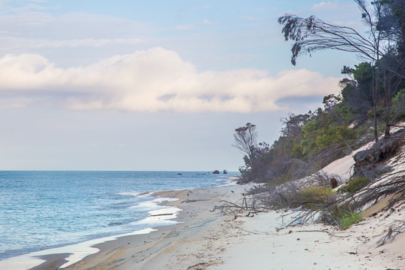
10:10 - Once around Shark Point I can see out to Tangalooma Point. The water has been eroding the sand hills bringing down trees making this part of the beach quite an obstacle course above the breaking waves. |
 |
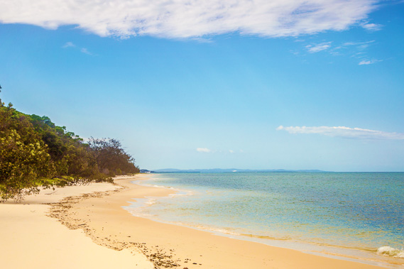
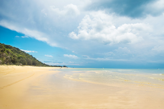
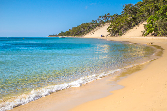
10:34 - The water here is so pristine, yet during low tide this would be a very wide sand flat like those I have been following in the past two days. |
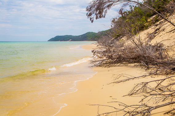 |
10:40 - Reaching a blocked area where either I have to climb over the dead vegetation or get a bit wet going around them as the waves come in. |
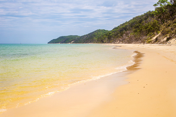 |
11:23 - I do make it around the fallen vegetation and continue to follow what seems to be a very remote beach, but just around the next point is a major resort, and many four wheel drives tear along this beach at low tide. |
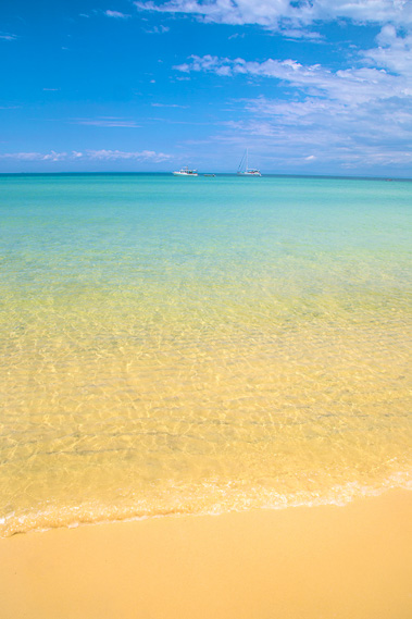 |
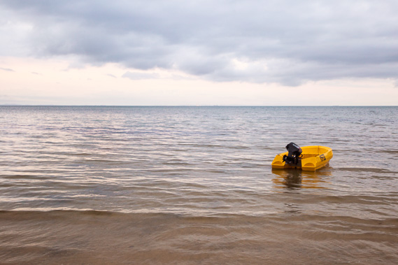
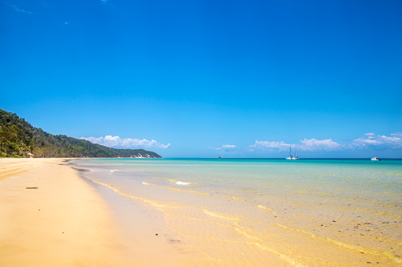
11:55 - Boats anchored some distance off the coast in the deeper water. |
 |
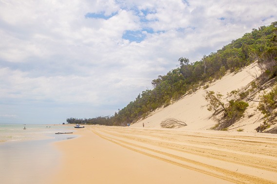
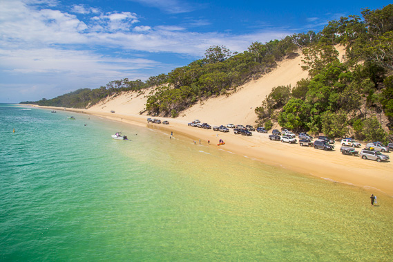
12:06 - Most of the way along the beach. The tide has gone out and a couple of four wheel drives have braved the soft sand heading towards Big Sand Hills. For them it would be best to wait a couple more hours before the tide is out exposing the hard sand. |
 |
12:23 - Approaching Tangalooma Point which turns out to be quite busy with four wheel drives stopped at the day use area waiting for the tide to go out. As you can see here quite a few vehicles have gone through now. More cloud is coming in to make the sky completely overcast. |
 |
13:04 - Relaxing on the dunes at Tangalooma Point looking towards Bulwer in the far distance where I aim to reach tomorrow. |
 |
13:38 - Crossing under another large sand patch. The resort starts shortly after this sand blow. The beach is blocked off directing the four wheel drives along a soft sandy road around the back of the resort to keep the beach safe. |
 |
13:40 - Looking back to Tangalooma Point as I head towards the resort. |
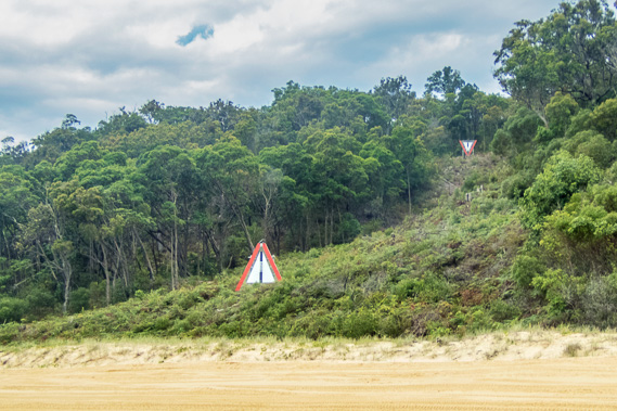 |
13:45 - Ship Patch, where the two markers are navigation aids for ships heading out of the Brisbane River. They come directly towards these markers until they are about two thirds of the way across the bay before turning towards Caloundra. |
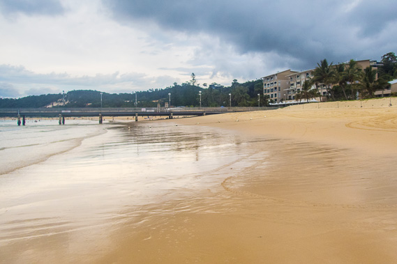 |
14:25 - Tangalooma Resort. The tide is already more than half out leaving a bit of a dirty sand flat, perhaps from sediment washing from the rivers and quickly building up in the bay in recent decades. A couple of movies were filmed here including the first Scooby Doo movie. |
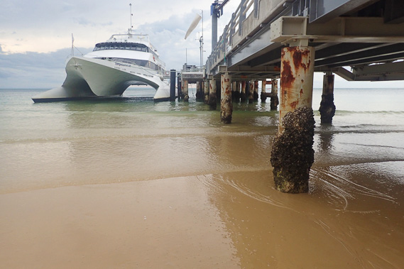 |
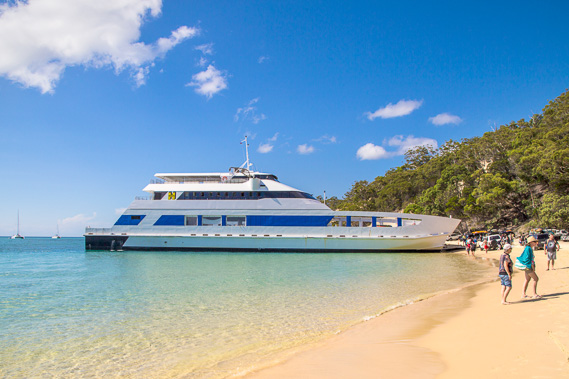
14:26 - The Tangalooma Flyer which makes quick work of crossing the bay from the Brisbane River Mouth across to here in less than an hour. This is the main transport for people staying and working at the resort. Some do the crossing by helicopter. The wharf was built for the whaling station which was based here between 1952 and 1962 and licensed to take 600 humpback whales per year. A sand mine was established here between 1957 and 1958 to mine zircon and rutile from the other side of the island, but fortunately this was abandoned due to being uneconomic. The whaling station closed in 1962 due to massive decreases in the whale population causing the operation to no longer be economic. |
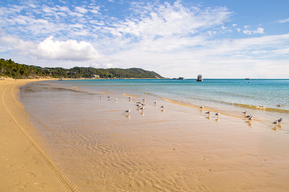 |
14:48 - Looking back to the resort having crossed it and reached the location where the bypass road returns to the beach. The cloud is now clearing and seagulls are at the water's edge waiting for their next meal. Until two decades ago, the resort was completely hidden in the trees (as are all the other settlements to this day) making it look uninhabited, but a huge amount of development here in the past twenty years has taken away from its pristine former self. |
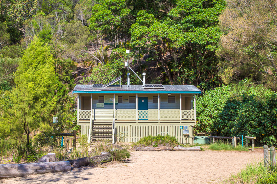 |
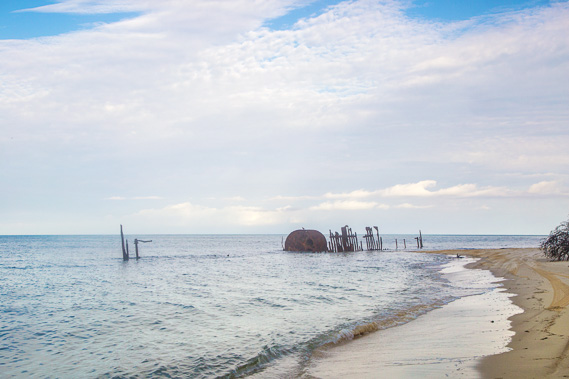
15:08 - Reaching the camping ground at The Wrecks. This is a bit more sophisticated than last night's camping ground with a descent toilet block and water supply. |
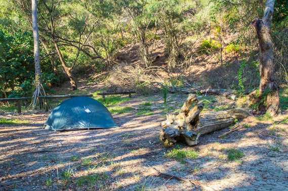 |
15:18 - I set up the tent in one of the camping spots showing my permit tag (though I will be gone before sunrise, so not likely to get it checked). |
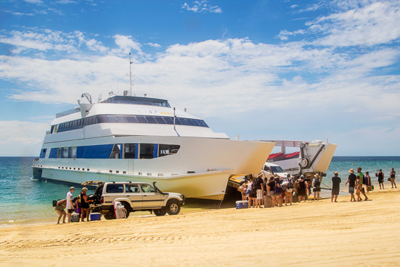 |
15:30 - Four wheel drives being loaded on and off the ferry which has come from the Port of Brisbane across the bay. This is the main landing point on the island. |
 |
15:33 - I quickly climb on the boat to get views of the pristine water, the sand blows, and the long queue of vehicles waiting to board for the trip back to the mainland. |
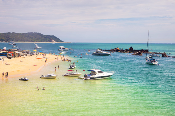 |
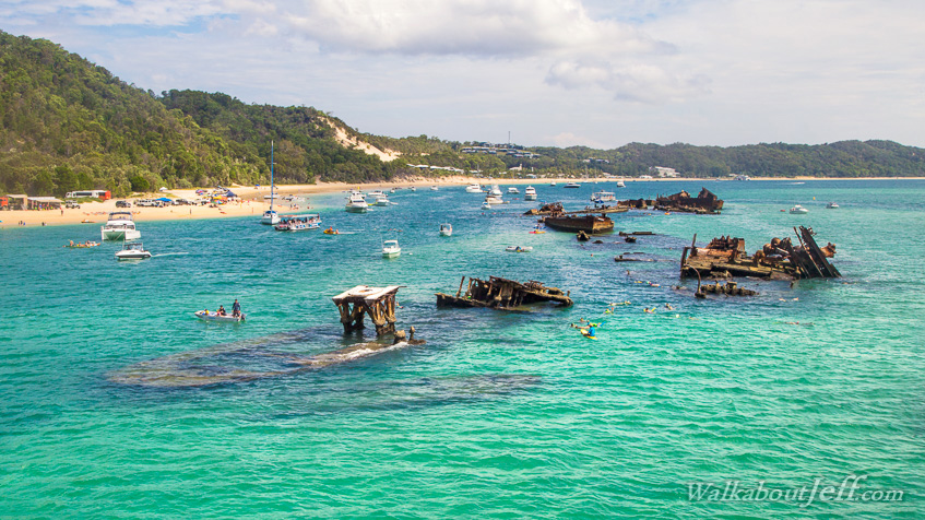
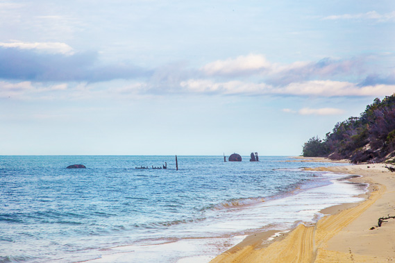
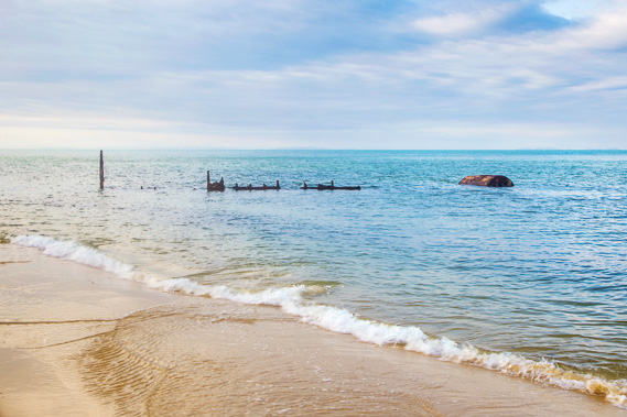
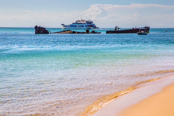
15:34 - Looking back towards Tangalooma Point. Numerous ships have been wrecked here to create a sheltered anchorage and good diving. |
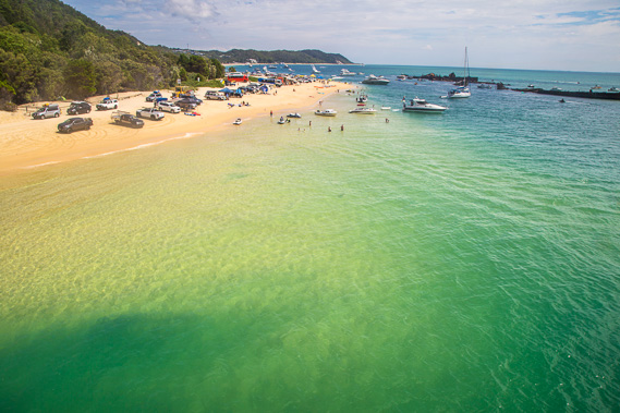 |
15:35 - The water here is still pristine, totally unlike the muddy soup on the other side of the bay. |
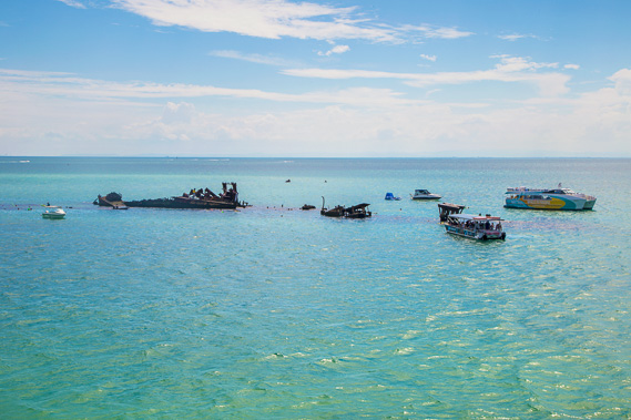 |
15:36 - Some diving groups at the wrecks. The ships were disposed of on a submerged sand bank a short distance offshore. |
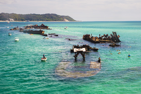 |
15:38 - The jumble of wrecks rusting away on the sand bank. These ships are mostly dredges and barges and the occasional launch all scuttled here to create a sheltered inshore anchorage between 1963 and 1984. |
 |
15:40 - A good view of the wrecks and the expanding resort leaving scars across the otherwise pristine forested sandhills. |
 |
15:55 - Back on land now as the boat continues to be loaded and the sky continues to clear. |
 |
16:03 - The boat heading off back across the bay to Brisbane. |
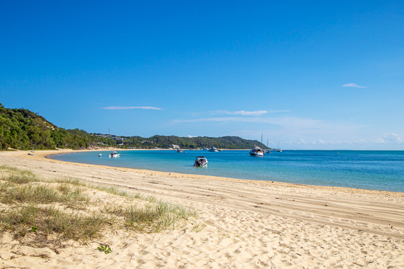 |
16:05 - Some time after the boat leaves, the four wheel drives have mostly gone (except the ones where their owners had booked this camping ground to stay) making the beach a bit more peaceful. There are quite a lot of boats anchored offshore in the bay, nicely sheltered from the prevailing south east trade winds. |
 |
16:09 - With the ferry gone, the beach is very quiet with the sand blows reflecting in the pristine water. The tide has started coming back in. |
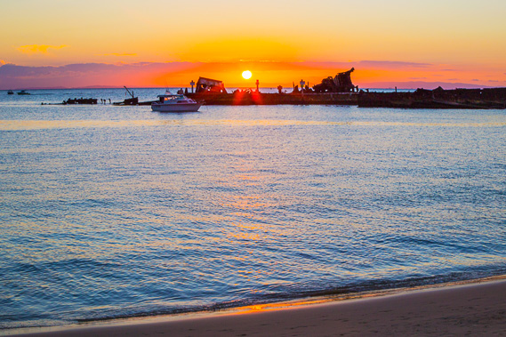 |
17:15 - Sunset over the wrecks as the divers leave the water and sharks start to lurk looking for food. They are at their most dangerous at dawn and dusk when they feed. |
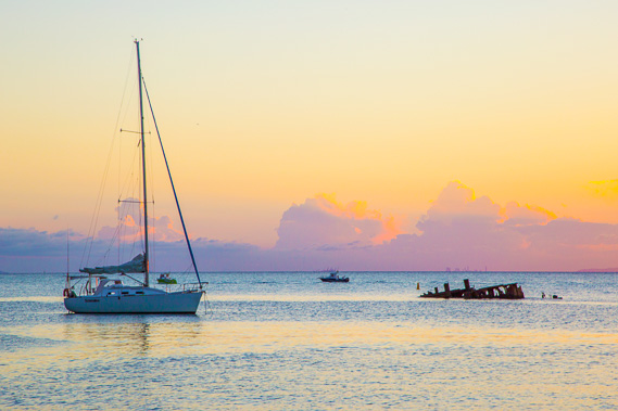 |
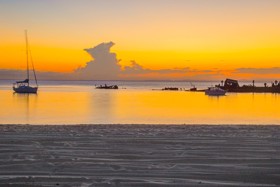
17:18 - Large clouds capture the western sunlight as the sun sets. |
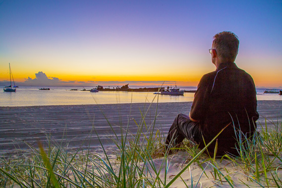 |
17:35 - I look out over the wrecks watching the last of the sunlight slip over the horizon. |
 |
17:45 - The last brightness of dusk before the city lights come on over the bay. I can't see the lights yet as most of the city is below the horizon. |
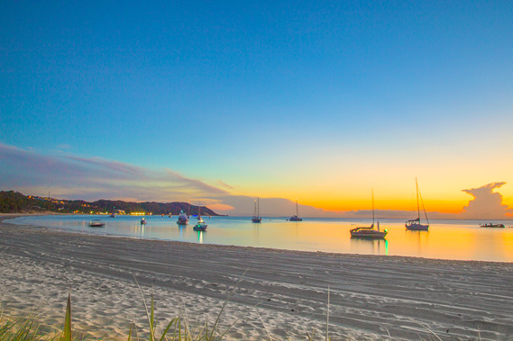 |
17:59 - Lights are already on at the resort, and the boats have their mast lights turned on. |
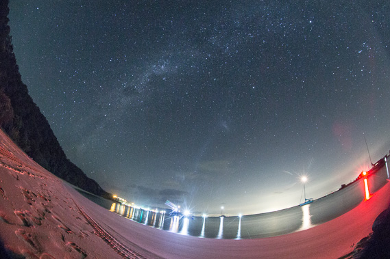 |
18:37 - In the darkness of night, the city is visible as a white glow in the distance. The galaxy towers overhead but soon to set. The resort and boats anchored offshore create a lot of light. |
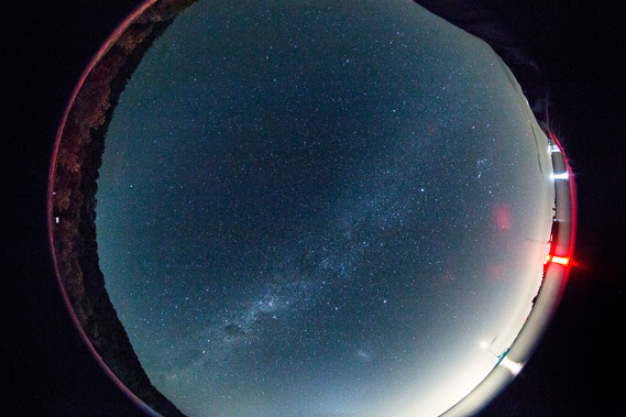 |
18:44 - A vertical shot with the fisheye looking at the galaxy. |
|