This week in South East Queensland
29 April - 5 May
ALTHOUGH Australia is a relatively peaceful country, it has been involved in a lot of conflicts in the past. In particular we have just celebrated ANZAC Day to commemorate the loss of many Soldiers in Gallipoli in Turkey over a century ago. Australia's main ports still hold evidence of Australia's military past, particularly over World War II between 1939 and 1945. To this day Australia continues to serve in conflicts around the world.
Today's hike takes me from The Wrecks, passing the remains of an old military base at Cowan Cowan to continue along the pristine beach up to Bulwer almost at the entrance to Moreton Bay.
Today's Journey
Distance hiked today: 14.1km
Total distance hiked to date: 924.4km
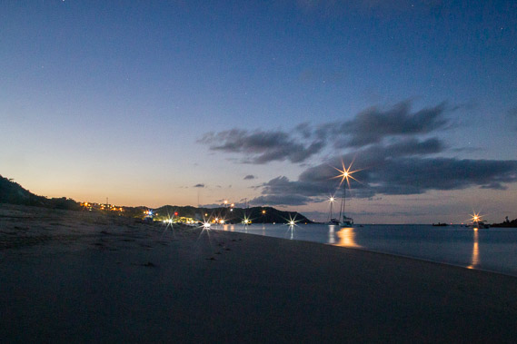 |
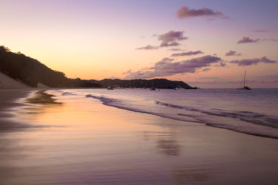
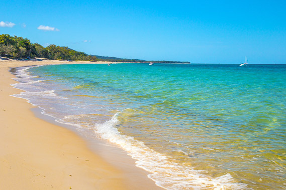
05:00 - First light on the beach as I start heading along the coast having packed up the camp. There are plenty of lights from the boats and the resort. |
 |
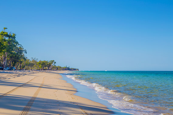
05:15 - The sky lightens as I head along the beach passing under the sand blows. |
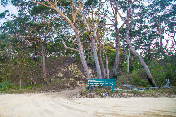 |
05:24 - Beyond the sandblows, I reach Middle Road. This is an eight kilometre long double sand track heading across the island to the main beach. Initially built in the 1960s to transport minerals from the other side of the island to the processing plant at Tangalooma, it is now the main and easiest beach access road for the four wheel drives. I will be continuing to follow the coast around the top of the island and will eventually reach where this road comes out on the main beach. |
 |
05:26 - Looking back from Middle Road entrance past the sand blows towards the resort as the sky continues to ligthen. The air is quite crisp this morning without being noticeably cold. |
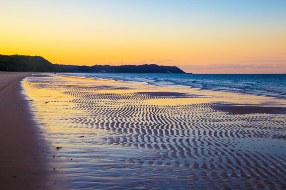 |
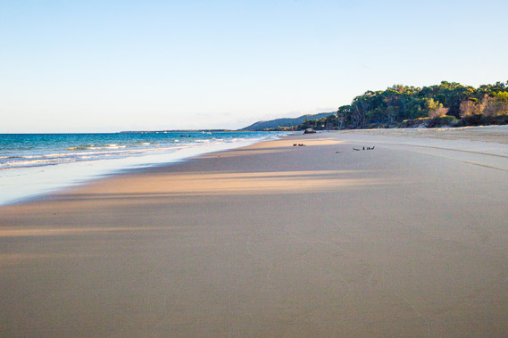
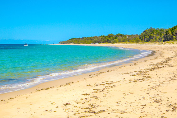
06:10 - Patterns in the sand from the overnight tide as I keep heading up the coast as the sun rises on the other side of the island. |
 |
06:18 - Rounding the flat point at Cowan Cowan. This is a small village with an air strip across its flat peninsula. There are several campsites set up in the trees here, and a few houses set further in the bush. |
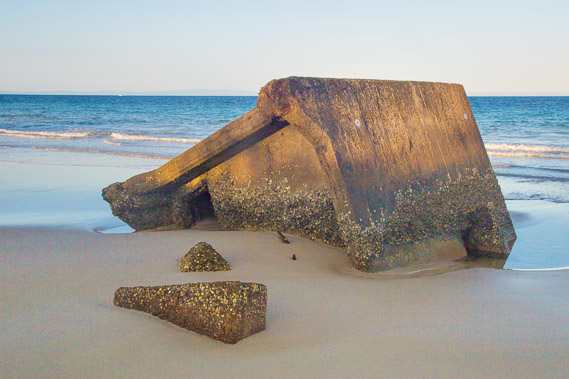 |
06:31 - The remains of a military bunker washed into the ocean by the advancing sea. This is the point on the island closest to the main shipping channel, so Fort Cowan Cowan became a similar military base to the one I had explored near the top of Bribie Island quite a long time ago now. |
 |
06:32 - Now I'm around the small peninsula, I can see along the coast to Comboyuro Point at the eastern entrance to Moreton Bay, where I will be staying tonight. Behind the point is the towering Howard Range, the tallest sand hill range in the world. I continue heading past the village of Cowan Cowan. |
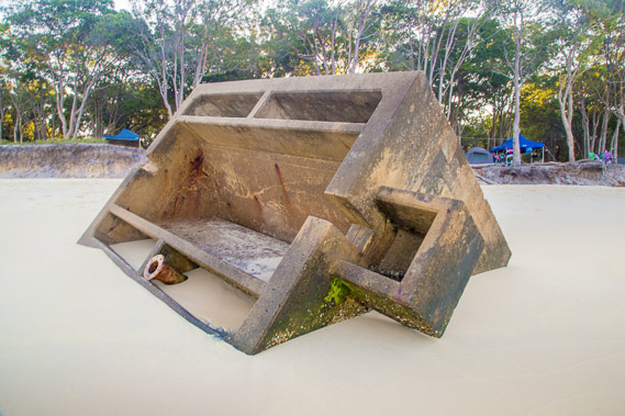 |
06:37 - The remains of another bunker in front of a temporary campsite set up on the bank. The fort's main function was to identify ships entering the Port of Brisbane during World War II to prevent invasion. Any ships that couldn't be identified were brought in for examination before being allowed to go to the port. |
 |
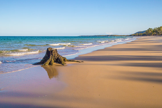
06:41 - The remains of tree roots where a couple of decades ago the forest was growing here. The sea has since advanced eroding the coast and taking the forest with it. These sand islands are particularly sensitive to rising sea levels. 20 centimetres rise in the past century doesn't sound like a lot, but on these delicate sand islands, this translates to tens of metres of erosion. |
 |
06:48 - More military bunkers collapsed off the bank from erosion. |
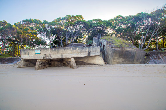 |
06:49 - This gun emplacement housed a six inch gun, big enough to cause serious damage to a large ship sailing several kilometres offshore along the main channel. It did fire on a Japanese submarine invading the harbour in 1942. No evidence has ever been found that the submarine was destroyed. |
 |
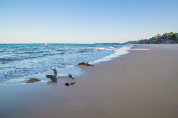
07:07 - The trunk of another large tree succumbed to the advancing sea. |
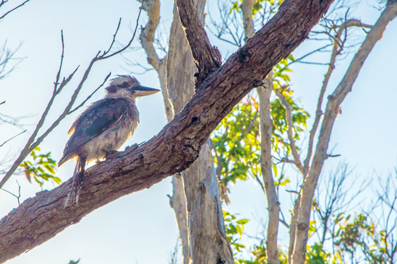 |
07:16 - A kookaburra in a tree at a small creek where I stop for breakfast. The kooaburra is the world's largest kingfisher, common and found only throughout Australia. |
 |
07:49 - Continuing along the coast after breakfast, the long shadows of the trees of the decreasing sun shine across the mouth of Craven Creek where the water sharply meanders across the sand banks built by the waves. |
 |
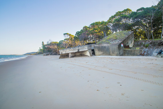
07:58 - Looking back towards the point at Cowan Cowan. The forest abruptly ends at the beach in times like this when the sand is being eroded away. |
 |
08:49 - A boat at anchor in the deep water near a couple of sunken ships creating artificial reefs for divers. The faint outline of the D'Aguilar Range spans across the horizon, concealing most of Brisbane City now sitting just below the horizon. |
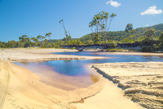 |
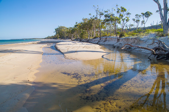
09:04 - The mouth of an unnamed creek draining from under the sandhills. North of Cowan Cowan is a large swamp extending from the sandhills. The swamp carries a lot of fresh water filtered through the sand hills, creating several small streams. The waves of recent tides have blocked this stream making a fairly deep lagoon. |
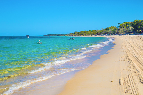 |
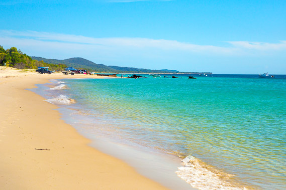
09:16 - Getting closer to Bulwer. The water of Moreton Bay is at its most pristine here near its mouth. The mud covering much of the bay is already long forgotten. |
 |
09:26 - Looking back to Cowan Cowan from near the start of Bulwer. |
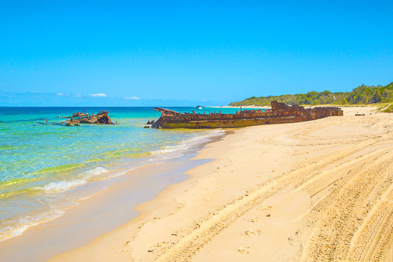 |
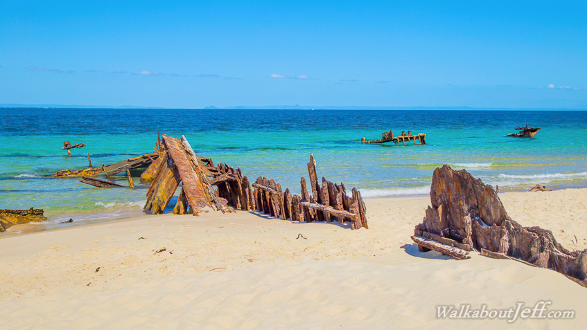
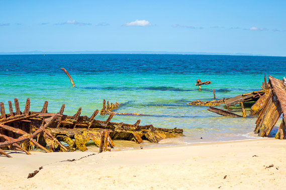
09:53 - The wrecks at the entrance to Bulwer village. |
 |
09:55 - Three ships were abandoned here to create a small sheltered port. This didn't work as the sand has built up around them over the decades. This is the main ship Kallatina which was a 628 ton steel steamer built in Glasgow in 1890. It was scuttled here in 1931. |
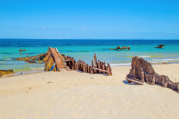 |
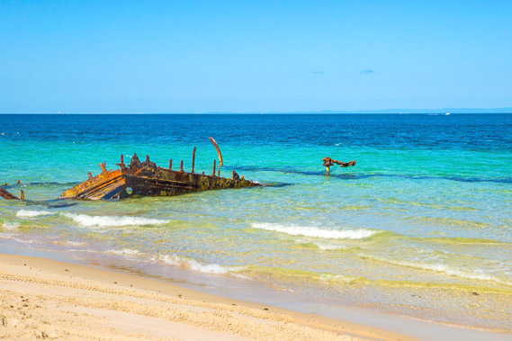
09:56 - Now the rusting remains of the ships largely sits on the beach overlooking the distant hills behind Brisbane. Hard to believe a major city is just across the bay. |
 |
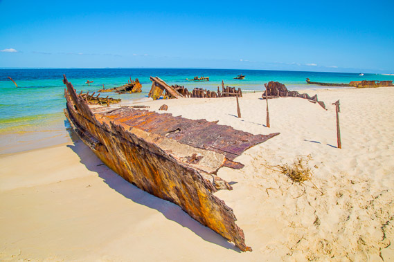
09:57 - Some of the taller buildings of Redcliffe is just visible on the horizon under the D'Aguilar Range. In the foreground is the wreckage of the 716 tonne Mt Kembla which was built in England in 1885 and scuttled here in 1930. |
 |
09:58 - Brisbane City Centre is just visible above the highest bits sticking out of the boat. You have to know where you are looking and most people would miss it. |
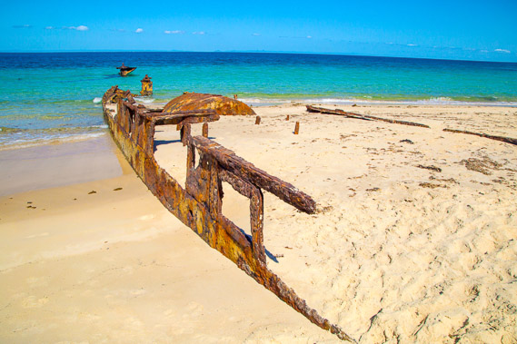 |
09:59 - The wreckage of the Hopewell which was the first ship scuttled here in 1930. Bribie Island is just visible across the bay. |
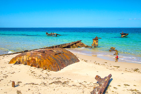 |
10:00 - A mostly buried boiler tank, the strongest and last past of the ship to deteriorate. |
 |
10:01 - Looking the short distance to Comboyuro Point at the mouth of Moreton Bay. |
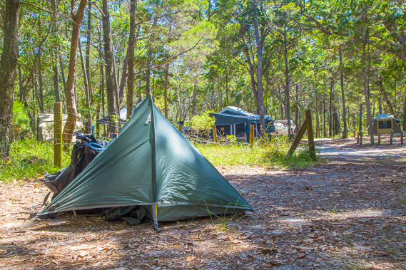 |
10:42 - My tent set up in the camping ground about half way between Bulwer and Comboyuro Point. |
 |
11:06 - Returning along the beach back to Bulwer to pick up supplies at high tide. |
 |
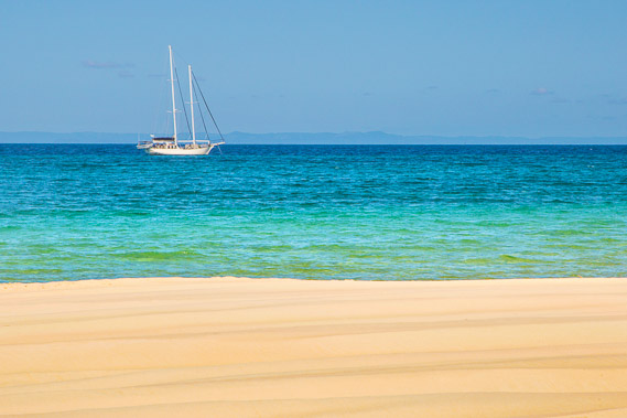
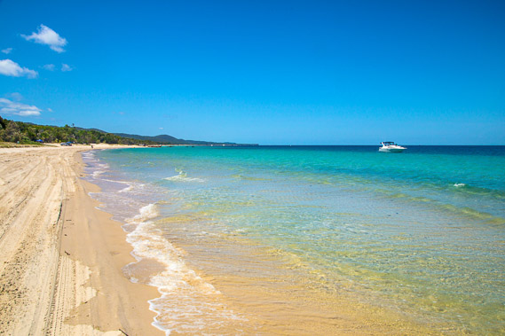
11:32 - The first of numerous ships following the former path of the Brisbane River along the deepest part of the bay. Huge sand banks lurk on either side of the channel making the trip in and out of the bay quite treacherous. This ship is only two kilometres offshore. Ships only pass at around the high tide when the shallow water is at its deepest. |
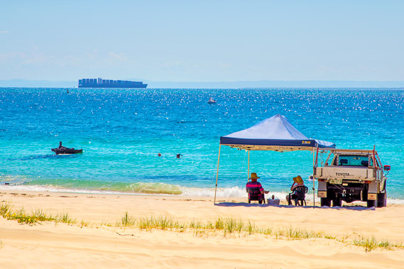 |
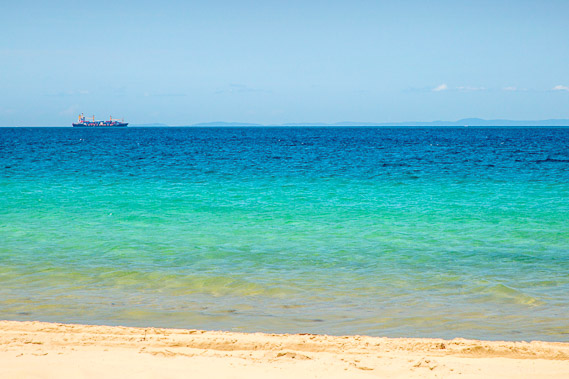
11:52 - Resting near the wrecks as a large container ship slowly drifts past. A ferry used to land here from Scarborough Harbour until it went out of business some years ago. This used to be how I travelled across the bay, but now need to go from the Brisbane River to The Wrecks where I had started this morning. |
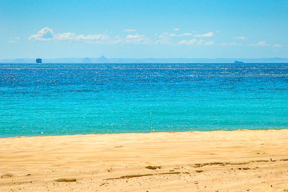 |
12:00 - After passing this point, the ships turn around to follow the river channel towards Bribie Island. One ship is heading towards the Glasshouse Mountains whilst the other ship to the right is tracking along a few kilometres off the coast of Bribie Island heading towards the exit of the bay at Caloundra. Although I'm almost at the top of the island, there is a huge mass of submerged sand banks extending to about level of Caloundra. |
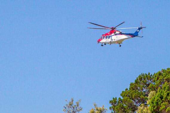 |
12:26 - A rescue helicopter arrives perhaps as part of a patrol, or maybe to rescue an injured person in the area. |
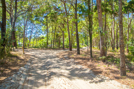 |
12:47 - Following the soft sand road from the beach back into the bush to the quiet village of Bulwer, containing mostly residential houses. The Moreton Bay pilot house was moved here from Amity Point in August 1848. Plots of land were later sold and a school was eventually built here. It is now a very quiet village with around seventy people living here. |
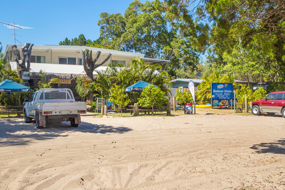 |
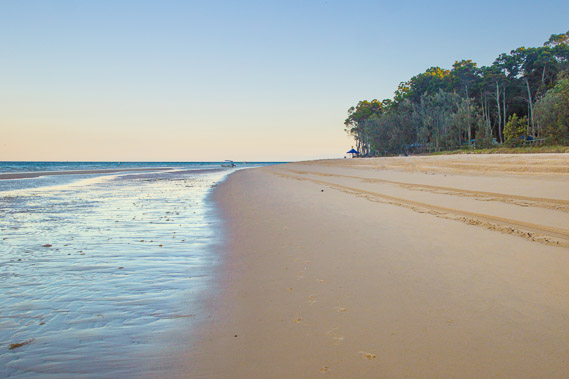
13:36 - The main store of Bulwer, where I pick up some more supplies to keep me going around the rest of the island and onto Point Lookout, the next port of civilisation, which I aim to reach in five days. |
 |
14:28 - With supplies in hand, I follow the beach back to my campsite. The tide has already started dropping. |
 |
16:44 - I visit a very small cemetery nestled into the bush. Here a couple of children from the early settlement were buried. The first grave was the one with the wrought iron fencing erected in 1883 for 11 month old William Leslie who died at sea. The other was added in 1885. |
 |
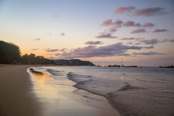
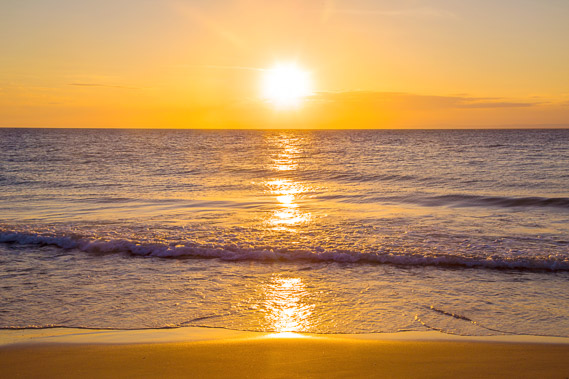
16:56 - I return to the beach to watch the sunset over Moreton Bay. This is the last sunset I will see across the water. |
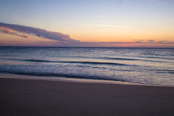 |
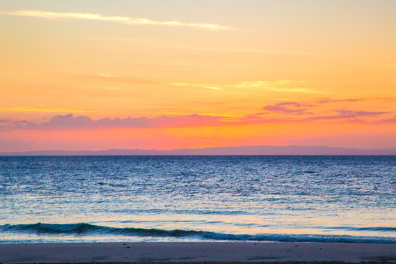
17:12 - The clouds hovering over the D'Aguilar Range as the air quickly cools as the sun sets behind the range. The city centre is just forty kilometres away to the left but there is no sign of it from here. |
 |
17:20 - The waves peacefully lap on the beach. This is probably the last of the calm water I am going to see on this trek. From here I'm expecting the waves to become bigger as I head onto the northern coast tomorrow, then from the next day will be following the exposed east coast all the way down to Point Danger. |
 |
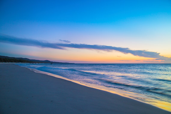
17:39 - Last light looking down the coast towards Cowan Cowan and Tangalooma. |
|