This week in South East Queensland
13 - 19 May
AS DESOLATE the sand islands are, they have many resources which have supported Aboriginal people for many thousands of years. During the last ice age when the sea level was 120 metres lower than it is today, and when Moreton Bay was a large floodplain, Aboriginal people lived on these sand hills for around from 18,000 to 6,000 years ago on various settlements in these pristine locations. With the rising of the sea level, the islands were largely abandoned with the resources becoming scarcer, but returned after a few thousand years to live comfortably with the abundance of marine life in the island's lagoons.
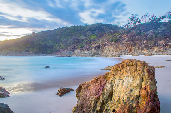
Today's trek starts from North Point. I head across to the isolated Honeymoon Bay to watch the sunrise before heading over the top of the volcano to the Cape Moreton Lighthouse. After exploring the area, I head down to the start of the ocean beach sweeping the length of Moreton Island, and start the long trek. I stop at Blue Lagoon, and explore the lagoon and the nearby Honeyeater Lake.
Today's Journey
Distance hiked today: 17.2km
Total distance hiked to date: 954.4km
 |
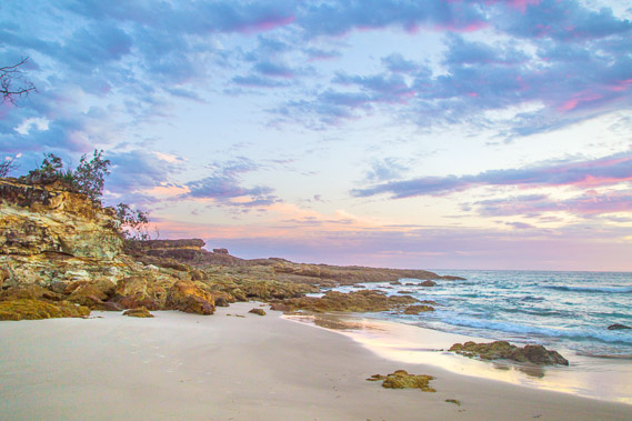
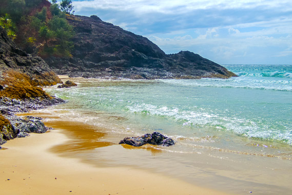
06:03 - Pre-dawn light at Honemoon Bay accessed by a short track over a low saddle from the camping ground. Giant boulders of brightly coloured volcanic rock litter the beach. |
 |
06:13 - North Point and Champagne Pools at the northern end of the tiny Honeymoon Bay on this cool morning. |
 |
06:16 - The sun shortly to rise at Honeymoon Bay. This will be my first ocean sunrise since Bribie Island. |
 |
06:18 - The rocks at North Point at sunrise as I head back across the beach to get the best view of the rising sun. |
 |
06:26 - The sun has risen behind the cape and streaming through a gap in the distant clouds which are thicker on the other side of the continental shelf. |
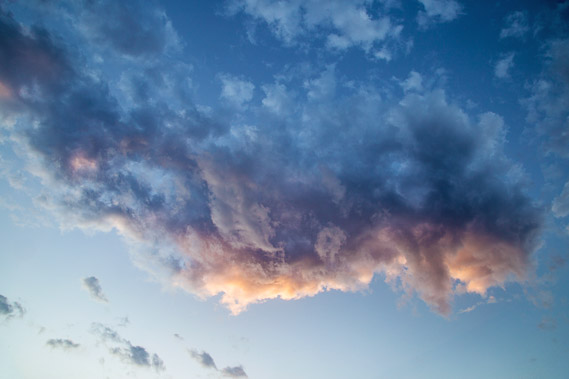 |
06:30 - Spectacular cloud overhead capturing the sun's fire with the western side of the cloud looking like smoke escaping the fiery front. |
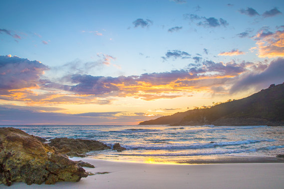 |
06:31 - Sunlight on the clouds as the ocean waves come into the bay. This is the crater of a long extinct volcano formed not long after the Glasshouse Mountains. In the millions of years since this volcano died, the entire far side of the volcano has eroded down to below sea level. This beach forms part of what used to be the crater. |
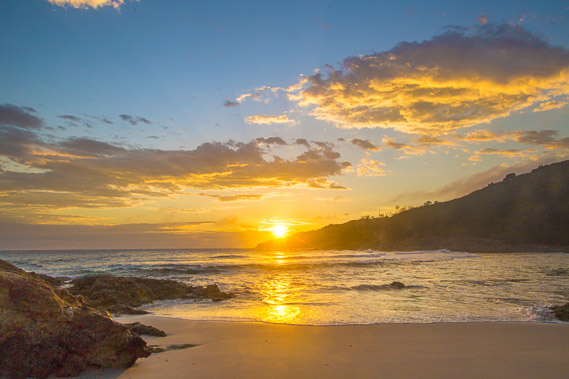 |
06:36 - The sun peeks through over the tip of Cape Moreton instantly bringing a little warmth to this cool morning. |
 |
06:40 - The rising sun has illuminated North Point but not for long as thick cloud is quicky building over the sky. |
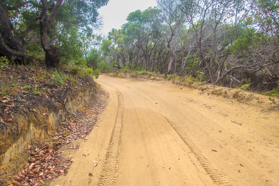 |
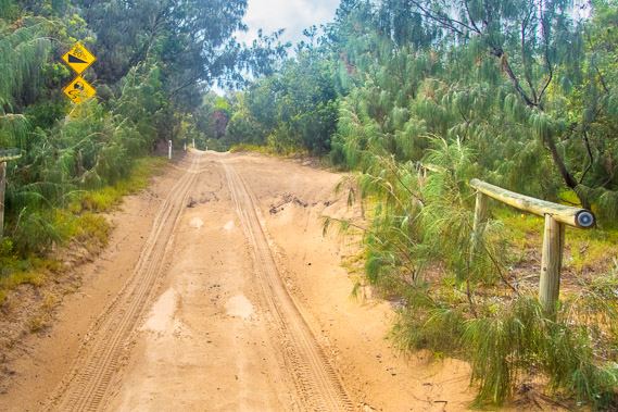
08:19 - I return to the camping ground and pack up before starting to follow the long sandy road over the back of Cape Moreton. The sky is completely overcast as I start heading uphill. |
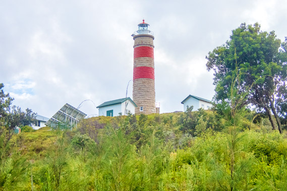 |
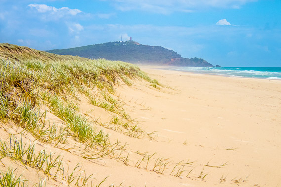
08:21 - After a couple of kilometres ascending the road I can see the spectacular Cape Moreton lighthouse. |
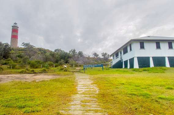 |
08:23 - Following the walking track up from the car park to the museum on the right. This is a very remote place for a museum, reminding me of the information centre at Double Island Point. |
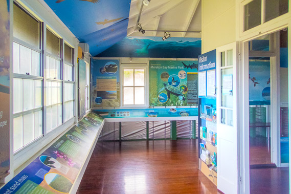 |
08:25 - Inside the museum, very nicely showing the history of the island. |
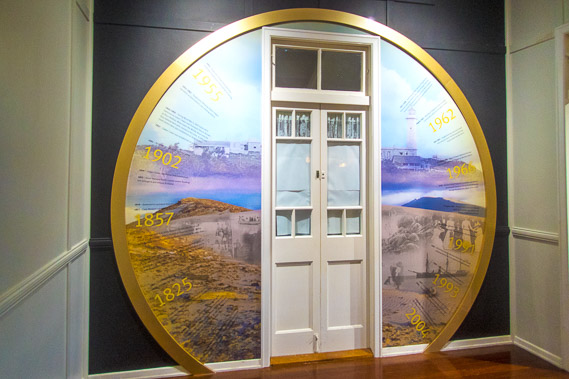 |
08:29 - An elegant display of historical events inside the museum. |
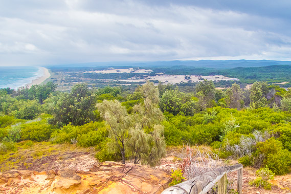 |
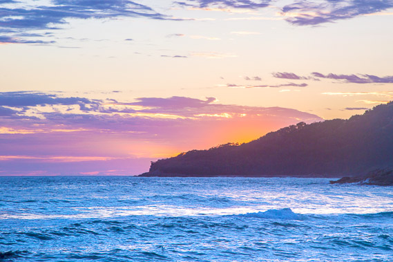
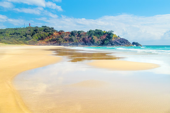
08:33 - View down the coast from the museum. The far end of the island is about 35 kilometres down the beach. Mount Tempest is hiding in the cloud, and it is probably raining there. |
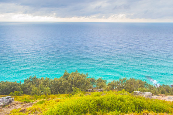 |
08:38 - Looking out into the Coral Sea. This is the point closest to the edge of the continental shelf about twenty kilometres offshore where it drops down a few kilometres crossing the ocean floor for a couple of hundred kilometres before rising to the top of the mostly submerged Zealandia continent, now formally recognised as the eighth continent. |
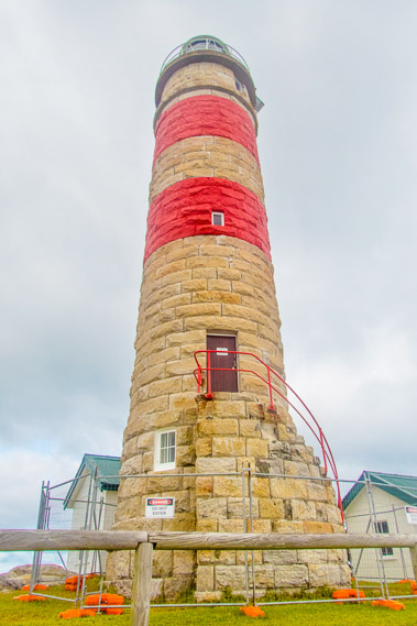 |
08:39 - Cape Moreton Lighthouse, constructed from sandstone quarried nearby from a formation deposited on the side of the volcano at a time when it was overrun by enormous sand dunes. It is Queensland's oldest lighthouse built in 1857, two years before Queensland became a state. Over the years it was gradually extended until reaching its current height in 1928. |
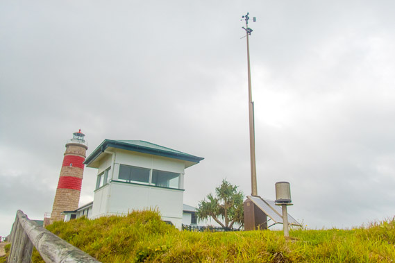 |
08:40 - The weather station at the cape, which generally records the lowest highs, highest lows and strongest winds in the Brisbane area. The rainfall at 1485 mm per year is higher here than in the bay and in Brisbane. |
 |
08:43 - Access down the cliff. It is closed but a couple just went down there. The dune accumulated from sand blown along the coast clings precariously onto the cliff. |
 |
09:19 - From the lighthouse I head back onto the road I return to the intersection and start the descent towards the eastern beach. |
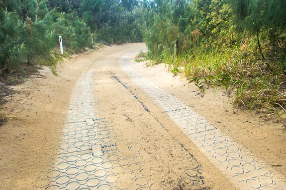 |
09:20 - The narrow road becomes very steep requiring this plastic gripping to help vehicles up and down. I don't hear any vehicles coming, so I walk along the gripping as it is a lot easier than the very soft sand on either side. |
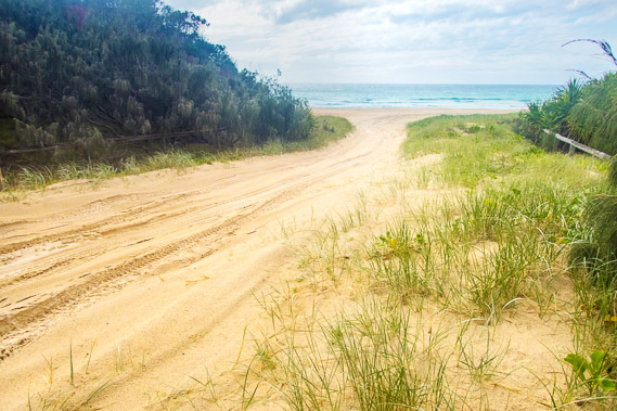 |
09:25 - Fortunately it is not long before I reach the beach, walking on the bank to avoid the very soft sand. This track would be difficult to drive on. |
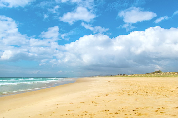 |
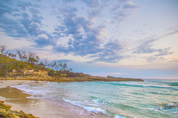
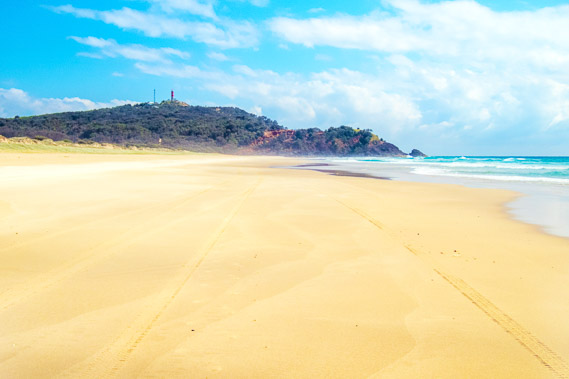
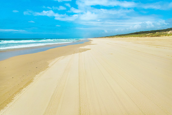
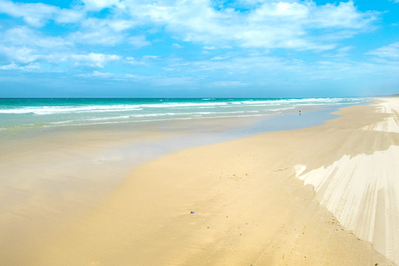
09:36 - View down the endless beach with large waves breaking on shore. There is no surf lifesaving on Moreton Island. The nearest surf club would be at Cylinder Beach on North Stradbroke nearly fifty kilometres away. Stradbroke is over the horizon, so it's hard to tell this is an enormous bay sweeping around to Point Lookout. From there I will have one more even longer sweeping bay before reaching Point Danger at the end of the trek. |
 |
09:47 - Cape Cliff from below where the road comes out. I stop here for a while to contemplate the long walk along the beach over the next three days. |
 |
09:58 - Leaving the cape and starting the long track down the beach as the sun comes out again. |
 |
10:09 - Soon the lighthouse appears towering over the top of the old volcanic cone. From here it is all eroded granite sand washed down from the Blue Mountains and carried up the coast. |
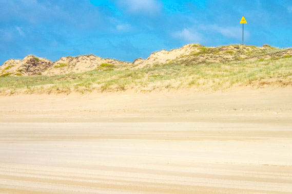 |
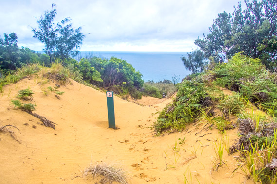
10:21 - A marker on the dunes. There is now no access over the exposed dunes above the beach due to instability and erosion with the lack of vegetation cover. |
 |
10:53 - I rest for lunch a few kilometres down from the lighthouse, The old volcano is already looking small. This tiny volcano holds together all the sand making up the island as the current drifts northwards carrying the train of sand up towards Fraser Island. |
 |
11:47 - In the almost complete absence of landmarks, bays, points, or signs of civilisation, this is going to be quite a testing walk. There is no mobile phone access here to help with navigation. I just need to follow the beach southwards until I eventually arrive back in Kooringal. |
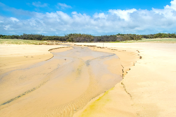 |
12:06 - I eventually reach Spitfire Creek, the first landmark about five kilometres south of Cape Cliff. This is the first fresh water stream I have seen since Dog Creek. Here I stop for lunch. |
 |
12:19 - The small lagoon of Spitfire Creek. This drains from Jabiru Lake in the middle of the island behind Seven Hills. The swampy creek is named as it was once a navigation marker for small planes heading up and down the coast. |
 |
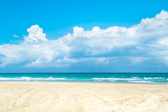
13:41 - Following the beach again following my lunch stop. The tide has come in now making the sand very soft and hard to walk along. From tomorrow on I'll aim to walk the beach only around low tide to help with progress. Most of the beach will be like this for the 120 kilometres to Surfer's Paradise before I can walk on path again, so I need to hike at low tide where possible. |
 |
14:03 - More clouds are coming over as I continue along the beach. Fortunately I've already passed a couple of camping ground access roads heading over the foreshore hill into the bush. This means I'm close to the main access track where I'll be stopping tonight. |
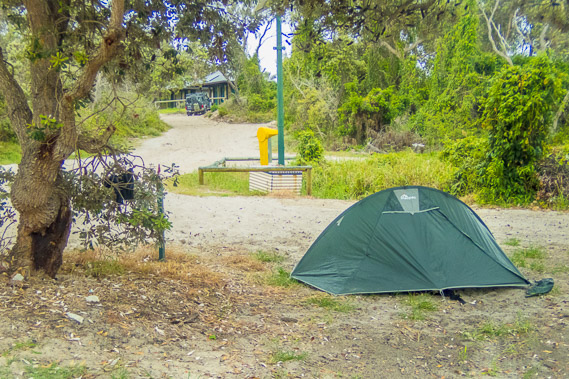 |
14:43 - I reach the main access road and pitch my tent in one of the sites, close to the toilet block in the background. Some of the campers in four wheel drives bring their own toilets allowing them to camp in the remote campsites without any problems. I stay at the main camping grounds where possible to minimise the toileting issue. Each block also has a fresh water supply on tap. |
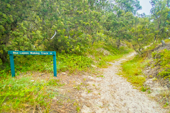 |
15:16 - The Blue Lagoon walking track starts near my campsite, so I follow it over the dunes. |
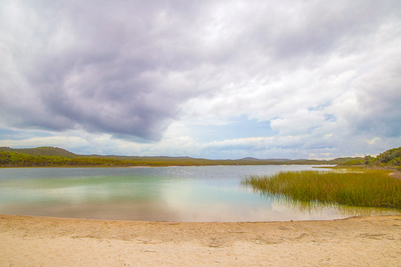 |
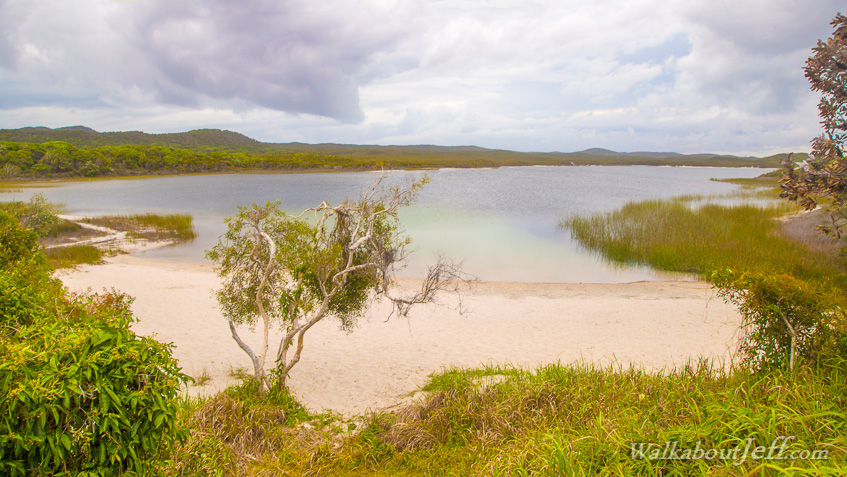
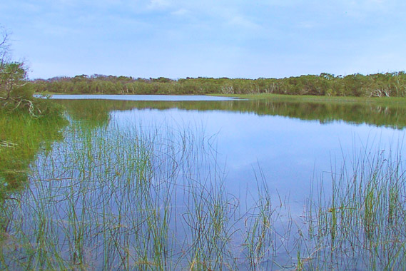
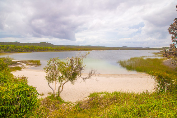
15:27 - I reach the beautiful Blue Lagoon. It is normally blue when the sky is blue, but it is more of a turquoise colour today under the thick cloud. The far side of the lake marks a past shoreline, but as lots of sand was deposited offshore, it rose into a sandhill cutting off the sea. This part of the new formation left a large depression now filled with fresh water creating the island's largest lake. |
 |
15:30 - I follow a rough track around the southern edge of the lagoon. The track is flooded when the water is higher, but in the absence of significant rain of late, the lake level is quite low now. |
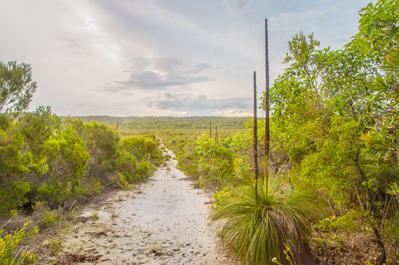 |
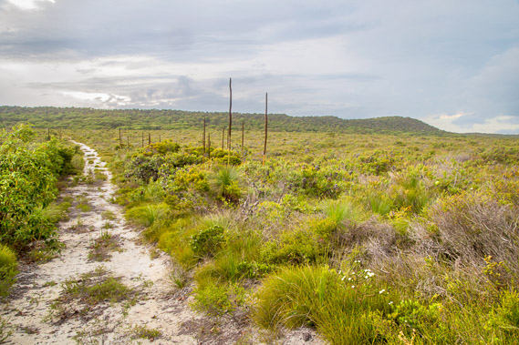
15:40 - The track heads inland towards the main sand road between the beach just south of Blue Lagoon crossing the top of the island to Bulwer. I follow the track through the grass trees into a wide sandy swamp. |
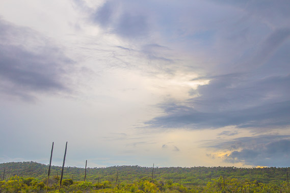 |
15:43 - The clouds look spectacular above over the swamp as the sun sinks low towards the horizon. |
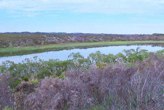 |
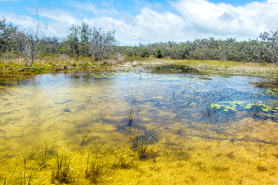
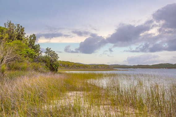
16:18 - Eventually I reach a lookout over Honeyeater Lake. |
 |
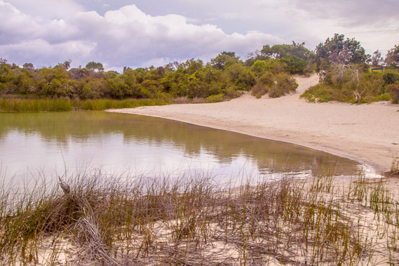
16:20 - At the edge of Honeyeater Lake looking across the lagoon. This stretch of water is about a third of the size of Blue Lagoon. |
 |
16:45 - I return along the track back towards Blue Lagoon before the sun sets. |
 |
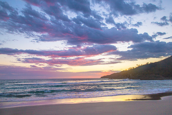
17:03 - When I return to the edge of Blue Lagoon as the setting sun turns the sky a curious pink colour. |
 |
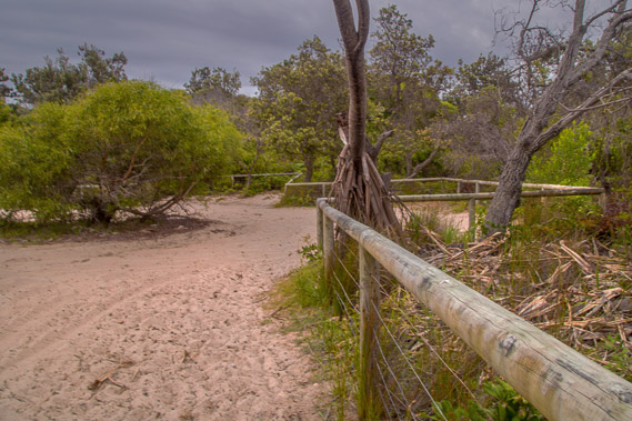
17:08 - I follow the track back to the main beach, clear of reeds from all the people who use it. |
 |
17:12 - Last view over Blue Lagoon as the sky darkens following sunset. |
 |
17:27 - Blue Lagoon car park before the rain starts falling. From here I hurry back to the tent for the night. |
|